
BIRM-166’s Drumlin Silt30798 BCE
30,798 BCE is a modern label within an uncertain Late Pleistocene range, not a recoverable historical year. During MIS 3, Ireland experienced unstable cold conditions, fluctuating ice, meltwater and sparse tundra-like vegetation. Derryvree, County Fermanagh, preserves freshwater organic sediments between glacial tills, documenting a locally ice-free wetland with sedges, mosses and Arctic-alpine plants before renewed glaciation. Castlepook Cave, County Cork, contains diverse Pleistocene animal remains, indicating changing ecological connections and open habitats, though deposits are chronologically complex. A possibly tool-marked reindeer bone suggests brief human contact, but no evidence establishes settlement, material culture, society, economy or political life with certainty.
Dateline
Limits of the Date
“30,798 BCE” is a modern chronological label, not a year that can be recovered from an Irish record. No calendar, written testimony, named individual, settlement, burial or event can be assigned to this particular twelve-month span. In radiocarbon terms it lies roughly 32,700 calendar years before present, where “present” conventionally means AD 1950. At such depth, dates are expressed as calibrated ranges, often with substantial uncertainty, rather than as exact historical years. The appropriate setting is the Late Pleistocene, during Marine Isotope Stage 3 (MIS 3), a long and climatically volatile phase of the last glacial cycle.
For Ireland, the evidence is principally environmental: glacier-laid sediment, cave deposits, animal remains, pollen, mosses, seeds and insect fragments. These archives can reveal broad conditions and sequences of change, but not a political narrative. They cannot establish kings, communities, treaties, battles, religious rites or a local language. The most responsible account of Ireland at this point is therefore one of changing ice, water, plants and animals, and of the narrow limits within which people may or may not have entered the island.
A Wetland Between Ice Advances
The closest major Irish archive is the Derryvree site near Maguiresbridge in County Fermanagh. Road works in 1969 cut through a drumlin and exposed freshwater silts, fine sands and organic material lying between two beds of till, the unsorted debris deposited by glacier ice. The sequence is unusually valuable. It shows that ice had occupied the locality, that an ice-free freshwater environment subsequently formed there, and that later glacial activity buried it beneath another till. It does not show that all Ireland was free of ice at once, but it securely records profound local environmental change.
The organic layer, sample BIRM-166, produced a conventional radiocarbon age of 30,500 years BP, with a large published error range. Calibration and later discussion place it broadly within about 36,900–31,700 calibrated years BP, approximately 34,950–29,750 BCE. The requested date falls inside that wide interval. This overlap makes Derryvree highly relevant, but it does not mean that every sediment grain, plant or insect lived in 30,798 BCE. The deposit represents an interval accumulated over time, not a dated diary entry.
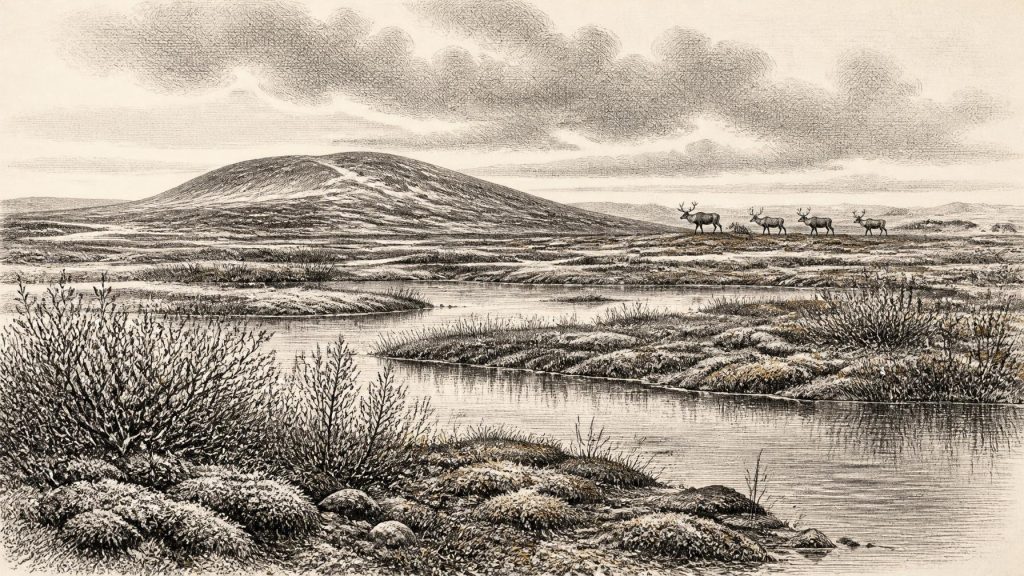
Its fossil evidence indicates cold, open and waterlogged ground: a tundra-like or muskeg landscape rather than forest. Mosses, grasses, sedges, herbs and wetland plants occupied shallow water, saturated margins and exposed soil. Plant remains including bogbean, dwarf willow, mountain avens and other Arctic-alpine or cold-stage taxa point to a short growing season and severe winters. The best-supported picture is a mosaic of pools, sedge beds, mossy ground and sparse low vegetation. It was not a featureless white desert. Even in a periglacial climate, sheltered depressions and wet hollows could support productive microhabitats.
Cold Ground, Unstable Climate
Periglacial does not mean permanently ice-covered. It describes terrain strongly affected by cold, frost, seasonal freezing and thawing, sparse vegetation and ground instability near an ice margin or within a cold climatic regime. At Derryvree, water was sufficiently persistent for fine sediment and organic matter to accumulate; elsewhere, frost action, wind and shifting drainage would have limited plant cover. The later drumlin landscape of Fermanagh was not a finished countryside awaiting settlement. It was being repeatedly altered by ice movement, meltwater and the burial or erosion of older surfaces.
The wider North Atlantic climate was notably unstable during MIS 3. Greenland ice cores record abrupt shifts between colder stadials and relatively milder interstadials on millennial, and sometimes shorter, timescales. Irish deposits cannot be matched safely to a precise ice-core event solely from a modern BCE year, and local responses did not necessarily occur in lockstep with Greenland. Nevertheless, the Derryvree sequence belongs to a world in which environmental conditions could change rapidly: wetlands formed during an ice-free interval, and later ice covered them. A single fixed reconstruction for the entire island would therefore be misleading.
Recent reconstruction of the British–Irish Ice Sheet also cautions against simple statements that Ireland was either wholly glaciated or wholly open. Around 31,000 years ago, growing ice masses and smaller ice fields occupied particular uplands and regions, while their extent, timing and behaviour varied. The fullest later expansion of the ice sheet lay ahead. At the notional date considered here, Ireland was approaching a major glacial transformation, but local conditions depended greatly on altitude, drainage, proximity to ice and the changing position of the sea.
Animals at Ireland’s Edge
Animal bones from Irish caves demonstrate that the island was not ecologically isolated from north-western Europe during parts of the Pleistocene. Castlepook Cave, near Doneraile in north County Cork, is especially important. Its complicated deposits have produced remains attributed to woolly mammoth, giant deer, reindeer, brown bear, spotted hyena, foxes, wolves and cold-adapted small mammals including lemmings. Taken together, these finds show that various animals reached Ireland during different phases before and around the growth of the last major ice sheet.
That does not make Castlepook a single, simultaneous Ice Age scene. Cave entrances can collect bones through carnivore activity, scavenging, water movement, natural deaths and human excavation; old excavations also mixed or disturbed deposits. Individual species may have arrived centuries or millennia apart. The cave is therefore strongest as evidence for a changing Pleistocene fauna, weaker as proof of one precisely dated local ecosystem. Still, reindeer and other grazing mammals imply open habitats capable of supporting herbivores, while the presence of large carnivores demonstrates wider food chains rather than an empty landscape.
Lower global sea levels exposed far more of the continental shelf than exists today. The coast was consequently unlike the modern map, and routes for animals may at times have been more accessible. Yet lower sea level alone does not prove a dry, simple land bridge to Ireland. Water channels, tidal terrain, ice, weather, food supply and the condition of the ground all mattered. It is safe to say that Ireland’s ecological connections changed repeatedly; it is not safe to claim a known migration corridor, regular crossings or established exchange with Britain or continental Europe in this particular year.
The Human Question
The most intriguing possible sign of people is a reindeer femur from Castlepook reported as bearing a mark consistent with cutting or chopping by a sharp stone tool. The bone has been presented as dating to about 33,000 years ago. If the mark is confirmed as human-made and contemporary with the animal’s death, it may indicate brief Upper Palaeolithic contact with a carcass, perhaps by a visitor who processed meat or other useful material. It is an important hypothesis because it would push evidence for human activity in Ireland far earlier than the traditionally accepted record.
It is not, however, evidence for a settled Irish population in 30,798 BCE. No securely associated hearth, stone-tool assemblage, dwelling, grave, human bone, artwork or undisturbed animal-processing floor has been recovered for this horizon. A radiocarbon result dates the animal tissue, while the identification of a surface mark as a cut mark is a separate taphonomic judgement. The most cautious conclusion is that a human visit is possible, perhaps even plausible, but continuous occupation cannot be demonstrated. Absence of evidence does not prove that no person ever entered Ireland; it does rule out writing a confident story of a resident society.
No Polities, No Proven Economy
Accordingly, there are no political affairs, diplomacy or warfare that can responsibly be described. There is no evidence for an Irish polity, a chiefdom, a territorial boundary or collective institutions. Nor is there evidence for farming, trade, boats, stored surplus, quarrying, formal learning, ritual monuments or organised religion. The economy visible in the evidence is ecological rather than social: plants surviving a short growing season, herbivores moving through open country, predators following prey, and water sustaining life in a cold basin.
If people did make occasional incursions, their everyday lives must remain unknown. Comparisons with Upper Palaeolithic hunter-gatherers elsewhere in Europe can suggest that mobile groups had sophisticated stone, bone, hide and fire technologies, but such comparisons are interpretation, not proof for Ireland. No securely Irish material culture permits an attribution to a named archaeological tradition. The surrounding European evidence establishes what was possible, not what must have occurred at Derryvree or Castlepook.
An Archive of Possibilities
Ireland around this notional date was a regional landscape in transition: locally ice-free in at least some places during a broader cold stage, marked by freshwater hollows and treeless vegetation, and inhabited at different times by animals adapted to open northern environments. Derryvree’s buried wetland is the clearest local witness, while Castlepook’s bones show the wider range of life that reached the island. The first offers a carefully delimited environmental interval; the second offers a complicated faunal archive and an unresolved human question.
That is a more compelling history than an invented annual event. It presents an Ireland without recorded rulers or monuments, but not without history: a place whose ground, waters and cave deposits preserve the effects of climate instability, animal movement and advancing ice. Modern research may refine the dates, deposits and interpretations. For now, the evidence supports a cold, open and changing Irish world—one in which certainty ends well before the tempting precision of “30,798 BCE”.
Primary Sources
- A Middle Midlandian Freshwater Series at Derryvree, Maguiresbridge, County Fermanagh, Northern Ireland
- Palaeoecology: The Quaternary of Northern Ireland
- The Subdivision of the Quaternary Period in Ireland
- The Irish Quaternary Fauna Project
- New Insights on the Fauna of Ireland’s Younger Dryas
- Castlepook Cave: County Geological Site Report
- Spotted Hyena Skull
- Growth and Retreat of the Last British–Irish Ice Sheet, 31,000 to 15,000 Years Ago: the BRITICE-CHRONO Reconstruction
- The Timing and Magnitude of the British–Irish Ice Sheet Between Marine Isotope Stages 5d and 2
- Exploring the Controls on British–Irish Ice Sheet Retreat During the Last Glaciation
- Trimlines, Blockfields and the Vertical Extent of the Last Ice Sheet in Southern Ireland
- New Data for the Last Glacial Maximum in Great Britain and Ireland
- Radiocarbon Constraints on the Age of the Maximum Advance of the British–Irish Ice Sheet in the Celtic Sea
- Dimensions and Chronology of the Last Ice Sheet in Western Ireland
- Pattern and Timing of Retreat of the Last British-Irish Ice Sheet
- The IntCal20 Northern Hemisphere Radiocarbon Age Calibration Curve (0–55 cal kBP)
- A Stratigraphic Framework for Abrupt Climatic Changes During the Last Glacial Period Based on Three Synchronized Greenland Ice-Core Records
- Rapid Global Ocean-Atmosphere Response to Southern Ocean Freshening During the Last Glacial
- Stable Stadial and Interstadial States of the Last Glacial’s Climate Identified in a Combined Stable Water Isotope and Dust Record from Greenland
- Ireland: Submerged Prehistoric Sites and Landscapes
