BIRM-166’s Cold Landscape30730 BCE
30,730 BCE is a nominal date within MIS 3, not a recoverable Irish year at a precise calendar point. At Derryvree, County Fermanagh, freshwater silts and organic deposits between glacial tills indicate a locally ice-free, treeless periglacial wetland during a broadly dated interval of 36,900–31,700 calibrated years BP. Mosses, sedges, tundra plants and insects reveal cold, varied habitats. Castlepook Cave, County Cork, preserves complex evidence of mammoth, reindeer, giant deer, predators and other cold-adapted fauna. Human presence remains unproven, despite a possibly cut-marked bone. Ice later expanded across Ireland. These fragmentary records document changing environments, not settlements, societies or events.
Dateline
30,730 BCE is a modern chronological label, not a year that can be recovered from Ireland’s archaeological record. No community then used a calendar, and no Irish settlement, burial, tool assemblage or historical event can be dated to this precise point. In radiocarbon convention, the label is roughly 32,679 years before AD 1950, but that arithmetic is not an archaeological date. The responsible view is broader: this was the Late Pleistocene, during Marine Isotope Stage 3 (MIS 3), a climatically unstable portion of the last Ice Age. Conditions can be discussed through calibrated ranges, stratigraphy, fossil remains and comparison with neighbouring regions; they cannot be turned into a diary of one Irish year.
A Date Within a Wide Range
The most relevant evidence comes from Derryvree, near Maguiresbridge in County Fermanagh. Road construction in 1969 cut through a drumlin and revealed freshwater silts and fine sands caught between two thick layers of till, the unsorted debris left by glacier ice. The sequence provides a secure relative history. First, ice deposited the lower till. Later, in an ice-free local setting, standing or slow-moving freshwater accumulated sediment and organic matter. Finally, a renewed glacial advance laid down the upper till and sealed the older wetland beneath it.
Organic material from the intervening deposit yielded the radiocarbon determination BIRM-166, conventionally reported as 30,500 radiocarbon years before present, with a large uncertainty. Modern calibration places the relevant episode broadly at about 36,900–31,700 calibrated years BP, approximately 34,950–29,750 BCE. 30,730 BCE falls within that broad span, but cannot be assigned to a particular layer, season or episode in the deposit. Nor did the silt accumulate instantaneously. It represents an environmental interval whose duration cannot be compressed honestly into a single calendar year.
Water Between the Tills
Derryvree is important because it disproves the simplest picture of an Ireland continuously buried beneath a uniform ice sheet throughout the last glacial period. At some point in the interval represented by BIRM-166, this part of Fermanagh had exposed ground, freshwater and vegetation. The evidence is local rather than island-wide: an ice-free wetland at Derryvree does not prove that every Irish region was simultaneously open, nor that the coastline, sea routes or uplands looked the same across the island.
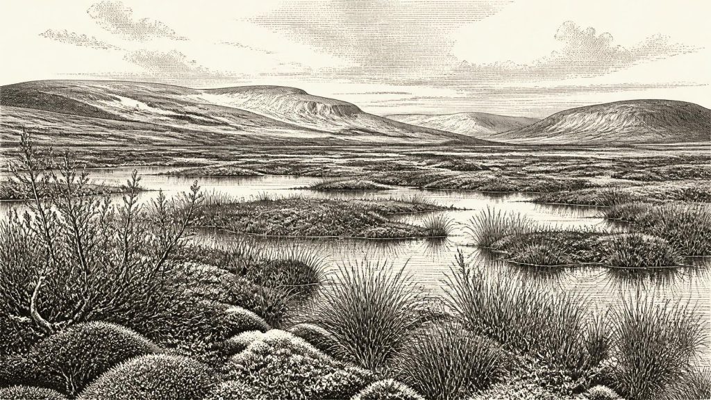
The plant and insect evidence indicates a treeless, periglacial environment. Mosses, sedges and herbaceous tundra plants survived in wet ground and around shallow water. Finds including dwarf willow, mountain-avens and bogbean point to a cold landscape with a mixture of marsh, pool margins and sparse dry-ground vegetation. Pollen was poorly preserved, as is unsurprising in such ancient sediments, but the overall picture is not of woodland. It is of open country in which wind, frost, seasonal thaw and waterlogging were major ecological forces.
‘Tundra’ should not imply a featureless plain. The Derryvree basin would have had different niches: wetter sedge and moss communities at the water’s edge, exposed mineral ground elsewhere, and scattered low shrubs in favourable places. In summer, the short growing season could nevertheless support flowering herbs, insects and grazing animals. In winter, frozen ground and snow would have sharply constrained movement and food. Such contrasts mattered more to life than any imagined political boundary. The principal historical change was ecological: water gathered, plants recolonised, sediments accumulated, and then ice returned.
Animals in a Changing Country
County Cork cave deposits supply a complementary, though more complicated, record. Castlepook Cave, near Doneraile and also known as Mammoth Cave, produced remains attributed to mammoth, reindeer, giant deer, wolf, fox, Arctic fox, brown bear, spotted hyaena and lemmings. Direct redating has confirmed that part of this fauna belongs to MIS 3, although individual bones do not necessarily represent one moment or one intact animal community. Cave deposits were accumulated and disturbed over long periods, while early excavations removed much of their original context.
Even with those qualifications, the fauna demonstrates that Ireland could support or receive cold-adapted mammals during portions of MIS 3. Reindeer and lemmings fit an open, cold setting; mammoth and giant deer indicate that, at least at intervals, sufficient grazing habitat existed. Wolves and spotted hyaenas remind us that large herbivores were embedded in a food web of predators and scavengers. A cave full of bones is not automatically a hunting camp or a natural census. Carcasses may have been brought in by carnivores, washed, scattered or redeposited. The safer conclusion is that animal populations moved through a variable Irish landscape rather than occupying a stable, fully known ‘mammoth-steppe’ world.
The animal record also warns against treating all named species as contemporaries. A mammoth bone dated from Castlepook may be close in broad age to the Derryvree wetland, but it does not establish that mammoths stood beside that particular Fermanagh pool. Equally, the absence of a species from the small surviving fossil record is not proof that it never entered Ireland. Repeated glaciation eroded deposits, altered river systems and buried earlier ground surfaces. What survives is a thin and selective archive.
People: Possibility, Not Chronicle
There is no securely excavated settlement, hearth, stone-tool industry or burial in Ireland that can be placed at 30,730 BCE. Consequently there is no basis for describing an Irish population, household structure, language, political authority, diplomacy or organised warfare. Such categories belong to later forms of evidence and must not be projected backwards merely because people elsewhere in Europe made sophisticated Upper Palaeolithic technologies, art and social networks.
A reindeer femur from Castlepook has been reported as bearing a deep linear mark consistent with cutting by a stone tool. If that interpretation and its association with the dated fauna are sustained, it would suggest that people reached Ireland or processed an animal here during this broad period. It would be an exceptionally important clue, not proof of permanent settlement. The cave’s disturbed collecting history, the lack of an excavated contemporaneous tool assemblage and the difficulty of tying a modified bone to a precise event all demand caution. The strongest statement is that human presence in MIS 3 Ireland remains possible and actively investigated, rather than securely documented as a continuous occupation.
If people did make occasional visits, they were likely highly mobile foragers whose practical knowledge centred on animal movement, weather, workable stone, shelter and seasonal resources. That is an inference from Upper Palaeolithic lifeways in north-west Europe, not a fact demonstrated at Derryvree or Castlepook. There is no evidence for farming, domestic animals, metalworking, pottery, monuments or permanent villages. There is likewise no evidence for trade in the later sense. Any movement of people, materials or ideas would have taken place through small-scale foraging networks across landscapes and coastlines now profoundly altered by ice, sea-level change and erosion.
Ice Was Building, Not Yet at Maximum
30,730 BCE preceded the fullest expansion of the last British–Irish Ice Sheet. Recent reconstructions describe ice growth across Ireland and Britain from about 31,000 years ago, with the wider maximum occurring later, broadly between about 26,000 and 20,000 years ago, though timing differed from region to region. Thus the Derryvree deposits belong near a threshold: they record a local ice-free interval before later glacial growth transformed much of the landscape.
This distinction matters. It is misleading to imagine either a temperate refuge or an island wholly entombed beneath ice. Ireland around this nominal date was part of a dynamic north-west European margin, where climate shifted abruptly and the extent of ice, water, vegetation and animal habitat changed over centuries and millennia. Sea level was lower than today, exposing areas now submerged, but the exact configuration of routes between Ireland, Britain and continental Europe at any particular moment cannot be read from one local deposit. Regional connection is plausible; a specific migration route is not demonstrated.
What Can Be Said Responsibly
The history of Ireland around 30,730 BCE is therefore chiefly a history of evidence and limits. Derryvree preserves the clearest nearby environmental window: freshwater silts, cold-climate vegetation and insects accumulating between glacial advances. Castlepook preserves evidence for an Ice Age fauna that included large grazers and predators, but with complex chronology and context. These archives show that parts of Ireland were ecologically active during MIS 3. They do not supply named peoples, leaders, battles, religions or year-specific events.
Religion, formal learning, political affairs and diplomacy leave no identifiable trace at this date. Culture survives, if at all, only indirectly in the unresolved question of whether people were present and in the wider human capacities implied by any future confirmation of tool use. Everyday life is clearer for plants and animals than for humans: a cold, open wetland landscape; shifting pools and sedgebeds; herds and predators moving through available ground; and advancing ice capable of burying or destroying what came before. BIRM-166’s real significance is precisely that it preserves one rare interval of life between the tills.
Primary Sources
- A Middle Midlandian Freshwater Series at Derryvree, Maguiresbridge, County Fermanagh, Northern Ireland
- Palaeoecology: The Middle Midlandian Palaeoenvironment of South Fermanagh
- Irish Pleistocene Biostratigraphy
- A Reconsideration of the Radiocarbon Dating of the Marine Isotope Stage 3 Fauna from Southern Ireland
- The Irish Quaternary Fauna Project
- Pleistocene Vertebrates in the British Isles
- Occurrence of Mammalia Relicts at Site Castlepook Cave
- The Exploration of Castlepook Cave, County Cork
- Archaeological Heritage of County Cork
- Growth and Retreat of the Last British–Irish Ice Sheet, 31,000 to 15,000 Years Ago: The BRITICE-CHRONO Reconstruction
- BRITICE-CHRONO Maps and GIS Data of the Last British-Irish Ice Sheet 31 to 15 ka
- Timing, Pace and Controls on Ice Sheet Retreat: An Introduction to the BRITICE-CHRONO Transect Reconstructions of the British–Irish Ice Sheet
- Last Glacial Maximum Cirque Glaciation in Ireland and Implications for Reconstructions of the Irish Ice Sheet
- Radiocarbon Constraints on the Age of the Maximum Advance of the British–Irish Ice Sheet in the Celtic Sea
- Maximum Extent and Dynamic Behaviour of the Last British–Irish Ice Sheet West of Ireland
- The IntCal20 Northern Hemisphere Radiocarbon Age Calibration Curve (0–55 cal kBP)
- IntCal Publications
- Freshwater Organic Deposits and Stratified Sediments Between Early and Late Midlandian (Devensian) Till Sheets, at Aghnadarragh, County Antrim, Northern Ireland
- Introduction to the Late Quaternary and Holocene of Northern Ireland
- The Mesolithic in Ireland: When Was It?
- New Insights on the Fauna of Ireland's Younger Dryas and Early Holocene from Alice & Gwendoline Cave
- Origin of British and Irish Mammals: Disparate Post-Glacial Colonisation and Species Introductions
- Archaeological Excavations at Killuragh Cave, Co. Limerick
- Castlepook Cave Excavation, County Cork, 2022
