Derryvree’s Intertill Pool30731 BCE
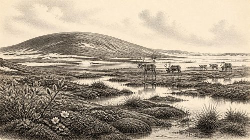
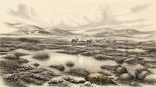
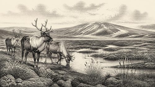
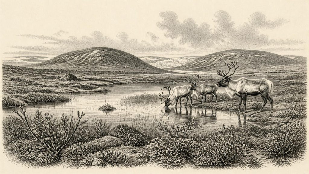
At the notional date of 30,731 BCE, Ireland lay within the climatically unstable MIS 3 cold stage, rather than a precisely datable year. Derryvree, County Fermanagh, preserves freshwater organic deposits between glacial tills, demonstrating a treeless, waterlogged tundra-like wetland during an interval between ice advances. Plant and insect remains indicate sedges, mosses and Arctic-alpine vegetation. Castlepook Cave, County Cork, records a diverse cold-stage fauna including mammoth, reindeer, giant deer, hyaena and Arctic fox. A marked reindeer femur may indicate human butchery, but cannot prove settlement. No evidence supports permanent population, polities, trade, or recoverable culture; subsequent glaciation destroyed much evidence.
Dateline
Modern calendar-year precision is not available for Ireland in 30,731 BCE. No inhabitants left a written date, and no Irish archaeological layer can be assigned responsibly to that individual year. The label is best treated as a point within the Late Pleistocene, during Marine Isotope Stage 3, a long and climatically unstable part of the last glacial cycle. In calendar terms it is roughly 32,681 years before AD 1950, but radiocarbon measurements from this depth of time require calibration and yield broad probability ranges rather than anniversaries. The relevant Irish evidence therefore describes an environmental interval, not a dated event.
A Wetland Between Glaciers
The most informative Irish deposit close to this notional date lies at Derryvree, near Maguiresbridge in County Fermanagh. Roadworks in 1969 cut through a drumlin and exposed a remarkable sequence: glacial till below, then freshwater sands, silts and organic deposits, followed by another till. Tills are the unsorted mixture of clay, stones and debris left directly by glacier ice. Their position above and below the freshwater beds demonstrates a simple but important sequence. Ice had covered the locality; a later interval allowed water, plants and insects to accumulate in a basin; then renewed glaciation buried the evidence. The organic material yielded the radiocarbon determination BIRM-166, conventionally dated to 30,500 +1,170/−1,030 radiocarbon years BP. When calibrated, this is commonly expressed as a broad range of roughly 36,900–31,700 calibrated years BP, or about 34,950–29,750 BCE. Thus 30,731 BCE falls within the wider range illuminated by Derryvree, but cannot be fixed to a particular layer, season or generation.
Derryvree is not a miniature map of the whole island. It is a local archive, unusually precious because later glaciers eroded, rearranged or concealed so much earlier terrain. Even so, it establishes that at least part of Fermanagh had a freshwater landscape during a cold-stage pause between ice advances. The old term “Middle Midlandian” is often used for this part of the Irish record; in broader international terminology it belongs within MIS 3. The interval came well before the Last Glacial Maximum, when the British–Irish Ice Sheet reached its greatest late-glacial extent around 26,000–21,000 years ago. Ireland at this point was not simply an island locked beneath continuous ice, nor a mild green land awaiting farmers. It was a changing northern landscape in which ice, bare ground, wetland and open vegetation shifted over long timescales.
Sedges, Mosses and Cold Water
The freshwater deposits preserve pollen, plant macrofossils, mosses and insects that allow a cautious reconstruction of the Derryvree basin. The evidence points to a treeless, waterlogged setting, often characterised as tundra or muskeg: shallow pools and saturated ground bordered by sedges, grasses, mosses and resilient Arctic-alpine plants. Finds reported from the deposits include dwarf willow, mountain-avens, bogbean, water-milfoil, clubmosses and numerous mosses. These are particularly valuable because seeds, leaves and moss fragments generally give stronger local evidence than wind-borne tree pollen. A grain of tree pollen may have travelled a great distance or been reworked from older sediment; a bogbean seed or aquatic plant fragment records vegetation growing in, or very near, the pool.
The responsible picture is therefore of a cold Fermanagh wetland with open ground and freshwater, not an image of uniform frozen desert. Summers may have been brief but sufficiently productive for plants, insects and herbivores; winters were severe, and permafrost or seasonally frozen ground is plausible in such a setting. Nearby slopes, gravelly ground, river margins and sheltered hollows would not all have supported identical vegetation. Nor should Derryvree’s plant record be projected unchanged across Cork, the western uplands or the coastal lowlands. Its real importance is more exact: it proves that a biologically active freshwater habitat existed in northern Ireland during part of this unstable interval.
The Castlepook Animal World
For the broader animal landscape, the principal Irish evidence comes from Castlepook Cave, also called Mammoth Cave, near Doneraile in north County Cork. Excavations undertaken between 1904 and 1913 recovered a substantial and complicated cave assemblage. Later reassessment and radiocarbon dating have shown that several fossils belong to MIS 3, although the cave deposits were accumulated, disturbed and excavated over a long period. The fauna includes woolly mammoth, reindeer, giant deer, brown bear, wolf, Arctic fox, mountain hare, collared and Norwegian lemmings, stoat and spotted hyaena. Not every species need have lived there at the same moment, and a cave collection cannot be read as a census. Yet together they demonstrate that Ireland supported, or was repeatedly reached by, a far richer cold-stage mammal community than the modern island.
Spotted hyaenas are especially revealing. Castlepook was not a human storeroom accidentally confused with a cave; carnivores could drag prey or scavenged bones into sheltered passages, chew them and disturb their positions. Hyaena remains and tooth-marked bones require archaeologists to distinguish carefully between animal accumulation and human activity. Mammoths and giant deer indicate extensive terrestrial habitat beyond the cave entrance, while reindeer, Arctic fox and lemmings signal cold, open environments. The notable Irish absences of some animals common elsewhere in Ice Age north-west Europe, such as woolly rhinoceros and steppe bison, may reflect real biogeographical limits, but they may also partly result from the small and uneven Irish fossil record. Evidence is strongest for a mosaic of open habitats and mobile animal populations, not for a complete food web reconstructed in detail.
A Single Marked Reindeer Bone
The period has exceptional archaeological interest because a reindeer femur from Castlepook has been reported as about 33,000 years old and as bearing a deep linear mark interpreted by zooarchaeologist Ruth Carden as damage made by a sharp stone tool during the butchery of fresh bone. If that interpretation is sustained, it may represent the earliest known evidence of human activity in Ireland: not a settlement, but an episode in which a person or small group handled a reindeer carcass. The possible action is modest and concrete. Meat, marrow, hide, sinew or bone may have been taken from a large animal in a demanding seasonal landscape.
Its limits are equally important. The femur was recovered from an old cave collection, not from a modern excavation of a sealed camp floor. No stone-tool assemblage securely associated with it, hearth, shelter, burial, human bone, artwork or extensive concentration of butchered remains of comparable age has been published from Ireland. The date concerns the animal’s death within a statistical range; it does not independently date the mark, identify its maker, establish where the animal was killed, or reveal the duration of a visit. Consequently, it would be wrong to claim a permanent Irish population, a named people, a continuous lineage, or even a definite hunting camp in 30,731 BCE. The femur is significant proposed evidence for human presence, while the wider Castlepook fauna is firm evidence for an Ice Age ecosystem.
No Polities, No Proven Trade
Political affairs, diplomacy and organised conflict cannot be recovered for Ireland at this date. There were no states, kingdoms, written laws or named leaders, and there is no evidence for a settled population large enough to reconstruct social institutions. If humans did reach the island, they would have belonged to highly mobile Upper Palaeolithic communities whose social knowledge, kinship and decision-making leave no direct trace in the Irish record. Nor is there evidence for farming, livestock, pottery, metalworking, villages, monuments or regular exchange networks. It is sensible to infer that successful visitors would have needed practical knowledge of weather, shelter, animal movement and stone-working; it is not sensible to turn that general likelihood into a detailed Irish society.
Sea levels were lower than today and the geography of the Irish Sea basin was different, but the precise routes by which animals or people reached Ireland remain unresolved. Reduced sea level did not automatically provide a simple land bridge, and the geological literature warns against assuming one. Faunal connectivity with Britain and continental Europe is evident over longer Pleistocene spans, but connectivity need not mean a permanently dry road, a single route, or one migration event. For possible human visitors, water crossings, temporary coastal corridors and routes now submerged by later sea-level rise must remain possibilities rather than assertions.
Culture Beyond Recovery
There is no securely attributable Irish cave art, personal ornament, ritual structure or burial from this horizon. Religion, language, music, stories and systems of learning therefore cannot be described as Irish facts for 30,731 BCE. The absence of such evidence does not prove that any visitors lacked belief or culture; it shows only that archaeology has not recovered material traces that allow them to be specified. Later Ice Age societies elsewhere in Europe demonstrate the cultural capacities of Homo sapiens, but their art and customs cannot simply be imported into Ireland.
The lasting historical significance of this period lies in its fragility. Derryvree preserves a cold freshwater refuge between glacier advances. Castlepook preserves bones from an animal world of mammoths, reindeer, giant deer and hyaenas. One marked reindeer femur raises the possibility that people also entered this world. Subsequent expansion of the British–Irish Ice Sheet transformed the landscape and probably removed much of the evidence that might settle the question. Around 30,731 BCE, then, Ireland is known less through events than through a few buried sediments and bones: enough to reveal a living, changing Ice Age land, but not enough to populate it confidently with an enduring human society.
Primary Sources
- A Middle Midlandian Freshwater Series at Derryvree, Maguiresbridge, County Fermanagh, Northern Ireland
- The Subdivision of the Quaternary Period in Ireland
- A Reconsideration of the Radiocarbon Dating of the Marine Isotope Stage 3 Fauna from Southern Ireland
- The Irish Quaternary Fauna Project
- The IntCal20 Northern Hemisphere Radiocarbon Age Calibration Curve (0–55 cal kBP)
- Prehistoric Details
- Heritage Artefacts of County Cork 2021
- Archaeological Heritage of County Cork 2020
- Castlepook Cave
- Pleistocene Vertebrates in the British Isles
- Dimensions and Chronology of the Last Ice Sheet in Western Ireland
- Maximum Extent and Dynamic Behaviour of the Last British–Irish Ice Sheet West of Ireland
- New Data for the Last Glacial Maximum in Great Britain and Ireland
- The Problem of a Late Quaternary Landbridge Between Britain and Ireland
- Freshwater Organic Deposits and Stratified Sediments Between Early and Late Midlandian Till Sheets, at Aghnadarragh, County Antrim, Northern Ireland
- First Evidence of a Late Upper Palaeolithic Human Presence in Ireland
- New Insights on the Fauna of Ireland’s Younger Dryas and Early Holocene from Alice & Gwendoline Cave
- Irish Caves Database: Mammoth Cave
- Sedimentary Ancient DNA Reveals Late Pleistocene Faunal Connectivity Between Ireland and Eurasia
- The IntCal20 Northern Hemisphere Radiocarbon Age Calibration Curve (0–55 kcal BP)
- Oscillating Retreat of the Last British-Irish Ice Sheet on the Continental Shelf Offshore Galway Bay, Western Ireland
- Radiocarbon Constraints on the Age of the Maximum Advance of the British–Irish Ice Sheet in the Celtic Sea