
Castlepook’s Cutmark Controversy30769 BCE
Around 30,769 BCE, Ireland’s history is reconstructed from broad environmental evidence rather than annual records. Derryvree, County Fermanagh, preserves freshwater sediments between tills, indicating an ice-free tundra wetland during later Marine Isotope Stage 3, with mountain-avens, dwarf willow, bogbean and other cold-adapted plants. Conditions varied regionally as ice accumulated, rather than covering the island uniformly. Castlepook Cave, County Cork, contains mixed-age remains of reindeer, mammoth, giant deer and predators, demonstrating episodic diverse fauna. A cut-marked reindeer bone may indicate early human butchery, but remains unconfirmed and cannot establish settlement. Climate, ice, water, vegetation and animals define this fragmentary period overall.
Dateline
30,769 BCE is a modern chronological label, not a year that can be recovered from an Irish calendar or historical record. No named people, settlements, rulers or events can be assigned to this particular twelve-month span. In archaeological terms, it falls about 32,719 years before the conventional reference year of AD 1950, within the Late Pleistocene and Marine Isotope Stage 3 (MIS 3), a climatically unstable part of the last Ice Age. The responsible approach is therefore to examine the evidence from broad calibrated ranges, rather than to invent an annual narrative.
The closest especially useful Irish environmental sequence is at Derryvree, near Maguiresbridge in County Fermanagh. Its organic sediments produced a conventional radiocarbon result of 30,500 +1,170/−1,030 years BP. Radiocarbon years are not calendar years, and the uncertainty is substantial at this depth of time. Calibration using modern curves places the deposit broadly within later MIS 3, often discussed at approximately 36,900–31,700 calibrated years BP, or roughly 34,950–29,750 BCE. The nominal year considered here falls within that wide interval, but cannot be attached to a particular layer, season or living community at Derryvree.
A Freshwater Interval Beneath Ice
Derryvree was revealed by road works in 1969, when a cutting through a drumlin exposed freshwater silts and fine sands trapped between two thick layers of till: stony sediment left by glacier ice. The sequence provides unusually secure relative evidence. Ice had first laid down the lower till. Later, the locality was free of overriding ice long enough for water, mineral sediment and organic remains to accumulate. A subsequent glacial advance then deposited the upper till, sealing the older wetland beneath the drumlin.
That sequence is important, but its limits are equally important. It proves that this part of Fermanagh contained an ice-free freshwater environment during a phase of MIS 3. It does not prove that every part of Ireland was ice-free at the same time, nor that the whole island had one uniform climate. Ice margins, upland glaciers, lowland wetlands and exposed ground could vary markedly across a relatively small island. Later ice movement also destroyed, buried or disturbed much of the evidence that might once have given a fuller picture.
Tundra, Pools and Short Seasons
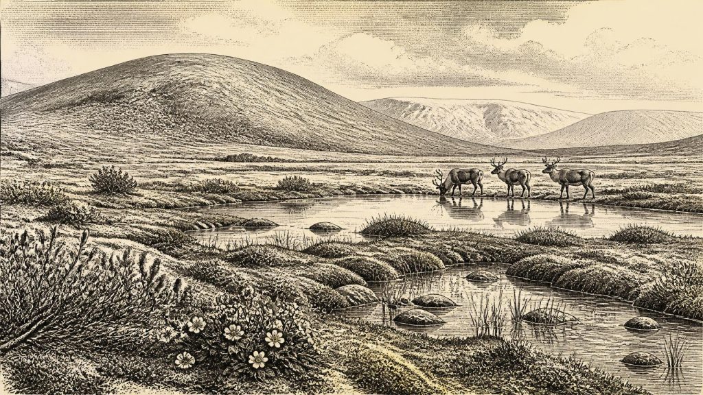
The Derryvree flora and fauna indicate open tundra vegetation and a periglacial climatic regime: cold-country conditions shaped by frost, severe winters and proximity to ice, but not necessarily permanent ice cover at the site itself. This was not the familiar wooded Ireland of later prehistory. Woodland, farming landscapes and the dense human settlement patterns of historical Ireland lay far in the future. Instead, the evidence points to low, sparse vegetation around wet ground and shallow water.
Plant remains make the reconstruction tangible. Fossils from Derryvree include mountain-avens (Dryas octopetala), dwarf willow (Salix herbacea) and bogbean (Menyanthes trifoliata), alongside mosses, sedges and other plants suited to cold, exposed or waterlogged settings. A bogbean seed is particularly eloquent evidence of freshwater margins, while mountain-avens and dwarf willow support the wider interpretation of open, cold-adapted vegetation. Such finds are direct evidence for plants in or near this basin; they should not be stretched into a precise island-wide map of every slope and valley.
At ground level, the landscape would have been varied rather than uniformly barren. A sheltered hollow could hold shallow pools, sedge edges, mossy ground and aquatic plants, while nearby gravelly or frost-churned ground supported herbs and dwarf shrubs. Seasonal meltwater probably mattered greatly to drainage and plant growth. The short summer growing season may have produced bursts of biological activity, followed by winters in which frozen ground, snow, wind and scarcity dominated. Derryvree shows that cold Ice Age Ireland nevertheless contained living freshwater habitats.
Ice Building, Not an Island-Wide Freeze
30,769 BCE belongs to a period of rapid environmental change, not to the fullest extent of the last British–Irish Ice Sheet. The large synthesis produced by the BRITICE-CHRONO project begins its mapped reconstruction at 31,000 years BP because earlier constraints are sparse. At that point it identifies growing centres of ice accumulation, including one in Northern Ireland, while emphasising considerable uncertainty. The same research reconstructs sustained ice-sheet growth between about 31,000 and 26,000 years BP, followed by a later maximum around 23,000 years BP.
The implication is caution rather than a simple picture of a wholly ice-covered or wholly open Ireland. Around the broad horizon represented by this date, some regions may have experienced advancing ice or small ice caps, especially on high ground, while other localities preserved wetland, tundra and animal habitat. Changing sea level also altered coastlines and routes across the surrounding shelves. Yet neither a precise Irish shoreline nor a dependable route for a particular year can be reconstructed. The record supports regional instability and changing connectivity, not a confident map of journeys.
Castlepook’s Mixed Animal Archive
In north County Cork, Castlepook Cave near Doneraile provides the principal Irish animal archive relevant to this broad pre-Last Glacial Maximum period. Its deposits have produced remains of reindeer, woolly mammoth, giant deer, brown bear, wolf, Arctic fox, lemmings and spotted hyaena. The list corrects any assumption that Ice Age Ireland was devoid of large mammals. It demonstrates that different cold-stage animal communities reached the island at different times during MIS 3 and afterwards.
But Castlepook is not a single moment frozen in the ground. Bones entered the cave through several processes: animals may have died in natural traps; bears and hyaenas used caves; water moved material; and nineteenth- and twentieth-century excavation disturbed deposits. Radiocarbon programmes have shown that specimens from the cave differ greatly in age. Some earlier dates were subsequently revised after improved pretreatment methods became available. The cave therefore cannot responsibly be presented as a single herd, hunt or ecosystem living together in 30,769 BCE.
The broad ecological interpretation is still powerful. Reindeer and lemmings indicate cold conditions; mammoth, giant deer and predators show that Ireland at intervals supported more diverse food webs than the modern island. Predators and scavengers had prey, carrion and shelter, while herbivores required enough seasonal vegetation to survive. Yet the precise relationship between Derryvree’s Fermanagh wetland and Castlepook’s Cork cave fauna remains uncertain. They are evidence from separate regions and deposits with different formation histories, not two panels of one contemporaneous landscape.
The Reindeer Bone and Human Presence
Castlepook also poses the most consequential question about people. A reindeer femur from the cave has been reported to bear a deep mark interpreted as having been made by a stone tool during butchery, and it has been publicised as dating to around 33,000 years ago. If the mark is confirmed as human-made and securely associated with the dated bone, it would push possible human activity in Ireland far earlier than the long-accepted late-glacial evidence.
That possibility must remain distinct from proof of settlement. The bone is not a hearth, dwelling floor, tool assemblage, burial or repeatedly occupied camp. Nor does it establish a permanent population, family group, named culture or migration route. It may point to a brief visit by Upper Palaeolithic hunter-gatherers who processed a carcass, but that is an interpretation awaiting fuller confirmation from securely excavated context and additional artefacts. Current work at Castlepook, including new excavation and scientific dating, is valuable precisely because it may test this exceptional claim.
What Cannot Be Written Into the Record
There is no evidence for political affairs, diplomacy, kingdoms, organised warfare, formal religion, monuments, agriculture, trade networks or literacy in Ireland at this date. There are no securely known houses, villages, graves, temples or artistic objects that permit a reconstruction of everyday social life. If people entered Ireland, they would have been mobile hunter-gatherers in a harsh and changing world; but Ireland’s evidence does not yet allow historians to describe their language, beliefs, kinship or technology beyond the disputed inference of a stone tool from the Castlepook mark.
The most meaningful history of Ireland around 30,769 BCE is therefore environmental and evidential. A Fermanagh drumlin preserves a buried freshwater tundra, with cold-adapted plants around pools and wet ground. Cork caves preserve the remains of mammals that crossed or survived within changing Ice Age landscapes. Growing ice later obscured much of this world. The central development was not a recorded human event, but the unstable relationship among climate, ice, water, vegetation and animals on the north-western edge of Europe. It is a fragmentary history, but a remarkable one: Ireland was neither timeless nor empty, even where its human story remains unresolved.
Primary Sources
- A Middle Midlandian Freshwater Series at Derryvree, Maguiresbridge, County Fermanagh, Northern Ireland
- A reconsideration of the radiocarbon dating of the Marine Isotope Stage 3 fauna from southern Ireland
- The Irish Quaternary Fauna Project
- Growth and retreat of the last British–Irish Ice Sheet, 31,000 to 15,000 years ago: the BRITICE-CHRONO reconstruction
- BRITICE-CHRONO maps and GIS data of the last British-Irish Ice Sheet 31 to 15 ka
- The IntCal20 Northern Hemisphere Radiocarbon Age Calibration Curve (0–55 cal kBP)
- Irish Pleistocene Biostratigraphy
- New insights on the fauna of Ireland’s Younger Dryas and Early Holocene from Alice & Gwendoline Cave
- Origin of British and Irish mammals: disparate post-glacial colonisation and species introductions
- Prehistoric Details
- Heritage Artefacts of County Cork
- 2022:564 – Castlepook Cave, Castlepook South, Cork
- Ireland’s Palaeolithic Archaeology – Fleeting Footprints in a Frozen Land
- Menyanthes trifoliata
- Dryas octopetala
- Salix herbacea
- The Greenland Ice Core Chronology 2005 (GICC05)
- NGRIP/GRIP GICC05 time scale and δ18O values
- The Palaeolithic: A Maritime Archaeological Research Agenda for England
- Timing, pace and controls on ice sheet retreat: an introduction to the BRITICE-CHRONO transect reconstructions of the British-Irish Ice Sheet
- Stratigraphic and palaeo-geomorphological evidence for the glacial-deglacial history of the last British-Irish Ice Sheet in the north-western Irish Sea
