Cork’s Incised Reindeer30740 BCE
Around 30,740 BCE, Ireland was a cold, changing frontier during Marine Isotope Stage 3, not a precisely datable historical moment. Lower sea levels altered geography, although routes from Britain remained uncertain. Derryvree, County Fermanagh, preserves evidence of an earlier ice-free freshwater interval, with tundra vegetation and small fauna, before later glaciation. Castlepook Cave, County Cork, yielded cold-climate mammals. A reindeer femur, dated about 33,000 years ago, bears a possible stone-tool cutmark, suggesting Upper Palaeolithic human activity. However, disturbed deposits and absent tools or occupation layers preclude claims for settlement. Evidence indicates ecologically inhabited, glacially vulnerable Ireland, perhaps visited by people.
Dateline
30,740 BCE is a modern chronological label, not a date anyone in prehistoric Ireland could have recognised or recorded. At this distance in time, archaeology cannot identify an event in a particular year, name a community, or reconstruct a political history. In calendar terms the point falls around 32,690 years before AD 1950, the conventional ‘present’ used in radiocarbon science. Yet even that conversion should not suggest false precision: radiocarbon ages must be calibrated, and Irish deposits of this antiquity normally yield ranges spanning centuries or millennia. The responsible subject is therefore Ireland during the later part of Marine Isotope Stage 3, shortly before the fullest expansion of the last British–Irish Ice Sheet.
A Cold Island, Not a Frozen Blank
Ireland around this broad interval was part of a markedly colder north-west European world, but it should not be imagined as permanently buried beneath an unbroken sheet of ice. The Last Glacial Maximum lay ahead, with the British–Irish Ice Sheet reaching its greatest overall extent much later, broadly between about 26,000 and 19,000 years ago. Ice growth was regional, episodic and difficult to reconstruct because later glaciers repeatedly eroded or covered older landscapes. Conditions in Cork, Fermanagh, the Irish Sea basin and upland districts need not have been identical at the same moment.
The island’s physical geography was also unlike the modern familiar outline. Global sea level was lower because enormous volumes of water were held in continental ice sheets, exposing more of the surrounding continental shelf. But lowered sea level does not automatically mean a convenient land bridge from Ireland to Britain. The Irish Sea’s changing bathymetry, local ice cover, islands and channels make the route uncertain. The presence of mammals demonstrates that viable dispersal routes existed at intervals; it does not prove a continuous dry corridor, a particular crossing point, or a human journey in 30,740 BCE.
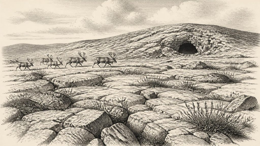
What can be said with confidence is that Ireland belonged to a climatic frontier. Long cold seasons, short growing periods, strong winds and periglacial processes shaped open ground. Frost fractured rock, seasonal thaw shifted sediment, and sparse plant cover left much soil exposed. The resulting country was not a forested agricultural landscape. There were no fields, roads, monuments, farms or villages whose traces can be assigned to this time.
Derryvree’s Buried Wetland
The most informative Irish environmental record for the wider period comes from Derryvree near Maguiresbridge in County Fermanagh. Road works in 1969 cut through a drumlin and exposed freshwater silts, fine sands and organic deposits trapped between two separate layers of glacial till. The sequence is powerful evidence in itself: glacier ice had occupied the site, an ice-free freshwater and wet-ground interval followed, and a later glacial advance sealed the deposits beneath more till.
Organic material from this freshwater series, laboratory sample Birm-166, produced a radiocarbon determination of 30,500 years before present, with a substantial error margin. That is a radiocarbon age, not 30,500 BCE; when calibrated, it belongs broadly to the mid-to-late 30,000s years before present. Derryvree must therefore be treated as evidence for an earlier environmental phase relevant to 30,740 BCE, rather than as a wetland observed in that exact numbered year.
Its flora and small-fauna assemblages indicate open tundra or muskeg-like ground under a periglacial climate. Mosses, sedges and cold-adapted flowering plants, alongside aquatic species, show that shallow freshwater survived locally. Fossils including mountain-avens, dwarf willow, bogbean and water-milfoil reveal a mosaic of wet hollows, pond margins and treeless ground, rather than a single featureless ice desert. Such evidence provides a useful environmental analogue for later MIS 3 Ireland: habitats could be severe, seasonal and sparsely vegetated while still sustaining plant and animal life.
It does not, however, establish that every Irish region was ice-free or that the same plants grew at Castlepook in north Cork at the same time. The strength of Derryvree is its carefully recorded stratigraphic sequence and its direct environmental evidence. Its limitation is geographical and chronological: one buried basin cannot stand for the entire island or for a calendar year.
The Castlepook Clue
For the possibility of people in Ireland, the crucial evidence lies far south at Castlepook Cave, near Doneraile in County Cork. Also known as Mammoth Cave, this limestone cave system produced a remarkable Pleistocene bone collection during excavations led by the naturalist Richard J. Ussher in the early twentieth century. Reassessment, modern radiocarbon dating and continuing investigation have shown that its remains span more than one phase of the last glacial cycle. This mixed history is both the cave’s value and its central difficulty.
The fauna demonstrates that mammals associated with cold, open environments reached Ireland between at least about 45,000 and 20,000 years ago. Castlepook has yielded remains attributed to reindeer, giant deer, woolly mammoth, brown bear, wolf, Arctic fox, spotted hyaena, mountain hare and lemmings. These animals did not necessarily live together at precisely the same time, nor did each use the cave in the same way. Carnivores could drag carcass parts underground; water, collapse, earlier digging and reworking could move bones. A cave collection is consequently not a snapshot of one living landscape.
One reindeer femur has exceptional importance. It has been dated to roughly 33,000 years ago and bears a deep linear mark interpreted by the palaeozoologist Ruth Carden as having been made on fresh bone with a sharp stone implement during butchery. If this interpretation is sustained, it is the earliest known indication of human activity in Ireland by a very large margin. It suggests that people—almost certainly mobile Upper Palaeolithic hunter-gatherers—may have processed a reindeer carcass on, or near, the island during the wider period.
The claim must remain proportionate to the object. The bone does not demonstrate a settlement, a permanent population, a named cultural group or a hunting camp at Castlepook. No securely associated stone-tool assemblage, hearth, dwelling floor, grave, human skeleton or stratified occupation layer of comparable age has yet been found there. The femur was recovered from an antiquarian cave collection whose original deposits had been disturbed. The date tells us when the animal lived; the judgement that the incision is a human cutmark depends separately on close taphonomic analysis. Modern excavations have sought surviving undisturbed deposits, but the question of Palaeolithic occupation remains open.
Life at the Edge of Evidence
If people did reach Ireland in this period, their economy would have depended on skill, movement and cooperation rather than cultivation. Reindeer were a potentially valuable resource for meat, fat, hide, sinew, antler and bone, while other large mammals offered opportunities as prey or scavenged carcasses. Yet the Castlepook evidence cannot distinguish hunting from the processing of an already dead animal, or establish the season, group size, route travelled or length of stay. It is safer to speak of a possible brief human presence than of a settled society.
There is no direct Irish evidence from around 30,740 BCE for chiefs, territories, warfare, diplomacy, trade networks, formal religion, language, art or teaching. Nor can later Gaelic identities, kingdoms or traditions be projected backwards into this Pleistocene world. Portable stone technology and social knowledge certainly existed among contemporary Upper Palaeolithic populations elsewhere in Europe, but no securely dated Irish toolkit permits a cultural label to be assigned here. Inferences about shared food, shelter, clothing, kinship or ritual would be plausible in a general European sense, but they remain unproven for Ireland.
What This Date Means
The principal development relevant to 30,740 BCE is not a recorded Irish event but a revision in the scale of the island’s deep past. Derryvree shows that cold-stage Ireland could include ice-free freshwater habitats and tundra vegetation before later ice advances. Castlepook shows that a varied large-mammal fauna occupied or passed through parts of the island, and its marked reindeer femur raises the serious possibility of human activity tens of millennia before the well-attested Mesolithic settlement of Ireland.
That possibility is historically important precisely because it is so limited. Around this date, Ireland was a changing cold landscape at Europe’s north-western margin: ecologically inhabited, glacially vulnerable and perhaps visited by people, but not yet documented as a permanently settled human homeland. The evidence asks for curiosity without certainty, and for a history built from dated bones, buried silts and carefully stated limits rather than invented episodes.
Primary Sources
- A Middle Midlandian Freshwater Series at Derryvree, Maguiresbridge, County Fermanagh, Northern Ireland
- A reconsideration of the radiocarbon dating of the Marine Isotope Stage 3 fauna from southern Ireland
- The Irish Quaternary Fauna Project
- Growth and retreat of the last British–Irish Ice Sheet, 31 000 to 15 000 years ago: the BRITICE-CHRONO reconstruction
- The timing and magnitude of the British–Irish Ice Sheet between Marine Isotope Stages 5d and 2: implications for glacio-isostatic adjustment, high relative sea levels and ‘giant erratic’ emplacement
- A stratigraphic framework for abrupt climatic changes during the Last Glacial period based on three synchronized Greenland ice-core records: refining and extending the INTIMATE event stratigraphy
- The subdivision of the Quaternary Period in Ireland
- Quaternary History of South Fermanagh: Field Guide
- Heritage Artefacts of County Cork
- 2022:564 – Castlepook Cave, Castlepook South, Cork
- Archaeology Research Excavation Grant 2022: Castlepook Cave Project Final Report
- Occurrence of mammalia relicts at site Castlepook Cave
- The problem of a late Quaternary landbridge between Britain and Ireland
- Pattern and timing of retreat of the last British-Irish Ice Sheet
- Pattern, style and timing of British–Irish Ice Sheet advance and retreat over the last 45 000 years: evidence from NW Scotland and the adjacent continental shelf
- Advance and retreat of the marine-terminating Irish Sea Ice Stream into the Celtic Sea during the Last Glacial: Timing and maximum extent
- New data for the Last Glacial Maximum in Great Britain and Ireland
- Radiocarbon constraints on the age of the maximum advance of the British–Irish Ice Sheet in the Celtic Sea
- New insights on the fauna of Ireland's Younger Dryas and Early Holocene from Alice & Gwendoline Cave
- Ireland's Palaeolithic Archaeology – Fleeting Footprints in a Frozen Land
