Derryvree’s Alpine Shallows30626 BCE
Around 30,626 BCE, Ireland has no recoverable annual history; evidence records fluctuating Late Pleistocene environments. At Derryvree, County Fermanagh, freshwater sediments between glacial tills indicate a local ice-free interval, dated broadly to 34,950–29,750 BCE, with tundra and wetland plants in a cold, open mosaic landscape. Ice margins, drainage and sea levels changed, preventing island-wide reconstructions. Castlepook Cave, County Cork, preserves MIS 3 fauna including mammoth, reindeer, giant deer and predators, but not a momentary census. Human presence remains unproven, despite a possible cut-marked bone. No settlements, institutions or cultural traditions can be assigned; fragile deposits instead reveal dynamic glacial environments.
Dateline
The label 30,626 BCE cannot denote a recoverable Irish year in the modern sense. No community on the island used a calendar that can be connected to this date, and no settlement, person, object or event can be fixed to it. Measured against the radiocarbon convention of “before present” (AD 1950), it falls roughly 32,575 years ago, in the Late Pleistocene and Marine Isotope Stage 3 (MIS 3). The responsible history of Ireland at this depth of time is therefore an account of environmental intervals, not an annual chronicle: what glaciers, wetland sediments, fossil plants and animal bones can show, and what they cannot.
The closest especially informative Irish record is the Derryvree deposit near Maguiresbridge, County Fermanagh. In 1969, roadworks cut through a drumlin and exposed freshwater silts, fine sands and organic material lying between two separate sheets of till: the unsorted debris deposited directly by glacier ice. The organic layer produced radiocarbon determination BIRM-166, conventionally reported as 30,500 radiocarbon years BP, with a substantial uncertainty of +1,170 and −1,030 years. A radiocarbon result is not a calendar date. Once calibrated against changing atmospheric carbon-14 concentrations, it gives a wide probability range, commonly expressed at approximately 36,900–31,700 calibrated years BP. In BCE terms, that is broadly about 34,950–29,750 BCE. The nominated year lies within that span, but does not identify one season, one sediment layer or one generation at Derryvree.
Fresh Water Between Glaciers
Derryvree’s sequence tells a clear but local story. Ice had first crossed the Fermanagh landscape and left the lower till. Later, at least in this basin, conditions allowed standing or slow-moving fresh water to collect silts, sands, plants and insects. A further glacial advance subsequently covered the deposits with the upper till, preserving them beneath the drumlin. This is strong evidence for an ice-free or non-glacial interval at the site; it is not evidence that every part of Ireland was simultaneously open, habitable ground. Uplands, Atlantic-facing districts, coasts and the Irish Sea basin may have experienced very different conditions.
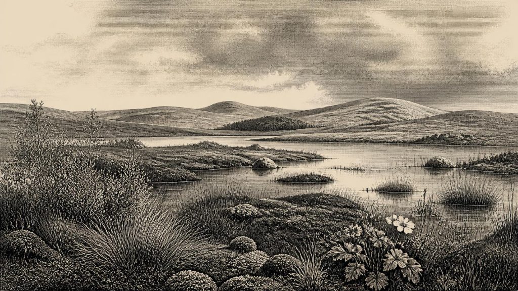
The preserved biological evidence points to a severe, open environment. Plant remains include cold-adapted species associated with tundra and wet ground, among them mountain avens, dwarf willow, clubmosses and sedges; bogbean and water-milfoil indicate freshwater habitats. These names should not conjure an unbroken carpet of Arctic vegetation. The likely landscape was a mosaic: sedgy pond margins and shallow water in sheltered hollows, damp mossy ground, herb-rich patches, gravelly or frost-disturbed surfaces, and exposed tracts where vegetation was sparse. Closed temperate woodland, so characteristic of much later Ireland, has no place in this reconstruction. The evidence supports a periglacial landscape with seasonal contrasts, not a single uniform “ice desert”.
This environmental window belongs to the climatically volatile middle part of the last glacial cycle. Greenland ice cores record abrupt shifts between colder stadials and shorter, relatively milder interstadials. The notional date is broadly close to Greenland Interstadial 5 in those distant records, but it would be unsafe to impose that event precisely upon Fermanagh. Derryvree’s original measurement has a broad uncertainty, its calibrated range is broader still, and local Irish weather, ice and vegetation did not necessarily respond in lockstep with Greenland. The defensible conclusion is less dramatic but more valuable: north-central Ireland was not continuously buried beneath glacier ice throughout this phase of MIS 3.
An Island of Moving Margins
Ireland around this time was shaped by changing ice margins and drainage rather than by stable coastlines, fields or settlements. The full Last Glacial Maximum lay ahead, although its timing and geometry varied across the British–Irish Ice Sheet. Recent syntheses demonstrate major ice-sheet growth around and after 31,000 years ago, followed by maximum expansion later in MIS 2. They also stress uncertainty over earlier advances. That uncertainty matters here. A map showing all Ireland ice-covered in 30,626 BCE would claim more than the evidence permits; a map showing an entirely ice-free island would be equally misleading. Derryvree records open freshwater conditions at one place in an interval framed by glaciation.
Lower global sea levels altered the Irish Sea and continental shelves, but they do not by themselves prove an easy overland route to Ireland at this particular moment. Ice margins, sea level, changing land levels and the configuration of channels all mattered. Animals plainly reached Ireland intermittently during the Late Pleistocene, but the route, timing and frequency of each movement remain difficult to reconstruct. The island was not a fixed ecological compartment. It was a changing north-western edge of wider European environments, alternately connected, constrained and transformed by ice and water.
Mammals and Carnivores
Castlepook Cave, also called Mammoth Cave, near Doneraile in north County Cork provides the most spectacular Irish animal archive relevant to this broad period. Its deposits have yielded remains of woolly mammoth, reindeer, giant deer, brown bear, wolf, Arctic fox, mountain hare, lemmings and spotted hyaena. Improved radiocarbon pretreatment and redating have shown that some older dates from Castlepook and other southern Irish caves were misleadingly young; the cave fauna is now understood to include a significant MIS 3 component. Yet cave deposits accumulated over long periods and were subject to disturbance, redeposition and early excavations with limited modern recording. The cave is evidence for an intermittently rich cold-stage fauna in southern Ireland, not a census taken in 30,626 BCE.
Even so, the animals illuminate everyday ecological realities more securely than they illuminate human ones. Reindeer, mammoth and giant deer point to open feeding landscapes; lemmings and Arctic fox strengthen the picture of cold conditions. Spotted hyaena, wolves and bears remind us that carcasses and caves were contested resources in animal terms. A cave containing bones need not have been a human camp: carnivores can transport, gnaw, scatter and accumulate remains, while water and sediment can later rearrange them. The most immediate forms of conflict demonstrable in this record are ecological—predation, scavenging, competition for shelter and survival through cold seasons—not warfare between known human groups.
The Human Question
There is no securely excavated settlement, hearth, stone-tool assemblage or human burial in Ireland that can be assigned to this date. A reindeer femur from Castlepook has been reported as carrying a mark consistent with cutting by a stone tool, and its possible age has drawn attention to the prospect of Upper Palaeolithic human activity far earlier than the island’s better-established terminal-Pleistocene evidence. If that interpretation is confirmed, it would demonstrate only a brief act of carcass processing: not an enduring population, a named people, a village or a migration route. The age of the bone, the nature of the mark and the lack of a securely associated artefact assemblage must be considered separately.
Accordingly, it is possible that highly mobile people entered Ireland during favourable windows in MIS 3, as Upper Palaeolithic groups were certainly present elsewhere in north-west Europe. It is not presently possible to say that they did so in 30,626 BCE, nor to reconstruct their numbers, language, kinship, ritual life or seasonal round. Ireland’s earliest well-supported evidence of human modification remains vastly later: the butchered brown-bear patella from Alice and Gwendoline Cave in County Clare, directly dated to about 12,810–12,590 calibrated BP. That later find cannot be projected backwards to supply a population where the older record is silent.
No Kingdoms, Trade or Recorded Beliefs
For this reason, political affairs, diplomacy and institutions cannot be described for Ireland at this point. There is no evidence for chiefs, territories, alliances, warfare, exchange systems or long-distance trade conducted by people on the island. Nor is there evidence from which to identify religion, art, formal learning or social rank. It would be tempting to borrow the vividly documented cave art and tool traditions of France, Iberia or central Europe and call them Irish culture; that would be analogy, not evidence. The material record instead reveals the environmental preconditions within which any transient human visit would have occurred: uncertain routes, sparse resources, dangerous carnivores, cold open ground and rapidly changing ice.
The great historical significance of this remote interval lies in its fragility as evidence. Later glaciers scoured away surfaces, reworked sediments and buried older landscapes, leaving rare protected archives such as Derryvree and Castlepook to carry much of the story. Around 30,626 BCE, Ireland was neither the green, wooded island of later prehistory nor simply a featureless sheet of ice. It was a dynamic cold-stage world in which freshwater shallows could briefly support alpine and wetland plants between episodes of glaciation, while large mammals moved through a shifting Atlantic frontier. That is the cautious, compelling Ireland archaeology can presently recover.
Primary Sources
- A Middle Midlandian Freshwater Series at Derryvree, Maguiresbridge, County Fermanagh, Northern Ireland
- A reconsideration of the radiocarbon dating of the Marine Isotope Stage 3 fauna from southern Ireland
- The Irish Quaternary Fauna Project
- Castlepook Cave, County Cork: County Geological Site Report
- Occurrence of mammalia relicts at site Castlepook Cave
- Growth and retreat of the last British–Irish Ice Sheet, 31,000 to 15,000 years ago: the BRITICE-CHRONO reconstruction
- The timing and magnitude of the British–Irish Ice Sheet between Marine Isotope Stages 5d and 2: implications for glacio-isostatic adjustment, high relative sea levels and ‘giant erratic’ emplacement
- Exploring controls of the early and stepped deglaciation on the western margin of the British Irish Ice Sheet
- Pattern, style and timing of British–Irish Ice Sheet advance and retreat over the last 45,000 years: evidence from NW Scotland and the adjacent continental shelf
- The IntCal20 Northern Hemisphere Radiocarbon Age Calibration Curve (0–55 cal kBP)
- Independent tephrochronological evidence for rapid and synchronous oceanic and atmospheric temperature rises over the Greenland stadial-interstadial transitions between ca. 32 and 40 ka b2k
- Figure 6.— The subdivision of the Quaternary Period in Ireland
- Irish Quaternary Association Publications
- Irish Quaternary Association Field Guides
- BRITICE-CHRONO: Aims, Hypotheses and Outcomes
- BRITICE-CHRONO: Project Introduction
- First evidence of a Late Upper Palaeolithic human presence in Ireland
- New insights on the fauna of Ireland's Younger Dryas and Early Holocene from Alice & Gwendoline Cave
- 2022:564 – Castlepook Cave, Castlepook South, Cork
- Heritage Artefacts of County Cork
