Maguirebridge’s Silted Interlude30665 BCE
Ireland around 30,665 BCE lay within unstable Marine Isotope Stage 3, not a precisely datable prehistoric year. Derryvree, near Maguiresbridge, preserves organic freshwater silts between glacial tills, indicating a cold, locally ice-free wetland during a broadly dated interval. Mosses, sedges and northern insects suggest open, treeless terrain, while related Fermanagh sites show intermittent non-glacial conditions in northern Ireland. Ireland’s coasts, sea levels and ice margins changed dynamically before the last glacial maximum. Cave faunas demonstrate mammoth, reindeer and other animals, but not synchronised landscapes or human occupation. No evidence establishes communities, settlement or migration; the record chiefly documents environmental transformation.

Dateline
The label 30,665 BCE is a modern way of counting backwards, not a year that anyone in prehistoric Ireland could have named or recorded. It equates only approximately to 32,600 years before AD 1950, the reference point used for “before present” dating. At such depth in time, calendar-year precision is unavailable: radiocarbon determinations have sizeable uncertainties, must be calibrated, and date particular samples rather than an entire island. The responsible subject is therefore Ireland around this point, in the later part of Marine Isotope Stage 3 (MIS 3), rather than an invented event in a single year.
A Date Within a Long Cold Stage
MIS 3 was not one uniform Ice Age winter. Greenland ice cores show that the North Atlantic climate repeatedly switched between colder stadials and relatively milder interstadials, often on timescales of centuries or millennia. Those shifts did not translate mechanically into identical weather in Ireland, but they make clear why Irish deposits from this era must be read as local records within an unstable wider climate. Temperatures, snowfall, growing seasons, sea ice and glacier margins could all alter substantially over periods far longer than a human lifetime yet far shorter than the span normally implied by “the Ice Age”.
The fullest expansion of the last British–Irish Ice Sheet lay ahead. Its maximum extent is generally associated with the period after about 27,000 calibrated years before present, although research increasingly stresses that ice-sheet growth and retreat before that maximum were complex, regionally varied and still imperfectly dated. Around 30,665 BCE, Ireland was moving through a cold world in which local ice-free terrain, glacier-fed landscapes and advancing ice could have coexisted in different regions and at different times. It would be misleading either to picture the whole island as a single white ice cap or to describe it as wholly open country.
The Derryvree Evidence
The clearest Irish environmental window relevant to this period comes from Derryvree near Maguiresbridge, County Fermanagh. There, road works exposed a remarkable sequence: organic-rich freshwater silts and fine sands lay between two tills, the unsorted debris left by moving glacier ice. The basic sequence is secure. Ice had affected the locality and deposited the lower till; later, a freshwater basin and wet margins existed long enough to collect sediment, plants and insects; subsequently, renewed glacial activity laid down or brought in the upper till. The deposit survived precisely because later sediment sealed it.
Organic material from Derryvree produced a conventional radiocarbon determination of 30,500 years BP, with a large quoted error of +1,170/−1,030 years. This must not be converted casually into “30,500 BCE”. Using modern calibration, the deposit is best treated as falling broadly within c. 36,900–31,700 calibrated years BP, or approximately 34,950–29,750 BCE. The nominal year 30,665 BCE lies within that wide range, near its younger part, but it cannot date every stratum in the deposit, let alone establish conditions throughout Ireland on that precise year.
Derryvree consequently provides evidence, not a panoramic scene. Its freshwater mosses and sedges, together with insects of cold northern aspect, demonstrate cold, non-glacial conditions at this particular locality during the formation of the organic layers. They do not supply a temperature for every season, prove that all of Fermanagh was ice-free at once, or identify a single synchronised landscape across the island. Yet they are exceptionally important because later glaciation erased, mixed or buried so much of Ireland’s earlier Pleistocene record.
Wet Ground in a Treeless Land
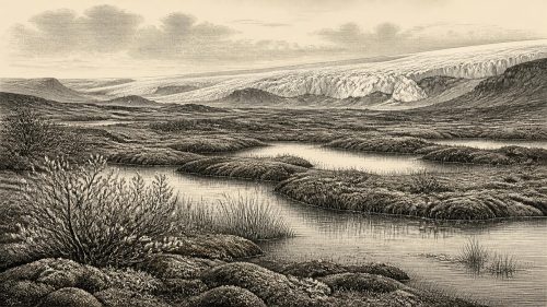
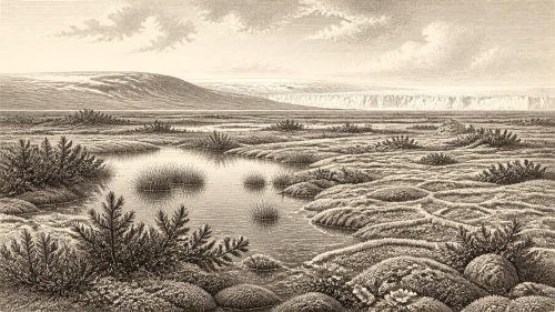
The landscape suggested by the Derryvree material was open and cold rather than wooded. Mosses, sedges and freshwater plants indicate shallow water, saturated margins and damp ground; the associated insect evidence supports a climate of northern character. “Tundra” and “muskeg” are useful shorthand for such a mosaic, provided they are not mistaken for a single, unchanging habitat. A pool, sedge bed and sparsely vegetated mineral ground could sit close together, while seasonal freezing, wind exposure and changing water levels shaped what could grow. The familiar Ireland of closed temperate woodland, blanket bog and farmed fields belonged to a vastly later world.
Nearby sites reinforce the wider point while also demonstrating the limits of correlation. Hollymount, also near Maguiresbridge, preserved an inter-till freshwater deposit, while Greenagho near Belcoo produced deposits interpreted as evidence for cold, non-glacial conditions. Their dates and stratigraphies do not permit historians to join them into one annual map. Instead, they show that northern Ireland retained or regained pockets of open, wet terrain during intervals within the Midlandian glacial sequence. This is regional environmental history at its most revealing: fragments of life preserved between episodes of ice.
Ice, Coast and Regional Change
At this time Ireland’s geography was not the familiar outline shown on a modern map. Global sea level was lower than today because more water was held in northern ice sheets, but local relative sea level was also affected by the weight and changing extent of ice. The continental shelves, Irish Sea basin and northern channels were landscapes undergoing profound change, not fixed routes that can safely be labelled land bridges for a particular year. Later marine and terrestrial evidence shows that the British–Irish Ice Sheet developed through distinct sectors and ice streams, with marine margins responding dynamically to water depth, climate and the shape of the seabed.
For people or animals, this mattered enormously. A cold open environment might offer passage and grazing in one phase, then become blocked by water, difficult terrain or ice in another. But Ireland has no site securely demonstrating a human route, camp or occupation at 30,665 BCE. The changing physical geography establishes possibilities and constraints; it does not authorise a narrative of migration, exploration or territorial control. That distinction is essential when the evidence is sparse and later glaciers have repeatedly remodelled the ground.
Caves and Ice-Age Animals
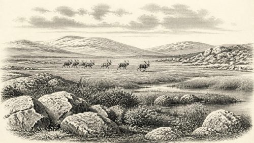
Southern cave assemblages show that Ireland supported a far richer Pleistocene fauna than the modern island. Castlepook Cave, near Doneraile in County Cork, has yielded remains attributed to woolly mammoth, reindeer, spotted hyaena, brown bear, wolf, Arctic fox, hare and lemmings. The Irish Quaternary Fauna Project demonstrated that many mammal species reached Ireland between at least about 45,000 and 20,000 years ago. Such evidence is directly relevant to the ecological setting of the period, though a cave bone does not necessarily date to the same episode as a Fermanagh silt bed.
Castlepook must also be handled with caution. Much of its material derives from antiquarian excavations, and cave deposits can be disturbed or accumulated over long intervals by predators, water, collapse and human collecting. A reindeer femur has been publicised as bearing marks consistent with stone-tool butchery and as dating to about 33,000 years ago. If that interpretation is confirmed through full contextual and analytical publication, it may point to a very early human visit. It is not, however, a securely excavated settlement floor, and it does not demonstrate a resident population in Ireland around 30,665 BCE.
No Polities, No Proven Communities
There is no evidence from this horizon for political communities, leaders, diplomacy, warfare, law or territorial boundaries in Ireland. Nor are there securely dated houses, hearths, burials, stone-tool assemblages, art, shrines, cultivated plants, domesticated animals or exchange goods from which to reconstruct everyday society. Religion, language, learning and social identity are therefore beyond recovery. Silence in these categories is not evidence that humans were incapable of such things elsewhere in Upper Palaeolithic Europe; it is recognition that Ireland has not yielded material that permits those claims here.
The same restraint applies to economy and trade. Reindeer or mammoth bones can tell us that large animals were present; freshwater plants and insects can identify habitats. They cannot prove that people hunted particular herds, made seasonal journeys, exchanged materials or occupied a camp beside Derryvree. At most, the environmental evidence identifies resources that could have attracted mobile visitors in favourable conditions: water, wetland plants, small animals and, elsewhere on the island, large grazing mammals and predators. Possibility is not proof.
What Can Be Said Responsibly
Ireland around 30,665 BCE was part of a climatically restless North Atlantic world before the last glacial maximum. In County Fermanagh, the Derryvree deposits preserve compelling evidence that cold, locally ice-free freshwater and wetland environments existed during a broadly comparable interval. Elsewhere, cave faunas demonstrate that Ice-Age mammals had reached the island, although their dates and depositional histories cannot be compressed into one moment. The strongest historical development is thus environmental: repeated transformations of ice, water, vegetation and animal habitat shaped the stage on which any human visit would have occurred.
This is not a lesser form of history. It is history read from silts, seeds, mosses, insects, bones and glacial sediments rather than from documents or monuments. Its proper scale is the calibrated range, the changing landscape and the carefully qualified inference—not a named event assigned to a modern calendar year.
Primary Sources
- Early Midlandian–Middle Midlandian, Pleistocene, Northern Ireland
- Middle Midlandian Interstadial Deposits at Greenagho, Near Belcoo, County Fermanagh, Northern Ireland
- Irish Pleistocene Biostratigraphy
- The Irish Quaternary Fauna Project
- The Timing and Magnitude of the British–Irish Ice Sheet Between Marine Isotope Stages 5d and 2
- Growth and Retreat of the Last British–Irish Ice Sheet, 31,000 to 15,000 Years Ago: The BRITICE-CHRONO Reconstruction
- Trimlines, Blockfields and the Vertical Extent of the Last Ice Sheet in Southern Ireland
- Maximum Extent and Dynamic Behaviour of the Last British–Irish Ice Sheet West of Ireland
- Early Deglaciation of the British–Irish Ice Sheet on the Atlantic Shelf Northwest of Ireland Driven by Glacioisostatic Depression and High Relative Sea Level
- Stratigraphic and Palaeo-Geomorphological Evidence for the Glacial-Deglacial History of the Last British-Irish Ice Sheet in the North-Western Irish Sea
- The IntCal20 Northern Hemisphere Radiocarbon Age Calibration Curve (0–55 cal kBP)
- A Stratigraphic Framework for Abrupt Climatic Changes During the Last Glacial Period Based on Three Synchronized Greenland Ice-Core Records
- The Nature of MIS 3 Stadial–Interstadial Transitions in Europe: New Insights from Model–Data Comparisons
- First Evidence of a Late Upper Palaeolithic Human Presence in Ireland
- New Insights on the Fauna of Ireland’s Younger Dryas and Early Holocene from Alice & Gwendoline Cave
- Archaeological Heritage of County Cork 2020
- Ireland’s Palaeolithic Archaeology – Fleeting Footprints in a Frozen Land
- BSBI: Menyanthes trifoliata
- BSBI: Salix herbacea
- Ireland: Submerged Prehistoric Sites and Landscapes