

Derryvree’s Frozen Sedgebank30666 BCE
Around 30,666 BCE, Ireland’s evidence records environmental change rather than dated events or communities. At Derryvree, County Fermanagh, freshwater silts between glacial tills indicate a locally ice-free interval during the unstable Late Pleistocene, preserving tundra plants, sedges, mosses, aquatic species and insect remains. Castlepook Cave, County Cork, contains bones of mammoth, giant deer, reindeer, bear, hyena and other cold-adapted animals, accumulated over a long period. A possibly stone-cut reindeer femur may suggest brief human involvement, but proves neither settlement nor population. Later ice advance destroyed or buried much evidence, leaving these deposits as limited records of a cold, changing landscape.
Dateline
“30,666 BCE” is a modern chronological label, not a year that can be recovered from Irish evidence. No written calendar, event record, settlement layer or human life can be assigned to it. In radiocarbon convention it falls roughly 32,600 years before AD 1950, during the Late Pleistocene and Marine Isotope Stage 3, a long and climatically unstable part of the last Ice Age. The responsible history of Ireland at this depth is therefore a history of dated ranges, sediments, plant remains, animal bones and glacial landforms rather than named people or year-specific happenings.
A Date Within a Broad Environmental Record
The strongest Irish evidence relevant to this approximate horizon comes from Derryvree townland, near Maguiresbridge in County Fermanagh. Roadworks in 1969 cut through a drumlin and exposed an unusual sequence: freshwater silts and fine sands rich in organic remains lay between two thick sheets of till, the unsorted debris deposited directly by glacier ice. The order of the layers is decisive. Glacial ice had previously occupied the locality; it then withdrew or ceased to cover this basin long enough for water, sediment, plants and small animals to accumulate; later ice advanced again and sealed the deposit.
Organic material from the Derryvree freshwater series produced a conventional radiocarbon determination of 30,500 +1,170/−1,030 radiocarbon years BP (Birm-166). That is not the same thing as a calendar date. Atmospheric radiocarbon levels varied in the past, so radiocarbon measurements require calibration, and their uncertainty becomes substantial at this age. Later ice-sheet chronologies have treated Derryvree as evidence for locally ice-free ground around the mid-30s to low-30s millennia before present, with one Bayesian synthesis centring the constraint at about 33.5 ± 1.2 thousand years ago. Thus 30,666 BCE belongs within a relevant broad window, but cannot be attached to a particular season, generation, pond level or individual organism.
The deposit has traditionally lent its name to the Derryvree Cold Phase in Irish Quaternary stratigraphy. Such labels are useful shorthand, not proof that all of Ireland shared precisely the same weather, vegetation or ice cover at every moment. Derryvree records one protected Fermanagh basin. Conditions on western coasts, in mountains, across lowland Ireland and on the changing continental shelves may have differed markedly. Nevertheless, the buried silts establish an important point: Ireland was not uniformly and continuously entombed beneath ice throughout the Late Pleistocene.
Wet Ground in an Open Landscape
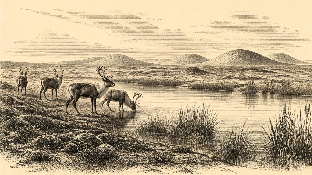
Derryvree preserves a surprisingly detailed glimpse of a cold but living environment. Its fossils indicate open tundra vegetation and a periglacial regime: ground subject to severe frost, seasonal thaw and low temperatures rather than woodland. Mosses and sedges were abundant. A seed of bogbean (Menyanthes trifoliata) and remains of water-milfoil show that standing or slow-moving freshwater existed. Mountain-avens, lesser clubmoss and other herbs point towards exposed, cold ground. Insect evidence added to the picture of a northern, rigorous environment.
This was not modern pastoral Fermanagh transposed into the Ice Age. There is no evidence for oak woodland, enclosed fields, farms, peat-cutting or settled villages. Yet neither should tundra be imagined as a sterile white desert. At Derryvree, shallow water, muddy mineral-rich margins, sedges, mossy wet ground and low herbaceous vegetation formed a functioning ecosystem. Water carried fine sand and organic debris into the basin; plants rooted and decayed; invertebrates occupied aquatic and terrestrial habitats. The landscape may have changed sharply with season, as freezing, meltwater and vegetation cover altered the ground.
Its economy, in the only sense directly visible, was ecological. Plants captured short growing seasons; herbivores found forage in open country; predators and scavengers followed animal movement; water and ice repeatedly redistributed sediment. There is no evidence at Derryvree for cultivation, domesticated animals, metalworking, market exchange or long-distance trade. The wetland’s value lies in demonstrating the resources and constraints of the landscape, not in supplying a human economic history that the deposits cannot bear.
Cork’s Cave Fauna
Far to the south, Castlepook Cave near Doneraile in north County Cork provides the principal Irish record of larger Ice Age animals relevant to this wider period. More than 2,000 bones have been recovered from its galleries. The cave fauna includes woolly mammoth, giant deer, reindeer, brown bear and spotted hyena; later deposits also contain wolf, Arctic fox, Norwegian lemming and collared lemming. Castlepook is consequently Ireland’s richest known vertebrate archive for the long span leading towards the Last Glacial Maximum.
It must not be treated as a snapshot of one community at 30,666 BCE. Individual bones from the cave span a very long interval, and the cave served as a repository rather than a single undisturbed occupation site. Carnivores dragged in carcass parts; animals died naturally; water disturbed deposits; and early excavations removed material before modern stratigraphic standards existed. The assemblage therefore shows that cold-adapted and large grazing mammals reached Ireland during parts of the Late Pleistocene, but it cannot establish that every listed species shared the same valley, year or season.
Spotted hyena is especially significant. A hyena den is an active taphonomic setting: teeth, feeding, bone transport and scavenging can modify remains and complicate interpretation. The caves and wetlands together show an island landscape connected, at least intermittently, with wider north-west European animal populations. Precisely how each species arrived remains less secure. Lower sea levels exposed extensive shelf landscapes, but changing relative sea level, glacier margins and topography mean that an easy, permanent land bridge between Ireland and Britain should not simply be assumed.
A Possible Human Trace, Not a Settlement
A reindeer femur from Castlepook has been publicly identified by zooarchaeologist Ruth Carden and by County Cork heritage material as bearing a deep mark made by a sharp stone tool during butchery. The bone has been associated broadly with about 31,000 BCE or roughly 33,000 years ago in public reporting. If the mark is confirmed as human-made and contemporary with the bone, it would be potentially momentous: evidence that people handled a reindeer carcass in Ireland far earlier than the better-established terminal-Pleistocene traces of human activity.
The distinction between evidence and interpretation is crucial. The direct evidence is one reindeer bone, an age estimate for the animal and a proposed tool mark from an old cave collection. It is not a securely excavated hearth, a stone-tool assemblage, a dwelling, a burial, a human skeleton or an occupation surface. Nor does it show whether people killed the animal, processed it where it died, visited the cave, travelled as a larger party or returned repeatedly. Carnivores could have moved the discarded bone into the cave after any human action occurred elsewhere.
A brief visit by mobile Upper Palaeolithic hunters following seasonal animal resources is therefore a reasonable hypothesis, especially in comparison with hunter-gatherer lifeways elsewhere in north-west Europe. It is not a demonstrated account of an Irish resident population. No language, ethnicity, political organisation, kin group, artistic tradition or religion can responsibly be attributed to Ireland at this point. There is likewise no evidence for warfare, diplomacy, formal leaders, shrines, monuments or institutional learning. Their absence from this account reflects the limits of the surviving record, not an assertion that possible visitors lacked social lives or beliefs.
Ice, Change and Survival of Evidence
The foremost regional development was climatic and glacial change. Ireland around this broad horizon lay before the Last Glacial Maximum, when the British-Irish Ice Sheet reached its greatest extent later, broadly between about 26,000 and 19,000 years ago. Ice expansion subsequently transformed valleys, coastlines and lowlands, eroding, burying and reworking older surfaces. That destructive history helps explain why evidence for any earlier people is so sparse, although it cannot be used as a licence to invent lost camps or migrations.
Derryvree survived because water-laid deposits were sealed beneath later till. Castlepook survived because a limestone cave trapped bones, though not in simple order. Together they offer a disciplined picture of Ireland around the notional date: a cold, open and changeable place with wetlands, tundra plants and Ice Age mammals; locally ice-free ground at some stage within a broad range; and a tantalising but still limited possibility of human activity. The most important historical lesson is not a fictional event in a numbered year, but the fragility and richness of the evidence that has endured.
Primary Sources
- A Middle Midlandian Freshwater Series at Derryvree, Maguiresbridge, County Fermanagh, Northern Ireland
- Field Guide to Selected Irish Sites: Derryvree and Greenagho
- The Subdivision of the Quaternary Period in Ireland
- The Irish Quaternary Fauna Project
- Castlepook Cave, County Geological Site Report
- Heritage Artefacts of County Cork
- Spotted Hyena Skull
- New Insights on the Fauna of Ireland's Younger Dryas and Early Holocene from Alice & Gwendoline Cave
- Dimensions and Chronology of the Last Ice Sheet in Western Ireland
- Trimlines, Blockfields and the Vertical Extent of the Last Ice Sheet in Southern Ireland
- Response of the Irish Ice Sheet to Abrupt Climate Change During the Last Deglaciation
- Maximum Extent and Dynamic Behaviour of the Last British–Irish Ice Sheet West of Ireland
- Early Deglaciation of the British-Irish Ice Sheet on the Atlantic Shelf Northwest of Ireland Driven by Glacioisostatic Depression and High Relative Sea Level
- Oscillating Retreat of the Last British-Irish Ice Sheet on the Continental Shelf Offshore Galway Bay, Western Ireland
- Character of Advance and Retreat of the Southwest Sector of the British-Irish Ice Sheet During the Last Glaciation
- The Island of Ireland: Drowning the Myth of an Irish Land-Bridge?
- The Problem of a Late Quaternary Landbridge Between Britain and Ireland
- Ireland: Submerged Prehistoric Sites and Landscapes
- The IntCal20 Northern Hemisphere Radiocarbon Age Calibration Curve (0–55 cal kBP)
- IntCal Publications
- Menyanthes trifoliata
- Dryas octopetala
- Ireland's Palaeolithic Archaeology – Fleeting Footprints in a Frozen Land