
BIRM-166’s Closing Wetland30593 BCE
Around 30,593 BCE, Ireland’s history is represented not by a precise year but by a broad MIS 3 interval. At Derryvree, County Fermanagh, freshwater sediments dated BIRM-166 lay between glacial tills, demonstrating a local cold wetland between episodes of ice cover. Plant and insect remains indicate treeless tundra vegetation, standing water and severe seasonal conditions. Later expansion of the British–Irish Ice Sheet transformed the island, though timing varied regionally. Faunal remains show links with wider European cold-stage ecosystems. Possible early human activity remains unproven. No settlements, polities or cultural practices can be securely identified; environmental change is the principal evidence.
Dateline
The label 30,593 BCE is a modern chronological convenience, not a recoverable year in Ireland’s past. No one on the island then used this calendar, and no written record, settlement surface or securely dated event can be fixed to its individual twelve months. Arithmetically, it lies about 32,542 years before AD 1950, the conventional ‘present’ of radiocarbon dating; that arithmetic is not itself a scientific date. The responsible subject is a broad Late Pleistocene interval in Marine Isotope Stage 3 (MIS 3), during the last Ice Age. The closest Irish evidence comes in ranges measured in centuries and millennia, rather than in calendar years.
A Wetland Between Glaciers
The key archive is Derryvree townland, near Maguiresbridge in County Fermanagh. Road construction in 1969 cut through a drumlin and exposed a remarkable sequence: a lower layer of glacial till, then freshwater silts and fine sands containing organic remains, capped by a second thick till. Till is the unsorted debris laid down by glacier ice. The sequence therefore establishes a firm relative order: ice had occupied this place; an interval followed in which freshwater and wetland sediment accumulated; and ice later returned or expanded sufficiently to seal the deposit.
Organic material from the freshwater horizon, known by the laboratory determination BIRM-166, produced a radiocarbon age of 30,500 years BP, with a substantial uncertainty of +1,170 and −1,030 years. Radiocarbon years are not identical to calendar years because atmospheric carbon-14 levels have changed through time. Modern calibration converts such a measurement into a probability range, not a single answer. Published discussions place the Derryvree evidence broadly at about 36,900–31,700 calibrated years BP, approximately 34,950–29,750 BCE. The notional date of 30,593 BCE falls within that wide window, but cannot be assigned to a particular sediment layer, season, generation or occurrence at Derryvree.
This distinction is more than a technicality. Sediment accumulated over time; fossils could represent successive years; and a small buried basin in Fermanagh cannot stand for every valley, coast and upland in Ireland. What Derryvree securely shows is that at some point during this broad cold-stage interval, there was locally open ground and freshwater between episodes of glaciation. It corrects any simple image of an Ireland that remained uniformly ice-covered throughout the whole last glacial period.
Open Ground and Cold Water
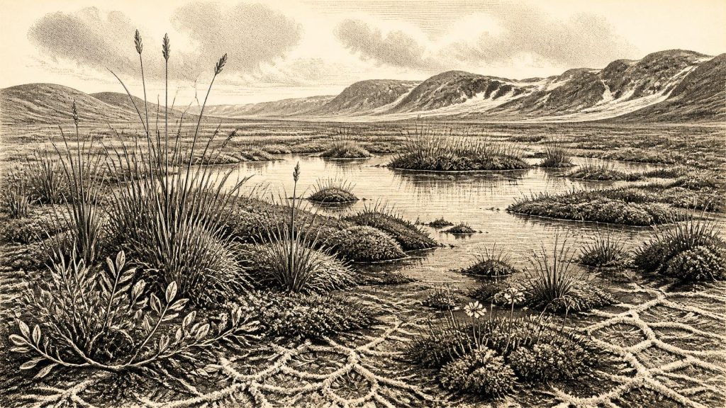
The Derryvree fossils indicate treeless, periglacial country: a landscape persistently affected by severe cold, freeze-thaw action and short growing seasons. Pollen was poorly preserved, but the surviving evidence includes herbaceous pollen and plant macrofossils. Mosses, sedges and cold-tolerant flowering plants, including mountain-avens, dwarf willow and bogbean, point to a patchwork of damp ground, pool margins and sparse vegetation on better-drained surfaces. Aquatic plants show that standing or slow-moving freshwater was available. This was neither modern bogland nor forest, but a tundra-like wetland mosaic.
Insects are especially valuable evidence in such a setting. Beetle and other invertebrate remains can reveal environmental conditions that are no longer found at the locality, because many species have narrow habitat and temperature requirements. Together with the plant record, they support an interpretation of exposed, cold terrain rather than woodland. The landscape would have changed seasonally: waterlogged ground during thaw, frozen soils in winter, wind exposure on open surfaces and brief summers in which wetland vegetation could grow. These are interpretations from the fossil assemblage, not observations of weather in the single modernly numbered year.
Other Fermanagh deposits, including those at Greenagho near Belcoo, show why the region matters to Ireland’s Ice Age history. Preserved organic layers beneath or between glacial deposits are rare survivors. Subsequent ice movement eroded, mixed or buried much of the earlier ground surface elsewhere. The Irish record is consequently uneven: a few local sedimentary windows provide detailed ecological evidence, while enormous areas have left little or no directly datable trace from the same interval.
Ice Was Advancing
Thirty millennia ago Ireland was approaching, rather than inhabiting the fullest phase of, the last British–Irish Ice Sheet. Large-scale reconstructions place major ice-sheet growth from around 31,000 years ago, although the timing and behaviour of individual sectors differed. The maximum extent came later, broadly around 27,000–23,000 calibrated years BP, when ice covered Ireland and extended across much of its continental shelf. Thus Derryvree belongs to a longer story of fluctuation and deterioration: an ice-free local wetland existed during MIS 3, but the later expansion of ice profoundly transformed the island.
This need not mean that every part of Ireland changed at once. Ice sheets advance through particular catchments and lowlands, and their margins respond to topography, snowfall, temperature, sea level and the behaviour of fast-flowing ice streams. A freshwater deposit between tills records change at one locality, not a neatly timed island-wide switch from habitable land to ice. Nor does it demonstrate that a later glacier arrived immediately after the final plants died there. The precise duration of the interval remains beyond resolution.
Sea level was much lower than today because water was locked in continental ice, so the outlines of the Irish coast and surrounding shelves differed greatly from those now familiar. Yet it is unsafe to draw a precise route across the Irish Sea for this particular date. Reconstructions of former shorelines, glaciers and exposed shelf lands remain dependent on regional modelling and incomplete evidence. Lower sea level made the geography different; it does not prove a land crossing, a migration corridor or a human journey to Ireland.
Animals and the Human Question
Southern Irish cave deposits, particularly Castlepook Cave near Doneraile in County Cork, preserve evidence that cold-stage Ireland supported or received a varied fauna over long spans of time. The assemblage has included woolly mammoth, reindeer, giant deer, brown bear, wolf, Arctic fox, lemmings and spotted hyaena. These animals should not be imagined as a single herd or community occupying one meadow. Cave bones accumulated by different processes, including carnivore activity, natural death, water movement and early excavation, and modern re-dating has revised several earlier chronologies. Nevertheless, the faunal evidence confirms that parts of Ireland were connected to wider north-west European cold-stage ecosystems before the Last Glacial Maximum.
A reindeer femur from Castlepook has been interpreted as bearing a mark made by a sharp stone tool and has been publicised as possible evidence of very early human activity. Its importance lies in that possibility, but it must be stated cautiously. A single marked bone from an old cave collection is not a securely sealed camp. It does not establish a hearth, stone-tool assemblage, dwelling, burial, repeated occupation or a permanent population. Nor can it securely tell us whether people killed the animal, scavenged it, processed it in the cave, or merely visited briefly. At present, human presence in Ireland at this depth of time remains a question under investigation rather than a demonstrated settled society.
No Polities, No Proven Settlements
There is no evidence from Ireland around this broad date for political institutions, rulers, diplomacy, organised warfare or territorial states. Terms such as tribe, chiefdom and nation would impose much later social forms upon a record that does not support them. If people did occasionally reach Ireland, comparison with Upper Palaeolithic groups elsewhere in north-west Europe suggests highly mobile foragers, reliant on detailed knowledge of animal behaviour, shelter, stone, seasonal water and weather. That comparison is an informed interpretation, not direct evidence from Derryvree.
For the same reason, there is no demonstrable agriculture, herding, pottery, metalworking, monument building or formal trade. The wetland’s plant remains are wild species, not crops. No Irish artefact assemblage of this date securely documents a local craft tradition or exchange network. Materials, people and information may have moved through small-scale contacts across changing coastal and glacial landscapes, but neither the routes nor the participants are known. The most defensible economic description is ecological: life, if humans were present at all, depended upon the immediate availability of animal and plant resources in a severe environment.
Culture Beyond Recovery
Religion, language, music, kinship rules and learning are almost wholly beyond archaeological recovery for Ireland at this point. There are no graves, images, ritual deposits or structures from which to infer belief with confidence. Absence of evidence is not proof that people had no social worlds or symbolic practices; it means Irish evidence cannot describe them responsibly. The art, ornaments and complex cultural traditions known from some European Upper Palaeolithic regions demonstrate what was possible among contemporary human populations elsewhere, but they must not be imported into Ireland without local evidence.
The principal development illuminated by 30,593 BCE is therefore environmental rather than political: Ireland lay within a volatile Ice Age world in which wetlands, tundra vegetation, animals and advancing ice reshaped the opportunities for any living creature. BIRM-166 preserves an unusually intimate fragment of that world. Its silts do not provide a chronicle of a year, but they preserve the stronger and more valuable historical lesson: before later ice transformed much of the island, a cold freshwater landscape existed in Fermanagh, sustaining a resilient community of plants and small animals at the edge of glacial change.
Primary Sources
- A Middle Midlandian Freshwater Series at Derryvree, Maguiresbridge, County Fermanagh, Northern Ireland
- Middle Midlandian Interstadial Deposits at Greenagho, Near Belcoo, County Fermanagh, Northern Ireland
- Palaeoecology: The Middle Midlandian Palaeoenvironment of South Fermanagh
- Figure 6: The Subdivision of the Quaternary Period in Ireland
- Growth and Retreat of the Last British–Irish Ice Sheet, 31,000 to 15,000 Years Ago: the BRITICE-CHRONO Reconstruction
- Growth and Retreat of the Last British–Irish Ice Sheet, 31,000 to 15,000 Years Ago: the BRITICE-CHRONO Reconstruction
- Pattern and Timing of Retreat of the Last British-Irish Ice Sheet
- The Timing and Magnitude of the British–Irish Ice Sheet Between Marine Isotope Stages 5d and 2
- New Data for the Last Glacial Maximum in Great Britain and Ireland
- Dimensions and Chronology of the Last Ice Sheet in Western Ireland
- Last Glacial Maximum Cirque Glaciation in Ireland and Implications for Reconstructions of the Irish Ice Sheet
- Character of Advance and Retreat of the Southwest Sector of the British-Irish Ice Sheet During the Last Glaciation
- Ireland: Submerged Prehistoric Sites and Landscapes
- The Colonization of Ireland: A Human Ecology Perspective
- A Reconsideration of the Radiocarbon Dating of the Marine Isotope Stage 3 Fauna from Southern Ireland
- Occurrence of Mammalia Relicts at Site Castlepook Cave
- The Exploration of Castlepook Cave, Co. Cork
- Heritage Artefacts of County Cork
- Looking for the Irish Palaeolithic: New Research Projects on Old Animal Bones and Cave Sediments
- Palaeolithic Ireland – New Evidence Emerges from the Emerald Isle
- New Insights on the Fauna of Ireland’s Younger Dryas and Early Holocene from Alice & Gwendoline Cave
- The IntCal20 Northern Hemisphere Radiocarbon Age Calibration Curve (0–55 cal kBP)
- IntCal Publications
- The Irish Ice Sheet
