Derryvree’s Milfoil Marsh30558 BCE
30,558 BCE denotes a broad Late Pleistocene horizon rather than a precise Irish date. At Derryvree, County Fermanagh, organic freshwater sediments between glacial tills preserve evidence of a treeless, periglacial tundra: sedges, grasses, mosses, dwarf willow, juniper, bogbean, water-milfoil and insects occupied shallow wetlands during an ice-free interval. Ireland experienced unstable climate, advancing glaciers, altered coastlines and low sea levels. Cave remains, notably from Castlepook, indicate diverse cold-stage fauna, though they represent separate episodes. A possibly cut-marked reindeer bone suggests an unconfirmed early human visit. No secure evidence supports settlement, society or institutions; the period is understood through environmental remains.

Dateline
The label 30,558 BCE is a modern way of indexing a remote prehistoric horizon, not a date that anyone living in Ireland could have recognised. It corresponds approximately to 32,507 years before AD 1950, the conventional “before present” reference point used in Quaternary science. Even that conversion must not suggest false precision. No Irish event, person, settlement, season or political development can responsibly be assigned to this single calendar year. The relevant evidence is dated in broad radiocarbon and calibrated ranges, often with uncertainties of centuries or millennia.
In archaeological terms, this was the Late Pleistocene, within Marine Isotope Stage 3: a long, climatically unstable portion of the last glacial cycle. The closest Irish environmental archive is the Derryvree freshwater deposit near Maguiresbridge, County Fermanagh. Its radiocarbon result, Birm-166, was reported as 30,500 radiocarbon years BP, with a substantial error range. Radiocarbon years are not calendar years, and calibration requires a curve based on changing atmospheric carbon levels. The resulting calendar range is broad; 30,558 BCE falls within the general time-window illuminated by Derryvree, rather than marking a precisely dated moment within its sediment.
A Buried Freshwater World
Derryvree was revealed by roadworks in 1969, when a cutting exposed a drumlin about two kilometres north-east of Maguiresbridge. Beneath the drumlin lay two substantial layers of till, sediment deposited directly by glacier ice. Between them were organic silts and fine sands laid down in freshwater. This simple sequence is exceptionally important. It demonstrates that, after an earlier glacial episode and before a later advance deposited the upper till, this locality supported open water, wet ground, vegetation and invertebrate life.
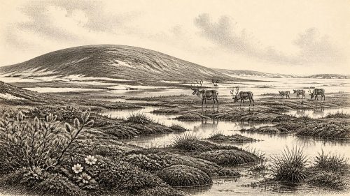
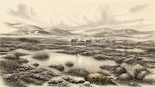
The fossils describe a severe but not lifeless environment. Plant pollen, seeds, mosses and insect remains indicate an open, treeless tundra landscape with a periglacial climate. Grasses and sedges flourished where moisture allowed. Dwarf willow and juniper were among the low woody plants; herbs and mosses occupied exposed or waterlogged surfaces. A fossil seed of bogbean, Menyanthes trifoliata, and aquatic plant material including water-milfoil show that still or slow-moving fresh water persisted locally. Such finds make a more exact point than a general statement that Ireland was “cold”: there was a shallow-water habitat with plant communities adapted to a short growing season and difficult winters.
It would nevertheless be misleading to picture Derryvree as a pleasant meadow, or to make its pond representative of every Irish district. The evidence is local. It records a wet hollow in what was probably a heterogeneous cold-stage landscape, not a complete map of the island. Around it, sparsely vegetated ground, seasonal freezing, frost-shattered material and powerful freeze-thaw processes would have shaped soils and slopes. In summer, long daylight could produce a brief flush of growth; in winter, exposed vegetation and shallow water faced intense cold. The original investigators compared the setting to muskeg: uneven, mossy, saturated ground threaded with pools and sedge-rich margins.
Ice, Land and Uncertain Coasts
At this date Ireland was not the wooded island of later prehistory, nor can it safely be described as entirely ice-covered. The Derryvree layers themselves establish an interval in which its part of Fermanagh was free of overriding ice long enough for freshwater sediments and tundra vegetation to accumulate. The upper till proves that ice later returned or advanced across the site. This alternation is one reason why the island’s earlier last-glacial history remains difficult to reconstruct: glacier growth was regional, episodic and not necessarily synchronous between uplands, lowlands and offshore basins.
The great British–Irish Ice Sheet was expanding during the wider period, but its maximum volume and fullest extent came later. The BRITICE-CHRONO synthesis places maximum extent and the beginnings of retreat at different times in different sectors, broadly between 30,000 and 22,000 years BP, with maximum ice volume around 23,000 BP. Consequently, it is safer to describe 30,558 BCE as a time of profound climatic deterioration and changing ice margins than to impose a single island-wide ice boundary on it. This was a landscape in transition, in which a wetland in Fermanagh could exist within a world increasingly conditioned by ice.
Sea level was much lower than today because large volumes of water were held in continental ice. Ireland’s coastlines, river mouths and shallow seas therefore differed greatly from their modern form. Yet lower sea level did not automatically make travel easy. The Irish Sea basin, glaciers, cold-water channels, changing shorelines and the physical condition of any intervening land all mattered. No evidence from this date identifies a route used by people, a boat, a crossing party or an organised exchange network. Geography made connections with Britain and continental Europe possible in some periods and places, but the archaeological record does not permit a specific reconstruction for this year.
Animals and Cave Evidence
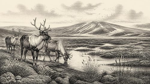
Southern Irish caves preserve another, more fragmentary, line of evidence. Castlepook Cave near Doneraile in County Cork produced a remarkable collection of Late Pleistocene animal remains, recovered largely in early twentieth-century excavations. Reindeer, giant deer, woolly mammoth, Arctic fox, lemming, wolf, brown bear and spotted hyaena feature in the wider assemblage and related Irish cave record. These species evoke cold, open habitats and food chains very different from those of historic Ireland: large herbivores feeding in sparse vegetation; predators and scavengers exploiting carcasses; smaller mammals occupying sheltered ground.
But the cave collections must not be treated as a single snapshot. Bones from different galleries, sediments and excavation campaigns may represent different episodes separated by thousands of years. Improved radiocarbon pretreatment has also shown that several older Irish cave dates required revision; at Castlepook, some redated specimens proved thousands of radiocarbon years older than previously thought. The responsible conclusion is that Ireland supported a varied cold-stage fauna during the broad span before the Last Glacial Maximum, not that every listed animal stood together near Derryvree in 30,558 BCE.
One Castlepook reindeer femur has particular importance. It has been presented as roughly 33,000 years old and as bearing a surface mark interpreted by zooarchaeologist Ruth Carden as a sharp stone-tool cut made during carcass processing. If that interpretation is sustained, it would provide striking evidence that Upper Palaeolithic people reached Ireland far earlier than the previously secure record of post-glacial settlement. Yet it remains one disputed and isolated object: the bone’s date is not automatically the date of the mark, cave deposits have complex histories, and Ireland has not yielded an associated stone-tool assemblage, hearth or excavated living floor of comparable age. It supports the possibility of a brief human visit, not continuous occupation or a known community.
No Polities, No Proven Society
For a conventional year-by-year history, the silences matter as much as the finds. There were no recorded rulers, tribes, kingdoms, laws, treaties or diplomatic relations in Ireland at this time. There is no evidence for farming, fields, livestock, monuments, graves, houses, pottery, metalworking, schooling or writing. Nor is there evidence for Irish religious institutions, ceremonial sites or artistic traditions that can be assigned to this horizon. Later prehistoric Ireland cannot be projected backwards into a landscape more than twenty millennia older than its first securely documented settled communities.
If people did enter Ireland during this broad phase, they would have been highly mobile hunter-gatherers, dependent on knowledge of animal behaviour, stone technology, fire, shelter, clothing and seasonal movement. That is an inference from the survival requirements of Upper Palaeolithic groups elsewhere in north-west Europe, not a directly evidenced description of an Irish band. There is no basis for naming their language, kinship system, beliefs, trade goods or political organisation. The Castlepook femur may indicate butchery; it does not reveal a camp, a population size or a social order.
The best-supported account of everyday life in Ireland around this nominal year is therefore ecological rather than biographical. At Derryvree, freshwater plants rooted in shallow water, insects inhabited wet margins, and sedges and mosses persisted in a treeless tundra. Elsewhere, animals moved through a changing cold-stage environment, while glaciers and periglacial processes remade the ground. This was not an empty land in a simple sense, but neither is it a historical Ireland of identifiable peoples. It is an Ireland known through a buried marsh, cave bones and the disciplined limits of archaeological interpretation.
The Historical Significance
Derryvree’s significance lies precisely in its modest scale. A thin layer of organic silt between tills preserves a local interval when freshwater life endured amid a glacial world. It shows that climatic history was not a smooth descent into a uniform ice sheet, but a sequence of changing conditions, local refuges and renewed advances. Castlepook adds a wider faunal context and a tantalising, unconfirmed prospect of human activity. Together they make 30,558 BCE meaningful—not as the anniversary of an event, but as a carefully bounded glimpse of Ireland’s deep environmental past.
Primary Sources
- A Middle Midlandian Freshwater Series at Derryvree, Maguiresbridge, County Fermanagh, Northern Ireland
- The IntCal20 Northern Hemisphere Radiocarbon Age Calibration Curve (0–55 cal kBP)
- A Reconsideration of the Radiocarbon Dating of the Marine Isotope Stage 3 Fauna from Southern Ireland
- The Irish Quaternary Fauna Project
- Irish Pleistocene Biostratigraphy
- Figure 6—The Subdivision of the Quaternary Period in Ireland
- Growth and Retreat of the Last British–Irish Ice Sheet, 31,000 to 15,000 Years Ago: The BRITICE-CHRONO Reconstruction
- Last Glacial Maximum Cirque Glaciation in Ireland and Implications for Reconstructions of the Irish Ice Sheet
- Late Pleistocene Chronostratigraphy and Ice Sheet Limits, Southern Ireland
- Dimensions and Chronology of the Last Ice Sheet in Western Ireland
- Trimlines, Blockfields and the Vertical Extent of the Last Ice Sheet in Southern Ireland
- Timing and Pace of Ice-Sheet Withdrawal Across the Marine–Terrestrial Transition West of Ireland During the Last Glaciation
- Early Deglaciation of the British-Irish Ice Sheet on the Atlantic Shelf Northwest of Ireland Driven by Glacioisostatic Depression and High Relative Sea Level
- Exploring Controls of the Early and Stepped Deglaciation on the Western Margin of the British-Irish Ice Sheet
- A Stratigraphic Framework for Abrupt Climatic Changes During the Last Glacial Period Based on Three Synchronized Greenland Ice-Core Records
- Consistently Dated Records from the Greenland GRIP, GISP2 and NGRIP Ice Cores for the Past 104 ka
- New Insights on the Fauna of Ireland’s Younger Dryas and Early Holocene from Alice & Gwendoline Cave
- Heritage Artefacts of County Cork
- Archaeological Heritage of County Cork
- Castlepook Cave, Castlepook South, County Cork: 2022 Excavation Report
- Menyanthes trifoliata L. (Bogbean): Fossil Record in Fermanagh
- Prehistoric Details: Stone Age Collections