The Maguiresbridge Tundra Basin30557 BCE
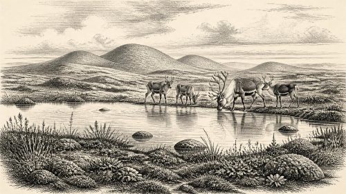
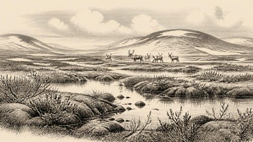
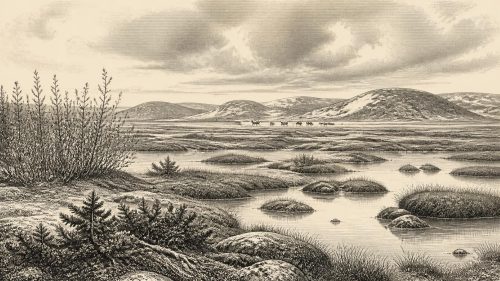
About 30,557 BCE, Ireland’s evidence records no datable event, but Derryvree near Maguiresbridge preserves freshwater sediments deposited between glacier advances during Marine Isotope Stage 3. Their broad calibrated range encompasses this notional date, indicating an open, cold tundra wetland with pools, sedges, dwarf willow, mountain avens, mosses and seasonally available water. Local ice had retreated temporarily, although the British-Irish Ice Sheet was growing towards its later maximum and national conditions remain uncertain. Castlepook Cave’s fauna, including reindeer, mammoth, predators and other cold-adapted species, demonstrates variable food webs. A possibly butchered reindeer bone suggests transient Upper Palaeolithic visitors, not proven settlement.

Dateline
“30,557 BCE” is a modern chronological label, not a year to which Irish evidence can be fixed with calendar-like precision. It lies about 32,506 years before AD 1950, the reference point used for “before present” dating, in the later part of the Last Glacial Period’s Marine Isotope Stage 3. No event, named person, settlement or season can responsibly be assigned to this precise year. The nearest and most informative Irish environmental record is the Derryvree site near Maguiresbridge, County Fermanagh: its dated freshwater deposits have a broad calibrated age range of roughly 36,900–31,700 calibrated years before present. The notional year therefore falls within a long interval represented by the deposit, not upon a recoverable moment within it.
Freshwater Between Two Glaciers
Derryvree was revealed by road works in 1969, which cut through a drumlin, the streamlined hill of glacial debris familiar across much of Ireland. Beneath one body of till and below another lay fine sands, silts and organic material laid down in freshwater. The sequence establishes a powerful local history: glacier ice had deposited the lower till; an unfrozen basin then held standing or slow-moving water long enough for sediment, plants and small animals to accumulate; and renewed ice later sealed the deposits below a second till. It is not proof that all Ireland was ice-free at once. It is proof that this part of Fermanagh contained a cold but biologically active freshwater environment during part of a climatically unsettled age.
The dated sample, BIRM-166, originally returned a conventional radiocarbon age of 30,500 years BP, with a substantial uncertainty range. Such a result cannot be read directly as a calendar date: radiocarbon concentrations have varied through time, so the measurement must be calibrated against independent records. The resulting calendar range is necessarily wide, especially at this depth in time. That uncertainty matters. Derryvree offers a rare window onto late Pleistocene Ireland, but it cannot supply a weather report for a single year, nor determine whether every valley, coast and upland on the island looked alike. Later ice movement, erosion and changing sea levels have removed much of the landscape that might otherwise have answered those questions.
An Open, Cold Wetland
The fossils from Derryvree nevertheless give the landscape texture. Plant remains, pollen, mosses and insect evidence indicate open tundra vegetation and a periglacial regime: ground strongly shaped by frost, thaw and cold-season conditions near or beyond the margins of more persistent ice. Mountain avens, dwarf willow, sedges, bogbean and lesser clubmoss belong to a low, treeless plant community rather than to the oak, elm and hazel woods of much later prehistory. Bogbean is especially revealing, because its seed points to shallow freshwater or saturated ground. Mosses and aquatic or wet-ground plants show that a severe climate did not mean an unbroken white wilderness. Pools, muddy margins, sedge-rich patches and seasonally productive ground formed a mosaic within a broad, exposed landscape.
This was a demanding environment, but not an empty one. The Derryvree evidence supports the inference of a short growing season, strong seasonal contrasts and ground often affected by freezing. It does not justify precise temperature figures, fixed snow depths or a claim that the district was continuously frozen. Water had to remain available for the freshwater sediments and wetland plants to form. The important historical development was environmental instability. Across north-west Europe, relatively milder interstadial episodes and colder stadials could alter vegetation, animal movements, sea ice and the reach of glaciers over periods far longer than a human lifetime yet brief in geological terms. Ireland’s landscapes were being repeatedly opened, narrowed, buried and remade by these changes.
Ice Was Growing, Not Yet at Its Greatest Extent
By 30,557 BCE, the British-Irish Ice Sheet had not reached the best-established maximum extent associated with the Last Glacial Maximum. Research places that later maximum phase broadly around 27,000 years ago for the British-Irish Ice Sheet, with major marine sectors off Ireland active from about 26,500 calibrated years BP and retreat beginning in some places after that. Yet the distinction between the later maximum and the present date must not be mistaken for a uniformly ice-free Ireland. The evidence for earlier glaciation is complex, and the size, location and longevity of Irish ice masses in late MIS 3 remain debated. Derryvree shows local open ground during its dated interval; its enclosing tills show that glaciers had also repeatedly occupied the same locality.
Sea level was lower than today because so much water was held in global ice sheets. This altered the outlines of the continental shelf and the Irish Sea basin, but present evidence does not allow a dependable map of coastlines or travel routes for this exact date. It would be unsafe to imagine a permanent land bridge, a familiar modern shoreline, or regular crossings between Ireland, Britain and continental Europe. Environmental connections could have changed as glaciers, sea level and sea ice changed. In practical terms, ice and water operated like shifting frontiers: they constrained which animals could move, where vegetation could establish itself, and whether any visiting people could reach or leave particular regions.
Castlepook’s Animal World
Southern Ireland provides a complementary, though differently preserved, record. Castlepook Cave, also called Mammoth Cave, near Doneraile in County Cork has yielded Ireland’s richest assemblage of pre-Last Glacial Maximum animal remains. Reassessment and improved radiocarbon preparation have shown that some older cave dates underestimated the true age of material by thousands of years. Across parts of MIS 3, the cave record includes reindeer, woolly mammoth, giant deer, brown bear, wolf, Arctic fox, mountain hare, lemmings and spotted hyaena. These species did not necessarily live together, and the cave does not offer a single-year census. Carnivore activity, water movement, collapse, nineteenth- and early twentieth-century excavation, and later disturbance all complicate the deposits. Even so, the assemblage demonstrates that portions of Ireland could support a substantial cold-climate food web before the Last Glacial Maximum.
Reindeer are particularly relevant to the open country suggested by Derryvree, while hyaenas and wolves indicate predators and scavengers within wider animal communities. Mammoth and giant deer remains make the fauna dramatic, but they should not be turned into a picture of endlessly abundant game. Animal populations moved, habitats contracted and expanded, and cave bones may represent widely separated episodes. There is likewise no basis for identifying a settled economy, managed herds, food stores or long-distance trade in Ireland at this time. The natural economy was one of wild plants and animals responding to climate, not farming: agriculture, permanent villages and domesticated livestock lay many millennia in the future.
A Possible Human Trace, Not a Settlement
The most consequential but uncertain human evidence close to this broad era is a reindeer femur from Castlepook. County Cork heritage material and researchers associated with the ongoing investigation have reported a deep mark on the bone as consistent with use of a sharp stone tool during butchery; the bone has been publicised as about 31,000 BC. If the mark is confirmed as human-made and contemporary with the fresh bone, it would indicate that Upper Palaeolithic people processed a reindeer in Ireland far earlier than the island’s well-attested post-glacial settlement record. It would not establish a village, a resident population, a named culture or a particular journey. The specimen came from an old and complicated cave assemblage rather than a newly excavated living floor with associated tools, hearths, shelters or burials.
Accordingly, political affairs, diplomacy, warfare, religion, language, art and formal learning cannot be described for Ireland in 30,557 BCE. There are no rulers, tribes, shrines, treaties or conflicts in the evidence. If people did enter the island during favourable intervals, they would have been highly mobile hunter-gatherers in the wider Upper Palaeolithic world of north-west Europe. That is an analogy based on neighbouring regions, not direct proof of an Irish community. The responsible history of this date is therefore not a fabricated human drama. It is the story of a tundra wetland briefly preserved between glacier advances, of animals living across a variable cold landscape, and of a possible human action that remains far too slight to become a biography of Ireland’s first inhabitants.
Primary Sources
- Middle Midlandian Freshwater Series at Derryvree, Maguiresbridge, County Fermanagh, Northern Ireland
- A Reconsideration of the Radiocarbon Dating of the Marine Isotope Stage 3 Fauna from Southern Ireland
- The Irish Quaternary Fauna Project
- New Insights on the Fauna of Ireland's Younger Dryas and Early Holocene from Alice & Gwendoline Cave
- Timing and Pace of Ice-Sheet Withdrawal Across the Marine-Terrestrial Transition West of Ireland During the Last Glaciation
- Growth and Retreat of the Last British–Irish Ice Sheet, 31,000 to 15,000 Years Ago: the BRITICE-CHRONO Reconstruction
- Geomorphological and Seismostratigraphic Evidence for Multidirectional Polyphase Glaciation of the Northern Celtic Sea
- Exploring Controls of the Early and Stepped Deglaciation on the Western Margin of the British-Irish Ice Sheet
- Cenozoic: Tertiary and Quaternary
- Heritage Artefacts of County Cork
- 2022:564 – Castlepook Cave, Castlepook South, Cork
- Archaeology Research Excavation Grant 2022: Castlepook Cave Final Report
- Pleistocene Vertebrates in the British Isles
- Occurrence of Mammalia Relicts at Site Castlepook Cave
- Mammoth Cave
- Our Ancient Landscapes: Hunter-Gatherers in Ireland
- Geology of Ireland
- Menyanthes trifoliata: Fossil Record in Fermanagh
- Dryas octopetala: Fermanagh Occurrence
- Ireland's Palaeolithic Archaeology – Fleeting Footprints in a Frozen Land
- Preliminary Assessment of the Archive of Faunal Remains from Excavated Irish Cave Sites
- Marine Isotope Stage 4 (71–57 ka) on the Western European Margin: Insights to the Drainage and Dynamics of the Western European Ice Sheet