The BIRM-166 Datum30562 BCE
Thirty thousand five hundred and sixty-two BCE is a modern chronological label, not a recoverable Irish historical year. The BIRM-166 radiocarbon date from Derryvree, County Fermanagh, falls within a calibrated range and documents an interval between glacier advances. Sediments, pollen, plants, insects and mosses indicate cold, open, treeless wetland with freshwater pools, rather than uniformly ice-covered terrain. Ireland experienced unstable Late Pleistocene climates and expanding ice sheets, with changing coastlines and uncertain routes. Castlepook Cave preserves cold-stage fauna and a butchered reindeer bone, but human presence remains unproven. Evidence therefore supports environmental reconstruction, not claims of society, settlement or politics.

Dateline
A Modern Point on Deep Time
30,562 BCE is not a year that can be recovered from Irish prehistory in the ordinary historical sense. Nobody in Ireland is known to have used a calendar, made a written record, or left an event that can be fixed to this numbered year. The label is a modern chronological convenience: expressed in the convention that counts calibrated years before AD 1950, it falls roughly 32,511 years ago. It belongs to the Late Pleistocene, within Marine Isotope Stage 3, a long, sharply variable part of the last Ice Age. The responsible history for this date is therefore not a tale of rulers or battles, but an account of what buried sediments, fossil plants, animal bones and glacial landforms can—and cannot—show.
The most illuminating Irish evidence is the Derryvree freshwater deposit near Maguiresbridge in County Fermanagh. It is not a snapshot of all Ireland, still less of one particular year. Yet it provides an unusually valuable local archive for a broad interval that encompasses this modern date. A radiocarbon measurement from the deposit, BIRM-166, was reported as 30,500 radiocarbon years before present, with a substantial uncertainty. Because radiocarbon years are not calendar years, they require calibration; published discussion places the material broadly at about 36,900–31,700 calibrated years before present. That range includes 30,562 BCE, while emphatically not allowing a precise annual reconstruction.
Fresh Water Between Two Glaciers
Derryvree was exposed during road works in February and March 1969, when a cutting passed through a drumlin about two kilometres north-east of Maguiresbridge. The section revealed a body of fine sand, silt and organic-rich sediment enclosed between two thick, distinct layers of till: the mixed debris deposited by glacier ice. This simple sequence is historically powerful. Ice had occupied the locality; afterwards, water, sediment and living organisms accumulated in an ice-free or locally ice-free interval; then renewed glaciation covered and preserved the deposit. Later ice did not merely shape the Irish landscape: it also removed or buried much of the evidence that might otherwise tell us more about this remote period.
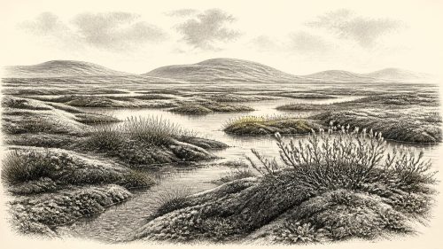
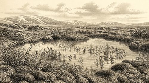
The Derryvree evidence does not support an image of a permanently frozen, featureless island. Its pollen, plant macrofossils, mosses and insect remains point instead to an open, treeless tundra or muskeg landscape: wet ground, shallow pools, sedge-rich margins, mossy vegetation and sparse herbs, subject to severe winters and periglacial conditions. A fossil seed of bogbean, Menyanthes trifoliata, is particularly evocative because it indicates standing or slow-moving fresh water amid the cold. There may have been seasonal thaw and patches of exposed mineral ground, but there is no basis for specifying the weather, temperature or snowfall of 30,562 BCE itself.
An Island in a Changing Ice World
The wider North Atlantic setting was unstable. Marine Isotope Stage 3 contained abrupt climatic swings registered especially clearly in Greenland ice cores, and Irish conditions responded to a mixture of changing temperature, precipitation, sea ice, ocean circulation and the behaviour of neighbouring ice masses. It would be misleading to assign a named Greenland warming or cooling event directly to a Fermanagh pool without a securely matching high-resolution chronology. What can be said is that the Derryvree wetland belongs to a period of pronounced climatic volatility before the fullest expansion of the last British–Irish Ice Sheet.
At roughly 31,000 years before present, reconstruction of the British–Irish Ice Sheet suggests an ice mass growing across parts of Ireland and Britain, although its exact margins at any particular moment remain debated. The extensive ice sheet maximum came later: major reconstructions place its greatest volume around 23,000 years before present, after a phase of growth from about 31,000 years ago. Thus Ireland around the date represented here was a regional mosaic rather than a country uniformly sealed beneath its later maximum ice cover. In Fermanagh, Derryvree proves that freshwater life occupied one locality during an interval between glacier advances; it does not prove that every Irish region was similarly open.
Coastlines, too, were unlike modern ones. Global sea levels were lower during the glacial world, and continental shelves now under the Atlantic, Irish Sea and Celtic Sea formed a changing part of the physical landscape. But ice loading and local changes in relative sea level complicate any simple map of a single land bridge or shoreline. A person, animal or plant did not encounter “Ireland” as the modern island; they encountered shifting terrain, water barriers, glacier margins and ecological corridors. For this date, the evidence does not justify a confident route from continental Europe to any particular Irish valley.
Animals and Caves
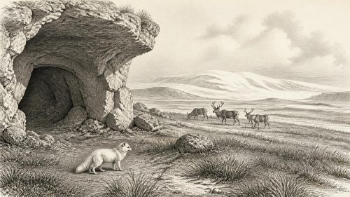
Southern Ireland offers another important but differently dated archive. Castlepook Cave, near Doneraile in north County Cork, is the country’s richest known Pleistocene vertebrate site. Its deposits have yielded remains attributed to woolly mammoth, reindeer, giant deer, brown bear, Arctic fox, wolf and spotted hyena, among other animals. These remains demonstrate that Ireland could support a striking cold-stage fauna during the wider Late Pleistocene. They should not, however, be arranged into a single imagined herd wandering past one another in 30,562 BCE: cave deposits may represent many episodes, and fossil specimens carry their own individual dates, histories of deposition and disturbance.
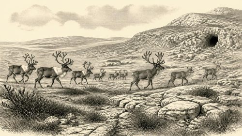
The fauna nevertheless helps give scale to the environment implied by Derryvree. Reindeer were adapted to open, cold country and could move across broad landscapes; mammoths and giant deer indicate that Ireland’s Pleistocene ecology was far richer and less familiar than the later wooded island. Predators and scavengers were also part of that world. Cave sites are especially valuable because limestone shelters can preserve bones when open-air surfaces have been eroded, but they are not ordinary settlements. A cave may have been visited by carnivores, used as a den, entered by flowing water, or accumulated material from more than one source.
The Reindeer Femur Question
One Castlepook find has made this period unusually important for the human story of Ireland: a reindeer femur bearing a deep mark interpreted by zooarchaeologist Ruth Carden as the result of butchery with a sharp stone tool. The bone has been publicised as dating to about 33,000 years ago, close in broad terms to the era considered here. If the mark is correctly identified and contemporary with the bone’s original use, it may be evidence that people handled a reindeer in Ireland during the Upper Palaeolithic—far earlier than the substantial, securely documented post-glacial archaeological record.
That possibility must remain carefully bounded. A single modified bone from an old cave collection is not a camp, a house, a hearth, a burial or a quarry site. No securely associated stone-tool assemblage, repeated occupation surface or human remains of this age has been recovered at Castlepook. The National Museum of Ireland accordingly still presents the Palaeolithic human presence in Ireland as unproven in clear archaeological terms. The femur is best understood as a significant and potentially transformative clue, not as evidence for a settled Ice Age population.
Society Without a Social Record
Consequently, political affairs, conflict and diplomacy cannot responsibly be described for Ireland at this point. There are no states, chiefs, territorial boundaries, treaties, weapons caches or communal monuments known from 30,562 BCE. Nor is there evidence from which to reconstruct kinship, language, clothing, gender roles, ritual, art, music, formal learning or burial practice. It would be tempting to import vivid scenes from contemporary Upper Palaeolithic France, Iberia or central Europe, where archaeological evidence is much fuller. That would be analogy, not Irish evidence.
The same restraint applies to economy and trade. The Derryvree deposit records an environment, not exchange networks; Castlepook’s bones record animals and perhaps one act of carcass processing, not a market or a trade route. If people entered Ireland, they may have done so intermittently, perhaps following animal movements or exploiting a short-lived opportunity in an altered landscape. But even this is interpretation. There is no secure basis for identifying a resident community, a seasonal round, a population size or a pattern of movement across the island.
Everyday life is therefore most securely approached through non-human evidence. At Derryvree, mosses, sedges, herbs, wet hollows and freshwater organisms sustained a small but resilient biological community. Around the island more broadly, changing ice and vegetation would have determined where grazing animals could move and where predators could follow. Freeze–thaw action, waterlogging, wind exposure and glacier advance were not background scenery: they governed the availability of shelter, food and routes through the landscape. This ecological framework is the closest available equivalent to a social history for the date.
What the Datum Preserves
The BIRM-166 date is valuable precisely because it disciplines the imagination. It confirms neither an Ice Age Irish nation nor a blank, uniformly white wilderness. Instead, it preserves evidence of a cold, open wetland in County Fermanagh, lying between episodes of glaciation, within a wider island whose habitats and ice limits were changing over millennia. Castlepook adds a fauna of reindeer, mammoth and carnivores, together with a provocative but still limited possible sign of human activity. Modern calendar-year precision is unavailable; calibrated ranges and stratigraphic sequence are the appropriate tools.
For Ireland around 30,562 BCE, environmental change is the dominant historical development. The most defensible picture is of regional instability: wet tundra in at least one northern locality, an expanding ice-world around it, and animal communities adapted to exposed cold landscapes. If people were present, their trace has not yet become a recoverable history. The surviving record asks for precision about evidence, and humility about everything beyond it.
Primary Sources
- A Middle Midlandian Freshwater Series at Derryvree, Maguiresbridge, County Fermanagh, Northern Ireland
- Middle Midlandian Freshwater Series at Derryvree, Maguiresbridge, County Fermanagh, Northern Ireland
- Palaeoecology
- Figure 6.— The Subdivision of the Quaternary Period in Ireland
- Irish Pleistocene Biostratigraphy
- The IntCal20 Northern Hemisphere Radiocarbon Age Calibration Curve (0–55 cal kBP)
- IntCal20 Issue
- IntCal
- Growth and Retreat of the Last British–Irish Ice Sheet, 31 000 to 15 000 Years Ago: the BRITICE-CHRONO Reconstruction
- Growth and Retreat of the Last British–Irish Ice Sheet, 31 000 to 15 000 Years Ago: the BRITICE-CHRONO Reconstruction
- The Timing and Magnitude of the British–Irish Ice Sheet Between Marine Isotope Stages 5d and 2
- Ireland: Submerged Prehistoric Sites and Landscapes
- Early Deglaciation of the British-Irish Ice Sheet on the Atlantic Shelf Northwest of Ireland Driven by Glacioisostatic Depression and High Relative Sea Level
- Ice Sheet Extension to the Celtic Sea Shelf Edge at the Last Glacial Maximum
- Marine Geophysical Evidence for Late Pleistocene Ice Sheet Extent and Recession off Northwest Ireland
- Castlepook Cave
- The Irish Quaternary Fauna Project
- Archaeology Research Excavation Grant 2022
- 2022:564 – Castlepook Cave, Castlepook South, Cork
- Prehistoric Details
- Archaeological Heritage of County Cork
- New Insights on the Fauna of Ireland's Younger Dryas and Early Holocene From Alice & Gwendoline Cave
- Fast and Slow Components of Interstadial Warming in the North Atlantic During the Last Glacial
- BSBI: Menyanthes trifoliata