
Derryvree’s Sub-Till Tundra30501 BCE
At roughly 30,501 BCE, Ireland lay within the climatically unstable Late Pleistocene, not a precisely knowable historical year. Derryvree, County Fermanagh, preserves freshwater sediments between glacial tills, indicating a temporary ice-free, periglacial landscape of wetlands, open ground and tundra vegetation. Its radiocarbon date spans a broad calibrated range, underscoring chronological uncertainty. Ice extent varied regionally before the later Last Glacial Maximum. Castlepook Cave, County Cork, contains mixed faunal remains, including mammoth, giant deer, reindeer, bear and hyaena, from different periods. A possibly cut-marked reindeer bone suggests brief human activity, but no settled population, farming, society or permanent occupation is established.
Dateline
“30,501 BCE” is a useful label for an immensely remote point in Ireland’s past, but it cannot identify a knowable calendar year in the modern sense. No written record, annual archaeological sequence or dated human settlement allows events to be assigned to that single year. In conventional archaeological arithmetic it falls about 32,450 years before AD 1950, the reference year used for “BP” dates. The responsible approach is therefore to place it within the Late Pleistocene, specifically Marine Isotope Stage 3, and to use broad calibrated ranges rather than imagine an episode occurring on a particular day, season or year.
The best Irish evidence near this horizon comes not from a village, grave or monument, but from sediments trapped beneath later glacial deposits. Around this time Ireland was a climatically unstable, high-latitude land at the western fringe of Europe. Its landscapes were repeatedly altered by cold, frost, water, ice growth and ice retreat. There were animals, wetlands and exposed ground; there may also have been brief human visits. Yet there is no secure evidence for a settled population, political community or enduring human occupation. The history of Ireland at this depth of time is primarily environmental and archaeological, reconstructed from painstakingly recovered traces.
Dating an Ice-Age Landscape
A crucial site lies at Derryvree, near Maguiresbridge in County Fermanagh. Roadworks cut through a drumlin in 1969 and revealed a striking sequence: glacial till below, freshwater silts and fine sands with organic material in the middle, and another thick till above. The order is clear. Ice had affected the locality; an ice-free interval then allowed water, sediment and plant remains to accumulate; later ice overrode and sealed the deposit. This is direct evidence for changing local conditions, not an annual chronicle and not proof that the entire island was simultaneously ice-free.
The Derryvree organic material returned the conventional radiocarbon determination BIRM-166, approximately 30,500 ± 1,100 radiocarbon years BP. That number must not be confused with either 30,501 BCE or an exact date for the wetland. Radiocarbon years are not calendar years, because atmospheric carbon-14 varied through time. Published calibrations express the Derryvree result as a broad span of roughly 36,900–31,700 calibrated years BP, approximately 34,950–29,750 BCE. The nominal year considered here lies within that wide window, but cannot be pinned to a particular layer, plant, animal or occurrence at the site.
Fresh Water Between the Ice
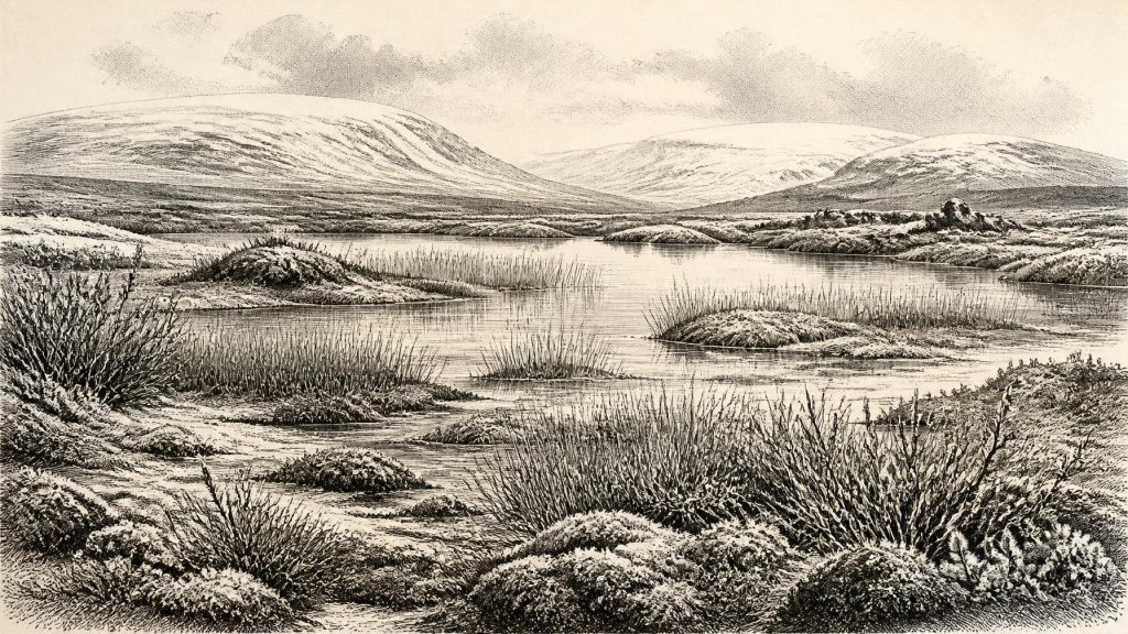
Derryvree nevertheless gives Ireland an unusually vivid local environmental record. Poorly preserved pollen, plant macrofossils, mosses and insect remains indicate treeless, open ground under periglacial conditions. The assemblage includes wetland and aquatic plants alongside species suited to cold, exposed terrain: sedges, mosses, dwarf willow, mountain-avens, bogbean, clubmosses and water-milfoil. Such evidence supports an interpretation of shallow or slow-moving freshwater bordered by mossy, sedgy ground, with sparse vegetation on drier surfaces and repeated freeze-thaw processes in the soil.
This was not the familiar green, wooded Ireland of later millennia. It was a patchwork of wet places, bare or thinly vegetated ground and low-growing plants, shaped by a short growing season and severe winters. “Tundra” is a useful shorthand, but should not conceal local variety. The freshwater plants demonstrate open water or saturated ground; the terrestrial flora demonstrates nearby exposed surfaces; the sediments record a basin into which fine material washed. The wider picture is an interpretation assembled from those observations, rather than a photograph of a whole province frozen in one unchanging state.
At this period, glaciers and ice sheets were important but their extent and timing remain subjects of continuing refinement. Recent work on the British–Irish Ice Sheet shows that its growth involved dynamic advance and retreat before the later Last Glacial Maximum. Derryvree’s sequence, together with organic deposits at Greenagho in Fermanagh, shows that north-central Ireland had at least some ice-free terrain during parts of this broader middle glacial interval. The much more extensive ice cover conventionally associated with the Last Glacial Maximum belongs later, chiefly after about 27,000 years BP in Irish Ice Sheet reconstructions. The landscape around 30,501 BCE was thus not simply “under ice” or “without ice”: its character varied by place and through time.
Animals and Caves in the South
County Cork supplies a different kind of evidence. Castlepook Cave, near Doneraile, has produced Ireland’s richest known pre-Last Glacial Maximum vertebrate assemblage. More than 2,000 bones recovered from its galleries document a long and complicated accumulation, with individual dates stretching broadly from about 45,700 to 19,950 radiocarbon years BP. The cave’s Ice-Age fauna includes woolly mammoth, giant deer, reindeer, brown bear and spotted hyaena; later cold-stage remains include Arctic fox, wolf and lemmings. These species do not all represent one moment or a single harmonious community. A cave is a trap, shelter, carnivore den and sedimentary archive, not an intact snapshot of a day’s landscape.
Re-dating has made the caution especially important. Improved methods have shown that some earlier cave determinations were substantially too young, and that particular animals in southern Ireland belonged earlier in Marine Isotope Stage 3 than once thought. The presence of giant deer and spotted hyaena before about 40,000 calibrated years BP, for example, should not automatically be projected onto every later point in the period. Even so, Castlepook establishes that Ireland could support substantial mammals and predators during the broader cold-stage world to which 30,501 BCE belongs. Its caves also reveal how easily bones can be moved, mixed or disturbed, limiting the certainty of fine-grained reconstructions.
A reindeer femur from Castlepook has acquired particular importance. County Cork heritage material identifies an incision on it as a possible stone-tool cut mark and associates the bone broadly with around 31,000 BC. If that interpretation is confirmed, it would indicate that a person used a sharp tool while processing a reindeer in Ireland during the Upper Palaeolithic. The implication is remarkable, but narrow. The bone does not demonstrate a camp, a dwelling, a hearth, a burial, a tool kit, a community or permanent settlement. It does not reveal who the people were, how many travelled together, whether they hunted the animal or merely encountered its carcass, or how long they remained.
People: Possibility, Not Population
Accordingly, Ireland cannot responsibly be described at this date as having a known human society. There are no securely dated houses, villages, cemeteries, artworks, named groups or language evidence for 30,501 BCE. No political affairs, rulers, diplomacy, warfare, law or territorial boundaries can be recovered. Nor is there evidence for religion, formal learning, exchange networks or trade in the historical sense. Such absences are not trivial gaps in a fuller story; they define the limits of what the record can bear.
If the Castlepook incision is anthropogenic, the most restrained inference is a short-lived activity by a small mobile party with a sharp stone edge and the practical knowledge to process animal tissue. Comparable Upper Palaeolithic groups elsewhere in north-west Europe made sophisticated tools, travelled widely and depended on flexible seasonal strategies, but it would be unsafe to transfer their social structures, art or beliefs directly to Ireland. The sea, coastlines and possible routes across the Irish Sea region also differed greatly from today, yet shifting sea level, glacial loading and subsequent erosion mean that neither a straightforward land crossing nor a specific water journey can be demonstrated for this moment.
Economy Without Farms
There was no agriculture in Ireland. There were no fields, livestock, metalworking, pottery, towns or markets. Any human economy, if people were present at all, would have depended on immediate resources: animal carcasses, hunted game, plant foods, fuel and sheltered places. The Derryvree wetlands could have offered freshwater and seasonal plant resources, while the wider open landscape supported herbivores and the carnivores that followed them. But the evidence does not allow archaeologists to calculate diets, identify hunting territories or reconstruct an annual round for Ireland itself.
The most important development near 30,501 BCE was therefore ecological rather than political: Ireland contained habitable pockets during an age of profound climatic volatility, while advancing ice and changing coastlines repeatedly constrained them. Derryvree records freshwater life flourishing temporarily between glacial episodes. Castlepook records a richer mammal world than survives on the island today, as well as the possibility—still requiring careful scrutiny—of an exceptionally early human encounter with it. These buried silts and cave bones are modest remains, but they are enough to replace a blank Ice Age with a cautious, compelling picture of a cold and living Ireland.
Primary Sources
- A Middle Midlandian Freshwater Series at Derryvree, Maguiresbridge, County Fermanagh, Northern Ireland
- Palaeoecology (Irish Quaternary Association Guide No. 16)
- Figure 6.— The Subdivision of the Quaternary Period in Ireland
- Trimlines, Blockfields and the Vertical Extent of the Last Ice Sheet in Southern Ireland
- The Timing and Magnitude of the British–Irish Ice Sheet Between Marine Isotope Stages 5d and 2
- Timing and Pace of Ice-Sheet Withdrawal Across the Marine–Terrestrial Transition West of Ireland During the Last Glaciation
- Exploring Controls of the Early and Stepped Deglaciation on the Western Margin of the British Irish Ice Sheet
- Stratigraphic and Palaeo-Geomorphological Evidence for the Glacial-Deglacial History of the Last British-Irish Ice Sheet in the North-Western Irish Sea
- Castlepook Cave, County Geological Site Report
- A Reconsideration of the Radiocarbon Dating of the Marine Isotope Stage 3 Fauna from Southern Ireland
- The Irish Quaternary Fauna Project
- Occurrence of Mammalia Relicts at Site Castlepook Cave
- Pleistocene Vertebrates in the British Isles
- Heritage Artefacts of County Cork
- The IntCal20 Northern Hemisphere Radiocarbon Age Calibration Curve (0–55 cal kBP)
- IntCal Publications
- A Stratigraphic Framework for Abrupt Climatic Changes During the Last Glacial Period Based on Three Synchronized Greenland Ice-Core Records
- Ireland: Submerged Prehistoric Sites and Landscapes
- First Evidence of a Late Upper Palaeolithic Human Presence in Ireland
- The Mesolithic in Ireland: When Was It?
- The Colonization of Ireland: A Human Ecology Perspective
- New Insights on the Fauna of Ireland’s Younger Dryas and Early Holocene from Alice & Gwendoline Cave
- Post-Glacial Relative Sea-Level Observations from Ireland and Their Role in Glacial Rebound Modelling