
BIRM-166’s Wide Clock30470 BCE
Around 30,470 BCE, Ireland lay within the climatically unstable Late Pleistocene, approaching more extensive glaciation. Derryvree, County Fermanagh, preserves organic freshwater deposits between glacial tills, indicating a locally ice-free wetland landscape around 33,500 calibrated years ago. Fossils show cold, treeless environments with pools, mosses, sedges and hardy vegetation. Castlepook Cave, County Cork, contains diverse Ice Age animal remains, including mammoth, reindeer, giant deer and hyaena, demonstrating wider faunal connections. Possible tool marks on a reindeer bone may indicate an early human visit, but settled occupation remains unproven. Evidence chiefly records changing environments, fauna and glacial erosion, not societies or events.
Dateline
The label 30,470 BCE is a modern point on a deep-time scale, not a year that anyone in Ireland could have named, recorded or experienced as a calendar date. It equates only approximately to 32,400 years before the conventional radiocarbon baseline of AD 1950. At that antiquity, even the best evidence is normally expressed as broad calibrated ranges, with margins of uncertainty measured in centuries or millennia. Ireland’s history at this horizon belongs to the Late Pleistocene, broadly within Marine Isotope Stage 3: a climatically unstable part of the last Ice Age, before the fullest expansion of the British–Irish Ice Sheet.
No event, ruler, settlement or community can responsibly be assigned to this exact year. The evidence instead consists of layers of sediment, fossil plants, insects, animal bones, cave deposits and the physical record of advancing and retreating ice. These materials permit a careful reconstruction of environments and possibilities. They do not provide a nationwide snapshot, nor do they justify turning one numbered year into a story of certain human occupation.
A Date Within a Range
The most relevant Irish record is from Derryvree, near Maguiresbridge in County Fermanagh. Roadworks in 1969 cut through a drumlin and exposed an unusual sequence. Thick glacial till lay below; freshwater silts, fine sands and organic deposits occurred in the middle; another thick body of till sealed them above. Till is unsorted sediment laid down directly by ice. The order of deposits is therefore powerful evidence: ice had occupied this locality, an interval followed in which fresh water and organic matter accumulated, and glacier ice later returned.
Organic material from the middle deposits produced the radiocarbon determination BIRM-166: 30,500 radiocarbon years BP, with a substantial laboratory uncertainty of roughly 1,100 years. A radiocarbon age is not itself a calendar age. The amount of carbon-14 in the atmosphere has changed through time, so a measurement must be calibrated against independently dated records. At more than 30,000 years ago, calibration is necessarily broad rather than annual. A later Bayesian treatment of the Derryvree evidence placed the relevant ice-free phase around 33.5 ± 1.2 thousand calibrated years BP. The notional date of 30,470 BCE, roughly 32.4 thousand years BP, falls close to the younger side of that modelled range, but cannot be attached to a particular bed, season, pool or living plant.
This distinction matters. BIRM-166 does not date “Ireland in 30,470 BCE”; it dates organic matter within a sedimentary sequence accumulated over an interval. Nor does Derryvree demonstrate that the entire island was ice-free at once. It provides firm local evidence from Fermanagh against any simple picture of an island continuously and uniformly buried by ice throughout the last glacial period.
Fresh Water Between Glaciers
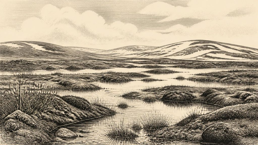
The Derryvree deposits illuminate a cold but living landscape. Plant macrofossils, pollen, mosses and insect remains point to treeless, open ground around standing or slow-moving fresh water. The older literature described the setting as muskeg or tundra: useful comparisons if understood cautiously, not labels for an exact modern ecological equivalent. It was a wet mosaic of shallow pools, muddy margins, sedges, mosses, low shrubs and hardy herbs, shaped by short growing seasons and severe winters.
Such evidence is direct in a limited sense. A fossil seed, moss fragment or beetle remain records an organism that was present in, or very near, the waterbody. Sediment texture records water and deposition. Together they show that this particular part of Fermanagh could sustain freshwater and wetland life during an interval between glacial episodes. They do not establish a familiar green Irish countryside, extensive woodland, permanent river valleys or a stable climate. The landscape was probably highly seasonal and vulnerable to abrupt cooling, changing snowfall and the shifting position of ice margins.
There were no farms, fields or managed forests. Nothing from Derryvree indicates cultivation, animal husbandry, pottery, buildings, exchange networks or a built settlement. The economic language appropriate to later prehistory simply does not apply. Energy in this environment was captured through natural food webs: aquatic plants and waterside vegetation, insects and other invertebrates, and the animals able to exploit the wider open country.
An Island Approaching Major Glaciation
Ireland was not yet at the maximum of the last glaciation. Syntheses of terrestrial landforms, offshore sediments and radiocarbon chronologies place the last maximum advance of the Irish sector of the British–Irish Ice Sheet later, broadly between about 27,000 and 23,000 calibrated years BP. At 30,470 BCE, the island therefore stood in a longer transition towards more extensive ice. That conclusion should not be mistaken for a claim that conditions were mild. An ice sheet need not be at its maximum size for the climate to be harsh, for local glaciers to be active, or for large parts of the landscape to be inhospitable.
Regional variation was crucial. Uplands, western coasts, lowland basins and the Irish Sea basin did not respond identically. Derryvree’s freshwater interval indicates local ice-free ground in the north-western interior; it cannot be projected unchanged onto Cork, Kerry, Dublin or the offshore shelf. Conversely, the later widespread ice cover helps explain why surviving evidence from this period is so fragmentary. Glacial erosion removed, redeposited or buried much of the earlier landscape. What remains is disproportionately found where sediments were protected beneath later till or where caves retained bone deposits.
Castlepook’s Animal Archive
Nearly 300 kilometres south-west of Derryvree, Castlepook Cave near Doneraile in County Cork preserves Ireland’s richest known Ice Age vertebrate assemblage. Its deposits and museum collections include remains attributed to woolly mammoth, reindeer, giant deer, brown bear, wolf, mountain hare, Arctic fox, lemmings and spotted hyaena. The list is impressive, but it must not be read as a single herd passing through Cork in one year. Cave deposits combine episodes separated by long periods; carnivores transport bones; excavation and collecting history can disturb their original relationships; and individual bones have different ages.
Modern radiocarbon reassessment has nevertheless strengthened the case that southern Ireland supported a more varied Marine Isotope Stage 3 fauna than older accounts allowed. Spotted hyaena, in particular, is important evidence that some Irish caves were part of wider north-west European animal landscapes rather than isolated refuges. Mammoths and reindeer show that cold-adapted large mammals reached the island at various times. Recent sedimentary ancient-DNA work from Castlepook is consistent with connections between Irish fauna and wider Eurasian populations before the Last Glacial Maximum. This is evidence of biogeographical connectivity, not proof of one permanent dry route, a fixed coastline or a human migration corridor at this particular date.
The cave also bears on the difficult question of people. A reindeer femur from older Castlepook collections has been reported as bearing a deep mark interpreted as possible stone-tool butchery, and the animal bone has been associated in public reporting with an age around 33,000 years ago. If that interpretation is ultimately sustained, it would suggest a brief Upper Palaeolithic human visit to Ireland far earlier than the long-accepted post-glacial settlement record. It would not demonstrate a resident population, village, political group or continuous occupation.
For now, caution is essential. The find is a single modified bone from an old cave collection, not a securely excavated living floor with hearths, stone-tool concentrations, human remains and tightly associated dates. The National Museum of Ireland’s general account still notes that clear evidence for human presence in Ireland during the Palaeolithic has not emerged. The responsible conclusion for around 30,470 BCE is therefore that human presence is possible and actively investigated, but unproven as an established settlement history.
Society Without a Social Record
There is no evidence on which to base claims about Irish political affairs, diplomacy, territorial rule, warfare, formal religion, language, art or learning at this date. There are no graves, monuments, houses, inscriptions or artefacts securely belonging to a community in Ireland around this horizon. Even if the Castlepook incision proves anthropogenic, it would attest to the processing of an animal, not to a named people or an organised polity.
It is reasonable, as an interpretation drawn from comparable Upper Palaeolithic societies elsewhere in north-west Europe, to suppose that any visitors would have travelled in small, mobile foraging groups and possessed detailed practical knowledge of animals, weather and stone-working. But that is comparative inference, not direct Irish evidence. Ireland’s own record at 30,470 BCE is principally environmental. Its strongest story is not one of kingdoms or trade, but of freshwater persisting between advances of ice, of cold-adapted fauna moving through changing habitats, and of a landscape whose archaeological traces were repeatedly erased by glaciation.
What This Year Can Mean
30,470 BCE is best understood as a waypoint within a broad late-Ice-Age interval. At Derryvree, an ice-free freshwater environment had existed between two glacial episodes; at Castlepook, animal remains preserve evidence of a complex southern fauna across Marine Isotope Stage 3. The island was changing, and more extensive glaciation still lay ahead. The evidence supports a cold, open and regionally varied Ireland, intermittently accessible to animals and perhaps briefly to people. It does not support calendar precision, a settled population, or an invented event for one prehistoric year.
Primary Sources
- A Middle Midlandian Freshwater Series at Derryvree, Maguiresbridge, County Fermanagh, Northern Ireland
- Deglacial Rates and Controls for BIIS Western Margin
- A Reconsideration of the Radiocarbon Dating of the Marine Isotope Stage 3 Fauna from Southern Ireland
- The Irish Quaternary Fauna Project
- Sedimentary Ancient DNA Reveals Late Pleistocene Faunal Connectivity Between Ireland and Eurasia
- Castlepook Cave, County Cork: County Geological Site Report
- Heritage Artefacts of County Cork 2021
- Prehistoric Details
- The IntCal20 Northern Hemisphere Radiocarbon Age Calibration Curve (0–55 cal kBP)
- IntCal
- A Critical Review and Re-investigation of the Pleistocene Deposits
- Late Pleistocene Chronostratigraphy and Ice Sheet Limits, Southern Ireland
- Response of the Irish Ice Sheet to Abrupt Climate Change During the Last Deglaciation
- Pattern and Timing of Retreat of the Last British-Irish Ice Sheet
- Reconstructing the Last Irish Ice Sheet 2: A Geomorphologically-Driven Model of Ice Sheet Growth, Retreat and Dynamics
- Maximum Extent and Dynamic Behaviour of the Last British–Irish Ice Sheet West of Ireland
- Radiocarbon Constraints on the Age of the Maximum Advance of the British–Irish Ice Sheet in the Celtic Sea
- Character of Advance and Retreat of the Southwest Sector of the British-Irish Ice Sheet During the Last Glaciation
- Oscillating Retreat of the Last British-Irish Ice Sheet on the Continental Shelf Offshore Galway Bay, Western Ireland
- Trimlines, Blockfields and the Vertical Extent of the Last Ice Sheet in Southern Ireland
- Geology of Ireland
- Quaternary
- Irish Quaternary Association
- Irish Association for Quaternary Studies: Guide 13
- References and Recommended Reading: IQUA Guide 16
