BIRM-166 Between the Tills30469 BCE
30,469 BCE is a notional modern date within Marine Isotope Stage 3, not a recoverable Irish historical year. At Derryvree, County Fermanagh, organic freshwater silts between glacial tills, dated by BIRM-166 to about 30,500 radiocarbon years before present, indicate an ice-free or ice-marginal wetland before later glaciation. Plants, mosses and insects reveal tundra, saturated ground and shallow water. Castlepook Cave in County Cork preserves mixed cold-stage fauna, including mammoth and reindeer. A possibly butchered reindeer bone suggests, but cannot prove, early human visitation. No secure evidence establishes settlement, society, trade or politics. Environmental change and ice-sheet expansion dominate this period.
Dateline
30,469 BCE is a modern notional label, not a year that can be recovered from Ireland’s archaeological record. No Irish calendar, settlement sequence or event narrative reaches this far back. At this depth of time, even radiocarbon ages carry large statistical uncertainties and must be calibrated; a date expressed in BCE cannot be matched confidently to a single season, generation or historical occurrence. The responsible approach is therefore to place this point within the Late Pleistocene, during Marine Isotope Stage 3, and to use the few surviving Irish environmental and faunal archives that illuminate the wider period.
The most revealing evidence comes not from a habitation site but from a road cutting at Derryvree, near Maguiresbridge in County Fermanagh. There, buried beneath the streamlined glacial hills known as drumlins, investigators found freshwater silts and fine sands containing organic material between two layers of till. Till is debris deposited directly by glacier ice. Its position above and below the organic bed establishes a simple but powerful sequence: ice affected the locality; then water, plants and insects occupied an ice-free or ice-marginal basin; later ice advanced and sealed that evidence beneath fresh glacial sediment.
Dating a Lost Landscape
The Derryvree organic deposits produced radiocarbon determination BIRM-166, conventionally reported as 30,500 radiocarbon years before present, with a substantial uncertainty of +1,170 and −1,030 years. “Before present” means before 1950, not before the present day. Such a result is not identical to a calendar age, because atmospheric radiocarbon levels have varied through time. Modern calibration curves translate it into a broad and uncertain calendar range rather than an exact date. Legacy summaries have placed the central estimate at roughly 35.9 thousand calibrated years before present, while newer reconstructions treat the old determination cautiously but retain it as evidence for pre-Last Glacial Maximum ice-free conditions.
Accordingly, BIRM-166 should not be presented as proof that a particular Fermanagh wetland existed precisely in 30,469 BCE. It does, however, belong to the broad climatic world relevant to this nominal date: a long interval before the fullest expansion of the last British–Irish Ice Sheet, when conditions and ice cover varied sharply across regions. Recent modelling indicates that parts of Ireland were ice-free in the earlier part of this period and that major ice-sheet build-up followed later. The Last Glacial Maximum, when ice covered almost all of Ireland and extended across adjoining marine shelves, came thousands of years afterwards, broadly between about 26,000 and 20,000 years ago.
Freshwater Under a Cold Sky
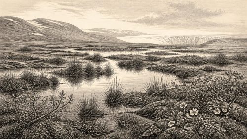
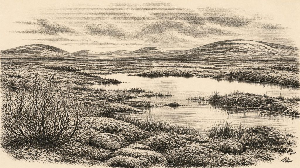
Derryvree overturns any simple image of an Ireland uniformly buried beneath ice throughout the last cold stage. The silts preserve a local freshwater environment. Fossil plants, mosses and insects indicate open tundra vegetation and a periglacial regime: a severe climate in which freezing, thawing and frost-affected soils shaped the land, but where ice was not permanently covering the basin. The evidence points to shallow or slow-moving water, muddy margins and saturated ground rather than woodland, pasture or a wholly barren snowfield.
The plant record is especially evocative. Sedges and mosses flourished around wet ground. Fossils recorded from the deposit include bogbean or buckbean (Menyanthes trifoliata), a plant of shallow freshwater and marshy margins, as well as dwarf willow (Salix herbacea) and other cold-adapted taxa. These are observations from a particular deposit, not an inventory of the entire island. Yet they demonstrate that, during the interval represented at Derryvree, Fermanagh included a functioning wetland ecosystem: plants grew, decayed, and were incorporated into accumulating sediment; insects occupied terrestrial and aquatic niches; and water moved fine sand through the small basin.
The older description of the landscape as “muskeg” is useful only if handled carefully. It conveys a mosaic of wet, organic ground, mosses, sedge margins and pools, comparable in some respects to northern cold-region wetlands. It must not be mistaken for a photographically exact reconstruction, nor extended automatically to Munster, Connacht or the Irish Sea basin. At 30,469 BCE, regional differences in altitude, exposure, snow cover, drainage and proximity to growing ice would have mattered greatly.
Mammals and the Cave Record
Southern Irish caves provide a different, less neatly dated archive. Castlepook Cave, also called Mammoth Cave, near Doneraile in north County Cork, yielded a remarkable collection during excavations in the early twentieth century. The assemblage includes remains attributed to woolly mammoth, reindeer, giant deer, brown bear, wolf, fox, Arctic fox, hare, lemming and spotted hyaena. It demonstrates that parts of Ireland were entered by a varied cold-stage fauna during the wider Late Pleistocene. Reindeer and mammoth suggest open grazing country; lemmings and Arctic fox fit cold conditions; and hyaena, wolf and bear remind us that large carcasses formed part of a complex food web involving predators and scavengers.
But this is not a single scene frozen in time. Cave bones can accumulate over long spans, be moved by carnivores or water, and become mixed by later disturbance. Castlepook’s historic excavations predated modern standards of stratigraphic recording, and subsequent radiocarbon work has revised the age of parts of Ireland’s Quaternary fauna. It would be unsound to put every species found in the cave beside one another, or to assume that its fauna lived at exactly the same time as the Derryvree wetland.
A reindeer femur from Castlepook has become central to the question of people in Ice Age Ireland. It has been reported as roughly 33,000 years old and as carrying a deep mark interpreted by palaeozoologist Ruth Carden as a fresh-bone incision made by a sharp stone tool during butchery. If that interpretation and association are confirmed, it would show a human encounter with a reindeer far earlier than Ireland’s formerly accepted record of occupation. Yet one modified bone is not a camp, a tool kit or a population. Ongoing work has rightly treated Castlepook as a promising research problem rather than a settled account of continuous Palaeolithic settlement.
People: Possibility, Not Population
There is therefore no secure basis for describing an Irish community in 30,469 BCE. No hearth, house, burial, stone-tool assemblage, artwork or repeated occupation surface of this age has been demonstrated on the island. The National Museum of Ireland still appropriately characterises evidence for a Palaeolithic human presence as unclear, while recognising that new finds and investigations may alter the picture. The Castlepook femur raises the possibility of a brief visit by people; it does not establish an enduring settlement, a named culture or an unbroken ancestry leading to later Irish populations.
Comparison with Upper Palaeolithic groups elsewhere in north-west Europe can indicate what mobile foragers may have known if they reached Ireland: animal movements, carcass processing, fuel, shelter, workable stone and the hazards of rapidly changing weather. Reindeer could supply meat, fat, marrow, hide, sinew and bone. This is a cautious comparative inference, however, not evidence that a documented Irish group pursued a regular reindeer-hunting economy. Nor can the Irish record identify language, kinship, dress, ritual practice or social rank.
No Polities, No Trade Routes
Political affairs, warfare and diplomacy cannot be recovered for Ireland at this date. There were no known kingdoms, chiefs, boundaries, treaties or institutions, and no written evidence of any kind. It is equally misleading to project later ideas of tribes or nations into the Late Pleistocene. If people entered the island, their movements would have occurred within small-scale hunter-gatherer networks, not through states or formal international relations.
Sea level was considerably lower than today, exposing land now beneath the Irish and Celtic seas and changing the shape of coasts and possible routes. That fact does not demonstrate a particular land bridge, shoreline path, crossing season or means of travel. Ice, sea and erosion have since remade the terrain. Trade in the later sense is unattested; the most that can be said is that Upper Palaeolithic mobility elsewhere sometimes carried stone, knowledge and personal connections across wide territories. Ireland has not yet supplied evidence sufficient to map such networks here.
Religion, culture and learning remain beyond direct recovery. There are no Irish monuments, shrines, images or graves from which to infer beliefs. The Derryvree deposit does nevertheless preserve another kind of inheritance: practical ecological history. Its plants and insects show that even a harsh glacial landscape contained varied habitats and short productive seasons. Castlepook’s animals show that Ireland was not simply empty ground between ice advances. Together they reveal a changing northern land of wet hollows, low vegetation, large mammals and approaching ice.
A Record Measured in Millennia
The major development relevant to 30,469 BCE was environmental instability rather than a datable human event. Derryvree records an interval when freshwater, tundra plants and insects survived between glacial episodes in Fermanagh. Castlepook preserves scattered evidence that cold-adapted mammals entered southern Ireland, alongside a provocative but still limited indication of human action. Later expansion of the British–Irish Ice Sheet would bury, erode and destroy much of the evidence needed for a fuller story. For this nominal year, Ireland’s history is therefore not an annual chronicle but a carefully bounded reconstruction: a cold, regionally varied Pleistocene landscape, capable of sustaining life, and only tentatively connected to the earliest human journeys at Europe’s north-western edge.
Primary Sources
- A Middle Midlandian Freshwater Series at Derryvree, Maguiresbridge, County Fermanagh, Northern Ireland
- IQUA Guide 16: Quaternary Geology of the Northern Ireland Midlands
- Figure 6.— The Subdivision of the Quaternary Period in Ireland
- Exploring Controls of the Early and Stepped Deglaciation on the Western Margin of the British Irish Ice Sheet
- Exploring Controls of the Early and Stepped Deglaciation on the Western Margin of the British Irish Ice Sheet
- Pattern, Style and Timing of British–Irish Ice Sheet Advance and Retreat Over the Last 45,000 Years: Evidence From NW Scotland and the Adjacent Continental Shelf
- The Irish Quaternary Fauna Project
- Archaeology Research Excavation Grant 2022: Final Reports
- 32564: Castlepook Cave, Doneraile, Cork
- Mammoth Cave
- Heritage Artefacts of County Cork
- Prehistoric Details
- Quaternary Site Descriptions
- Outreach and Education Resources
- Irish Quaternary Association Publications
- The IntCal20 Northern Hemisphere Radiocarbon Age Calibration Curve (0–55 cal kBP)
- IntCal Publications
- IntCal History
- Menyanthes trifoliata L.
- Salix herbacea L.
- Ireland's Palaeolithic Archaeology – Fleeting Footprints in a Frozen Land
- Ireland’s Palaeolithic Archaeology: Fleeting Footprints in a Frozen Land
- New Insights on the Fauna of Ireland's Younger Dryas and Early Holocene From Alice & Gwendoline Cave