Maguiresbridge’s Frost Fen30428 BCE
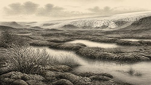
Around 30,428 BCE, Ireland has no recoverable calendar year, written history or securely dated human settlement. Evidence from Derryvree near Maguiresbridge, County Fermanagh, instead documents a broad interval: organic freshwater silts and sands, radiocarbon dated approximately 34,950–29,750 BCE, lie between two glacial tills. They show locally ice-free, open tundra wetland, with pools, mosses, sedges, herbs and low shrubs, before later ice covered the site. Ireland’s ice sheet was growing unevenly, reshaping habitable land and drainage. Cave fauna indicate cold-adapted animals across relevant periods, while possible human evidence remains uncertain. Derryvree preserves environmental change, not a specific event or historical moment.
Dateline
“30,428 BCE” is a useful modern label, but it is not a recoverable Irish year. No calendar used by people in or near Ireland can be correlated with it; indeed, it is not certain that people were present on the island at this particular point. There are no written records, named individuals, settlements, political communities or events that can be assigned to a single year so deep in the Pleistocene. The responsible history of this date is therefore an account of evidence from broad intervals: buried sediments, fossils, glacial landforms and laboratory dates. The strongest local guide is a remarkable freshwater deposit at Derryvree, near Maguiresbridge in present-day County Fermanagh.
A Date Range, Not a Day
The modern label 30,428 BCE corresponds approximately to 32,377 years before present, where “present” is conventionally AD 1950. That conversion must not be mistaken for precision. Radiocarbon laboratories initially report ages in radiocarbon years, because atmospheric carbon-14 has varied substantially through time. Those measurements must be calibrated against independently dated environmental records, and at this antiquity the resulting calendar ranges are broad.
At Derryvree, organic silts and fine sands produced the conventional radiocarbon determination Birm-166 of 30,500 radiocarbon years before present, with a large uncertainty of +1,170 and −1,030 years. A published calibration places the result broadly at about 36,900–31,700 calibrated years before present, roughly 34,950–29,750 BCE. Thus 30,428 BCE falls within the wide chronological window represented by this deposit, but it cannot be tied to a particular season, generation, water level or historical occurrence. The deposit illuminates an interval, not a dated episode.
Freshwater Between Two Ices
Road works in February and March 1969 cut through a drumlin at Derryvree, about two kilometres north-east of Maguiresbridge. Drumlins are streamlined hills shaped beneath moving glacier ice. The exposed section revealed two substantial sheets of till, the unsorted debris deposited by glaciers, separated by freshwater silts and fine sands rich in organic remains. It was an unusually fortunate geological window: a wetland had accumulated in a local hollow after one phase of glaciation and before a later advance covered it.
The fundamental inference is secure. During deposition of the organic layer, this part of Fermanagh was not beneath active glacier ice. Freshwater existed locally, and plants and small animals lived at or close to its margins. The upper till demonstrates that ice later crossed the site. What the sequence does not show is equally important. It does not establish that all Ireland was simultaneously ice-free, identify the exact direction or date of the later advance, or provide a continuous record of every intervening century. A single roadside exposure is a local archive, not a map of an entire island.
An Open, Cold Wetland
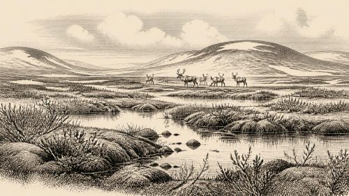
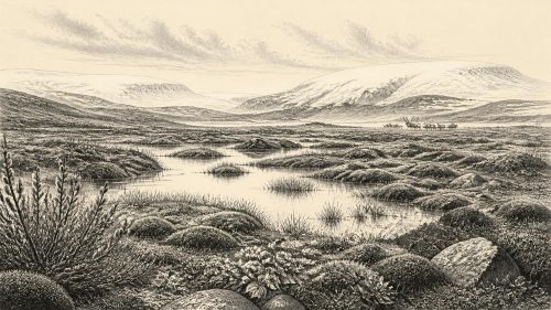
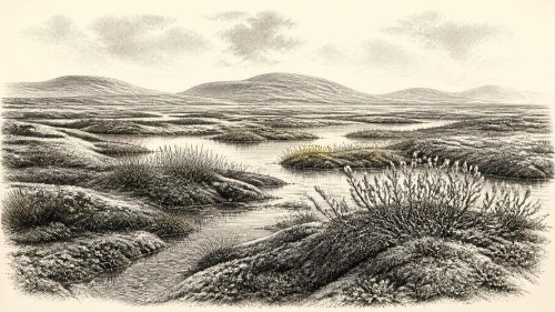
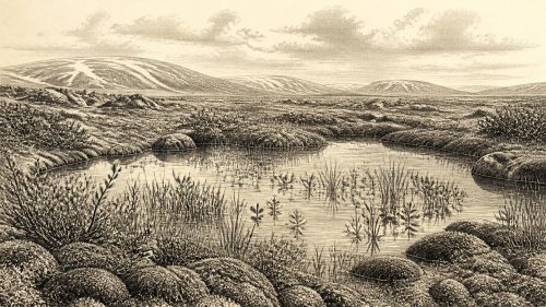
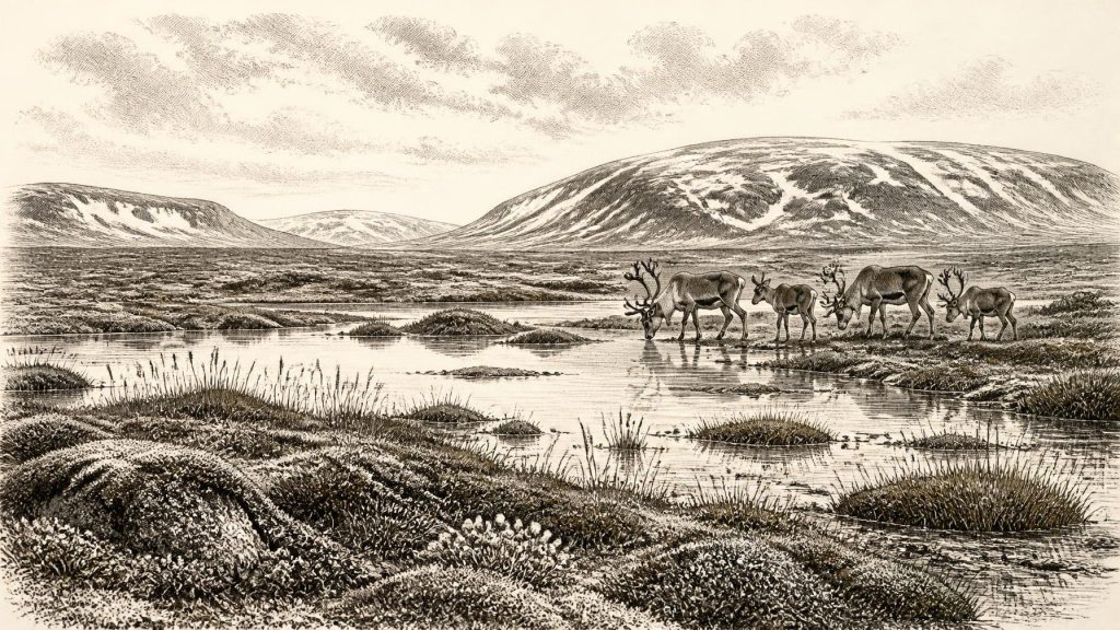
The original study found a flora and fauna of full-glacial character and interpreted the setting as open tundra under a periglacial climate: a landscape strongly governed by freezing and thawing at the edge of, or beyond, permanent ice. The word tundra should not conjure an unbroken desert of snow. Derryvree’s organic material records freshwater and wet ground, with vegetation able to occupy shallow water, damp sediment and surrounding open terrain. Mosses, sedges, herbaceous plants and low shrubs could exploit a short growing season where conditions allowed.
The likely scene was therefore varied at a small scale: shallow pools or slowly moving water, silty margins, wet mossy ground and exposed mineral soils. Trees were absent locally. Winter frost, meltwater and seasonal saturation would have influenced both landforms and plant cover. Such a mosaic could support insects and other invertebrates as well as visiting or resident larger animals, but it was not an environment of stable woodland, fields or long-established human villages. The surviving evidence is especially valuable precisely because later ice normally destroyed or buried deposits of this age.
Ireland During Ice-Sheet Growth
This interval belongs to the later Pleistocene, within Marine Isotope Stage 3, before the fullest expansion of the last British–Irish Ice Sheet. Recent reconstructions show that ice growth was not a single, island-wide switch from open land to total cover. Different sectors advanced at different times, and maximum limits were asynchronous. Ice in northern and western sectors reached far offshore during the broad period from about 30,000 to 26,000 years ago, while some southern margins expanded later.
Derryvree captures the difficulty of converting such regional reconstruction into a statement about one numbered year. Its freshwater layer indicates locally ice-free ground during a broad interval; the enclosing tills prove glaciation before and after it. Wider work on the Irish Ice Sheet indicates rapid growth and changing flow patterns around this era. Together, these findings make Ireland around 30,428 BCE a changing geographical setting rather than a fixed climatic tableau. Some ground may have remained habitable for cold-adapted life while expanding ice altered drainage, sea levels, routes and the preservation of evidence elsewhere.
Animals in the Wider Record
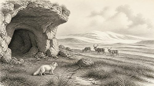
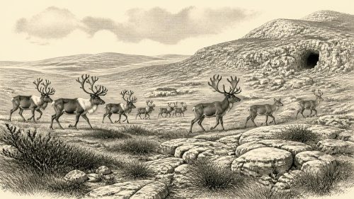
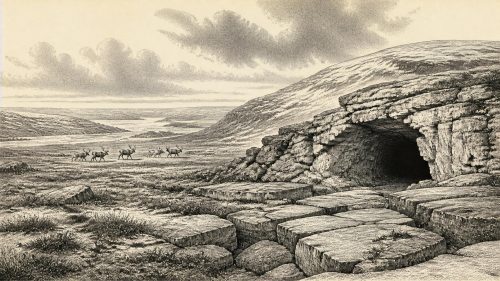
Irish cave deposits add a wider, though imperfect, picture of late Ice Age fauna. Castlepook Cave near Doneraile in County Cork is Ireland’s richest known site for vertebrate evidence from the long period leading towards the Last Glacial Maximum. Its dated animal bones span many thousands of years, rather than one occupation or one ecosystem. The recorded assemblage includes woolly mammoth, giant deer, reindeer, brown bear and spotted hyena; later material includes Arctic fox, wolf and lemmings.
These finds show that Ireland, at different times in the middle and later Ice Age, formed part of a north-west European world capable of supporting large herbivores and predators. But cave bones must be interpreted carefully. Carnivores could carry carcass parts into caves; water could move remains; excavations undertaken more than a century ago lacked modern recovery standards; and deposits could be disturbed or mixed. It would be wrong to turn Castlepook’s long faunal list into a census for Fermanagh in 30,428 BCE. The defensible conclusion is more modest: cold-adapted animal communities occurred in Ireland during broadly relevant Pleistocene intervals.
The Human Question
A reindeer femur from Castlepook has attracted particular attention because it bears a deep mark interpreted by zooarchaeologist Ruth Carden as made by a sharp stone tool during carcass processing. Public reporting associates the bone with an age of about 33,000 years ago. If the mark was made on fresh bone and is broadly contemporary with the animal’s death, it is potentially evidence that people visited Ireland and processed a reindeer several millennia before the modern year considered here.
That possibility must not be inflated into a story of permanent colonisation. The femur came from an old cave collection, not a newly excavated occupation floor containing associated hearths, stone tools, structures, human remains and securely linked sediments. Its date is the date of the bone, not automatically the date of the incision. Nor does one specimen demonstrate a continuing population, a named Upper Palaeolithic tradition or descent from later inhabitants. For 30,428 BCE specifically, there is no securely dated Irish camp, house, burial or tool assemblage. Human presence remains a question for further research, while Derryvree’s environmental evidence is considerably firmer.
No Polities, but Real Constraints
There is no evidence for political affairs, leadership, diplomacy, warfare, territorial institutions or formal religion in Ireland at this date. Nor can archaeologists responsibly reconstruct households, kinship systems, languages, teaching or artistic traditions from the Derryvree silts. Absence of evidence is not proof that no people ever crossed the region, but it is decisive against inventing chiefs, tribes, rituals or conflicts. The later prehistoric vocabulary of kingdoms, clans and monuments has no place here.
Similarly, there is no demonstrable local economy or trade network. If people did make brief visits during suitable ice-free phases, they would have faced a landscape in which mobility, weather, animal movements, freshwater access and the risk posed by predators mattered far more than agriculture or settled exchange. Such statements are ecological interpretation, not direct evidence for a camp at Derryvree. The direct evidence is the wetland itself: its sediments preserve the conditions that shaped what life, human or animal, could have endured there.
What This Moment Means
The most important development around this notional year was environmental instability during the build-up of major ice. At Derryvree, freshwater life and open tundra existed between two glacial episodes. Across the wider island, ice, sea and habitable ground were being reorganised on timescales of centuries and millennia. Ireland was not yet the familiar Atlantic island of forests, farms and towns, nor was it simply a blank white ice sheet. It was a fragmented Ice Age landscape whose history survives in rare sediments, cave bones and the limits left by moving ice.
Maguiresbridge’s frost fen is consequently more than a curiosity beneath a drumlin. It supplies one of the clearest Irish reminders that deep prehistory is not an empty period awaiting fictional events. Its evidence allows a vivid but disciplined reconstruction: open, cold, freshwater-edged ground in Fermanagh, later sealed by glacial deposits, within a changing north-west European Ice Age. Beyond that, certainty gives way to possibility—and the distinction is the beginning of sound history.
Primary Sources
- Middle Midlandian Freshwater Series at Derryvree, Maguiresbridge, County Fermanagh, Northern Ireland
- Middle Midlandian Freshwater Series at Derryvree, Maguiresbridge, County Fermanagh, Northern Ireland
- Trimlines, Blockfields and the Vertical Extent of the Last Ice Sheet in Southern Ireland
- Growth and Retreat of the Last British–Irish Ice Sheet, 31,000 to 15,000 Years Ago: the BRITICE-CHRONO Reconstruction
- The Evolution of the Terrestrial-Terminating Irish Sea Glacier During the Last Glaciation
- The Deglaciation of the Western Sector of the Irish Ice Sheet from the Inner Continental Shelf to Its Terrestrial Margin
- Deglaciation Chronology of the Donegal Ice Centre, North-West Ireland
- New Data for the Last Glacial Maximum in Great Britain and Ireland
- Castlepook Cave, County Geological Site Report CK032
- New Insights on the Fauna of Ireland's Younger Dryas and Early Holocene from Alice & Gwendoline Cave
- The Irish Quaternary Fauna Project
- The IntCal20 Northern Hemisphere Radiocarbon Age Calibration Curve (0–55 cal kBP)
- IntCal Publications
- Marine20—The Marine Radiocarbon Age Calibration Curve (0–55,000 cal BP)
- Ice Age Ireland – Cool Fossils
- Guide to the National Museum of Ireland – Natural History
- Irish Quaternary Association: Outreach and Education Resources
- References and Recommended Reading: Irish Quaternary Association Guide
- The Pattern and Timing of Retreat of the Last British-Irish Ice Sheet
- Continuity of Brown Bear Maternal Lineages in Northern England Through the Last-Glacial Period