Derryvree’s Freshwater Clock30427 BCE
30,427 BCE is a modern label for a broad, uncertain Late Pleistocene interval, not a recoverable Irish historical year. Derryvree, County Fermanagh, preserves freshwater silts between glacial tills, indicating temporarily ice-free, wet, treeless tundra during Marine Isotope Stage 3. Its radiocarbon date requires calibration and cannot identify a precise moment. Castlepook Cave, County Cork, contains a long-span assemblage of mammoths, reindeer, giant deer, carnivores and cold-climate fauna, although deposits may mix ages. Possible tool marking on a reindeer bone suggests episodic human presence, not settlement. Ireland had no polities, farming or population; climate, ice and sea levels shaped its landscapes.

Dateline
“30,427 BCE” is a modern calendar label, not a date at which an Irish event can be recovered. No written record, settlement sequence or securely dated human episode can be assigned to that single year. In scientific terms it approximates 32,376 years before AD 1950, the conventional “present” used in radiocarbon reporting. Even that conversion should not create false precision: Late Pleistocene chronologies are built from measurements with margins of error and then calibrated against changing atmospheric radiocarbon. Ireland at this point belongs to the Middle Pleniglacial part of the last glacial cycle, conventionally Marine Isotope Stage 3, rather than to a historical year-by-year past.
A Window Between Ice Sheets
The best Irish evidence relevant to this broad period comes from Derryvree, near Maguiresbridge in County Fermanagh. Roadworks in 1969 exposed a remarkable sequence inside a drumlin: freshwater silts and fine sands, rich in organic material, lay between two substantial sheets of glacial till. The lower till records an earlier advance of ice; the upper till records later overriding ice. Between them, the Derryvree deposit preserves a period when this locality supported standing or slow-moving fresh water, wet ground and vegetation. It is an unusually valuable survival because later glaciers commonly scoured, buried or rearranged older Irish landscapes.
The original radiocarbon determination, BIRM-166, was 30,500 radiocarbon years BP, with an uncertainty of roughly a millennium either side. A radiocarbon age is not equivalent to a calendar age, especially this far back. Subsequent calibration and ice-sheet modelling therefore place the deposit within a broad Late Pleistocene interval rather than on a single line of a modern calendar. A recent reconstruction models Derryvree as part of an ice-free phase centred around 33.5 thousand calendar years BP, with substantial uncertainty. Thus the date represented by 30,427 BCE is reasonably discussed alongside Derryvree, but it cannot be claimed that the organisms in its silt lived in that precise year.
Cold Water, Open Ground
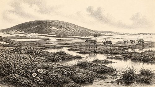
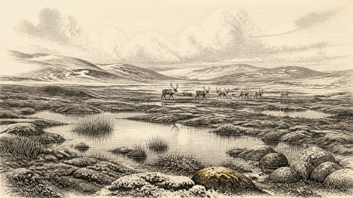
Derryvree’s fossils describe a cold, treeless and periglacial environment, not an Ireland uniformly smothered by ice and not a familiar green countryside. The sediments contained freshwater mosses and sedges, together with plant and insect remains characteristic of a full-glacial setting. Their combination indicates wet hollows, shallow water and marshy margins set within open tundra-like ground. Frost action, seasonal thaw, wind exposure and waterlogging would have shaped daily ecological conditions. The important point is local but decisive: at some time represented by this deposit, ground around Derryvree was exposed, vegetated and watered between two glacial episodes.
That evidence must not be stretched into a map of the whole island. A protected freshwater basin in Fermanagh cannot demonstrate that every upland, coast or southern plain was simultaneously ice-free. Nor can its plants provide exact temperatures or a year-by-year sequence of seasons. Greenland ice-core records show that the last glacial period was marked by abrupt switches between colder stadials and relatively milder interstadials. Ireland stood on the north-western edge of this volatile climatic world. Its ice margins, rivers, sea level, vegetation and animal habitats changed over centuries and millennia, while the evidence now available survives only in scattered pockets.
Caves and Moving Fauna
Castlepook Cave, near Doneraile in north County Cork, provides the complementary animal record. Geological Survey Ireland identifies it as the country’s richest known site for vertebrate remains from the period leading towards the Last Glacial Maximum. More than 2,000 bones have been recovered, and individual radiocarbon dates cover a long span, approximately 45,700 to 19,950 radiocarbon years BP. The assemblage includes woolly mammoth, giant deer, reindeer, brown bear and spotted hyena; later material includes Arctic fox, wolf and lemmings. These remains establish that a varied cold-climate fauna reached Ireland during parts of the Late Pleistocene.
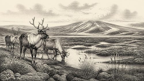
They do not, however, prove that every listed animal shared the same valley or season, much less the year 30,427 BCE. A cave is a selective archive. Hyenas could carry bones inside; flowing water could disturb deposits; scavenging, sediment movement, early excavation and later collecting could mix material of different ages. Castlepook is therefore strongest as evidence for the repeated presence or movement of animals through Irish landscapes over a long interval. Reindeer suggest open grazing country; mammoth and giant deer point to substantial herbivore habitats at particular times; hyenas, wolves and bears show that those herbivores belonged to a food web that included major carnivores and scavengers.
People: A Serious Possibility, Not a Settled Population
The human story at this date is more constrained. Ireland has no securely excavated Upper Palaeolithic settlement, hearth, lithic assemblage, dwelling, burial or human skeleton that can be assigned to around 30,427 BCE. There is consequently no responsible basis for naming a people, describing a permanent camp, reconstructing a social hierarchy or supposing a continuous Irish population. The first well-supported evidence for sustained settlement belongs far later, after the Last Glacial Maximum, in the Mesolithic.
A reindeer femur from Castlepook has nevertheless prompted important debate. It has been reported as about 33,000 radiocarbon years old and bears a deep mark interpreted by Ruth Carden as possible cutting with a sharp stone tool during carcass processing. If that interpretation is confirmed, it would show a brief human encounter with an animal in pre-maximum Ice Age Ireland and would transform the long-standing picture of Ireland’s earliest visitors. Yet the cautious conclusion remains narrow. The measurement dates the animal bone, not the instant of marking; cave deposits have complex formation histories; and one modified bone is not an occupation site. It may indicate a short visit or butchery episode, but cannot demonstrate an enduring community.
No Polities, No Borders
For this reason, the usual categories of political history do not apply. There is no evidence for rulers, territories, diplomacy, organised warfare, law, tribute or institutions in Ireland at this time. Nor is there evidence for farming, herding, pottery, metalworking, monuments, formal religious sites, writing or schools. “Trade” is equally misleading if it implies regular exchange between settled communities. If people did reach the island, their movements would have belonged to the mobile foraging worlds known elsewhere in Upper Palaeolithic north-west Europe: small-scale travel shaped by weather, animal movements, stone resources, shelter and food. That is a contextual inference from neighbouring regions, not a discovery made at Derryvree or Castlepook.
Sea levels were lower than today, exposing areas of continental shelf now submerged, but lower sea level alone does not settle whether there was a walkable route into Ireland at a particular moment. The relationship between Ireland, Britain and the continent depended on ice loading, relative sea level and changing coastlines. Scholars disagree over the form and timing of possible connections, and the available Irish faunal evidence cannot identify a route, direction of movement or frequency of crossings. Any human presence around this broad date must therefore be understood as possible, episodic and geographically connected to wider north-west Europe, rather than as the beginning of a demonstrable national settlement story.
What This Date Can Mean
The responsible historical image of Ireland around 30,427 BCE is a dynamic cold landscape rather than an empty white void or a lost Ice Age kingdom. In Fermanagh, the Derryvree freshwater deposit records open, wet tundra conditions during an interval between glacier advances. In Cork, Castlepook’s cave deposits show that large mammals and carnivores used, entered or were accumulated in the island’s landscapes across a long Late Pleistocene span. The apparent human modification of a reindeer bone is an important research question, not yet permission to populate Ireland with named hunters, villages or traditions.
The chief development relevant to this nominal year was environmental: Ireland remained part of a climatically unstable northern Atlantic world before the fullest expansion of the British–Irish Ice Sheet. Its record survives in silts beneath a drumlin and bones in a limestone cave. Those fragile archives illuminate water, plants, animals and ice; they also define the limits of present knowledge. At 30,427 BCE, the past can be dated in broad calibrated ranges and interpreted through material traces, but not narrated as a calendar-year event.
Primary Sources
- Middle Midlandian Freshwater Series at Derryvree, Maguiresbridge, County Fermanagh, Northern Ireland
- Early Midlandian–Middle Midlandian, Pleistocene, Northern Ireland
- Quaternary Deposits and Glacial Stratigraphy in Ireland
- Figure 6.— The Subdivision of the Quaternary Period in Ireland
- Exploring Controls of the Early and Stepped Deglaciation on the Western Margin of the British-Irish Ice Sheet
- The Timing and Magnitude of the British–Irish Ice Sheet Between Marine Isotope Stages 5d and 2
- Pleistocene Glaciations in Ireland
- New Data for the Last Glacial Maximum in Great Britain and Ireland
- Castlepook Cave: County Geological Site Report
- The Irish Quaternary Fauna Project
- A Reconsideration of the Radiocarbon Dating of the Marine Isotope Stage 3 Fauna from Southern Ireland
- The Exploration of Castlepook Cave, County Cork, Being the Third Report from the Committee Appointed to Explore Irish Caves
- Occurrence of Mammalia Relicts at Site Castlepook Cave
- Middle Midlandian Interstadial Deposits at Greenagho, Near Belcoo, County Fermanagh, Northern Ireland
- First Evidence of a Late Upper Palaeolithic Human Presence in Ireland
- New Insights on the Fauna of Ireland's Younger Dryas and Early Holocene from Alice & Gwendoline Cave
- The Archaeology of Caves in Ireland
- The IntCal20 Northern Hemisphere Radiocarbon Age Calibration Curve (0–55 cal kBP)
- A Stratigraphic Framework for Abrupt Climatic Changes During the Last Glacial Period Based on Three Synchronized Greenland Ice-Core Records
- The Problem of a Late Quaternary Landbridge Between Britain and Ireland
- Deglaciation, Earth Crustal Behaviour and Sea-Level Changes in the Determination of Insularity: A Perspective from Ireland
- Ireland: Submerged Prehistoric Sites and Landscapes
- Mammoth and Musk Ox ESR-Dated to the Early Midlandian at Aghnadarragh, County Antrim, Northern Ireland, and the Age of the Fermanagh Stadial
- Introduction to the Late Quaternary and Holocene of Northern Ireland