Derryvree’s Ice-Sealed Interlude30377 BCE
Around 30,377 BCE, Ireland has no year-specific historical record; the date is best understood within MIS 3. At Derryvree, County Fermanagh, organic sediments between glacial tills record an interval of shallow freshwater, wetland vegetation and treeless, cold open ground before renewed ice advance. Fossils indicate mosses, sedges, herbs, low shrubs and northern insects. Castlepook Cave, County Cork, preserves remains of mammoth, reindeer, giant deer, predators and cold-stage fauna, accumulated over varied periods. A possibly tool-cut reindeer bone may indicate fleeting Upper Palaeolithic human activity, but not settlement. Increasing glaciation later culminated in near-total ice cover during the Last Glacial Maximum.
Dateline
The label 30,377 BCE is a modern point on a timeline, not a year for which Ireland possesses an event record. No calendar, writing, named community, ruler or dated settlement survives from this depth of time. Modern calendar-year precision is not available. The responsible approach is to place the notional year within the later Pleistocene, broadly Marine Isotope Stage 3 (MIS 3), and to use dated deposits and calibrated ranges rather than pretend that an occurrence can be assigned to one particular Irish day, season or generation.
The closest and most informative Irish environmental archive is the Derryvree site near Maguiresbridge, County Fermanagh. Its organic sediments produced radiocarbon determination BIRM-166, conventionally reported as 30,500 radiocarbon years before present, with a substantial uncertainty of +1,170/−1,030 years. “Present” in radiocarbon terminology means AD 1950. It is not a calendar date. When calibrated, the age belongs broadly within a range of roughly 36,900–31,700 calibrated years before present, or approximately 34,950–29,750 BCE. The nominal year 30,377 BCE lies near the younger end of that broad interval. It cannot identify a single phase of life at the site, but it can illuminate the cold, unstable world represented by the deposit.
A Wetland Sealed by Ice
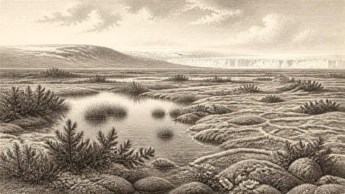
Derryvree came to light when roadworks in 1969 cut through a Fermanagh drumlin. The exposure contained a striking sequence: a lower till, then fine sands, freshwater silts and organic-rich mud, followed by an upper till. Till is the unsorted mixture of clay, stones and other debris laid down directly by glacier ice. The order of these layers is the essential evidence. Ice had occupied or affected the locality before the organic sediments formed. There was then an interval in which water could stand or move slowly, sediment settled, and plants and small animals inhabited the wet ground. Later ice overrode or buried the basin, preserving its contents beneath a further sheet of glacial debris.
This sequence does not prove that all Ireland was ice-free at once. It records one locality, and the British–Irish Ice Sheet changed through time and from region to region. Nonetheless, Derryvree decisively corrects the idea of an Ireland continuously hidden beneath unbroken ice throughout the last glacial period. At least in this part of Fermanagh, there was an interval of exposed land, shallow freshwater and living vegetation between glacial advances. The later drumlin landscape of the county is itself testimony to the immense capacity of moving ice to reshape terrain, remove older surfaces and leave only rare protected fragments of earlier environments.
Cold Water, Moss and Open Ground
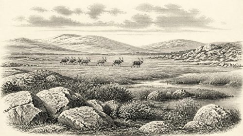
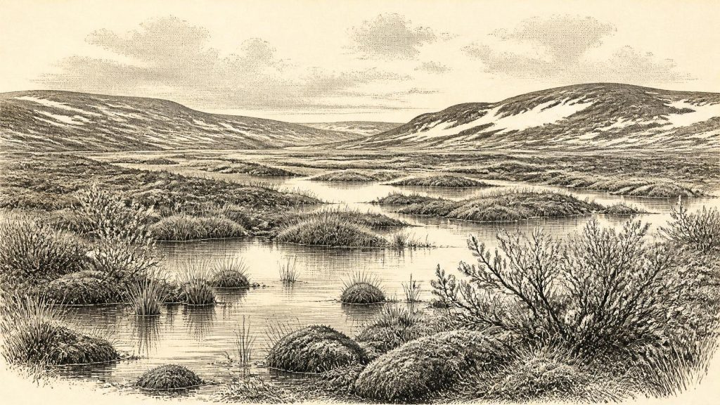
The fossils from the Derryvree silts describe a treeless, cold and wet landscape. Plant macrofossils, pollen, mosses and insects have been interpreted as evidence for freshwater pools, saturated margins, sedges, grasses, herbs and low-growing shrubs. Finds associated with bogbean or buckbean (Menyanthes trifoliata), dwarf willow, juniper, mountain avens and lesser clubmoss are especially useful because they point towards cold, open habitats and wet ground rather than forest. Insects of northern aspect strengthen that reading. Earlier researchers compared the setting to muskeg: a patchwork of waterlogged organic material, mossy ground, sedge margins and shallow pools.
“Muskeg” should be understood as an ecological comparison, not as an exact reproduction of a modern northern peatland. The record is local, its dates are broad, and individual plant remains reflect the microhabitats in which they grew. Yet its central implication is robust. This was neither familiar pastureland nor a featureless sheet of ice. Water collected in hollows, aquatic and waterside plants found footholds, and brief summers supported a limited growing season. Winters were probably severe, frost action disturbed exposed soils, and conditions were too harsh and unstable for woodland to establish. The landscape would have been open, low in vegetation and vulnerable to renewed snow accumulation and glacial advance.
These environmental limits mattered more than any political boundary could have done. There is no evidence for fields, crops, livestock, houses, villages, roads, monuments or managed woodland in Ireland at this time. There is consequently no basis for discussing Irish government, diplomacy, warfare between communities, formal religion, language, schooling or trade networks as if they were historically recoverable institutions. The relevant history is instead geological and ecological: the relationship between ice, water, plants, animals and the changing routes by which life could reach the island.
The Wider Animal Landscape
County Cork’s Castlepook Cave, also called Mammoth Cave, provides the chief complementary record. Near Doneraile, its limestone passages yielded a remarkable collection of Pleistocene animal remains during early excavations, later reassessed by the Irish Quaternary Fauna Project and more recent researchers. Bones attributed to reindeer, woolly mammoth, giant deer, brown bear, wolf, Arctic fox, mountain hare, lemmings and spotted hyaena demonstrate that Ireland formed part of a wider north-west European cold-stage faunal world at different points before the Last Glacial Maximum.
The cave must not be mistaken for a single scene frozen in time. Its deposits accumulated over long periods, and bones may have arrived through carnivore activity, natural death, water movement, fissures, sediment disturbance and early excavation methods that did not meet modern standards. Radiocarbon redating has also shown why each specimen needs to be assessed on its own merits. A mammoth rib, hyaena bone and reindeer bone from Castlepook need not represent one herd, one season or even the same millennium. Nor do they prove that all these animals lived at Derryvree around the nominal date.
Even with those cautions, the assemblage is historically important. Reindeer and mammoth are consistent with extensive open country capable, at favourable times, of sustaining large grazing animals. Lemmings and Arctic foxes indicate cold conditions; wolves and hyaenas show that predators and scavengers formed part of the food web. Such animals could only have reached Ireland when shifting conditions of ice, sea level and terrain allowed movement across the broader region. Lower global sea levels exposed land now beneath the sea, but this alone does not establish a simple, continuous land bridge from Ireland to Britain or continental Europe. Coastlines, channels and ice margins were changing, and the precise route available around 30,377 BCE remains uncertain.
The Castlepook Human Question
Castlepook also raises the most consequential question about people in Ireland at this remote date. A reindeer femur from the cave has been reported as bearing a deep incision interpreted by the zooarchaeologist Ruth Carden as a cut made by a sharp stone tool on fresh bone. County Cork heritage material places the object broadly around 31,000 BC, while public discussion has often described the bone as about 33,000 years old. The distinction is important: a radiocarbon measurement dates the death of the animal, and calibration produces a range; it does not date a cut to an exact calendar year.
If the mark is confirmed as anthropogenic and belongs to the same broad period as the bone, it may be evidence that a person or small group processed a reindeer carcass in Ireland during the Upper Palaeolithic. That would be an extraordinary extension of the island’s human story, far earlier than the better-established Late Glacial evidence from Alice and Gwendoline Cave in County Clare. It would suggest a brief human encounter with an Irish Ice Age landscape, perhaps by highly mobile hunter-gatherers familiar with the wider European world.
But the inference must remain narrow. The marked femur is not a securely excavated occupation floor accompanied by a hearth, stone-tool assemblage, dwelling, burial, food store or repeated sequence of butchery. It cannot reveal whether any visitors lived nearby, crossed only once, hunted seasonally, travelled in a family party, or left descendants. Nor can it support claims about their identity, language, beliefs, artistic traditions or relations with other groups. For 30,377 BCE, human presence in Ireland is therefore possible and highly significant, but still evidenced by a contested and limited trace rather than a demonstrated resident population.
Approaching a More Glacial Ireland
The long-term direction of change was towards more extensive glaciation. Reconstructions of the British–Irish Ice Sheet indicate that its growth was under way around this period, though timing and extent varied markedly across the archipelago. The maximum phase of the Last Glacial Maximum lay later, commonly placed around 27,000–21,000 years ago, when ice covered almost all of Ireland and extended across adjoining shelves. That later expansion would transform drainage, shorelines and habitats, while eroding, redepositing or concealing much of the older archaeological and environmental record.
Derryvree’s freshwater horizon is valuable precisely because it survived that destruction. It gives Ireland around this notional year a tangible setting: a cold Fermanagh basin of shallow water, mosses, sedges and open tundra-like ground, enclosed within a larger landscape undergoing climatic instability. Castlepook adds evidence that varied large mammals entered Ireland during the wider period, and perhaps that people did too. Together the sites offer no year-specific narrative, but they do recover something more reliable: an island of changing ice and exposed ground, where life persisted in small ecological opportunities before the next glacial transformation.
Primary Sources
- Early Midlandian–Middle Midlandian, Pleistocene, Northern Ireland
- The Irish Quaternary Fauna Project
- A reconsideration of the radiocarbon dating of the Marine Isotope Stage 3 fauna from southern Ireland
- Archaeology Research Excavation Grant 2022: Castlepook Caves Project Final Report
- Castlepook Cave, County Cork, Excavations 2022
- Heritage Artefacts of County Cork
- Occurrence of mammalia relicts at site Castlepook Cave
- The Exploration of Castlepook Cave, County Cork
- Exploring controls of the early and stepped deglaciation on the western margin of the British–Irish Ice Sheet
- Growth and retreat of the last British-Irish Ice Sheet, 31,000 to 15,000 years ago: the BRITICE-CHRONO reconstruction
- Extent and timing of the Last Glacial Maximum (LGM) in Britain and Ireland: a review
- The timing and magnitude of the British–Irish Ice Sheet between Marine Isotope Stages 5d and 2
- Behavioural tendencies of the last British–Irish Ice Sheet revealed by data–model comparison
- Growth and decay of a marine terminating sector of the last British-Irish Ice Sheet: a geomorphological reconstruction
- The IntCal20 Northern Hemisphere radiocarbon age calibration curve (0–55 cal kBP)
- IntCal: RadioCarbon Dating Research
- Extended dilation of the radiocarbon time scale between 40,000 and 48,000 y BP and the overlap between Neanderthals and Homo sapiens
- Episodic speleothem deposition tracks the terrestrial impact of millennial-scale last glacial climate variability in SW Ireland
- Cave air and hydrological controls on prior calcite precipitation and stalagmite growth rates: Implications for palaeoclimate reconstructions using speleothems
- The Mesolithic in Ireland: when was it?
- New Insights on the Fauna of Ireland's Younger Dryas and Early Holocene from Alice & Gwendoline Cave
- Irish Caves Database: Mammoth Cave