

BIRM-166’s Periglacial Interval30328 BCE
Around 30,328 BCE, Ireland experienced severe, unstable Ice Age conditions rather than a datable historical event. At Derryvree, County Fermanagh, freshwater sediments between glacial tills preserve evidence of tundra wetlands, shallow pools, sedges, aquatic plants and sparse cold-adapted vegetation during a locally ice-free interval. Ice-sheet growth varied regionally, with later advances burying such landscapes. Southern cave deposits demonstrate diverse fauna, including mammoth, reindeer and hyaena, although assemblages span long periods. A possibly tool-marked reindeer bone from Castlepook may suggest brief Upper Palaeolithic human activity, but does not prove settlement. Environmental evidence is stronger than evidence for human society or occupation.
Dateline
Modern calendar-year precision is not available for Ireland at this depth of time. “30,328 BCE” is a useful point on a modern chronological scale, not a year in which a dated Irish event can be identified. In archaeological terms it lies about 32,277 years before AD 1950, within the later part of the Pleistocene and broadly within Marine Isotope Stage 3, a climatically unstable portion of the last Ice Age. The evidence is measured in radiocarbon ages, calibrated ranges, sediments and fossil remains whose uncertainties run to centuries or millennia. The responsible question is therefore what can be said about Ireland around this point, rather than what happened in one precise calendar year.
A Date Within a Range
The most informative Irish environmental archive for this approximate horizon was exposed at Derryvree near Maguiresbridge, County Fermanagh. Roadworks in 1969 cut through a drumlin and revealed organic freshwater silts and fine sands trapped between two separate sheets of glacial till. The deposit was not a settlement layer. It was a surviving fragment of an Ice Age wetland, subsequently buried and protected beneath later ice-laid sediment.
Its key conventional radiocarbon measurement, BIRM-166, was 30,500 years BP, with a substantial uncertainty. Later discussion has placed the calibrated result broadly between about 36,900 and 31,700 cal BP. The modern label 30,328 BCE falls near the young end of that broad calibrated interval, rather than at a securely identifiable moment within it. The Derryvree sequence can consequently illuminate the kind of landscape present in north-eastern Ireland during a cold phase before, or amid, the build-up of the last great ice sheet; it cannot certify the weather, season or events of a single notional year.
Fresh Water Beneath Future Ice
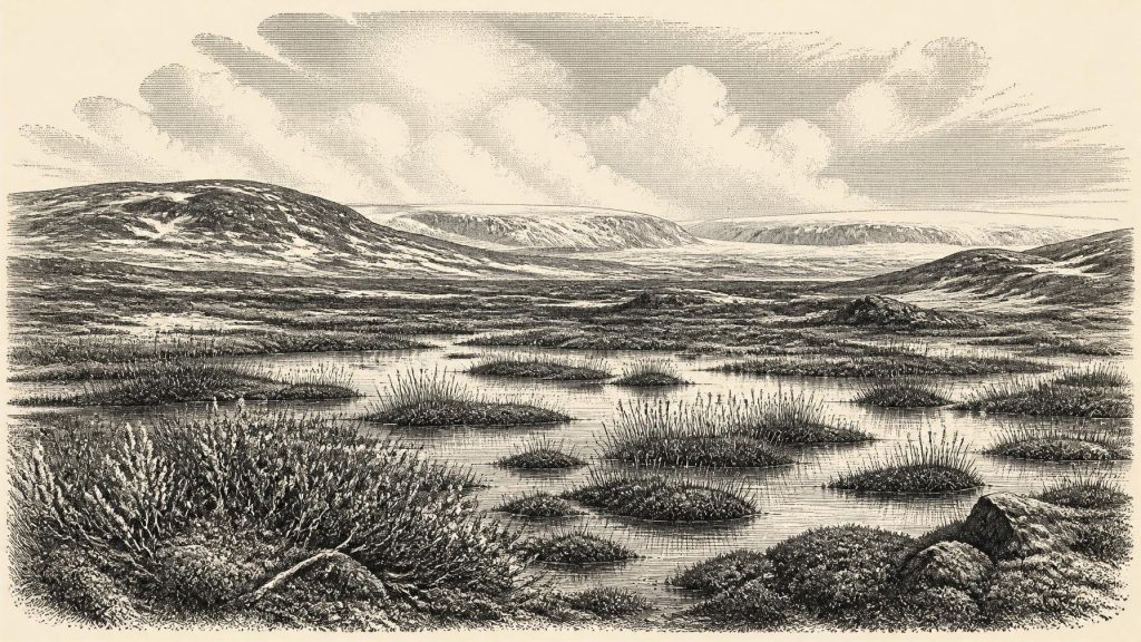
The Derryvree plants and small animals indicate open tundra and a periglacial regime: ground subject to intense freezing and thawing, with very short growing seasons and little or no tree cover. Sedge-rich wet ground lay beside shallow freshwater. Fossils of aquatic and marsh plants, including bogbean and water-milfoil, together with mosses and cold-adapted herbs, show that this was not an unbroken field of snow or a lifeless ice desert. Water persisted locally, fed by a landscape in which summer thaw could support pools, wet margins and sparse vegetation.
That distinction matters. Ireland at this time should not be pictured as the familiar green and wooded island, but neither should it be reduced to a single frozen image. The ecological evidence points to a treeless mosaic of damp ground, open herbaceous cover, exposed mineral soils and cold freshwater habitats. Dwarf willow and alpine-arctic species are evidence for hardy vegetation close to the ground, not for woodland. The resulting landscape would have changed sharply across short distances according to drainage, shelter, elevation and proximity to ice.
Derryvree also preserves a larger geological lesson. The freshwater deposit lies between tills, evidence that local conditions altered profoundly through time. An earlier glacial advance had left one till sheet; an interval sufficiently ice-free for wetland sediments and living communities followed; later ice deposited the upper till. This does not mean that the whole island was simultaneously free of ice whenever Derryvree was open ground. It demonstrates local ice-free conditions in Fermanagh during the formation of the organic layer, while the extent and timing of ice in other Irish regions remained variable.
An Island in Ice-Sheet Formation
At roughly 32,000 years ago, Ireland was approaching the Last Glacial Maximum, but the growth of the British–Irish Ice Sheet was not a simple island-wide on-off event. Recent reconstructions show that ice expansion and maximum extent differed from sector to sector. By about 30 ka, combined ice masses had formed across Britain and Ireland in modelling and synthesis work; other evidence records locally open ground before later advances. The full glacial maximum affecting Ireland and its continental shelf came later, conventionally placed around 27,000–23,000 cal BP, though particular margins advanced and retreated asynchronously.
For the date represented here, the safest reconstruction is one of severe cold, changing ice margins and ecological instability. The Fermanagh wetland record shows that a periglacial freshwater environment was possible within the wider glacial cycle. In southern Ireland, cave faunas show that large mammals had reached or persisted on parts of the island during the broader pre-maximum interval. Neither record warrants a neat national map for 30,328 BCE. Much of the evidence is necessarily local, and later glaciers eroded, buried or redeposited earlier deposits.
Sea level was much lower than today as global ice volume grew, reshaping the surrounding shelf and coastal plain. Yet this does not provide proof of a particular walking route, shoreline or migration corridor at the chosen date. The sea basins, changing ice margins and now-submerged landscapes of the Irish Sea region require reconstruction from marine geophysics and modelling. It is more secure to say that Ireland formed part of a wider north-west European Ice Age world, environmentally connected to neighbouring lands, than to claim a known route or regular traffic across a specific land bridge.
Caves and Mobile Fauna
Castlepook Cave, near Doneraile in north County Cork, offers a different kind of evidence. Its collections include remains of woolly mammoth, reindeer, giant deer, brown bear, wolf, Arctic fox, lemmings and spotted hyaena. Direct dating of specimens from Irish cave collections has shown that a diverse mammal fauna was present on the island at various times between at least about 45,000 and 20,000 years ago. Such animals were adapted in different ways to open, cold or seasonally productive country; they make clear that Ice Age Ireland could sustain mobile animal populations when suitable habitats existed.
But a cave assemblage is not a snapshot of one valley or one generation. Carnivores could carry prey and bones into caves; animals might die there naturally; water could move remains; and nineteenth- and early twentieth-century excavations did not always record deposits to modern standards. The species from Castlepook were accumulated over a long span. Their presence in the same museum collection does not establish that mammoths, hyaenas, reindeer and every other listed animal shared the same place at the same time.
A reindeer femur from Castlepook has attracted exceptional attention because a deep mark on it has been interpreted as damage from a sharp stone tool during carcass processing. Public reports associate the bone with an age of about 33,000 years ago, close enough to make it relevant to this period. If the mark is confirmed as anthropogenic, it would indicate that people handled a reindeer carcass in Ireland during the Upper Palaeolithic, far earlier than the island’s long-established post-glacial settlement record.
The limits of that inference are as important as its promise. A radiocarbon measurement dates the animal’s death within a probability range; it does not independently date the instant a surface mark was made. Nor does one marked bone demonstrate a camp, a family group, a permanent population or uninterrupted occupation. Castlepook has not produced a securely associated house, hearth, human burial, stratified stone-tool industry or settlement surface of this age. Ongoing work seeks better-preserved, securely stratified deposits and further direct dates precisely because the claim is so consequential.
Human History Before Human Institutions
No evidence supports named peoples, rulers, political territories, diplomacy or organised warfare in Ireland around this date. There are no farms, fields, livestock, monuments, graves, written records or objects that reveal formal religion. There is likewise no basis for describing trade routes, leadership or a learned tradition. These are not omissions in an otherwise full record: they are the condition of the evidence. A cautious possible trace of carcass processing is not a licence to supply a society from later Irish prehistory or from better-known Upper Palaeolithic communities elsewhere in Europe.
If people did reach Ireland, the most defensible interpretation is of a small and mobile presence, perhaps brief and opportunistic, in a demanding landscape where animal movements, weather and access to shelter mattered greatly. That remains an interpretation, not a demonstrated biography. The archaeological fact is much narrower: one potentially modified bone deserves further scrutiny. The geological fact is stronger: portions of Ireland supported open, cold, wetland environments and diverse fauna during an interval of major climatic change.
The Significance of a Buried Wetland
For Ireland around 30,328 BCE, Derryvree’s buried freshwater sediments are more revealing than any imagined event. They preserve a world before the later advance sealed it beneath a drumlin: shallow water, sedges and aquatic plants, low tundra vegetation and repeated frost. Castlepook complements that northern record by showing the wider presence of Ice Age mammals in the island’s south. Together they replace the old image of a uniformly empty, permanently ice-covered Ireland with a more complicated one of shifting habitats, expanding ice and intermittent ecological opportunity.
They do not, however, make this an age of known Irish settlement. The historical importance of the period lies in its uncertainty and in the evidence that survives despite it. The wetland at Derryvree and the bones from Castlepook are fragmentary witnesses to landscapes repeatedly transformed by climate and ice. They establish the environmental stage on which later human colonisation would eventually occur, while reminding us that, at this remote date, geology and palaeoecology can speak more clearly than political or social history.
Primary Sources
- Middle Midlandian Freshwater Series at Derryvree, Maguiresbridge, County Fermanagh, Northern Ireland
- Growth and Retreat of the Last British–Irish Ice Sheet, 31,000 to 15,000 Years Ago: The BRITICE-CHRONO Reconstruction
- A Reconsideration of the Radiocarbon Dating of the Marine Isotope Stage 3 Fauna from Southern Ireland
- The Irish Quaternary Fauna Project
- Trimlines, Blockfields and the Vertical Extent of the Last Ice Sheet in Southern Ireland
- Pleistocene Glaciations in Ireland
- Radiocarbon Constraints on the Age of the Maximum Advance of the British–Irish Ice Sheet in the Celtic Sea
- Stratigraphic and Palaeo-Geomorphological Evidence for the Glacial-Deglacial History of the Last British-Irish Ice Sheet in the North-Western Irish Sea
- Ireland: Submerged Prehistoric Sites and Landscapes
- The Colonization of Ireland: A Human Ecology Perspective
- The Colonization of Ireland: A Human Ecology Perspective
- Phylogeographic, Ancient DNA, Fossil and Morphometric Analyses Reveal Ancient and Modern Introductions of a Large Mammal: The Complex Case of Red Deer (Cervus elaphus) in Ireland
- Figure 6.— The Subdivision of the Quaternary Period in Ireland
- Palaeoecology
- An All-Ireland Quaternary Map
- Land and Soils
- Deglacial Rates and Controls for BIIS Western Margin
- Archaeology Research Excavation Grant 2022: Final Report
- Castlepook Cave, Co. Cork, 2022
- Heritage Artefacts of County Cork 2021
- New Insights on the Fauna of Ireland’s Younger Dryas and Early Holocene from Alice & Gwendoline Cave
- The Mesolithic in Ireland: When Was It?





