
Derryvree’s Freshwater Interbed30327 BCE
30,327 BCE cannot describe a recoverable Irish year, but provides a broad Late Pleistocene context within Marine Isotope Stage 3. At Derryvree, County Fermanagh, organic freshwater silts between tills record an ice-free or ice-marginal wetland during a fluctuating, cold climate. Tundra plants, shallow water and periglacial conditions supported seasonal ecological diversity. Castlepook Cave, County Cork, preserves remains of mammoth, reindeer, hyaena and other cold-adapted animals, demonstrating varied habitats. A cut-marked reindeer femur may indicate a fleeting human visit, not settlement. Fragmentary evidence reveals climatically volatile, patchy Ice Age Ireland, while excluding claims about annual conditions, society or continuous occupation elsewhere.
Dateline
The label 30,327 BCE is useful for arranging a modern timeline, but it cannot denote a recoverable Irish year. No written record, named community, dated settlement or annual environmental sequence exists for Ireland at this depth of time. In radiocarbon convention, the label falls about 32,276 years before AD 1950; that conversion is arithmetic, not evidence that conditions can be identified for that particular year. The responsible subject is therefore a broad interval in the Late Pleistocene, within Marine Isotope Stage 3, when climate, ice and habitats in and around Ireland changed repeatedly over centuries and millennia.
A Date Without Annual Precision
The distinction between calendar years and laboratory ages is fundamental. Radiocarbon results are given in years “BP”, meaning before AD 1950, and cannot simply be read as BCE dates. Atmospheric carbon-14 levels varied through time, so a result must be calibrated against an internationally maintained curve; the outcome is a probability range, sometimes a complex one, rather than a single historical date. At more than thirty millennia ago, both the uncertainty of the measurement and the uncertainty in linking one local deposit to wider climatic events are substantial.
The closest major Irish environmental record is the freshwater sequence at Derryvree, near Maguiresbridge in County Fermanagh. It does not date 30,327 BCE itself. But its conventional radiocarbon determination, BIRM-166, of 30,500 years BP, with a quoted uncertainty of +1,170 and −1,030 years, makes it an important guide to the changing world around this broad phase. Modern calibration places such an age in the later part of Marine Isotope Stage 3, broadly the mid-to-late 30,000s calibrated years BP rather than at one exact point. It should be treated as contextual evidence, not as a clock reading for an individual summer, winter or human generation.
The Wetland Under the Drumlin
Derryvree was exposed by roadworks in February and March 1969. The cutting passed through a drumlin, one of the smooth hills formed in glacial terrain, roughly two kilometres north-east of Maguiresbridge. Researchers found a striking sequence: a thick lower till, then freshwater silts and fine sands rich in organic matter, followed by another thick till. Till is unsorted material laid down directly by ice. The order of the deposits gives the secure historical result: glacier ice had occupied the locality; an interval then permitted water, sediment and organic remains to accumulate; later glacial action covered and preserved that record beneath a fresh blanket of till.
That is powerful evidence for an ice-free or ice-marginal patch of north-central Ireland during the formation of the freshwater bed. It is not evidence that the entire island was clear of ice at the same time. Nor does it identify the size, direction or exact timing of every surrounding ice mass. Irish and British–Irish ice-sheet reconstructions have changed as offshore mapping, dating methods and models have improved. Derryvree supplies a rare local observation amid that larger uncertainty: even in a severe glacial climate, a functioning wetland existed there between two episodes of glacial deposition.
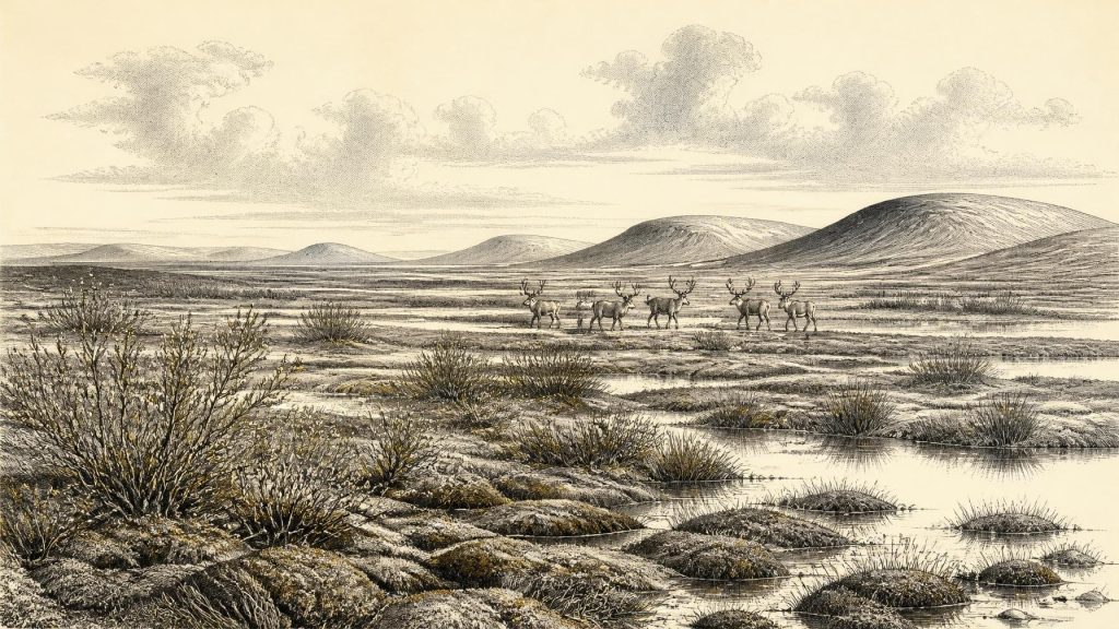
The flora and fauna in the organic silts were described as having a full-glacial aspect. Their combined evidence indicates open tundra vegetation and a periglacial regime: ground subject to intense freezing and thawing, sparse or absent woodland, saturated mossy margins and shallow fresh water. Sedges, grasses, herbaceous plants, mosses and aquatic taxa indicate more ecological variety than the word “tundra” can suggest. This was not an unbroken white waste. During the growing season, pools and wet ground could support plant life, insects and grazing animals, while prolonged cold and frozen soil restricted trees and made conditions highly seasonal.
An Uneven Ice-Age Landscape
At this time Ireland lay on the north-western Atlantic margin, where conditions were sensitive to abrupt swings in the North Atlantic climate system. Greenland ice cores record repeated stadial and interstadial shifts during Marine Isotope Stage 3. Irish cave calcite from Crag Cave in County Kerry independently shows that episodes warm enough for liquid water to feed speleothem growth occurred intermittently during the last glacial period. These records do not allow a simple transfer of a Greenland temperature curve to a Fermanagh drumlin. They do, however, reinforce the broader interpretation that cold conditions were not uniform or static.
Regional contrast is especially important. An exposed freshwater hollow at Derryvree, limestone caves in north County Cork, uplands with local snow and ice, and marine basins beyond the coast need not have experienced precisely the same conditions. Ice sheets can advance, stagnate and retreat unevenly; landscapes also preserve evidence unevenly. Later glaciers eroded or buried many earlier surfaces, while caves and sediment pockets retained fragments. The apparent scarcity of sites should therefore not be confused with proof that Ireland was empty of life or entirely ice-covered. Equally, the survival of a few deposits cannot be inflated into a detailed map of the island.
Castlepook’s Faunal Evidence
The other major Irish archive relevant to this deep period is Castlepook Cave, also called Mammoth Cave, near Doneraile in north County Cork. Antiquarian excavations undertaken between 1904 and 1912 recovered a remarkable assemblage of Ice Age animal remains. Later study and dating have identified a changing fauna that includes woolly mammoth, reindeer, spotted hyaena, brown bear, wolf, Arctic fox, hares and lemmings, alongside other species. These animals were not necessarily contemporaries, and cave bone accumulations can be made by predators, scavengers, water movement, natural deaths and human collecting. Castlepook is consequently an archive spanning long intervals, not a snapshot of one landscape on one day.
Nevertheless, the assemblage shows that at least some Irish environments could sustain substantial cold-adapted mammals during the wider pre-Last Glacial Maximum world. Reindeer imply open grazing country; hyaenas and wolves point to carnivore as well as prey networks; mammoth remains evoke the wider mammoth-steppe fauna familiar across glacial Eurasia. Such labels should not make the landscape seem uniform. Animals moved through seasonal ranges, and caves may have served as carnivore dens rather than places where every animal died. The strongest inference is ecological: southern Ireland possessed, at intervals, enough accessible forage and terrain to support a varied large-mammal community.
The Reindeer Femur Question
A reindeer femur from Castlepook adds a potentially momentous but still limited human dimension. Zooarchaeologist Ruth Carden has interpreted a deep linear mark on the bone as damage made by a sharp stone tool while a fresh carcass was processed. County Cork heritage material assigns the specimen broadly to about 31,000 BCE. If the incision is correctly identified as a cut mark, it may indicate that people reached Ireland and handled reindeer far earlier than the formerly accepted evidence for post-glacial human presence.
That possibility must be kept separate from claims the bone cannot support. The marked femur is not a securely excavated camp floor. No associated stone-tool assemblage, hearth, built shelter, burial, human skeleton, art or repeatedly occupied settlement of comparable age has yet been demonstrated at Castlepook. The age of an animal bone is not an exact timestamp for the cutting action, and the old excavations left imperfect contextual information. Nor can one bone establish whether people killed the reindeer, scavenged it, removed meat elsewhere, travelled in a larger group, or lived on the island continuously.
It is therefore reasonable to speak of a possible, probably fleeting Upper Palaeolithic human incursion, not of a settled Irish population. If people were present, their likely social world was mobile and small-scale, organised around movement, knowledge of animal behaviour and the practical handling of carcasses in a harsh seasonal environment. That is an interpretation drawn from the cut-mark claim and wider European hunter-gatherer comparison, not direct evidence for an Irish camp, family group or cultural identity.
What Cannot Be Recovered
There is no evidence from around 30,327 BCE for political institutions, rulers, diplomacy, warfare, law, formal religion, monuments, literacy, schooling, agriculture, markets or regular overseas trade in Ireland. It would be misleading to manufacture equivalents for them. There are no known houses, fields, graves, boats or artefact industries securely tied to this nominal year. Even the most evocative human evidence remains a single modified bone from a complex cave archive.
Everyday life is more safely approached through environmental constraint than through narrative invention. Derryvree indicates wet ground, fresh water and treeless vegetation under a cold climate. Castlepook indicates animal communities capable of entering or ranging across Irish landscapes. Together, they imply that food, shelter, travel and survival would have depended on brief favourable seasons and rapidly changing local conditions. They do not show how any people spoke, believed, governed or exchanged goods.
The lasting significance of this point in Ireland’s past is thus not a year-specific event but the survival of fragile evidence. A moss-rich freshwater bed beneath a Fermanagh drumlin and a Cork cave’s scattered bones preserve traces of a landscape repeatedly altered by ice. They reveal a country that was neither a timeless frozen blank nor a known human homeland: it was an ecologically patchy, climatically volatile edge of Ice Age Europe, only intermittently visible through the sediments and bones that escaped later destruction.
Primary Sources
- Middle Midlandian Freshwater Series at Derryvree, Maguiresbridge, County Fermanagh, Northern Ireland
- Middle Midlandian Freshwater Series at Derryvree, Maguiresbridge, County Fermanagh, Northern Ireland
- Exploring contrasting ice-sheet retreat dynamics in the northern and southern sectors of the last British–Irish Ice Sheet
- Growth and Retreat of the Last British–Irish Ice Sheet, 31,000 to 15,000 Years Ago: The BRITICE-CHRONO Reconstruction
- Pattern, Style and Timing of British–Irish Ice Sheet Advance and Retreat Over the Last 45,000 Years: Evidence from NW Scotland and the Adjacent Continental Shelf
- Episodic Speleothem Deposition Tracks the Terrestrial Impact of Millennial-Scale Last Glacial Climate Variability in SW Ireland
- Episodic Speleothem Deposition Tracks the Terrestrial Impact of Millennial-Scale Last Glacial Climate Variability in SW Ireland
- The Irish Quaternary Fauna Project
- A Reconsideration of the Radiocarbon Dating of the Marine Isotope Stage 3 Fauna from Southern Ireland
- Heritage Artefacts of County Cork
- Ireland's Palaeolithic Archaeology – Fleeting Footprints in a Frozen Land
- First Evidence of a Late Upper Palaeolithic Human Presence in Ireland
- First Evidence of a Late Upper Palaeolithic Human Presence in Ireland
- New Insights on the Fauna of Ireland's Younger Dryas and Early Holocene from Alice & Gwendoline Cave
- New Insights on the Fauna of Ireland's Younger Dryas and Early Holocene from Alice & Gwendoline Cave
- The IntCal20 Northern Hemisphere Radiocarbon Age Calibration Curve (0–55 cal kBP)
- The Greenland Ice Core Chronology 2005, 15–42 ka. Part 1: Constructing the Time Scale
- The Greenland Ice Core Chronology 2005, 15–42 ka. Part 1: Constructing the Time Scale
- Figure 6.— The Subdivision of the Quaternary Period in Ireland
- Ireland Under the Ice