Maguirebridge’s Sealed Fen30329 BCE
30,329 BCE is a modern label within the climatically unstable Late Pleistocene, not a date for a known Irish event. At Derryvree, County Fermanagh, sediments between two glacial tills show that an ice-free freshwater wetland developed during a broadly dated interval, probably about 36,900–31,700 calibrated years BP. Fossils indicate cold, treeless tundra-like vegetation around shallow water. Irish cave and speleothem records reveal shifting climates, fauna and ice extent. Castlepook Cave preserves remains of mammoth, reindeer, giant deer and predators, but complicated deposition precludes a single community. Possible human visits remain unproven; no secure settlement, society or annual narrative is known.
Dateline
30,329 BCE is a modern chronological label, not a date at which an event in Ireland can be named or a contemporary calendar can be recovered. It corresponds approximately to 32,279 years before AD 1950, the conventional ‘present’ used in radiocarbon science, but it is not itself a radiocarbon result. At this depth of time, calendar-year precision is unavailable. The responsible history is therefore one of stratified deposits, calibrated ranges, fossil plants, animal bones and changing ice, rather than rulers, battles or settlements.
The date lies within the Late Pleistocene, during Marine Isotope Stage 3, a long and climatically volatile interval of the last Ice Age. The nearest especially informative Irish evidence comes from Derryvree, near Maguiresbridge in County Fermanagh. There, roadworks exposed a remarkable sequence inside a drumlin: glacial till below, freshwater sands and organic silts in the middle, and a second till above. The sequence proves a local order of events: glacier ice affected the site; an ice-free freshwater and wetland environment followed; later ice again crossed or buried the locality. It does not provide a diary entry for one numbered year.
A Range, Not a Year
Organic material from the Derryvree freshwater bed, laboratory sample BIRM-166, produced a conventional radiocarbon age of 30,500 radiocarbon years BP, with a substantial uncertainty of +1,170/−1,030 years. Radiocarbon years are not identical to calendar years, because atmospheric radiocarbon has varied through time. Once calibrated, the measurement is best treated as a broad probability range; published discussions place the deposit generally within about 36,900–31,700 calibrated years BP. In BCE terms, that is roughly 34,950–29,750 BCE. The nominal year considered here falls within this wide environmental horizon, but cannot be assigned to any particular layer, season or episode of sediment accumulation.
The cave and wetland records of Ireland are similarly uneven. Deposits can be moved by water, disturbed by animals, exposed by antiquarian excavation, or destroyed when glaciers advance. The evidence that survives is valuable precisely because later ice and erosion have removed so many older land surfaces. Derryvree is not a representative sample of every Irish valley, coast and upland. It is, however, direct testimony that north-central Ireland contained an ice-free freshwater setting during part of this broadly dated interval.
Wet Ground Between Glaciers
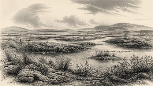
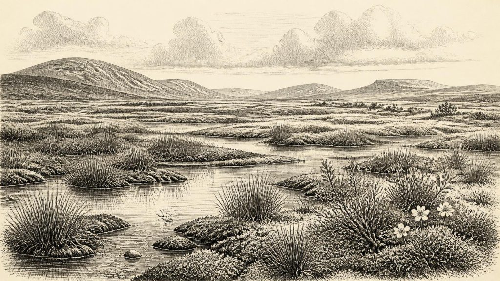
The Derryvree sediments preserve a cold-climate biological assemblage. Plant macrofossils, pollen and insect evidence indicate open, treeless vegetation around wet ground and shallow water. Sedges, mosses, bogbean, water-milfoil, dwarf willow, mountain-avens and other herbs associated with northern or alpine conditions have been reported from the deposit. Such finds should not be read as a complete list of every plant then growing in Ireland. They establish the ecology of a particular freshwater basin and its margins. Yet they strongly support an interpretation of tundra-like, periglacial country rather than a wooded island.
Its everyday life, in the ecological sense, was structured by water and seasonality. Fine silts settled where water was sufficiently still or slow-moving; organic matter accumulated among mosses and sedges; aquatic plants occupied pools or sheltered margins; insects exploited habitats that differed over short distances. Frost, thaw, sparse cover and exposed mineral ground probably affected terrain beyond the wetland. A brief growing season could nevertheless be biologically productive where meltwater, springs or shallow pools persisted. The image is not of a lifeless white desert, but of a rigorous and variable landscape in which living communities occupied favourable niches.
Other Irish evidence reinforces the point that the climate was not unchanging. Speleothems in Crag Cave, County Kerry, formed episodically during the last glacial period. Because calcite dripstone requires liquid water moving through a cave system, its growth registers phases in which local conditions rose above a freezing threshold. It does not establish that all Ireland was mild or ice-free at the same time, nor does it date Derryvree to a single climatic oscillation. Together, however, the records show that the island’s Ice Age history involved repeated shifts in temperature, moisture, vegetation and ice extent.
Ice in a Changing Island
The British–Irish Ice Sheet had not yet reached the fullest late-glacial extent for which it is best documented. That maximum lay thousands of years ahead, broadly during the global Last Glacial Maximum, conventionally dated to about 26,500–19,000 years ago. Even before then, ice was regionally dynamic. Ice centres, land-based margins and marine outlets did not necessarily advance or retreat together. A sheltered hollow in Fermanagh could sustain freshwater sediment and vegetation while other districts experienced severe cold, permafrost conditions or nearby glacier activity.
The Derryvree sequence matters because it rejects a simple picture of Ireland as either wholly frozen or wholly open throughout the Ice Age. Its upper till records subsequent glacial action, while the lower till records an earlier one. The wetland lies between them as evidence of interruption and environmental recovery. Modern reconstructions remain cautious about the timing and limits of pre-Last Glacial Maximum ice in Ireland, partly because old radiocarbon determinations need critical assessment and partly because later glaciers erased evidence. The most secure conclusion is local: the Derryvree site was ice-free long enough for a freshwater ecosystem to develop before it was sealed beneath later glacial sediment.
Sea level was also much lower than today because water was stored in northern ice sheets. The geography of the Irish Sea basin consequently differed from the modern map, affecting the distances, shorelines and possible routes available to animals and people. Lower sea level alone does not prove a continuous dry land bridge, a particular crossing point or a migration route at 30,329 BCE. Changing coasts, ice fronts and marine waters make such claims far more difficult than an outline map of exposed shelf might suggest.
Animals and the Cave Record
County Cork provides another important, but differently formed, archive. Castlepook Cave near Doneraile, also called Mammoth Cave, has produced Ireland’s richest known assemblage of vertebrate remains from the period leading towards the Last Glacial Maximum. Its collections include woolly mammoth, reindeer, giant deer, brown bear, wolf, Arctic fox and spotted hyena, alongside smaller cold-adapted mammals. Direct dates from individual bones span a long period rather than a single occupation. Cave deposits accumulated through animal deaths, carnivore activity, water movement and excavation disturbance; they cannot simply be assembled into one living community at one moment.
Nevertheless, the fauna demonstrates that Ireland was connected ecologically to wider north-west European worlds during suitable phases. Large herbivores and their predators could reach, occupy or pass through parts of the island under conditions very unlike those of later forested Ireland. Reindeer suggest open grazing landscapes; mammoth and giant deer indicate the potential for substantial herbivore biomass; hyena, wolf and fox remind us that carcasses and bones were subject to predation, scavenging and transport. A cave bone is evidence first of an animal and a depositional history, not automatically of hunting or a nearby human camp.
A reindeer femur from Castlepook has been reported as bearing a possible stone-tool cut mark and has prompted discussion of human activity in Ireland around 33,000 years ago. This possibility is important, but it cannot sustain a year-specific narrative for 30,329 BCE. No securely associated stone-tool assemblage, hearth, dwelling floor, burial, human bone, repeated butchered deposit or other settlement evidence has been demonstrated for this broad Irish interval. Improved dating has also shown that some older cave-bone determinations require reassessment. The prudent conclusion is that a fleeting human visit remains possible, not that a resident Upper Palaeolithic population has been established.
Society Beyond Recovery
Accordingly, political affairs, diplomacy and organised conflict cannot responsibly be described. There are no named groups, territories, leaders, monuments, ritual places or exchange networks known from Ireland at this date. Nor can religion, language, art, learning or social rank be recovered from the Derryvree wetland or Castlepook bone collections. Silence in the record is not proof that people could never have been present; it is a limit on what archaeology presently allows historians to say.
If people did reach Ireland during a favourable phase of the Late Pleistocene, comparisons with better-documented Upper Palaeolithic groups elsewhere in north-west Europe suggest small, highly mobile foraging parties rather than villages or states. They would have needed knowledge of weather, animal movement, stone sources, shelter and seasonal water. That is an inference from comparable societies, not evidence of a known Irish community. No local economy or trade system can yet be identified. At Derryvree, the only securely visible ‘economy’ is ecological: plants capturing a short season’s growth, animals feeding across open ground, and water depositing the sediment that later preserved their traces.
The chief development illuminated around this nominal year is therefore environmental, not political. Ireland contained changing and regionally uneven Ice Age landscapes. At Derryvree, a cold, treeless wetland formed between glacial episodes; at Castlepook, animal remains record a far-ranging Pleistocene fauna and complicated cave histories; in Kerry, dripstone registers episodes of less severe conditions. These fragments do not yield an annual chronicle. They do preserve a rigorous, evidence-based glimpse of an island repeatedly remade by climate, water, vegetation and ice.
Primary Sources
- A Middle Midlandian Freshwater Series at Derryvree, Maguiresbridge, County Fermanagh, Northern Ireland
- Exploring Controls of the Early and Stepped Deglaciation of the Western Margin of the British-Irish Ice Sheet
- The Timing and Magnitude of the British–Irish Ice Sheet Between Marine Isotope Stages 5d and 2: Implications for Glacio-Isostatic Adjustment, High Relative Sea Levels and ‘Giant Erratic’ Emplacement
- Timing and Pace of Ice-Sheet Withdrawal Across the Marine–Terrestrial Transition West of Ireland During the Last Glaciation
- Pleistocene Glaciations in Ireland
- Trimlines, Blockfields and the Vertical Extent of the Last Ice Sheet in Southern Ireland
- Episodic Speleothem Deposition Tracks the Terrestrial Impact of Millennial-Scale Last Glacial Climate Variability in SW Ireland
- Spatio-Temporal Dynamics of Speleothem Growth and Glaciation in the British Isles
- A Reconsideration of the Radiocarbon Dating of the Marine Isotope Stage 3 Fauna from Southern Ireland
- The Irish Quaternary Fauna Project
- Castlepook Cave: Cork County Geological Site Report
- The Exploration of Castlepook Cave, County Cork
- 2022:564 – Castlepook Cave, Castlepook South, Cork
- The Colonization of Ireland: A Human Ecology Perspective
- New Insights on the Fauna of Ireland’s Younger Dryas and Early Holocene from Alice & Gwendoline Cave
- The IntCal20 Northern Hemisphere Radiocarbon Age Calibration Curve (0–55 cal kBP)
- A Stratigraphic Framework for Abrupt Climatic Changes During the Last Glacial Period Based on Three Synchronized Greenland Ice-Core Records
- The Subdivision of the Quaternary Period in Ireland
- Menyanthes trifoliata L.
- Dryas octopetala L.