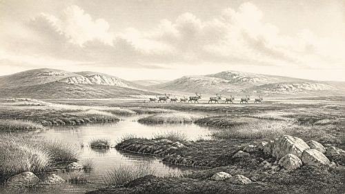
Derryvree’s Lower Till30290 BCE
30,290 BCE is a modern label within a broad Late Pleistocene interval, not a datable Irish year. Derryvree, County Fermanagh, preserves freshwater sediments between two tills, indicating an ice-free wetland episode amid changing glaciation. Its plants, pollen and fauna depict treeless, periglacial tundra with shallow water and productive summer vegetation. Ireland was a varied mosaic of ice, open ground and altered coastlines, without proven land routes. Castlepook and Shandon caves record cold-stage mammals, including mammoth, reindeer and predators. A marked reindeer bone may suggest human butchery, yet no permanent population is established. Environmental uncertainty defines this prehistoric Ireland in evidence.
Dateline
30,290 BCE is a modern calendar label, not a date that can be matched to a recorded Irish event. No people in Ireland then left writing, a calendar, a named settlement or a sequence of acts that can be fixed to this single year. The responsible unit of history is therefore not one year but a broad Late Pleistocene interval: the later part of Marine Isotope Stage 3, within the last Ice Age. Scientific dating can narrow that interval, but cannot produce annal-like precision. Radiocarbon results are expressed in years before present, conventionally before AD 1950, and must be calibrated into calendar ranges. Those ranges can span centuries or millennia.
The nominal date falls about 32,240 calendar years before AD 1950. Ireland’s most relevant environmental record is the Derryvree deposit near Maguiresbridge in County Fermanagh. Its conventional radiocarbon determination, BIRM-166, was 30,500 radiocarbon years BP, with a large laboratory uncertainty. Calibration using modern curves places the deposit broadly at about 36,900–31,700 calibrated years BP, or roughly 34,950–29,750 BCE. That range encompasses 30,290 BCE, but it does not identify conditions in that precise year. Derryvree is a time-averaged natural archive: evidence for an Ice-Age landscape over a long episode, not a snapshot of one season.
A Wetland Between Ice Advances
Derryvree was revealed in roadworks during 1969, when a cutting passed through a drumlin about two kilometres north-east of Maguiresbridge. The section contained a remarkable sequence: a lower sheet of till, freshwater silts and fine sands with organic material, and then a second, thick till. Till is the unsorted debris laid down directly by glacier ice. The order of deposits establishes a powerful but limited story. Ice had occupied the locality; subsequently, enough ice-free time elapsed for freshwater sediment, plants and small animals to accumulate; later, another ice advance covered and preserved the wetland beneath fresh glacial debris.
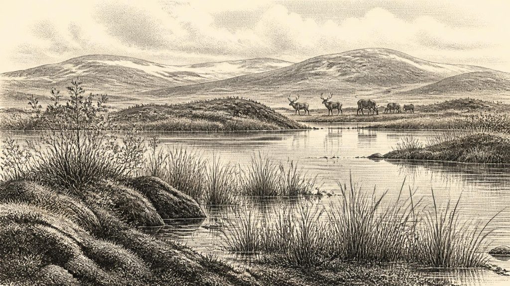
The organic bed contained pollen, plant macrofossils, mosses and faunal remains. Taken together, these support an interpretation of open tundra vegetation and a periglacial climate: severe cold, repeated freezing and thawing, and ground that was generally treeless rather than clothed in the woodland familiar in modern Ireland. The most useful evidence comes from the entire assemblage, not from any isolated pollen grain. A little pollen of pine or hazel can travel far on wind and water and does not prove a local forest. By contrast, the predominance of herbaceous material, cold-adapted plants and wetland organisms points to sparse vegetation on drier ground, interrupted by richer margins around pools and slow water.
This was not simply a blank, snow-bound waste. Freshwater plants and mossy wet ground indicate that summer thaw sustained shallow water and productive patches of vegetation. Sedges, grasses, bogbean, water-milfoil, dwarf willow, mountain avens and lesser clubmoss belong to the picture built from the Derryvree material. Such evidence permits a landscape of low herbs, damp hollows, shallow pools and frost-disturbed open ground. It does not permit a detailed map of rivers, a reconstruction of a particular day’s weather, or the assumption that the whole island looked alike. Sheltered basins, exposed uplands, coasts and areas influenced by nearby ice would have differed sharply.
Before the Greatest Expansion
At this date Ireland was in an unstable part of the last glacial cycle, not yet in the fullest and most extensive phase commonly called the Last Glacial Maximum. The British–Irish Ice Sheet did not grow as one simple, evenly advancing mass. Its centres, margins and fast-flowing outlets changed at different times. Recent reconstruction places major expansion across parts of Ireland and the surrounding shelf after about 31,000 years ago, with further growth by around 29,000 years ago; maximum positions across the wider ice sheet were asynchronous. Derryvree’s two tills provide local physical evidence for more than one episode of glaciation, while its freshwater bed proves that ice-free conditions occurred there between them.
The important qualification is regional scale. A buried wetland in Fermanagh does not show that all Ireland was simultaneously free of ice, just as a glacial deposit elsewhere does not prove universal ice cover in the same year. Later glaciers also eroded or buried much of the older landscape, leaving an incomplete archive. For 30,290 BCE, it is safest to describe Ireland as a changing mosaic of cold environments shaped by advancing and retreating ice, rather than to draw a firm national ice margin.
Lower global sea levels altered the surrounding geography, exposing areas now submerged around the continental shelves. Yet low sea level should not be converted automatically into a walkable route to Ireland. Research on possible late-glacial land bridges has found no convincing continuous crossing through the Irish Sea or southern shelf routes, while ice, water and changing relative sea level made the northern approaches complex. Whether people, if present, arrived by a temporary route over ice and land, by watercraft, or not at all in this particular interval cannot be established from the available evidence.
Caves and Cold-Stage Animals
County Cork provides a different archive. Castlepook Cave, near Doneraile in the Awbeg valley, has yielded more than 2,000 animal bones and is Ireland’s richest known cave assemblage for the period leading up to the Last Glacial Maximum. Its Pleistocene fauna includes woolly mammoth, reindeer, giant deer, brown bear, wolf, Arctic fox, spotted hyaena and lemmings. Shandon Cave in County Waterford has also produced mammoth, reindeer, horse, bear, wolf and hare. These finds demonstrate that a striking range of cold-stage animals reached or lived in Ireland during parts of the Late Pleistocene.
They must not, however, be treated as a single herd gathered in one valley in 30,290 BCE. Castlepook’s dated bones span a long interval, approximately 45,700 to 19,950 years BP, and the cave was a repository affected by carnivores, water movement and early excavations conducted before modern recording methods. A hyaena den, scavenging, animals dying near an entrance, flooding and later disturbance can all contribute bones to cave deposits. The fauna is direct evidence for animals; the precise ecological scene, their exact coexistence and their relationship to one another are interpretations requiring caution.
Nevertheless, the animal evidence gives the period its strongest sense of scale. Reindeer and mammoth point towards open, cold habitats rather than dense forest. Predators and scavengers reveal food chains more varied than those of later historic Ireland. Giant deer, despite the popular name “Irish elk”, were neither confined to Ireland nor elk. Their presence in Irish Pleistocene records is a reminder that the island’s fauna repeatedly changed as climate, ice cover and access routes changed. The later Last Glacial Maximum would sharply interrupt this older world.
The Human Question
Castlepook also contains Ireland’s most provocative possible evidence of human activity at this depth of time: a reindeer femur bearing a deep mark interpreted by zooarchaeologist Ruth Carden as a cut or chop made during the removal of fresh tissue with a sharp stone tool. The bone has been reported as dating to about 33,000 years ago. If the interpretation is sustained by further analysis, it would indicate that a person or a very small party processed a reindeer in Ireland during the broader pre-maximum Ice-Age interval.
That possibility is important, but it is not a licence to invent a settled Palaeolithic Ireland. The dated bone is not securely tied to a contemporary hearth, stone-tool scatter, dwelling floor, burial, art site or human remains. The cave’s deposits are complex, and a radiocarbon date establishes the age of the animal bone, not automatically the identity of the agent who marked it. Around 30,290 BCE, therefore, there is no securely demonstrated village, permanent population or named cultural group in Ireland. Even a genuine cut mark would show an episode of carcass processing, not a political community.
What Cannot Be Written
Politics, diplomacy and organised warfare leave no identifiable evidence for Ireland at this date. Nor can religion, language, learning, kinship rules or artistic traditions be responsibly reconstructed from Derryvree’s silts and Castlepook’s bones. European Upper Palaeolithic communities elsewhere made sophisticated tools, ornaments and images, but none of that material can simply be transferred across the sea and attributed to Ireland. Likewise, there is no evidence for farming, trade networks, livestock, fields or a local economy beyond the possible use of animal resources by a transient human visitor.
The most meaningful history of 30,290 BCE is thus environmental and evidential. In Fermanagh, an ancient wetland was preserved between two ice advances. In southern caves, bones record a changing cold-stage fauna and perhaps a rare human trace. Together they reveal neither a lost kingdom nor an ancestral nation, but a difficult, dynamic Ireland in which water, frost, vegetation, animals and ice set the terms of life. Continued work at Castlepook, including modern excavation of undisturbed deposits, may test the human interpretation. For now, uncertainty is not a gap to fill with legend; it is one of the central facts of Ireland’s deepest past.
Primary Sources
- Middle Midlandian Freshwater Series at Derryvree, Maguiresbridge, County Fermanagh, Northern Ireland
- A Middle Midlandian Freshwater Series at Derryvree, Maguiresbridge, County Fermanagh, Northern Ireland
- Palaeoecology: Irish Quaternary Association Field Guide No. 16
- A Reconsideration of the Radiocarbon Dating of the Marine Isotope Stage 3 Fauna from Southern Ireland
- The Irish Quaternary Fauna Project
- New Insights on the Fauna of Ireland’s Younger Dryas: Implications for Environmental Reconstruction and Human Activity
- Castlepook Cave: Cork County Geological Site Report
- 2022:564 – Castlepook Cave, Castlepook South, Cork
- Castlepook Caves Project: Archaeology Research Excavation Grant Report
- The Archaeological Heritage of County Cork
- Heritage Artefacts of County Cork
- Irish Cave Exploration
- Pleistocene Vertebrates in the British Isles
- Phylogeographic, Ancient DNA, Fossil and Morphometric Analyses Reveal Ancient and Modern Introductions of a Large Mammal: the Complex Case of Red Deer in Ireland
- Growth and Retreat of the Last British–Irish Ice Sheet, 31,000 to 15,000 Years Ago: the BRITICE-CHRONO Reconstruction
- Growth and Retreat of the Last British–Irish Ice Sheet, 31,000 to 15,000 Years Ago: the BRITICE-CHRONO Reconstruction
- The Timing and Magnitude of the British–Irish Ice Sheet Between Marine Isotope Stages 5d and 2
- Trimlines, Blockfields and the Vertical Extent of the Last Ice Sheet in Southern Ireland
- Deglaciation Chronology of the Donegal Ice Centre, North-West Ireland
- The Problem of a Late Quaternary Landbridge Between Britain and Ireland
- The Island of Ireland: Drowning the Myth of an Irish Land-Bridge?
- The IntCal20 Northern Hemisphere Radiocarbon Age Calibration Curve (0–55 cal kBP)
- The IntCal20 Approach to Radiocarbon Calibration Curve Construction: a New Methodology Using Bayesian Splines and Errors-in-Variables