
BIRM-166’s Open Water30289 BCE
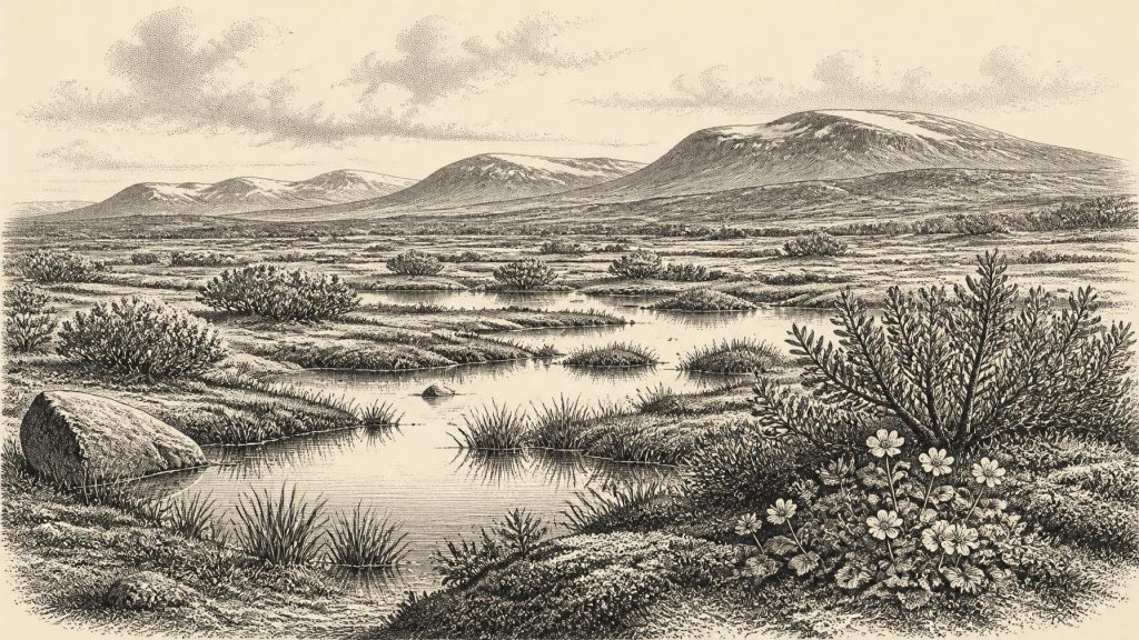
Around 30,289 BCE, Ireland cannot be described through a specific recoverable year, but through a broad Late Pleistocene interval. At Derryvree, County Fermanagh, freshwater organic deposits between glacial tills, dated broadly to the middle-to-late 30,000s calibrated years BP, record a temporary ice-free wetland. Plant and insect remains indicate cold, open, treeless terrain with pools, sedges, mosses and tundra vegetation, later overridden by ice. Castlepook Cave preserves a mixed, long-term assemblage of cold-stage mammals, including mammoth and reindeer. A possibly cut-marked reindeer bone may indicate a brief human visit, but no evidence demonstrates permanent settlement, society or continuity within Ireland itself.
Dateline
The label 30,289 BCE gives a useful place in a modern chronological sequence, but it must not be mistaken for a recoverable Irish year. No calendar, written record, annual settlement layer or dated event allows historians to distinguish this particular year from those around it. At this depth in time, the responsible subject is a broad Late Pleistocene interval during the Middle Midlandian cold stage, part of Marine Isotope Stage 3. Ireland’s evidence consists chiefly of glacial sediments, fossil plants and insects, cave bones and laboratory dates. It can illuminate changing environments and animal movements; it cannot supply rulers, wars, tribes or a continuous human story.
A Date Within a Wide Range
The closest Irish archive is Derryvree, near Maguiresbridge in County Fermanagh. Roadworks in 1969 cut through a drumlin and exposed an exceptional sequence: a lower layer of till, organic freshwater silts and sands, and another thick till above. Till is unsorted debris deposited directly by glacier ice. The order of the deposits is therefore decisive. Ice had occupied the locality; later, water and organic matter accumulated while it was ice-free locally; finally, renewed glacial activity buried and protected that evidence.
Organic material from the intervening freshwater deposit returned the conventional radiocarbon determination BIRM-166, 30,500 radiocarbon years before present, with a substantial uncertainty of +1,170 and −1,030 years. Radiocarbon years are not calendar years. Atmospheric carbon-14 has changed through time, so measurements require calibration against independently dated records. Published calibrated estimates for this legacy determination span a broad portion of the middle-to-late 30,000s calibrated years before present, often expressed approximately as 36,900–31,700 cal BP, or about 34,950–29,750 BCE. The nominal year 30,289 BCE belongs in that wide chronological neighbourhood, but cannot be assigned to a particular Derryvree layer, season, animal or human action.
Fresh Water Between Glaciers
Derryvree corrects the familiar but misleading picture of Ice Age Ireland as either a permanently frozen wilderness or a uniformly ice-covered island. The site demonstrates that, during one interval, a basin in Fermanagh held fresh or slow-moving water long enough for fine sediment and organic remains to build up. It does not prove that all of Ireland was ice-free at the same time. Equally, it does not represent a mild landscape in the modern sense. The later till shows that glacier ice or closely associated glacial processes returned and overran the locality.
The fossil assemblage indicates open, cold and largely treeless ground, commonly described as tundra or muskeg-like wetland. Grasses, sedges, juniper and other herbs are represented, together with a distinctive moss flora. Plant macrofossils give the local record particular force. Mountain-avens, dwarf willow and lesser clubmoss are consistent with exposed, cold-climate terrain. Bogbean (Menyanthes trifoliata) indicates saturated ground or shallow freshwater margins; water-milfoil points to standing or gently moving fresh water. These plants do not amount to a botanical survey of the entire island. They show, more securely, that the Derryvree hollow supported a specialised wetland community amid a cold, open landscape.
Insect remains reinforce that conclusion. They point to plant-rich, mossy wet ground and open pools, rather than closed woodland. The growing season was likely short, while winter cold and repeated freezing and thawing shaped soils, drainage and vegetation. Bare mineral surfaces, frost-shattered ground, sedge margins and pools could have existed close together. This was a dynamic small-scale mosaic, not a single unchanging expanse of snow or grassland.
Ice, Coast and Changing Ground
At this time Ireland lay within the wider British–Irish Ice Sheet system, whose build-up and maximum extent varied markedly from region to region. Later in the last glacial cycle, the ice sheet achieved its greatest overall volume around 23,000 years ago, while its sectors advanced and retreated asynchronously. Around the horizon represented by Derryvree, therefore, the important environmental development was instability: local ice-free terrain, wetland formation and later ice advance formed parts of a long and uneven glacial history.
Sea level was considerably lower than today because vast quantities of water were locked in global ice sheets. The exposed continental shelves changed the shape of north-west Europe, but one should not turn that fact into a simple claim that Ireland was easily reached on foot. The precise palaeogeography of the Irish Sea depended on ice margins, local sea level, topography and season. Ice could itself provide connections or barriers; open water, unstable shorelines and severe weather could make movement hazardous. The evidence supports fluctuating ecological links between Ireland, Britain and continental Europe, not a known route or a regular traffic of people.
Castlepook’s Uneven Fauna
Animal bones from Castlepook Cave, also known as Mammoth Cave, near Doneraile in north County Cork provide a complementary, though chronologically complicated, record. The cave has yielded remains attributed to woolly mammoth, reindeer, giant deer, brown bear, wolf, fox, mountain hare, lemmings and spotted hyaena. Such a fauna shows that Ireland could support, or periodically receive, large herbivores and predators adapted to cold-stage conditions. It also demonstrates that Ireland was connected ecologically to wider north-west European animal populations.
However, Castlepook is not a snapshot of one herd, one season or one landscape. Antiquarian excavation removed much material, and cave deposits can mix bones accumulated through carnivore activity, natural deaths, water movement, collapse and later disturbance. Individual dates from the collection span long periods. The responsible interpretation is limited but important: cold-stage mammals occurred in Ireland during the wider Late Pleistocene; it is not possible to place every species beside the Derryvree wetland in 30,289 BCE.
The Human Question
One Castlepook reindeer femur has attracted attention because a deep surface mark has been interpreted as damage from a sharp stone implement used while processing a fresh carcass. If that interpretation is confirmed, it may represent a remarkably early human visit to Ireland during the Upper Palaeolithic. It would suggest the handling of a reindeer, not the presence of a settled population. No securely associated hearth, house, stone-tool assemblage, burial ground, camp floor or repeatedly occupied hunting station of comparable age has been established in Ireland.
Accordingly, there is no sound basis for describing an Irish people, language, kin group or migration at this date. The National Museum of Ireland has continued to characterise unequivocal Palaeolithic human evidence on the island as absent, while recent work has kept open the possibility of brief earlier incursions. That distinction matters. A single possibly modified bone, however consequential, cannot demonstrate permanent occupation or continuity with the island’s much later Mesolithic settlers.
Society Beyond the Evidence
Political affairs, diplomacy and organised warfare cannot responsibly be reconstructed for Ireland around this point. There are no states, borders, chiefs, monuments, farms or written traditions in the evidence. Nor is there support for domestic agriculture, stock-keeping, permanent villages, trade institutions or formal religion. Should people have visited, their likely activities would have involved mobile foraging and the opportunistic use of animal resources, as elsewhere in Upper Palaeolithic Europe; that is an informed comparison, not a demonstrated Irish social history.
The period’s real historical significance lies in what later ice nearly erased. Derryvree preserves a brief environmental archive beneath a drumlin: freshwater, mosses, sedges, cold-adapted plants and insects, followed by renewed glaciation. Castlepook preserves a long and uneven record of Ice Age animals. Together they reveal an Ireland undergoing profound environmental change—neither familiar green island nor timeless ice sheet, but a region of open ground, wet hollows, mobile fauna and shifting glacial limits.
Primary Sources
- New Insights on the Fauna of Ireland’s Younger Dryas and Early Holocene from Alice & Gwendoline Cave
- Exploring the Climate Change Context of the Last British–Irish Ice Sheet
- Growth and Retreat of the Last British–Irish Ice Sheet, 31,000 to 15,000 Years Ago: the BRITICE-CHRONO Reconstruction
- Trimlines, Blockfields and the Vertical Extent of the Last Ice Sheet in Southern Ireland
- Response of the Irish Ice Sheet to Abrupt Climate Change During the Last Deglaciation
- Dimensions and Chronology of the Last Ice Sheet in Western Ireland
- The IntCal20 Northern Hemisphere Radiocarbon Age Calibration Curve (0–55 cal kBP)
- IntCal Publications
- Figure 6.— The Subdivision of the Quaternary Period in Ireland
- Irish Association for Quaternary Studies Field Guide 13
- Land-Bridge, Relative Sea-Level Change and Palaeogeography: Ireland and Britain
- The Mesolithic in Ireland: When Was It?
- Prehistoric Details: Mell Flint Flake
- Stone Age
- Archaeological Heritage of County Cork
- Heritage Artefacts of County Cork
- Pleistocene Vertebrates in the British Isles
- Mammoth Cave, County Cork
- Menyanthes trifoliata L. (Bogbean): Fermanagh Fossil Record
- Dryas octopetala L. (Mountain-avens): Fermanagh Fossil Record
- Myriophyllum alterniflorum DC. (Alternate Water-milfoil): Fermanagh Fossil Record
- Landscapes and Environments of the Last Glacial-Interglacial Transition: A Time of Amazingly Rapid Change in Ireland
- The Irish Quaternary Fauna Project
- BRITICE Glacial Mapping Project
