Fermanagh’s Threeleaf Tundra30302 BCE
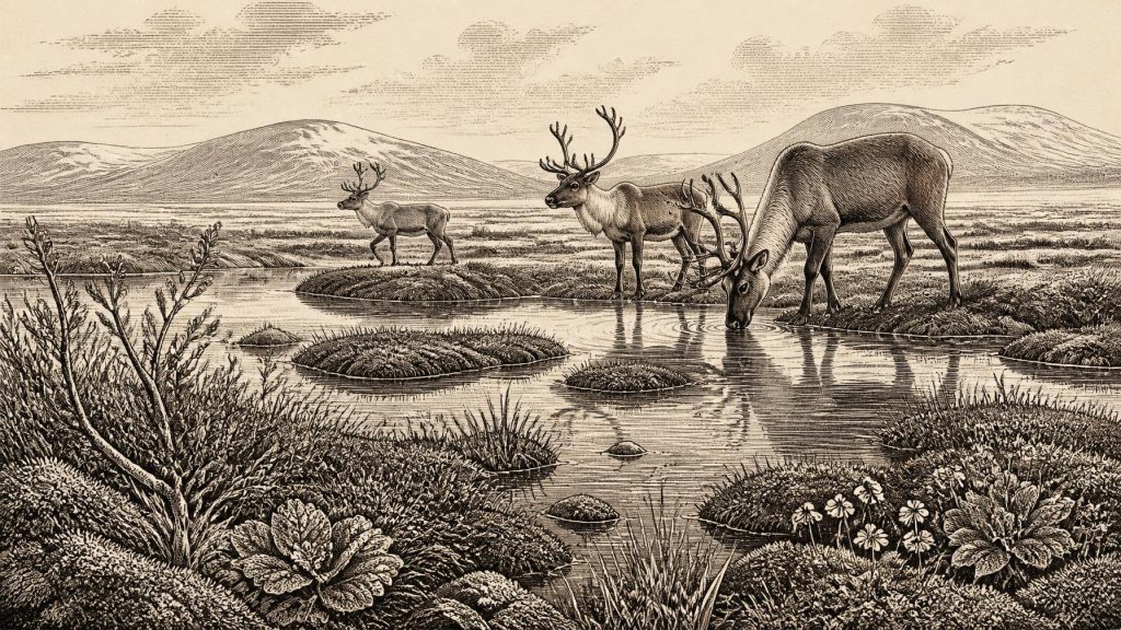
30,302 BCE is best understood as a broad later Pleistocene horizon, not a recoverable historical year. At Derryvree, County Fermanagh, freshwater organic beds between glacial tills preserve tundra wetland plants, including three-leaved bogbean, indicating an ice-free, treeless but biologically active interval. Castlepook Cave, County Cork, contains mixed Marine Isotope Stage 3 fauna, including mammoth, reindeer, hyaena and giant deer, demonstrating varied open habitats. These records reflect unstable pre-Last Glacial Maximum conditions and dynamic ice margins. A cut-marked reindeer bone may indicate fleeting human activity, but no settlement, tools or organised society is securely evidenced. Ireland’s record remains fragmentary and ecological.
Dateline
30,302 BCE is not a recoverable year in the ordinary historical sense. No Irish document, settlement layer, ruler, battle or human life can be fixed to it. At this depth of time, modern calendar notation is a convenience rather than a date known to the people—or animals—then alive. The responsible frame is a broad interval in the later Pleistocene, within Marine Isotope Stage 3, when climate in the North Atlantic region fluctuated sharply and the British–Irish Ice Sheet was developing towards its later maximum extent.
The strongest evidence relevant to this nominal date comes not from an archaeological town or camp, but from sediments and bones. A freshwater deposit at Derryvree near Maguiresbridge, County Fermanagh, and animal remains from Castlepook Cave near Doneraile, County Cork, together show that parts of Ireland supported life during a cold, unstable pre-Last Glacial Maximum world. They do not amount to a continuous narrative. They are separate archives, formed in different environments and over long spans of time.
A Date Beyond Calendar Precision
The calendar equivalent 30,302 BCE corresponds broadly to about 32,250 calibrated years before present, conventionally counted from 1950. That conversion should not be mistaken for precision in the evidence. The key Derryvree organic horizon yielded the radiocarbon determination BIRM-166, approximately 30,500 ± 1,100 radiocarbon years BP. Radiocarbon years and calendar years are not interchangeable: atmospheric carbon levels varied through time, and conversion requires a calibration curve with substantial uncertainty at this antiquity. Rather than identifying a particular year, BIRM-166 illuminates a wide span in the mid- to lower-thirty-thousands of calibrated years BP.
Accordingly, 30,302 BCE may be used as a point from which to view this period, but not as the date of a known occurrence at Derryvree. The deposit cannot tell us what happened in a particular season, nor whether every plant and animal recorded there occupied the site simultaneously. It does, however, preserve unusually direct evidence that an ice-free wetland existed in part of Fermanagh between episodes of glaciation.
The Derryvree Wetland
Derryvree was exposed in a road cutting through drumlin country. Its importance lies in its sequence: a lower glacial till, then freshwater sands, silts and organic material, followed by an upper till. Till is sediment laid down directly by glacier ice. The organic and water-laid beds between the tills therefore record an interval when local conditions permitted standing or slow-moving freshwater, vegetation and sediment accumulation before ice again crossed the landscape.
The plant remains are particularly revealing. Mosses, sedges and cold-adapted flowering plants point to open tundra or muskeg-like ground rather than woodland. Fossil evidence includes three-leaved bogbean, Menyanthes trifoliata, alongside mountain avens, dwarf willow and other plants capable of surviving short growing seasons, saturated soils and severe winters. Aquatic remains, including water-milfoil, show that there was freshwater rather than merely frost-shattered rubble. This was a living wetland margin: cold, treeless and exposed, yet not biologically empty.
That distinction matters. Ice-age Ireland was not one unchanging white expanse. The Derryvree record demonstrates local environmental opportunity amid a colder glacial regime. Plants occupied wet hollows; invertebrates and small animals would have exploited the vegetation and water; larger herbivores could have moved through wider open country. But the evidence does not justify a detailed reconstruction of the view from a single spot. Pollen can travel far, deposits can be disturbed, and organic beds represent accumulated time rather than an instant photograph.
Ice, Water and Changing Ground
The Derryvree interval preceded the fullest expansion of the last British–Irish Ice Sheet, generally placed during the global Last Glacial Maximum, about 26,500 to 19,000 years ago. It would be misleading, however, to imagine a simple advance from mild country to total ice cover. Ice sheets grew and changed sector by sector, responding to shifts in temperature, snowfall, sea level and the behaviour of fast-flowing ice streams. Research on Ireland’s uplands, coasts and continental shelf has shown that the last ice sheet was dynamic and that its maximum positions varied regionally.
Around the broad horizon represented by 30,302 BCE, Ireland’s landforms were already being shaped by cold-climate processes. Frost action broke rock; seasonal thaw moved sediment; rivers and meltwater rearranged sands and silts; glacier margins advanced or retreated elsewhere. Sea level was much lower than today because vast quantities of water were held in global ice sheets. Coasts and shelves therefore had different outlines, but the exact routes across the Irish Sea available at any one moment cannot be reconstructed from the Irish evidence alone. No responsible account can turn lower sea level into proof of a land bridge or a particular migration route.
The later ice advance also explains why the human archaeological record is so slight. Glaciers eroded, buried and redistributed older landscapes. Any campsites on exposed ground were vulnerable to destruction, while caves and sealed sediments had a better chance of preserving fragments. Absence of evidence is not proof that no person ever entered Ireland, but neither is it licence to supply lost settlements, trails or communities from imagination.
Castlepook’s Animal Evidence
At Castlepook Cave—also known as Mammoth Cave—in the Awbeg valley of north County Cork, excavations in the early twentieth century produced a remarkable collection of Pleistocene animal remains. Subsequent work and improved radiocarbon methods have shown that parts of this fauna belong to Marine Isotope Stage 3, well before the Last Glacial Maximum. The cave is directly relevant to the same broad period as Derryvree, but it is not a neatly dated single deposit. Bones entered cave passages through natural deaths, carnivore activity, water movement and other processes over considerable time; antiquarian excavation further complicated their original relationships.
The assemblage nevertheless establishes that Ireland was reached by a varied cold-climate fauna. Species represented include reindeer, woolly mammoth, spotted hyaena, brown bear, wolf, Arctic fox, mountain hare, lemmings and giant deer. They should not be treated as a single herd roaming together in 30,302 BCE. Each specimen has its own age and taphonomic history. Taken together, though, they indicate open habitats capable of sustaining substantial herbivores, predators and scavengers during portions of the pre-maximum glacial period.
For everyday animal life, the contrast between Derryvree and Castlepook is useful. Fermanagh’s buried wetland gives close evidence for plants and freshwater conditions; the Cork cave gives a longer, more mixed record of mammals moving through a southern limestone landscape. Neither site can supply a full island-wide map, but together they caution against depicting Ireland as either luxuriantly forested or wholly sterile. It contained shifting ecological mosaics.
The Human Question
Castlepook has also become central to the question of whether people visited Ireland this early. A reindeer femur reported as about 33,000 years old bears a deep linear mark interpreted by zooarchaeologist Ruth Carden as damage from a sharp stone tool during fresh-bone processing. If that interpretation is confirmed, it would be extraordinarily early evidence for human activity in Ireland: not a later Mesolithic arrival, but a brief Upper Palaeolithic presence before the Last Glacial Maximum.
The limits of that claim are as important as its promise. A single marked bone cannot establish a settled population, a dwelling, a hunting territory, a language or a social group. It cannot show whether a person killed the animal, found a carcass, removed meat, hide or sinew, or carried part of it into the cave. Nor has a securely associated stone-tool assemblage, hearth, occupation floor, burial or art assemblage of this age been published from Ireland. The mark is evidence under investigation, not a warrant for populating the landscape with imagined camps.
There is therefore no recoverable political history for Ireland at this point: no kingdoms, chiefs, treaties, warfare or diplomacy can be responsibly identified. There is likewise no direct Irish evidence for formal religion, ritual monuments, teaching, artistic traditions or exchange networks. Comparisons with Upper Palaeolithic communities elsewhere in north-west Europe may show what mobile hunter-gatherers were capable of, but such comparisons are interpretation, not evidence for an Irish society. The better-attested history of sustained human occupation begins far later, after the ice sheets had retreated.
A Fragmentary Irish Past
The economic and social history that can be stated is ecological rather than institutional. If people were present, the Castlepook femur suggests only the possibility of animal processing. The securely demonstrated economy belongs to plants and animals: wetland vegetation capturing sediment, herbivores feeding in open country, and predators or scavengers using caves and carcasses. There is no basis for claims of farming, permanent settlement, trade, seafaring, named peoples or territorial control.
Yet the evidence is not trivial. Derryvree’s organic silts survived beneath later glacier deposits; Castlepook’s bones survived in a cave system; modern dating, palaeobotany and zooarchaeology allow both to be read afresh. They reveal an Ireland undergoing profound regional environmental change before the later ice maximum transformed much of its surface. For 30,302 BCE, that is the soundest historical conclusion: not a year of known human events, but a cold, intermittently habitable landscape in which freshwater wetlands, tundra plants and large mammals persisted, and where the possibility of a fleeting human encounter remains open but unproven.
Primary Sources
- A reconsideration of the radiocarbon dating of the Marine Isotope Stage 3 fauna from southern Ireland
- The Irish Quaternary Fauna Project
- Figure 6.— The subdivision of the Quaternary Period in Ireland
- The Geology of Ireland: Cenozoic, Tertiary and Quaternary
- The IntCal20 Northern Hemisphere Radiocarbon Age Calibration Curve (0–55 cal kBP)
- IntCal: International Radiocarbon Calibration
- Growth and retreat of the last British–Irish Ice Sheet, 31,000 to 15,000 years ago: the BRITICE-CHRONO reconstruction
- The timing and magnitude of the British–Irish Ice Sheet between Marine Isotope Stages 5d and 2
- Radiocarbon constraints on the age of the maximum advance of the British–Irish Ice Sheet in the Celtic Sea
- Dimensions and chronology of the last ice sheet in Western Ireland
- Trimlines, blockfields and the vertical extent of the last ice sheet in southern Ireland
- The deglaciation of the western sector of the Irish Ice Sheet from the inner continental shelf to its terrestrial margin
- Timing and pace of ice-sheet withdrawal across the marine–terrestrial transition west of Ireland during the last glaciation
- Oscillating retreat of the last British-Irish Ice Sheet on the continental shelf offshore Galway Bay, western Ireland
- Deglaciation chronology of the Donegal Ice Centre, north-west Ireland
- Menyanthes trifoliata L.
- Dryas octopetala L.
- Archaeological Heritage of County Cork
- The Mesolithic in Ireland: when was it?
- First evidence of a Late Upper Palaeolithic human presence in Ireland
- New insights on the fauna of Ireland’s Younger Dryas and Early Holocene from Alice & Gwendoline Cave
- Ireland Under The Ice