
Alternate Milfoil Silts30191 BCE
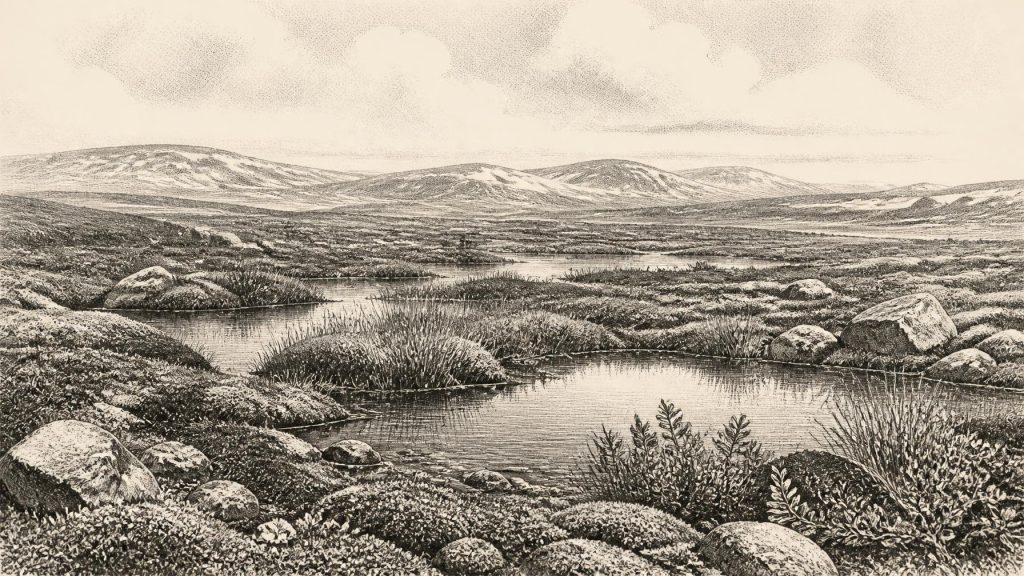
Around 30,191 BCE, Ireland was a fluctuating later-Pleistocene landscape, not a historically recoverable year. Organic silts at Derryvree, Fermanagh, dated broadly rather than precisely, indicate an interval of ice-free tundra wetland between glacial advances, supporting sedges, mosses, dwarf shrubs and aquatic plants. Ice margins, sea levels and connections with Britain varied regionally. Castlepook Cave in Cork preserves evidence of diverse cold-adapted fauna, including mammoth, reindeer, giant deer, predators and smaller mammals, though its mixed bones are not contemporaneous. A possibly cut-marked reindeer bone suggests unresolved early human activity, but no secure settlement evidence exists. Subsequent glaciation destroyed or buried evidence.
Dateline
The numbered year 30,191 BCE cannot be recovered as a moment in Ireland’s past in the way that a medieval or modern year can. No written records, named communities, political boundaries or annual calendar survive from this depth of time. It is better understood as an approximate point about 32,140 years before AD 1950, within the later Pleistocene and broadly Marine Isotope Stage 3, a fluctuating phase of the last Ice Age. The responsible evidence is regional and uneven: freshwater deposits sealed beneath later ice in County Fermanagh, cave-fauna collections in County Cork, changing ice-sheet reconstructions, and wider north-west European climate records. These can illuminate conditions across spans of centuries or millennia. They cannot securely tell us what happened in one particular year.
A Date Within a Range
The closest named Irish chronological witness is BIRM-166, a radiocarbon determination made on organic material from Derryvree, near Maguiresbridge in County Fermanagh. Roadworks in 1969 cut through a drumlin and exposed silts and fine sands lying between two substantial sheets of till, sediment deposited directly by glacier ice. The intervening freshwater sequence yielded an age of 30,500 radiocarbon years before present, with a very large quoted uncertainty of +1,170/−1,030 years. Calibration converts such measurements into calendar-age probabilities rather than a single answer; later syntheses place the result broadly between about 36,900 and 31,700 calibrated years before present, or roughly 34,950–29,750 BCE.
Thus 30,191 BCE falls inside the broad calibrated range associated with the Derryvree deposit, but it cannot be pinned to a particular layer, season or episode in that deposit. The sample was not a timestamp for a historical occurrence. It dates carbon in a complex sedimentary context, while the surrounding tills show that the landscape was overridden by ice before and after the freshwater interval. The useful conclusion is modest but significant: at some time represented by the organic beds, a part of north-central Ireland was not under glacier ice, and it supported cold-climate wetland life. The precise duration of that window, and whether its conditions held simultaneously in every Irish region, remain uncertain.
Wetland Beneath the Drumlin
Derryvree offers an unusually vivid environmental record. Plant macrofossils and other remains from its silts point to open tundra and a periglacial regime: ground subject to severe cold and repeated freezing and thawing, rather than forested countryside. The flora included sedges, mosses, dwarf willow, mountain avens, rosy saxifrage, lesser clubmoss and aquatic plants such as bogbean and alternate water-milfoil. This was not a uniform white wilderness. The evidence indicates shallow freshwater, wet margins and patches of low vegetation, with seasonal growth wherever water and thawed ground allowed it. Yet it was a treeless landscape, exposed to a far harsher climate than that of modern Fermanagh.
The combination matters because it shows a working ecosystem rather than bare ground at the edge of an ice sheet. Fine sands and silts accumulated in water; plants rooted or shed remains into and around it; insects and small animals occupied suitable niches. Such evidence supports a picture of pools, sedge-rich margins and mossy ground embedded in a broader open tundra. It does not justify reconstructing a modern bog, a dense blanket of peat, or a settled lakeside community. “Muskeg”, sometimes used for the vegetation, is a descriptive comparison for a waterlogged, mossy tundra wetland, not evidence that Ireland had acquired its later familiar peatlands.
Ice, Land and Changing Coasts
Ireland around this time stood near the onset of the major expansion that would culminate in the Last Glacial Maximum. The British–Irish Ice Sheet was not a fixed blanket advancing everywhere at once. Modern reconstructions combine landforms, sediments, radiocarbon dating, luminescence ages, sea-floor mapping and ice-sheet modelling, and they therefore show ranges of possible ice margins rather than a single unquestionable outline. One reconstruction at 31,000 years before present models a substantial ice cap across parts of northern Ireland and smaller upland glaciers elsewhere; conversely, organic beds at Derryvree and Greenagho demonstrate local ice-free intervals before subsequent glacial advance. The apparent tension is instructive: changing ice margins, inherited older deposits and imperfect dating make this a landscape of regional variation, not a map that can be read with annual precision.
Sea level was much lower than today because immense volumes of water were held in global ice sheets. Ireland’s coastline and its connections to Britain were consequently unlike the modern island’s, although the exact presence, width and duration of dry routes changed with sea level, crustal depression beneath ice and local marine incursions. Animal movements between Ireland, Britain and continental Europe were plainly possible over the longer term, as the Irish fossil record contains species belonging to wider Eurasian populations. That fact is not proof of an easy, permanent land bridge at 30,191 BCE, still less proof of a human migration on that date. It establishes connectivity as a biogeographical question, not a mapped road.
Castlepook and the Animal World
For larger animals, Castlepook Cave near Doneraile in north County Cork is crucial. Antiquarian excavations there, historically called Mammoth Cave, recovered a rich but difficult collection whose bones accumulated over a long period and through more than one process. The assemblage includes woolly mammoth, reindeer, giant deer, brown bear, wolf, Arctic fox, mountain hare, lemmings and spotted hyaena. These species should not be imagined as one herd gathered in a single valley in 30,191 BCE. Direct dating has shown that individual bones from old cave collections may differ greatly in age, and carnivores, natural deaths, water movement and excavation methods all shaped what survives.
Even with those cautions, Castlepook demonstrates that Ireland could sustain a far more varied cold-stage fauna than its later historic landscape. Reindeer and lemmings accord with open, northern environments; mammoth and giant deer reveal the potential for substantial grazing animals; hyaenas and wolves show that scavengers and predators were also present. Caves were not necessarily homes for every species represented within them. A hyaena den, carnivore scavenging, bones washed into fissures, and episodic natural mortality can all create deposits. The evidence nevertheless makes clear that the island was not biologically empty before the greatest later ice expansion transformed much of it.
The Human Question
A reindeer femur from Castlepook has been presented as bearing a cut mark made on fresh bone by a sharp stone tool and has been reported as dating to roughly 33,000 years ago. If that interpretation is sustained by further analysis, it would be exceptional evidence for a brief Upper Palaeolithic human presence in Ireland, thousands of years before the better-established terminal-Pleistocene traces. It would imply that at least one person, or a small group, processed animal tissue at the north-western edge of Europe during an earlier habitable interval.
It cannot, however, bear the weight of a complete social history. Ireland has not produced a securely excavated camp, hearth, house floor, human burial or diagnostic stone-tool assemblage of comparable age. Nor can a modified bone identify a people’s language, kinship system, beliefs, route of arrival or duration of stay. The careful wording is therefore “possible early human activity”, rather than permanent settlement. New work at Castlepook, including investigation of previously undisturbed deposits and sedimentary ancient-DNA research, may refine the story. For now, the reindeer bone is an important but limited clue, not a licence to populate the island with a known hunting society.
Society Without Institutions
No evidence supports political institutions, rulers, territorial states, diplomacy or organised warfare in Ireland at this date. Those categories depend on durable archaeological signatures or written testimony that are absent here. The same restraint applies to religion, art, formal learning and burial custom: there are no Irish ritual sites, images, inscriptions or graves securely attributable to this period. Wider Upper Palaeolithic Europe certainly contains sophisticated hunting technologies, ornament, imagery and long-distance exchange, but parallel developments elsewhere cannot simply be assigned to Ireland. Cultural possibility is not local proof.
Economy, if people were present, would have depended on immediate landscape knowledge: movement through an open cold environment, access to freshwater and fuel, shelter during severe weather, and the risky acquisition or scavenging of animal resources. Stone suitable for tools may have been locally available, but no tool kit demonstrably belonging to 30,191 BCE has been recovered. There is likewise no evidence for trade in the usual archaeological sense. Animal dispersal across the wider region should not be mistaken for commerce. The strongest economic evidence concerns non-human ecology: seasonal vegetation, grazing and predation within a changing tundra mosaic.
A Landscape Soon Reworked
The eventual advance of glacier ice is part of why this episode is so hard to see. Ice eroded older surfaces, transported material and buried some rare pockets of organic sediment beneath till. Derryvree survives precisely because its freshwater record was sealed, while countless contemporary campsites, shorelines and animal tracks may have been destroyed or now lie beneath later deposits and offshore sediments. Absence of evidence is therefore not straightforward evidence of absence, but neither is it positive evidence for hidden settlements. Archaeology must distinguish what erosion may have removed from what excavation has actually demonstrated.
For Ireland at 30,191 BCE, the most defensible history is consequently a history of thresholds. The Derryvree wetlands show an ice-free, treeless and biologically active cold landscape within a broad dated interval. Castlepook shows that large mammals and formidable carnivores reached the island, while a marked reindeer bone raises the serious, unresolved possibility of fleeting human activity. Approaching glaciation would later rework and obscure much of this world. The people, politics and stories familiar from later Irish history had not yet begun; what remains is more fragile, but no less remarkable: plants in silt, bones in caves and a landscape repeatedly remade by ice.
Primary Sources
- Middle Midlandian Freshwater Series at Derryvree, Maguiresbridge, County Fermanagh, Northern Ireland
- Middle Midlandian Interstadial Deposits at Greenagho, Near Belcoo, County Fermanagh, Northern Ireland
- Growth and Retreat of the Last British–Irish Ice Sheet, 31,000 to 15,000 Years Ago: the BRITICE-CHRONO Reconstruction
- BRITICE-CHRONO Maps and GIS Data of the Last British-Irish Ice Sheet 31 to 15 ka
- Exploring Controls of the Early and Stepped Deglaciation on the Western Margin of the British-Irish Ice Sheet
- Timing, Pace and Controls on Ice Sheet Retreat: An Introduction to the BRITICE-CHRONO Transect Reconstructions of the British–Irish Ice Sheet
- The Timing and Magnitude of the British–Irish Ice Sheet Between Marine Isotope Stages 5d and 2
- Radiocarbon Constraints on the Age of the Maximum Advance of the British–Irish Ice Sheet in the Celtic Sea
- Trimlines, Blockfields and the Vertical Extent of the Last Ice Sheet in Southern Ireland
- Pleistocene Glaciations in Ireland
- Ireland: Submerged Prehistoric Sites and Landscapes
- Anthropogenic Changes to the Holocene Nitrogen Cycle in Ireland
- The Subdivision of the Quaternary Period in Ireland
- New Insights on the Fauna of Ireland’s Younger Dryas and Early Holocene from Alice & Gwendoline Cave
- New Insights on the Fauna of Ireland’s Younger Dryas and Early Holocene from Alice & Gwendoline Cave
- Sedimentary Ancient DNA Reveals Late Pleistocene Faunal Connectivity Between Ireland and Eurasia
- Ireland’s Palaeolithic Archaeology – Fleeting Footprints in a Frozen Land
- The Archaeological Heritage of County Cork
- The Mesolithic in Ireland: When Was It?
- Growth and Retreat of the Last British–Irish Ice Sheet: British Antarctic Survey Publication Record
- A Critical Review and Re-investigation of the Pleistocene Deposits at Castlepook Cave, Co. Cork, Ireland