
BIRM-166’s Tundra Biota30198 BCE
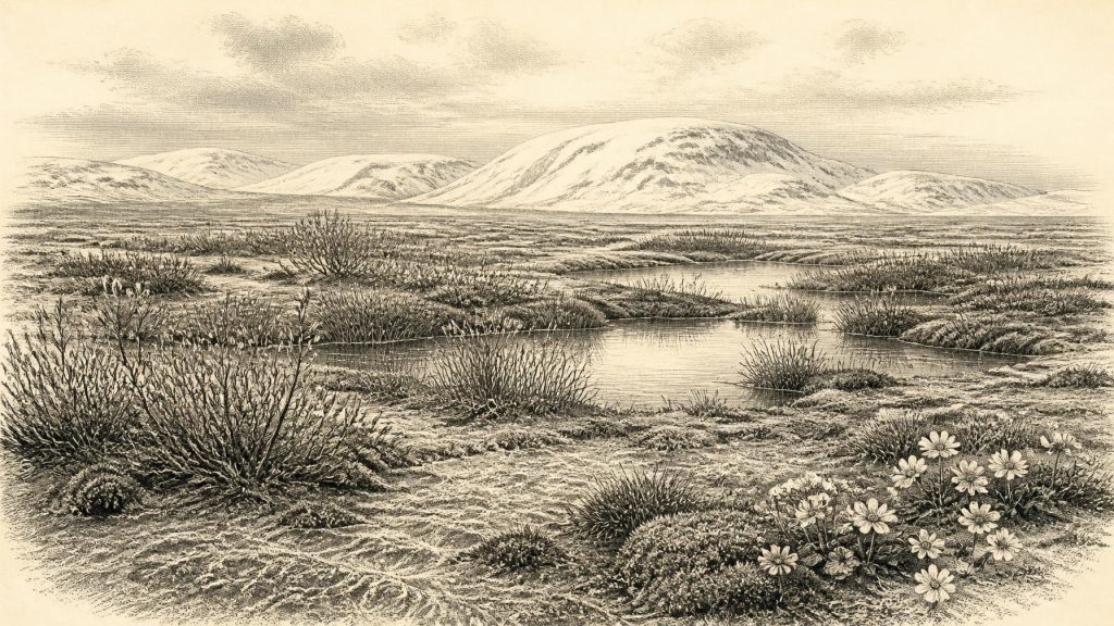
Around 30,198 BCE, Ireland formed part of a Late Pleistocene cold landscape linked with the Midlandian and Marine Isotope Stage 3. Derryvree, County Fermanagh, preserves freshwater sediments between glacial tills dated broadly to this period, indicating tundra wetland with sedges, mosses, aquatic plants and cold-adapted herbs. Ice cover was regionally uneven and advancing, while glaciation obscured earlier evidence. Cave remains reveal mammals including mammoth, reindeer, giant deer, predators and Arctic species, reflecting connections with Britain and Europe. No secure human occupation is known, although a possibly butchered reindeer bone suggests a tentative human encounter. Derryvree demonstrates refuges amid glacial change.
Dateline
30,198 BCE is not a year that can be matched to a recorded Irish event. It is a modern calendar label imposed upon a deep-prehistoric landscape. In the chronological convention used by Quaternary scientists, it falls approximately 32,147 years before AD 1950, or about 32.1 thousand calendar years BP. Neither archaeology nor palaeoenvironmental science can resolve conditions in Ireland to that individual year. What can responsibly be described is a broader Late Pleistocene setting, using dated deposits whose ranges overlap the surrounding millennia and distinguishing their evidence from later interpretation.
Ireland at this time belonged to the last cold stage, commonly called the Midlandian in Irish geological writing and correlated broadly with Marine Isotope Stage 3. It was not yet the familiar island of fields, woods, farms, towns or even established human settlement. Its history is recovered instead from layers of silt, till, cave bone, pollen, plant remains, insects, landforms and the physics of ice. These archives do not provide a national snapshot. They preserve scattered moments in particular places, often separated by centuries or millennia.
Dating a Cold Landscape
The closest celebrated Irish environmental record is from Derryvree near Maguiresbridge, County Fermanagh. Roadworks in 1969 cut through a drumlin and exposed freshwater silts and fine sands sealed between two substantial sheets of glacial till. The organic deposit, laboratory sample Birm-166, yielded a conventional radiocarbon age of 30,500 years BP, with a large uncertainty of +1,170/−1,030 years. Its investigators identified a full-glacial flora and fauna and concluded that open tundra and periglacial conditions prevailed when the sediments accumulated.
That measurement must not be quietly converted into an exact date for 30,198 BCE. A conventional radiocarbon age is not a calendar age: atmospheric carbon-14 has varied through time, and calibration produces probability distributions rather than a single answer. IntCal20 extends calibration through this period, but the uncertainty in the original Derryvree measurement and the character of the deposit mean that it offers a broad chronological window, not an annual timestamp. Derryvree is therefore highly informative about a cold episode in the wider period, but it cannot prove that every part of Ireland had identical conditions in the numbered year used here.
A Freshwater Pocket Between Ice Advances
Derryvree’s importance lies in its stratigraphy. Beneath and above the freshwater material are tills: sediments deposited directly by glacier ice. Between them is evidence for standing or slow-moving fresh water, vegetation and small animals. At least locally, there was an interval when a basin near modern Maguiresbridge supported a cold wetland before a later ice advance overran and sealed it. The later drumlin preserved the evidence, even as it transformed the surrounding terrain.
The plants point to an open, treeless landscape rather than forest. Mosses, sedges, aquatic plants and cold-adapted herbs indicate damp ground, shallow pools and short growing seasons. Fossils reported from the deposit include bogbean (Menyanthes trifoliata) and mountain avens (Dryas octopetala), plants compatible with cold, open habitats. Such remains are direct evidence for vegetation close to the former water body; the wider reconstruction of a tundra mosaic is an interpretation made by combining them with sediments, insects and regional climate evidence.
“Muskeg”, a term used in older descriptions of the Derryvree environment, conveys wet, peat-forming or organic-rich ground rather than a neat modern ecosystem. It should not conjure a uniform bog spread across Ireland. The likely reality was patchy: wet hollows and pools, mineral ground exposed by frost action, sedgy margins, herb-rich open patches and snow that lingered in sheltered places. No evidence supports woodland, cultivated land or permanent villages here. The living landscape was shaped by seasonality, frozen ground and the movement of ice and meltwater.
An Unevenly Glaciated Island
At roughly 32,000 calendar years BP, the British–Irish Ice Sheet was growing and changing, but its precise extent around Ireland remains a research problem. The principal BRITICE-CHRONO reconstruction begins at 31,000 years BP, slightly later than the modern calendar equivalent of this article’s date; its authors stress the need to separate dated landform evidence from climatic correlation. Other work argues for substantial pre-Last Glacial Maximum ice activity in the Irish Sea region and on Irish uplands, while the great maximum ice expansion around Ireland is generally placed later, during the Last Glacial Maximum.
It is consequently misleading to say simply that “Ireland was under ice” in 30,198 BCE, or that it was wholly ice-free. The evidence instead permits a dynamic regional picture. Some ice centres and marine outlets were active or expanding; some lowland basins could briefly sustain freshwater sedimentation and tundra vegetation; and later advances erased, buried or reworked much earlier evidence. Northern and western uplands, the Irish Sea basin, southern coasts and interior lowlands did not necessarily respond together. Ireland’s future physical geography was being made through erosion, deposition and the repeated redirection of water beneath and beyond ice.
Animals Without a Human Landscape
Cave collections show that Ireland supported a much richer Late Pleistocene mammal fauna than its modern fauna. The Irish Quaternary Fauna Project found evidence that a wide range of mammals reached the island between at least about 45,000 and 20,000 years ago. Castlepook Cave in County Cork is especially important, with records that include mammoth, reindeer, giant deer, brown bear, wolf, spotted hyaena, Arctic fox, mountain hare and lemmings. These animals imply intermittent ecological and geographical connections with Britain and continental north-west Europe when sea level was lower and routes across the wider shelf were available.
But cave faunas must be read cautiously. Bones may have been accumulated by carnivores, natural deaths, water movement and antiquarian excavation; dates attached to individual bones do not mean that every species lived together or occupied the cave at the same moment. Castlepook provides a long faunal archive, not a scene from one day. Recent sedimentary ancient-DNA work, currently available as a preprint, nevertheless strengthens the broader conclusion that Irish Late Pleistocene megafauna belonged to a Eurasian biogeographical continuum before the Last Glacial Maximum.
No Polities, No Proven Society
There were no political affairs, diplomacy, kingdoms, trade networks or religious institutions in the historical sense that can be documented for Ireland at this point. Nor is there secure evidence for a resident human society from which everyday life, language, ritual or learning can be reconstructed. The National Museum of Ireland continues to state that no clear evidence has emerged for human presence in Ireland during the Palaeolithic, despite occasional debated finds.
A reindeer femur from Castlepook, dated to around 33,000 years ago, has been interpreted as bearing a mark made by a stone tool during butchery. If that interpretation is sustained, it would indicate a human encounter with an animal in Ireland within the broad period under discussion. It would not demonstrate a settlement, family group, camp, economy or political community. There is no associated habitation floor, hearth, lithic assemblage or human burial that can securely describe such people. Responsible history must leave the question open: this is a tantalising possible trace of human action, not proof of an occupied Ireland.
The economy that can be identified was ecological rather than human: plants drawing brief summer growth from wet ground; herbivores and predators using open country; freshwater systems carrying fine sediment; glaciers transporting rock and debris. Animal movement was not trade, and possible human butchery was not evidence of an exchange network. The absence of material evidence is itself historically important, because it marks the gulf between this unstable Pleistocene world and the securely attested hunter-gatherer occupation that followed the final retreat of ice many millennia later.
What Derryvree Preserves
The most important development around 30,198 BCE was environmental, not political: Ireland was part of a volatile north-west European cold-world in which ice, water, plants and animals repeatedly remade the possibilities for life. Derryvree preserves a rare local interval when tundra wetland existed between glacier advances. It does not yield an annual chronicle, but it gives Ireland something more valuable for this remote time: tangible evidence that even within an ice-age landscape there were changing freshwater habitats, living communities and temporary refuges before the ice returned.
Primary Sources
- Middle Midlandian Freshwater Series at Derryvree, Maguiresbridge, County Fermanagh, Northern Ireland
- Pleistocene Glaciations in Ireland
- Growth and Retreat of the Last British–Irish Ice Sheet, 31,000 to 15,000 Years Ago: the BRITICE-CHRONO Reconstruction
- Timing, Pace and Controls on Ice Sheet Retreat: an Introduction to the BRITICE-CHRONO Transect Reconstructions of the British–Irish Ice Sheet
- The Timing and Magnitude of the British–Irish Ice Sheet Between Marine Isotope Stages 5d and 2
- Radiocarbon Constraints on the Age of the Maximum Advance of the British–Irish Ice Sheet in the Celtic Sea
- Dimensions and Chronology of the Last Ice Sheet in Western Ireland
- Trimlines, Blockfields and the Vertical Extent of the Last Ice Sheet in Southern Ireland
- Deglaciation Chronology of the Donegal Ice Centre, North-West Ireland
- Pattern, Style and Timing of British–Irish Ice Sheet Advance and Retreat Over the Last 45,000 Years
- Dynamic Cycles, Ice Streams and Their Impact on the Extent, Chronology and Deglaciation of the British-Irish Ice Sheet
- The Irish Quaternary Fauna Project
- Occurrence of Mammalia Relicts at Site Castlepook Cave
- Sedimentary Ancient DNA Reveals Late Pleistocene Faunal Connectivity Between Ireland and Eurasia
- New Insights on the Fauna of Ireland’s Younger Dryas and Early Holocene from Alice & Gwendoline Cave
- Prehistoric Details
- Figure 6.—The Subdivision of the Quaternary Period in Ireland
- Menyanthes trifoliata L.
- Dryas octopetala L.
- The IntCal20 Northern Hemisphere Radiocarbon Age Calibration Curve (0–55 cal kBP)
- OxCal: Radiocarbon Calibration
- Geology of Ireland
- Timing and Pace of Ice-Sheet Withdrawal Across the Marine–Terrestrial Transition West of Ireland During the Last Glaciation