
The Awbeg Faunal Window31878 BCE
Around 31,878 BCE, Ireland lay within the unstable cold conditions of Marine Isotope Stage 3, before the Last Glacial Maximum. Derryvree, County Fermanagh, preserves freshwater sediments indicating an ice-free, treeless wet-tundra landscape of sedges, grasses, mosses and juniper. Castlepook Cave, County Cork, yielded late Pleistocene fauna including reindeer, mammoth, giant deer, horse, bear, wolf, arctic fox and hyaena. These sites demonstrate surviving habitats and grazing land before major ice-sheet expansion. Possible butchered bones raise, but do not prove, human presence. No secure evidence supports settlement, farming, communities or specific events. Dating ranges, disturbed deposits and later glaciation require cautious interpretation.
Dateline
31,878 BCE is a modern calendar label, not a year that can be isolated in the Irish archaeological record. It falls roughly 33,828 years before AD 1950, within Marine Isotope Stage 3 (MIS 3), a long, cold and climatically unstable part of the Last Glacial Period. Neither written records nor archaeological deposits permit a narrative of events in one particular year. The responsible approach is to use evidence dated across calibrated ranges and to ask what it can reveal about Ireland at approximately this depth of time.
The nearest especially valuable Irish evidence comes from Derryvree, near Maguiresbridge in County Fermanagh, and from Castlepook Cave near Doneraile in County Cork. Their evidence is very different: Derryvree preserves an ancient freshwater environment beneath later glacial deposits; Castlepook produced a remarkable assemblage of animal bones from a limestone cave. Together they illuminate a country that was not yet wholly overwhelmed by the last great ice-sheet advance, but was already an exacting, treeless and changeable northern landscape.
A Date Within Ranges
Radiocarbon years are not calendar years. The quantity of carbon-14 in the atmosphere has varied through time, so a laboratory measurement must be calibrated against an internationally maintained curve. At about 34,000 years ago, the conversion may produce broad intervals rather than a precise answer, and the dated material itself may represent only one moment within a longer-lived deposit. A nominal date such as 31,878 BCE must therefore not be treated as the anniversary of a hunt, a migration or a climatic episode.
Derryvree provides the closest dated environmental framework. Road works in 1969 cut through a drumlin and exposed freshwater silts and fine sands sealed between two separate tills: layers left by ice at different times. Organic material within the freshwater deposit returned a conventional radiocarbon age of 30,500 years BP, with an uncertainty of more than a thousand years. A published calibrated range places it at roughly 36,900–31,700 calendar years BP. The modern year in question lies within that wide range, but it cannot be pinned to a particular layer, season or generation.
That stratigraphic position matters as much as the measurement. The organic sediments accumulated after an earlier glaciation and before a later ice advance. They demonstrate that this part of north-central Ireland was ice-free during an interval of the Midlandian glaciation, the Irish name for the last glacial cycle. Comparable lacustrine organic deposits at Greenagho, near Belcoo in County Fermanagh, have an older radiocarbon determination calibrated to about 37,200–35,700 years BP. Taken together, such sites show that the spread of the last Irish ice sheet was neither simple nor instantaneous.
Open Ground and Sedge Water
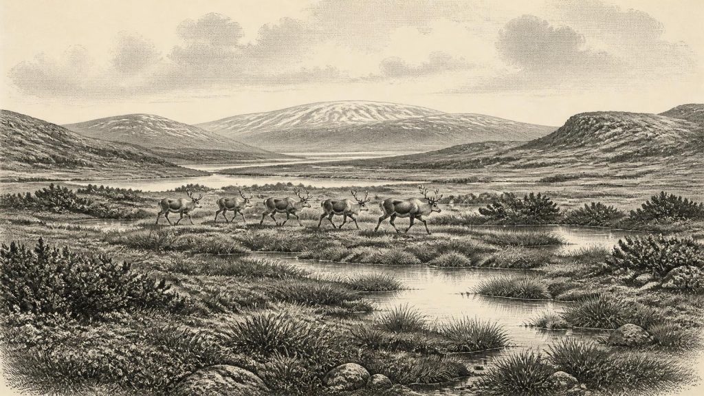
Derryvree does not give us a landscape photograph, but its pollen, plant remains, mosses and insects offer unusually direct testimony. The deposit has been interpreted as a treeless muskeg or wet tundra: waterlogged ground with shallow pools, abundant mosses and decaying plant matter, set within open vegetation. Grasses, sedges, juniper and herbs point away from woodland and towards a sparse, low-growing flora capable of enduring short summers, hard winters and exposed conditions.
This was not an empty white wilderness. Open tundra can support varied plant communities, insects and grazing animals, especially in sheltered hollows and beside freshwater. But productivity would have been seasonal and uneven. Permafrost or intensely frozen ground, wind, fluctuating snow cover and brief growing seasons shaped the opportunities available to every living thing. The evidence supports a periglacial climate—one dominated by freezing and thawing near an ice-sheet world—not a claim that every part of Ireland looked identical. County Fermanagh is a powerful local archive, not a complete map of the island.
Regional contrast is essential. The island’s relief, western maritime exposure, rivers, caves and lowlands could create different conditions over relatively short distances. Offshore evidence and later geomorphological reconstruction indicate that much of the major expansion of the British–Irish Ice Sheet occurred after this broad interval. By its maximum extent, approximately 27,000–23,000 calendar years BP, ice covered Ireland and reached far onto the continental shelf. Around the Derryvree interval, however, the geological record still preserves windows onto exposed land and freshwater habitats before that maximum.
The Awbeg Cave Record
Castlepook Cave, in the Awbeg Valley of north County Cork, is the principal faunal counterpart to Derryvree. Excavated mainly in the early twentieth century by Richard J. Ussher, it yielded a large but now much reduced collection of bones. Identified animals include reindeer, woolly mammoth, giant deer, brown bear, wolf, arctic fox, wild horse, lemmings and spotted hyaena. No one of these animals should be imagined as necessarily living together on a single day. Cave assemblages can accumulate through repeated visits by animals, carnivore activity, water movement and changes at the cave entrance over long periods.
Even so, the collection establishes an important fact: parts of Ireland supported a characteristic late Pleistocene fauna before the Last Glacial Maximum. Reindeer suit open, cold country and are especially compatible with the tundra conditions suggested by Derryvree. Mammoth, horse and giant deer imply substantial grazing landscapes at some points within the wider sequence. Hyaenas and wolves were competitors and scavengers as well as predators. A cave can preserve their remains not because it was a human dwelling, but because it functioned intermittently as a den, trap, shelter or place where bones were carried and reworked.
Recent redating has made the Castlepook archive more significant and more complicated. Improved pretreatment of bone samples has produced dates substantially older than some earlier results, with implications for the timing of Irish MIS 3 fauna and for when species such as spotted hyaena and giant deer may have disappeared locally before the ice maximum. This is a reminder that scientific dating is cumulative rather than final: a date is evidence produced by a method and sample, not an unchallengeable label attached to a whole site.
People: A Possibility, Not a Population
The most arresting question is whether Upper Palaeolithic people reached Ireland in this period. A reindeer bone from the Castlepook collections has been reported as bearing modifications consistent with butchery, and researchers have identified other potentially modified bones from different phases of the last glacial cycle. If those marks prove to be human-made and contemporary with the animals’ deaths, they would be exceptionally early evidence for hominin activity on the island.
That conditional language is indispensable. Castlepook was excavated before modern standards of recording and much original sediment was removed. The bone collection is not a securely excavated camp assemblage. No stone-tool industry, hearth, dwelling surface, burial, human skeleton, artwork or coherent scatter of food refuse has yet demonstrated a resident community in Ireland at approximately 31,878 BCE. Excavation undertaken in 2022 located surviving cave sediments, but did not establish an in-situ Palaeolithic occupation horizon. The question remains open, not settled.
It follows that political affairs, diplomacy, named leaders, territorial boundaries and organised warfare cannot responsibly be written for this year. Nor can religion be reconstructed as a system of beliefs, or culture and learning as traditions traceable to a particular Irish group. The animal record may suggest that people could have found prey and raw materials if they reached Ireland; it does not show how many came, whether they stayed, what language they used, or whether they returned. A single modified bone, even if confirmed, would document an encounter rather than a society.
Movement, Coast and Economy
At lower global sea levels, the outlines of surrounding coasts differed from those of today, but this does not automatically mean that Ireland had an easy land connection to Britain or continental Europe. Relative sea level around Ireland was shaped not only by global ice volume but also by the loading and flexure of the Earth’s crust beneath nearby ice sheets. The geography is still modelled with uncertainty. Any human arrival in this interval may have involved changing coastal routes, short water crossings or landscapes now submerged; none can presently be demonstrated for Ireland.
There is equally no evidence for farming, herding, permanent villages, long-distance trade networks or monuments. If hunters visited, their economy would have depended on mobile foraging: reading animal movements, finding freshwater, securing fuel and shelter, and making portable tools from stone, bone or wood. That is an informed comparison with contemporary Upper Palaeolithic lifeways elsewhere in Europe, not a direct description of an Irish camp. Ireland’s evidence presently cannot distinguish a brief foray from repeated seasonal visits, still less permanent occupation.
What This Horizon Means
The central development around this remote horizon was environmental, not political: Ireland stood in a precarious interval before the last ice sheet reached its greatest extent. Derryvree’s wet tundra and Castlepook’s fauna show that portions of the island retained ice-free habitats, freshwater and animal life during MIS 3. They also show why later glaciation has made the human story so difficult to recover. Ice eroded older surfaces, redeposited material and buried rare organic deposits beneath till; rising seas later removed or concealed parts of former coastal landscapes.
For 31,878 BCE, then, the best Irish history is necessarily cautious. Evidence supports an open, cold, largely treeless environment in Fermanagh, and a wider Ice Age animal world documented dramatically in Cork. It permits the possibility of human contact with that world, especially through the contested Castlepook bone modifications. It does not permit a named settlement, a people, a battle or an exact event. The value of this year lies precisely in that restraint: it marks a narrow archaeological window onto Ireland before the ice-sheet maximum closed much of the landscape again.
Primary Sources
- A Middle Midlandian Freshwater Series at Derryvree, Maguiresbridge, County Fermanagh, Northern Ireland
- Middle Midlandian Interstadial Deposits at Greenagho, Near Belcoo, County Fermanagh, Northern Ireland
- A Reconsideration of the Radiocarbon Dating of the Marine Isotope Stage 3 Fauna from Southern Ireland
- Trimlines, Blockfields and the Vertical Extent of the Last Ice Sheet in Southern Ireland
- Growth and Retreat of the Last British–Irish Ice Sheet, 31,000 to 15,000 Years Ago: The BRITICE-CHRONO Reconstruction
- Pattern and Timing of Retreat of the Last British–Irish Ice Sheet
- Maximum Extent and Dynamic Behaviour of the Last British–Irish Ice Sheet West of Ireland
- Radiocarbon Constraints on the Age of the Maximum Advance of the British–Irish Ice Sheet in the Celtic Sea
- New Data for the Last Glacial Maximum in Great Britain and Ireland
- The Timing and Magnitude of the British–Irish Ice Sheet Between Marine Isotope Stages 5d and 2
- Stratigraphic and Palaeo-Geomorphological Evidence for the Glacial-Deglacial History of the Last British-Irish Ice Sheet in the North-Western Irish Sea
- Ireland: Submerged Prehistoric Sites and Landscapes
- The Problem of a Late Quaternary Landbridge Between Britain and Ireland
- The IntCal20 Northern Hemisphere Radiocarbon Age Calibration Curve (0–55 cal kBP)
- Early Midlandian–Middle Midlandian, Pleistocene, Northern Ireland
- Figure 6—The Subdivision of the Quaternary Period in Ireland
- 2022:564 — Castlepook Cave, Castlepook South, Cork
- Archaeology Research Excavation Grant 2022: Castlepook Cave, Co. Cork
- Archaeological Heritage of County Cork
- Castlepook Caves
- Prehistoric Details
- New Insights on the Fauna of Ireland’s Younger Dryas
