Derryvree’s Buried Fen31879 BCE
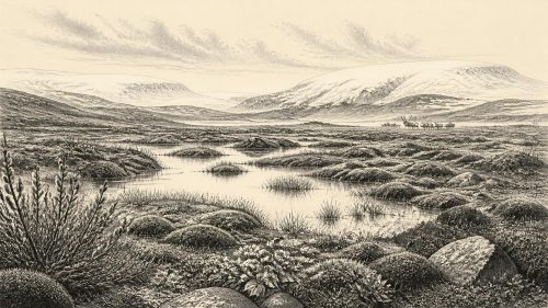
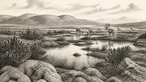
Derryvree in County Fermanagh preserves freshwater sediments beneath later glacial till from a broad period spanning the nominal date of 31,879 BCE. Mosses, herbaceous pollen and invertebrates indicate open, treeless tundra with cold wetlands during climatically unstable Marine Isotope Stage 3. Southern caves, especially Castlepook in Cork, contain reindeer, mammoth, hyaena and lemming remains supporting cold-adapted ecosystems. A cut-marked reindeer femur may indicate human butchery around 31,000 BC, but disturbed deposits and absent associated artefacts prevent claims of settlement. Ireland was intermittently ice-free and perhaps occasionally visited before the British–Irish Ice Sheet expanded towards its Last Glacial Maximum much later.

Dateline
The label 31,879 BCE is a modern way of marking a point about 33,828 years before the 1950 reference point used in ‘BP’ dating. It must not be mistaken for a year that anyone then living could have named, nor for a moment archaeology can isolate to twelve months. For Ireland, the responsible scale is the Late Pleistocene’s Marine Isotope Stage 3 (MIS 3), a long and climatically volatile interval of the last Ice Age. The closest useful evidence is expressed in calibrated ranges of centuries or millennia. This particular nominal year falls within the calibrated span of an exceptional deposit at Derryvree, County Fermanagh: c. 36.9–31.7 thousand calendar years BP.
A Fen Beneath Later Ice
Derryvree was revealed in a road cutting near Maguiresbridge in 1969. Beneath the material that forms a drumlin lay freshwater silts and fine sands, rich enough in organic matter to preserve traces of plants and small animals. Above and below were tills: dense deposits made or reworked by glaciers. The sequence is therefore an unusually direct piece of evidence that, before a later advance of the Irish Ice Sheet, this part of Fermanagh contained open ground and freshwater rather than permanent ice.
The original radiocarbon measurement on the Derryvree organic deposit was 30,500 radiocarbon years BP, with a substantial uncertainty. When calibrated, it has been presented as approximately 36.9–31.7 cal ka BP. The target year belongs inside that range, but this does not date the whole fen precisely to 31,879 BCE. It establishes that the deposit belongs to a cold-stage interval overlapping that broad period. Radiocarbon years and calendar years are not interchangeable: atmospheric carbon-14 varied through time, so scientific calibration curves are needed, and the resulting calendar ranges remain wide at this antiquity.
That distinction matters. Derryvree provides evidence for an environment, not a diary of an event. It cannot tell us who stood on a particular shore, whether a herd passed on a particular day, or whether people were present. Yet it offers something more valuable than a forced annual narrative: a securely relevant glimpse of northern Irish ground conditions before the much fuller glacial expansion of the Last Glacial Maximum.
Open Ground, Cold Water
The plants and invertebrates recovered from Derryvree indicate an open, treeless tundra landscape under periglacial conditions. Pollen was poorly preserved, but it was overwhelmingly herbaceous; moss macrofossils were especially important. A few grains attributed to trees such as pine and hazel are not evidence for local woodland. They may have travelled long distances, been redeposited, or otherwise entered the deposit after the plants themselves had disappeared. The cautious conclusion is stark: this was a country of low vegetation, exposed soils, wet hollows and cold freshwater, not the wooded island familiar today.
‘Tundra’ should not conjure a uniform white wilderness. The Irish climate was unstable on both long and short timescales. Mossy wetland, sedges, herbs and sparse dwarf-shrub communities could occupy protected or damp ground, while wind and frost acted strongly on more exposed slopes. Seasonal thaw fed pools and shallow lakes; winter freezing, snow cover and permafrost-like ground processes shaped the terrain. Crag Cave in south-west Ireland preserves speleothems whose interrupted growth records repeated MIS 3 climatic shifts, reinforcing the wider picture of sharp alternations between relatively milder interstadials and harsher stadials.
The island’s outlines were also unlike modern ones. Global sea level was lower during the Ice Age, exposing areas of continental shelf. But it would be unsafe to draw a simple land bridge between Ireland and Britain for this particular interval. Changing ice margins, rivers, marine channels and local topography determined possible routes; no evidence shows a settled corridor or a regular human crossing at 31,879 BCE. Ireland was part of a wider north-west European environmental zone, but its exact accessibility changed through time.
Animals in the Southern Caves
Irish caves supply a complementary, if geographically distant and often more difficult, record. Castlepook Cave near Doneraile in north Cork has produced an extraordinary Late Pleistocene assemblage: woolly mammoth, reindeer, giant deer, brown bear, spotted hyaena, wolf, foxes, hares and lemmings among the identified fauna. Revised radiocarbon work places the MIS 3 animal material from southern Irish caves within a broad interval roughly between 54.9 and 23.3 thousand years ago. That span comfortably includes the date under discussion, but it does not prove that every listed species lived together at one instant or in one local habitat.
The assemblage nevertheless makes the Irish landscape intelligible. Reindeer and mammoth imply cold-adapted grazing country; lemmings and Arctic fox point in the same direction. Spotted hyaena is an equally important corrective to sentimental pictures of Ice-Age nature. Caves could be carnivore dens and bone accumulators, not merely shelters. Tooth marks, breakage, scavenging and water movement complicate the journey from living animal to museum specimen. A bone in a cave may testify to a predator’s behaviour rather than a human hunt, and may have been carried there from elsewhere.
In Fermanagh, Derryvree’s pollen, mosses and freshwater fauna cannot be matched species-for-species with Castlepook’s cave bones. The sites are far apart and their individual dates are ranges, not snapshots. Their value lies in convergence: both indicate that parts of Ireland supported cold-stage terrestrial ecosystems during MIS 3, well before the ice sheet reached its later maximum extent.
The Human Question
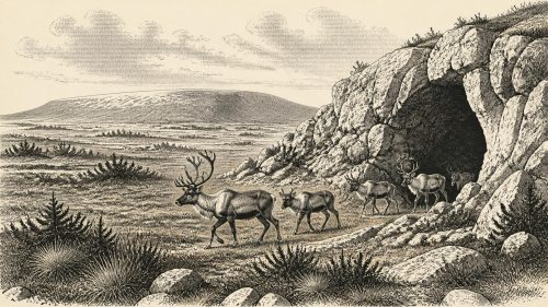
The most provocative evidence is a reindeer femur from Castlepook, excavated in the early twentieth century and held in the National Museum of Ireland. Ruth Carden’s examination identified a deep incision interpreted as a cut made by a sharp stone tool during butchery. County Cork heritage publications associate the bone with about 31,000 BC. If that interpretation is confirmed, it would indicate that a person used a stone edge on a reindeer carcass in Ireland during MIS 3—far earlier than the island’s previously accepted late-glacial evidence for people.
It is an important possibility, not a licence for certainty. No associated stone tool, hearth, dwelling floor, human bone or securely excavated camp of this age has yet been found in Ireland. Castlepook was explored long before modern excavation standards, and the cave’s deposits have been disturbed by carnivores, sediment movement and earlier digging. The cut-mark claim is best treated as evidence for a possible act of carcass processing, not proof of a permanent population, a named archaeological culture or a ‘first settlement’ in the modern sense.
If people did visit, the most defensible interpretation is of small, highly mobile hunter-gatherer parties entering a demanding landscape intermittently. Reindeer offered meat, fat, marrow, hide, sinew and bone; a single processed limb could reflect the selective transport of useful portions rather than a kill beside the cave. This remains inference from a limited record. It should not be expanded into confident claims about population numbers, campsites, hunting weapons or seasonal routines in Ireland itself.
No Kingdoms, No Trade Network
Political affairs, diplomacy and organised warfare are beyond the evidence. There were no Irish kingdoms, borders, chiefs or institutions that can be recovered from Derryvree’s silts or Castlepook’s bones. Nor can archaeology at this date demonstrate religion, formal learning, visual art, language or burial custom in Ireland. The absence of evidence does not establish that Ice-Age visitors had no beliefs, knowledge or social rules; it means that none can responsibly be described as Irish historical fact.
The same restraint applies to economy and trade. A cut-marked reindeer bone, if humanly modified, indicates practical use of animal resources. It does not demonstrate exchange routes, domestication, herding or commerce. Reindeer were wild; farming lay tens of millennia in the future. People elsewhere in Europe made sophisticated stone and organic technologies and maintained social connections across wide territories, but direct evidence is needed before those patterns can be projected onto Ireland.
Before the Ice Peak
The larger regional change was climatic. Derryvree and comparable pre-Last Glacial Maximum evidence show that Ireland was not simply sealed beneath ice throughout the last glacial cycle. At around this point in MIS 3, some areas were ice-free, though cold and environmentally severe; modelling and geological evidence suggest glaciers and ice caps were developing in upland and north-western sectors. The British–Irish Ice Sheet would later expand dramatically, reaching its greatest overall volume around 23 ka BP and transforming both land and sea.
Thus the historical reality of 31,879 BCE is not an event but a threshold. In the north, a buried fen preserves mosses and freshwater sediments from exposed tundra. In the south, cave deposits preserve an animal world of reindeer, hyaenas and mammoths, alongside a debated hint of human butchery. Together they show an Ireland intermittently habitable for cold-adapted wildlife, perhaps occasionally entered by people, but still far from continuous human settlement. The record is fragmentary, its dates broad and its interpretations open to revision; that honesty is central to the story.
Primary Sources
- A Middle Midlandian Freshwater Series at Derryvree, Maguiresbridge, County Fermanagh, Northern Ireland
- Middle Midlandian Interstadial Deposits at Greenagho, Near Belcoo, County Fermanagh, Northern Ireland
- A Reconsideration of the Radiocarbon Dating of the Marine Isotope Stage 3 Fauna from Southern Ireland
- Trimlines, Blockfields and the Vertical Extent of the Last Ice Sheet in Southern Ireland
- Growth and Retreat of the Last British–Irish Ice Sheet, 31,000 to 15,000 Years Ago: the BRITICE-CHRONO Reconstruction
- Growth and Retreat of the Last British–Irish Ice Sheet, 31,000 to 15,000 Years Ago: the BRITICE-CHRONO Reconstruction
- Episodic Speleothem Deposition Tracks the Terrestrial Impact of Millennial-Scale Last Glacial Climate Variability in SW Ireland
- Exploring Controls of the Early and Stepped Deglaciation on the Western Margin of the British Irish Ice Sheet
- Early Deglaciation of the British-Irish Ice Sheet on the Atlantic Shelf Northwest of Ireland Driven by Glacioisostatic Depression and High Relative Sea Level
- Oscillating Retreat of the Last British-Irish Ice Sheet on the Continental Shelf Offshore Galway Bay, Western Ireland
- Advance and Retreat of the Marine-Terminating Irish Sea Ice Stream into the Celtic Sea During the Last Glacial: Timing and Maximum Extent
- Late Pleistocene Chronostratigraphy and Ice Sheet Limits, Southern Ireland
- BRITICE Glacial Map, Version 2: a Map and GIS Database of Glacial Landforms of the Last British–Irish Ice Sheet
- The IntCal20 Northern Hemisphere Radiocarbon Age Calibration Curve (0–55 cal kBP)
- Palaeoecology: Irish Quaternary Association Field Guide
- Archaeological Heritage of County Cork
- Heritage Artefacts of County Cork
- Castlepook Cave, Co. Cork, 2022 Excavation Report
- The Colonization of Ireland: A Human Ecology Perspective
- Ireland: Submerged Prehistoric Sites and Landscapes