
Maguirebridge’s Buried Wetland31799 BCE
Although 31,799 BCE is an artificial precise label, it denotes later Marine Isotope Stage 3, when parts of Ireland were ice-free before the Last Glacial Maximum. At Derryvree near Maguiresbridge, freshwater silts sealed between glacial tills, radiocarbon dated broadly to 36,900–31,700 calibrated years BP, reveal cold open tundra, wetlands and periglacial conditions. Southern caves preserve remains of mammoth, reindeer, giant deer and predators, though mixed deposits cannot provide a single-time census. A possibly tool-marked Castlepook reindeer bone suggests an early human visit, not settlement. Subsequent British–Irish Ice Sheet expansion transformed and obscured these fragile prehistoric landscapes over the following millennia.
Dateline
31,799 BCE is a modern chronological label, not a year that anybody in prehistoric Ireland could have named, recorded or commemorated. It falls roughly 33,750 calendar years before AD 1950, the conventional reference point for “before present” dating. No Irish archaeological layer can be assigned securely to that single year. Radiocarbon determinations measure residual carbon rather than a calendar date, and calibration at this depth of time produces ranges that may extend across centuries or millennia. The responsible subject, therefore, is Ireland during the broad interval around this nominal date: later Marine Isotope Stage 3, within the last Ice Age.
This was not yet the Last Glacial Maximum, when the British–Irish Ice Sheet would expand dramatically across Ireland and its surrounding shelf. Nor was it a familiar island of green fields, forests and settled communities. The evidence instead reveals a shifting, cold landscape in which areas of open ground, wetlands and perhaps local ice existed within a climate capable of changing sharply over long human lifetimes. Much has been erased or disturbed by later ice, rising seas and millennia of erosion. What survives is fragmentary: buried silts, pollen, plant remains, cave bones, landforms and laboratory dates.
Dating an Ice-Age Landscape
The date convention itself needs care. “31,799 BCE” is calculated backwards from the modern calendar and gives an appearance of precision that the evidence cannot match. Archaeologists and Quaternary scientists normally use radiocarbon years BP and calibrated calendar years BP. The internationally used IntCal20 calibration curve reaches back to 55,000 calendar years BP, but it does not turn a sample into a record of a particular season or year. A radiocarbon measurement dates the death of an organism, while the deposition, disturbance and excavation of its remains may all be later.
For this horizon, the most useful Irish chronological evidence comes from sequences that bracket environmental intervals rather than from a dated settlement. The key conclusion is secure in broad outline: parts of Ireland were ice-free during later MIS 3, before the main advance of the last ice sheet. The exact limits of ice, water and habitable ground changed over time and varied from region to region. It would be misleading to picture all Ireland as either an unbroken glacier or a wholly open plain.
Silts Beneath the Drumlin
The clearest local window lies at Derryvree, near Maguiresbridge in County Fermanagh. Roadworks in 1969 cut through a drumlin and exposed freshwater silts and fine sands sealed between two layers of glacial till. The sequence matters greatly. An earlier ice advance had deposited the lower till; a non-glacial freshwater environment then developed; later ice overrode and buried that archive beneath fresh till. The deposits are evidence for a major environmental reversal, not a chronicle of continuous annual accumulation.
Organic material from the Derryvree sediments produced a radiocarbon determination of 30,500 years BP, with a substantial uncertainty. Later calibration places the relevant range broadly at c. 36,900–31,700 calibrated years BP. The nominal date of 31,799 BCE falls within that range, but cannot be located at a precise point in it. Derryvree nevertheless demonstrates that north-central Ireland could support freshwater conditions during this part of the Late Pleistocene, before a later glacial expansion remodelled the ground.
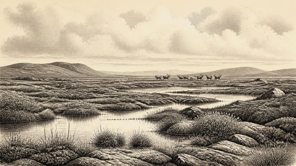
The plant and animal traces from the buried sediments indicate open tundra and periglacial conditions. Grasses, sedges, herbs, mosses and low shrubs were better suited to the landscape than dense woodland. Wet ground lay beside shallow freshwater, while seasonally frozen soil and severe winters shaped drainage and vegetation. Occasional tree pollen should not automatically be read as evidence of local forest: pollen can travel far, and sparse woodland was not the defining character of this environment. This was a biologically active but exposed country, not an empty white wilderness.
Animals in Open Country
Cave assemblages from southern Ireland complement the Fermanagh environmental record. Castlepook Cave, also called Mammoth Cave, near Doneraile in north County Cork, has yielded remains attributed to woolly mammoth, reindeer, giant deer, brown bear, wolf, Arctic fox, mountain hare, lemmings and spotted hyaena. Shandon Cave near Dungarvan in County Waterford has also produced mammoth, reindeer, horse, bear, wolf and hare. Together, such remains show that Ireland intermittently supported a varied cold-stage fauna between at least about 45,000 and 20,000 years ago.
These lists must not be treated as a census of animals alive together in 31,799 BCE. Cave deposits can form over very long periods. Carnivores may carry bones into dens; animals can die in crevices; roof falls, water, sediment movement and early excavations can mix material from different episodes. Some of Castlepook’s oldest collections were recovered in the early twentieth century, before modern methods of fine-grained stratigraphic recording. Recent redating has shown that several earlier radiocarbon results underestimated the antiquity of southern Irish cave fauna, but it has also reinforced the need for caution when reconstructing individual events.
Even so, the fauna gives a credible impression of the food webs available in an open, cold landscape. Reindeer and giant deer browsed or grazed; mammoths required extensive forage; hares and lemmings occupied smaller ecological niches; wolves and hyaenas were predators and scavengers. Their presence suggests seasonal productivity in grassland, herb-rich tundra and wetland margins. It does not establish that every species shared one place at one time, nor that animal abundance made the country easy or safe for people.
The Castlepook Question
A reindeer femur from Castlepook has made this period especially important in Irish archaeology. Re-examination identified a deep linear mark interpreted as consistent with cutting or chopping by a sharp stone tool, perhaps during carcass processing. The bone has been reported as dating to about 33,000 years ago. If the modification was indeed made by people close to the animal’s death, it would indicate a human visit to Ireland far earlier than the long-recognised terminal-Pleistocene evidence from County Clare.
That is an important possibility, not a licence to invent an established Ice-Age population. The specimen came from an old cave collection rather than a modern excavation of an intact camp surface. No securely associated hearth, stone-tool assemblage, shelter floor, burial or repeated occupation horizon of comparable age has yet been recovered at Castlepook. The radiocarbon date dates the animal, not necessarily the making of the mark, its place of killing or the length of any human presence. Ongoing investigation at the cave has located undisturbed fossil-bearing deposits, which may eventually clarify the wider context.
The most defensible interpretation around this date is therefore modest. Small Upper Palaeolithic hunting parties may have reached parts of Ireland during a favourable interval of MIS 3 and may have exploited animal carcasses. They might have arrived across a changing north-west European landscape in which lower sea levels altered coastlines and routes. But there is no direct evidence for a permanent Irish population, a village, a named group or continuous occupation. Whether access was by exposed land, ice, short sea crossings or a combination of routes remains unresolved for this specific phase.
No Kingdoms, No Recorded Wars
Political affairs, diplomacy and formal institutions cannot responsibly be reconstructed for Ireland at this time. There were no written records, no known monuments, no proven settlements and no evidence for territorial states. Nor can conflict be inferred from the mere presence of predators or from damaged bone: gnawing, breakage and carcass scavenging belong first to natural and animal processes. If people were present, their social organisation would have been on the scale of highly mobile hunter-gatherer groups, but that is an inference drawn from wider Upper Palaeolithic contexts, not something demonstrated by an Irish camp.
The same restraint applies to religion, culture, learning, trade and everyday life. There is no Irish evidence from this horizon for ritual structures, art, burial practice, exchange networks, farming, pottery, metalworking or long-term houses. A possible butchered reindeer bone speaks most directly to practical knowledge: the use of a sharp implement on animal tissue and bone. It does not reveal a language, belief system or political identity. The absence of such evidence is not proof that people had no culture; it is a limit on what the Irish record can presently show.
Before the Major Advance
The greatest development relevant to this nominal year was environmental rather than political. Ireland stood within an unstable prelude to the most extensive phase of the last glaciation. During the following millennia, the British–Irish Ice Sheet grew and eventually covered Ireland and much of the continental shelf, reaching maximum extent broadly around 27,000–23,000 calibrated years BP. That later expansion would scour, bury and transform many older landscapes, leaving rare protected pockets such as Derryvree and cave deposits as vital witnesses.
Thus Ireland around 31,799 BCE is best understood through its buried wetland and cave-bone archives: a cold, open, changing land with freshwater refuges and substantial mammals, before the full glacial maximum. The possible Castlepook human trace makes the period unusually significant, but its ambiguity is part of the history. It reminds us that the earliest Irish past is not a sequence of confidently dated events, but a careful reconstruction from evidence that is precious precisely because so little of it survives.
Primary Sources
- A reconsideration of the radiocarbon dating of the Marine Isotope Stage 3 fauna from southern Ireland
- The Irish Quaternary Fauna Project
- A Middle Midlandian Freshwater Series at Derryvree, Maguiresbridge, County Fermanagh, Northern Ireland
- Trimlines, blockfields and the vertical extent of the last ice sheet in southern Ireland
- Growth and retreat of the last British–Irish Ice Sheet, 31,000 to 15,000 years ago: the BRITICE-CHRONO reconstruction
- Maximum extent and dynamic behaviour of the last British–Irish Ice Sheet west of Ireland
- Early deglaciation of the British-Irish Ice Sheet on the Atlantic shelf northwest of Ireland driven by glacioisostatic depression and high relative sea level
- Ireland: Submerged Prehistoric Sites and Landscapes
- The IntCal20 Northern Hemisphere Radiocarbon Age Calibration Curve (0–55 cal kBP)
- IntCal Publications
- The IntCal20 approach to radiocarbon calibration curve construction: a new methodology using Bayesian splines and errors-in-variables
- Palaeoecology
- Cenozoic: Tertiary and Quaternary
- Heritage Artefacts of County Cork
- Archaeological Heritage of County Cork
- 2022:564 – Castlepook Cave, Castlepook South, Cork
- Archaeology Research Excavation Grant 2022: Castlepook Cave Project Final Report
- Irish Cave Exploration
- The Dungarvan Valley Caves Project: First Interim Report
- First evidence of a Late Upper Palaeolithic human presence in Ireland
- New insights on the fauna of Ireland's Younger Dryas and Early Holocene from Alice & Gwendoline Cave
