
Trifoliate Seed Beneath a Drumlin31800 BCE
Circa 31,800 BCE, Ireland lay within the climatically unstable Marine Isotope Stage 3, not a precisely datable historical year. Calibrated evidence from Derryvree, County Fermanagh, records freshwater tundra sediments, including bogbean, between glacial tills, showing locally ice-free, periglacial conditions before later ice expansion. Cave and speleothem records indicate shifting cold environments and intermittent habitats for mammoth, reindeer, giant deer, carnivores and other fauna. A cut-marked Castlepook reindeer bone may suggest a brief Upper Palaeolithic visit, but disturbed context prevents confirmation. No secure evidence supports permanent human settlement, society, culture or political life. Ireland remained an ecologically demanding Ice Age fringe.
Dateline
31,800 BCE cannot be treated as a year in the modern historical sense. No Irish record can identify an event, a ruler, a journey or even a single season at this precise point. The date is best understood as an approximate place within the later Pleistocene: roughly 33,750 calendar years before AD 1950, within Marine Isotope Stage 3 (MIS 3), a highly unstable interval of the last Ice Age. Radiocarbon measurements from this depth of time must be calibrated, and their probability ranges commonly span centuries or millennia. What can responsibly be said is therefore regional and environmental: around this notional date, parts of Ireland appear to have been ice-free, cold and treeless, while the island’s evidence for human presence remains tantalising but unproven.
A Date Within Ranges
The distinction between radiocarbon years and calendar years matters especially here. A determination of 30,500 radiocarbon years before present from organic deposits at Derryvree, near Maguiresbridge in County Fermanagh, has been calibrated in later work to a broad range of about 36,900–31,700 cal BP. “Before present” conventionally means before AD 1950. Thus 31,800 BCE falls near the younger end of the wider calibrated interval, rather than marking a separate archaeological horizon. The Derryvree material is not a diary of 31,800 BCE; it is a deposit accumulated in a cold-stage environment and dated with an uncertainty that must remain visible in any account of the period.
This was MIS 3, an Ice Age phase between approximately 57,000 and 29,000 years ago. It was not a single uniform freeze. Greenland ice-core sequences show repeated, rapid shifts between relatively milder interstadials and colder stadials across the North Atlantic region. Irish cave deposits and buried wetlands indicate that Ireland responded to these swings, though local evidence is far less finely dated than the Greenland record. The future Last Glacial Maximum, when the British-Irish Ice Sheet reached much greater extent, still lay ahead. The timing and pattern of that expansion remain subjects of active research, but the strongest synthesis places the main build-up after about 34,000 years ago and the crossing of Ireland’s south coast by inland ice after about 24,000 years ago.
Derryvree’s Buried Wetland
The most revealing Irish evidence relevant to this moment came to light in road cuttings through a drumlin at Derryvree. Investigators found freshwater silts and fine sands sealed between two thick sheets of glacial till. That position is crucial. The lower till records an earlier advance of ice; the organic-rich sediments preserve an interval in which ice had withdrawn or was absent locally; the upper till shows that ice returned. Later glacial action did not wholly erase the evidence, but it buried it deeply enough for a rare fragment of an older Irish landscape to survive.
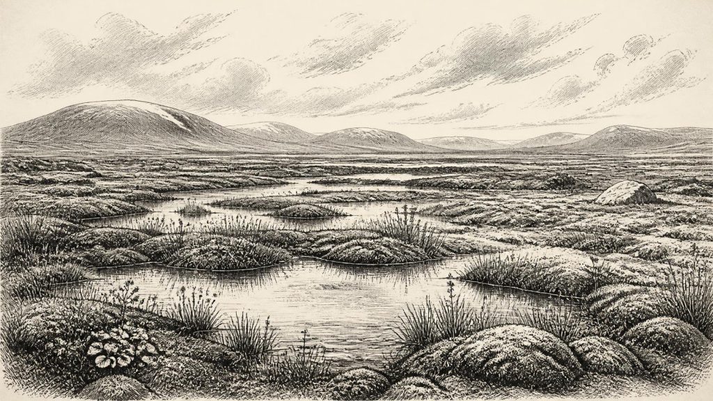
Plant and animal remains in the Derryvree sediments indicate an open tundra and a periglacial regime. “Periglacial” does not mean that a glacier stood in the exact spot. It describes a landscape strongly shaped by severe cold, frost, seasonal thaw and ground instability near or beyond ice margins. The vegetation was not woodland. It included hardy wetland and tundra plants, among them bogbean, Menyanthes trifoliata, whose three-part leaves are familiar around later Irish lakes and bogs. At Derryvree, however, the fossil is evidence for freshwater margins in a sparse, cold environment rather than for the lush, wooded Ireland of later millennia.
Such deposits also correct an easy but misleading image of an entirely ice-buried island. At some points in MIS 3, north-central Ireland contained freshwater hollows, sedge-rich or mossy ground and exposed terrain capable of supporting cold-adapted life. That does not establish a mild climate, a stable ecosystem or continuous habitable land across the island. It demonstrates only that the region represented by Derryvree was not permanently entombed beneath ice during the dated interval.
Cold Ground, Changing Ice
Around the notional date of 31,800 BCE, Ireland was approaching a major transformation. Ice-sheet growth was uneven: uplands, coastal sectors and the Irish Sea basin did not necessarily respond at the same pace. In the Fermanagh record, organic sediments below later till provide strong local evidence for ice-free conditions before the final major expansion. In south-west Ireland, uranium-series dates from speleothems in Crag Cave, County Kerry, show that cave drip water periodically formed calcite during relatively improved climatic episodes of the last glacial cycle. Speleothem growth is not a thermometer and cannot reconstruct an Irish weather forecast for a single year, but it indicates that groundwater circulation and surface conditions sometimes permitted deposition.
The wider landscape would have been exposed to powerful freeze-thaw processes. Seasonal meltwater could pool in shallow basins, while cold winds crossed largely unwooded ground. Soil development was limited, and vegetation cover was thin by later standards. Rivers and streams carried sediment; caves, fissures and hollows trapped bones and organic matter. These were the archives from which the period is now reconstructed. They are partial archives: erosion, ice advance, water movement and nineteenth- and early twentieth-century excavation all mixed or removed much of the original evidence.
The Animal Country
Faunal remains, particularly from Castlepook Cave near Doneraile in north County Cork, show that Ireland supported a more varied large-mammal community during parts of MIS 3 than the bare tundra label alone suggests. The cave’s long and disturbed assemblage includes woolly mammoth, reindeer, giant deer, brown bear and spotted hyaena; later deposits include lemmings, Arctic fox and wolf. Individual bones have dates ranging broadly from about 45,700 to 19,950 years before present. They do not all belong to one moment, and no honest reconstruction should place every species together in a single scene at 31,800 BCE.
Nevertheless, the dated assemblage establishes that cold-stage Ireland could be occupied intermittently by large herbivores and their predators. Reindeer were suited to open, low-vegetation environments. Mammoth and giant deer attest to a landscape with sufficient forage at particular times, while spotted hyaena is an important warning against assuming caves were human shelters. Carnivores can drag prey or scavenged carcass parts into caves; water can subsequently shift bones again. Castlepook was a repository over a very long period, not a neatly sealed hunting camp.
There is no basis for imagining domestic livestock, cultivation, fields or managed herds. The animal economy visible in the fossils was ecological, not agricultural. Nor can seasonal migration routes be mapped confidently from the Irish bones alone. The lowered seas of the Ice Age exposed more of the continental shelf and altered the distances between Ireland, Britain and Europe, but shifting shorelines, channels, glaciers and ice conditions make any particular crossing route uncertain.
The Castlepook Question
The most provocative evidence is a reindeer femur from Castlepook bearing a deep incision identified by zooarchaeologist Ruth Carden as consistent with a sharp stone tool used during carcass processing. A date publicised for the bone places it at about 33,000 years ago, broadly close to the chronological neighbourhood of 31,800 BCE. If the mark is demonstrably anthropogenic and contemporary with the fresh bone, it could indicate a brief Upper Palaeolithic human visit to Ireland far earlier than the island’s securely evidenced post-glacial settlement.
That conditional wording is essential. The femur came from an old cave collection, not from a recently excavated, intact occupation floor. No associated hearth, stone-tool assemblage, dwelling surface, human burial or repeated sequence of butchered remains has yet established a settled community of this age. Cave deposits have complicated formation histories, including carnivore activity, water disturbance and early excavation methods that did not meet modern standards. The marked bone is therefore significant evidence requiring further testing, not a licence to populate Ireland with named hunter bands, permanent camps or a known culture.
The cautious institutional position remains that there is no clear, secure demonstration of Palaeolithic humankind in Ireland. This does not make the Castlepook find unimportant. Rather, it defines the research frontier. Modern fieldwork at the cave seeks undisturbed deposits that might connect animal remains, lithics, charcoal, sediment micromorphology and reliable dates. Until that context is found, a fleeting human incursion is possible; continuous occupation is not established.
No Polity, No Recorded Culture
For this period there is no evidence from which to infer political affairs, diplomacy, collective conflict, kinship systems, religion, language, art, formal learning or social hierarchy in Ireland. There are no houses, graves, monuments, pottery, textiles or securely dated tools that permit such claims. If people did reach the island, they would have belonged to wider Upper Palaeolithic worlds known elsewhere in Europe, but importing their practices wholesale into Ireland would be interpretation rather than evidence.
The same restraint applies to everyday life. A reindeer carcass, if processed by people, could have supplied meat, hide, sinew, marrow and bone; it cannot tell us how many people were present, whether they lived nearby, or why they came. The strongest history of society at this date is consequently a history of limits: mobile animals certainly used parts of the landscape; ice margins and climate changed repeatedly; humans may have appeared briefly; and nothing yet supports a durable Irish population.
A Landscape Before Settlement
The significance of 31,800 BCE lies in that combination of possibility and absence. Ireland was not yet the wooded, settled island of the Mesolithic, still less the farming landscape of the Neolithic or the politically divided island of recorded history. It was a changing north-western fringe of Ice Age Europe, where a freshwater tundra basin could be sealed beneath a drumlin, cave chambers could preserve the traces of mammoth-age fauna, and a single cut-marked bone could reopen a fundamental question about human arrival.
The archaeological lesson is methodological as much as historical. Ireland’s Pleistocene past survives in sediments, fossils, cave calcite and calibrated probability ranges, not in calendar-annal precision. Derryvree’s trifoliate seed and Castlepook’s reindeer bone illuminate real environments and real research problems. They do not, by themselves, yield an event for 31,800 BCE. Their value is that they show an Ireland in motion: intermittently ice-free, ecologically demanding and on the threshold of the more extensive glaciation that would again remodel much of the island.
Primary Sources
- Middle Midlandian Freshwater Series at Derryvree, Maguiresbridge, County Fermanagh, Northern Ireland
- Middle Midlandian Freshwater Series at Derryvree, Maguiresbridge, County Fermanagh, Northern Ireland
- The Irish Quaternary Fauna Project
- The Irish Quaternary Fauna Project
- A Reconsideration of the Radiocarbon Dating of the Marine Isotope Stage 3 Fauna from Southern Ireland
- Episodic Speleothem Deposition Tracks the Terrestrial Impact of Millennial-Scale Last Glacial Climate Variability in SW Ireland
- Spatio-Temporal Dynamics of Speleothem Growth and Glaciation in the British Isles
- Cork CGS Castlepook Cave
- Prehistoric Details: Mell Flint Flake
- Ice Age Ireland: Cool Fossils!
- Trimlines, Blockfields and the Vertical Extent of the Last Ice Sheet in Southern Ireland
- Bayesian Modelling the Retreat of the Irish Sea Ice Stream
- A Stratigraphic Framework for Abrupt Climatic Changes During the Last Glacial Period Based on Three Synchronized Greenland Ice-Core Records: Refining and Extending the INTIMATE Event Stratigraphy
- IntCal20 Northern Hemisphere Radiocarbon Age Calibration Curve (0–55 cal kBP)
- The IntCal20 Approach to Radiocarbon Calibration Curve Construction: A New Methodology Using Bayesian Splines and Errors-in-Variables
- Exploring the Glacial Landscape of the Last British-Irish Ice Sheet in the Celtic Sea: A Review
- Archaeology Research Excavation Grant 2022: Final Report
- 32564: Castlepook Cave, Castlepook, Doneraile, Cork
- Heritage Artefacts of County Cork
- An Inventory of the Areas of Scientific Interest in County Cork: Castlepook Caves
- Advance and Retreat of the Marine-Terminating Irish Sea Ice Stream into the Celtic Sea During the Last Glacial: Timing and Maximum Extent
- Postglacial Variations in the Level of the Sea: Implications for Climate Dynamics and Solid-Earth Geophysics
