Sedges Under Maguiresbridge31790 BCE
Dateline
The label 31,790 BCE offers a useful point of orientation, but it cannot identify an Irish event in a particular twelve-month period. No written record, annual chronology or excavated occupation layer has that resolution. In calendar terms it lies roughly 33,700 years before AD 1950, within the later part of the Late Pleistocene and broadly within Marine Isotope Stage 3 (MIS 3), a volatile phase of the last Ice Age. The responsible evidence comes instead from radiocarbon ranges, cave fauna, pollen and plant remains, insects, sediments, landforms and the cautious interpretation of marks on animal bone. These sources illuminate an environmental horizon, not an anniversary.
A Cold Phase Between Ice Advances
Ireland was not yet simply the ice-covered land of the Last Glacial Maximum. The great maximum expansion of the British–Irish Ice Sheet came later, with different sectors advancing and retreating at different times. Yet this was already a cold world of recurring climatic shifts, local glaciation and expanding ice masses. Recent syntheses emphasise that the ice sheet’s history before its maximum remains less securely dated than its later retreat. There are indications of substantial ice in Ireland and western Britain before 30,000 years ago, but the precise extent, thickness and timing of individual advances are still matters for research rather than settled fact.
This uncertainty matters. It is tempting to draw a single coast-to-coast line across a map and call the island either habitable or frozen. The actual landscape was more changeable. Ice, permafrost, snow cover, exposed ground, freshwater basins and coastal margins could coexist over relatively short distances and change through time. In some areas later glaciers eroded or buried the evidence of earlier conditions. Thus the survival of organic deposits beneath till is exceptional. They are small windows through which archaeologists and Quaternary scientists can see landscapes otherwise removed by ice.
Derryvree’s Freshwater Record
The most evocative Irish window near this broad horizon lies at Derryvree near Maguiresbridge, County Fermanagh. Road works in 1969 exposed organic-rich freshwater silts and fine sands between two layers of glacial till. The deposit produced a radiocarbon determination of 30,500 +1,170/−1,030 radiocarbon years BP. That result must not be converted mechanically into one calendar year: radiocarbon ages require calibration and carry statistical uncertainty. Nevertheless, the Derryvree sequence belongs broadly to the cold middle part of MIS 3 and is directly relevant to understanding Ireland around the early 30,000s BCE.
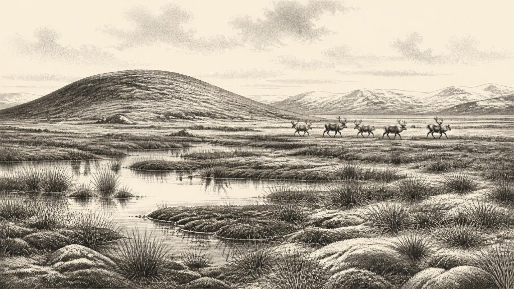
Its contents make the deposit important. Mosses, sedges and other plant remains, together with poorly preserved herb pollen and an insect fauna of northern aspect, indicate open ground around freshwater channels or pools. This was not a wooded Irish landscape. The evidence supports tundra-like or muskeg conditions: wet, mossy, often waterlogged terrain, with sedge-rich vegetation, sparse dry-ground cover and short productive summers. A few grains of tree pollen cannot responsibly be treated as proof of local forest, since pollen may travel long distances or be redeposited from older sediments. What is secure is the contrast with later post-glacial woodland.
Derryvree also corrects an image of the Ice Age as an unchanging white desert. Fresh water was present; plants grew; insects lived in and around the wetland; sediment accumulated in quiet water. Winter conditions may have been severe and the growing season brief, but the ecology was active. Comparable inter-till deposits at Hollymount near Maguiresbridge and Greenagho near Belcoo show that parts of Fermanagh preserve a wider, if discontinuous, record of cold open environments between phases of ice action. Their dates and correlations are imperfect, so they should not be forced into a single neat sequence. Together, however, they establish that northern Ireland experienced habitable, though harsh, ice-age intervals.
Cork Caves and Wandering Animals
In the south, limestone caves near Doneraile in County Cork preserve another kind of archive. Castlepook Cave, also known as Mammoth Cave or Doneraile Cave, yielded a rich assemblage of Late Pleistocene animal remains from historic excavations. The fauna includes reindeer, wolf, Arctic fox and other animals associated with cold, open country; earlier reports from the cave complex also point to a wider large-mammal community including hyaena and mammoth. Such species do not demonstrate that every animal lived together in one season, nor that the cave was a peaceful shelter. Cave assemblages may be accumulated by carnivores, water, scavengers or people over long spans of time.
Even so, the fauna establishes a major regional change. Ireland was not biologically isolated in the way familiar from the modern sea map. Lower global sea levels enlarged the continental shelves and altered coastlines, while animals could move through changing land and maritime corridors in north-west Europe. Reindeer are especially informative because they suggest open vegetation capable of supporting grazing herds. Their movements would have shaped the opportunities of predators and any human visitors. Hyaena and wolf, if present in a cave deposit, also warn against casually calling it a human home: predators often carried carcass parts into dens, leaving teeth marks, broken bone and mixed assemblages.
The cave evidence therefore speaks most confidently about animal geography and environment. It suggests a cold, treeless or lightly vegetated Ireland with sufficient seasonal productivity for large herbivores and their predators. It does not provide a map of territories, a count of animals, or proof that conditions were identical in Fermanagh and Cork. The island’s relief, exposure to Atlantic weather, proximity to ice and local water supply would all have produced regional variation. Indeed, the contrast between wet Fermanagh sediments and Cork’s cave deposits is precisely why both archives are needed.
The Reindeer Femur Question
Castlepook has acquired special historical importance because a reindeer femur from its old collection has been reported as dating to about 33,000 years ago and as bearing an incision interpreted as a cut made by a sharp stone edge during carcass processing. County Cork’s archaeological heritage publication presents the find as evidence for Palaeolithic people butchering reindeer. If the identification of the mark as anthropogenic is confirmed, and if it is securely related to the bone’s age, it would push evidence for human activity in Ireland far earlier than the better-established terminal-Pleistocene evidence.
That conditional language is essential. The bone comes from historic cave work rather than a modern excavation of an intact occupation surface. A date on bone dates the animal’s death within a calibrated range; it does not itself date the moment of cutting, identify the cutter, show where the animal was killed, or prove that the bone entered the cave through human action. Single grooves must be assessed against damage caused by carnivore teeth, trampling, sediment movement, excavation tools, handling and weathering. Current investigation at Castlepook is valuable precisely because it seeks undisturbed deposits, further fauna, lithics and contextual evidence capable of testing this striking claim.
The modest interpretation, if the mark is human-made, is that one or more Upper Palaeolithic people handled a reindeer carcass in Ireland during the broader pre-maximum Ice Age. It could represent a brief visit by highly mobile foragers, perhaps following seasonal animal movements, rather than a permanent settlement. No securely stratified Irish hearth, dwelling, burial, substantial stone-tool assemblage or repeated campsite has yet been demonstrated for this date. There is no basis for naming a people, assigning a language, tracing descent to later populations, or describing an Irish ‘tribe’ at 31,790 BCE.
Society Beyond the Evidence
For that reason, conventional headings such as political affairs, diplomacy and warfare have almost no direct content here. There were no states, kingdoms, borders, rulers, treaties or institutions known in Ireland at this time. Nor is there evidence for organised conflict. A damaged animal bone cannot distinguish hunting, scavenging, exchange, ritual action or violence between people. The absence of evidence should not become a claim that people elsewhere in north-west Europe had no social worlds; Upper Palaeolithic hunter-gatherers certainly depended on co-operation, practical knowledge and relationships. It means only that Ireland’s evidence cannot reconstruct such arrangements for this date.
The same restraint applies to religion, culture and learning. No Irish cave art, carved object, musical instrument, grave or ceremonial site can securely be assigned to this horizon. If people visited, their knowledge of animal behaviour, weather, fuel, stone and safe routes would have been sophisticated, but that is an inference from the demands of survival and from comparative European archaeology, not an observed Irish curriculum or belief system. Reindeer could have supplied meat, hide, sinew, bone and antler; wetlands could have offered water and plant materials. Yet no excavated Irish assemblage of this age permits a detailed reconstruction of diet, clothing or exchange.
Trade is similarly unproven. The wider European Upper Palaeolithic contains long-distance movement of stone, shell and social connections, but no contemporary Irish material establishes an exchange network. Geography does make mobility a reasonable question. Sea level was lower than today, coastlines differed, and Ireland’s position within the north-western European land-and-sea mosaic was not fixed in modern terms. But routes across water or exposed shelf cannot be assumed without direct evidence. The decisive fact is that people, if present, encountered a difficult and changing landscape rather than an empty stage awaiting permanent settlement.
An Environmental History, Not an Annal
The largest development appropriate to 31,790 BCE is therefore environmental. Ireland was moving through a cold, unstable portion of the last glacial cycle. At Derryvree, freshwater silts preserve mosses, sedges and insects from an open northern landscape between ice advances. At Castlepook, animal remains reveal the passage of cold-adapted fauna through southern Ireland. Across the island, later ice expansion would reshape surfaces and destroy much of the older record, making every surviving deposit disproportionately important.
This is also why the possible Castlepook cut mark deserves attention without exaggeration. It opens a serious question about an unexpectedly early human presence, but it is not a foundation for a settled Palaeolithic Ireland. The clearest published direct evidence of human processing in Ireland remains much later: cut-marked brown-bear bone from Alice and Gwendoline Cave in County Clare, dated to about 12,810–12,590 calibrated years BP. The gulf between that late-glacial evidence and the Castlepook possibility cannot be filled with invented generations of inhabitants.
Around this notional year, then, Ireland’s history is written in sediment, bone and ice. The evidence securely identifies a severe but living landscape of waterlogged tundra, roaming animals and climatic change. It may preserve a fleeting human trace. It cannot tell us who those people were, whether they returned, or what happened in this precise year. That limitation is not a failure of history. It is the central historical fact of Ireland at the deep edge of the human past.
Primary Sources
- Early Midlandian–Middle Midlandian, Pleistocene, Northern Ireland
- A Middle Midlandian Fresh-Water Series at Derryvree, Maguiresbridge, County Fermanagh, Northern Ireland
- Middle Midlandian Interstadial Deposits at Greenagho, Near Belcoo, County Fermanagh, Northern Ireland
- An Inter-Till Fresh-Water Deposit at Hollymount, Maguiresbridge, Co. Fermanagh
- Freshwater Organic Deposits and Stratified Sediments Between Early and Late Midlandian (Devensian) Till Sheets, at Aghnadarragh, County Antrim, Northern Ireland
- Palaeoecology: Field Guide No. 16
- Growth and Retreat of the Last British–Irish Ice Sheet, 31,000 to 15,000 Years Ago: the BRITICE-CHRONO Reconstruction
- Growth and Retreat of the Last British–Irish Ice Sheet, 31,000 to 15,000 Years Ago: the BRITICE-CHRONO Reconstruction
- The Timing and Magnitude of the British–Irish Ice Sheet Between Marine Isotope Stages 5d and 2: Implications for Glacio-Isostatic Adjustment, High Relative Sea Levels and ‘Giant Erratic’ Emplacement
- Late Pleistocene Chronostratigraphy and Ice Sheet Limits, Southern Ireland
- Trimlines, Blockfields and the Vertical Extent of the Last Ice Sheet in Southern Ireland
- Dimensions and Chronology of the Last Ice Sheet in Western Ireland
- Radiocarbon Constraints on the Age of the Maximum Advance of the British-Irish Ice Sheet in the Celtic Sea
- Stratigraphic and Palaeo-Geomorphological Evidence for the Glacial-Deglacial History of the Last British-Irish Ice Sheet in the North-Western Irish Sea
- New Data for the Last Glacial Maximum in Great Britain and Ireland
- Pattern and Timing of Retreat of the Last British-Irish Ice Sheet
- Archaeological Heritage of County Cork
- Archaeology Research Excavation Grant Report 2023: Castlepook Cave Project
- The Mesolithic in Ireland: When Was It?
- Irish Pleistocene Biostratigraphy
