Birm-166 Beneath the Drumlin31781 BCE
At the notional date of 31,781 BCE, Ireland lay in Marine Isotope Stage 3, during a cold, changing interval before the Last Glacial Maximum. Derryvree, County Fermanagh, preserves freshwater organic silts between glacial tills, radiocarbon-dated broadly to 36,900–31,700 calendar years BP. Its plants and insects indicate an ice-free, treeless tundra wetland with pools, sedges, herbs and short growing seasons. Elsewhere, expanding ice, altered coastlines and later erosion obscure conditions. Southern cave faunas demonstrate Late Pleistocene animal networks, but cannot date species precisely to this time. No confirmed human remains, artefacts or settlements exist; Ireland’s evidence is environmental, local and uncertain.
Dateline
“31,781 BCE” is a useful modern label, but it cannot describe a year in Ireland in the ordinary historical sense. No calendar, writing, named community or dated human event survives from this remote period. The number corresponds approximately to 33,730 years before AD 1950, the conventional reference point used for “BP” dating. Even that conversion should not be mistaken for precision: radiocarbon results require calibration, their uncertainty ranges can span centuries or millennia, and a sediment layer records an interval rather than a single day. What can responsibly be said is that this notional date falls in the later part of Marine Isotope Stage 3, within Ireland’s Midlandian cold stage and before the fullest expansion of the last British–Irish Ice Sheet.
The best Irish evidence relevant to this point comes not from houses, tools or graves, but from buried mud, plant remains, insect fragments, cave bones and the landforms left by later glaciers. It presents an Ireland that was cold, exposed and environmentally changeable, but not simply a featureless country sealed continuously beneath ice. The evidence is local and incomplete. Its importance lies precisely in showing how much can be recovered from small, unusual archives, while also marking the limits of what cannot be known.
A Date Range, Not a Moment
The principal anchor is a road-cut through a drumlin at Derryvree, near Maguiresbridge in County Fermanagh. Excavations in 1969 revealed organic freshwater silts and fine sands enclosed between two thick, distinct sheets of till: unsorted debris deposited by glacier ice. The sequence gives a clear relative order. An earlier glacier had laid down the lower till; a freshwater environment then developed; and a later advance buried the deposits beneath another till. The organic horizon produced the conventional radiocarbon measurement Birm-166, 30,500 years BP, with a substantial uncertainty of minus 1,030 and plus 1,170 years.
Published discussion has converted that legacy measurement into a broad calibrated range of roughly 36,900–31,700 calendar years BP. The modern label 31,781 BCE lies within that range, but it does not identify the beginning, end or central point of the Derryvree deposit. Nor should the range be treated as a precise weather record for all Ireland. Calibration curves are refined as new evidence becomes available, while old samples and their contexts deserve continuing scrutiny. Nonetheless, the Derryvree sequence is strong evidence that north-central Ireland had ice-free freshwater ground during a cold interval broadly relevant to this date.
This distinction between measured evidence and interpretation matters. The evidence is the stratigraphy, the dated organic material and the biological remains. The interpretation is that they represent a periglacial tundra wetland during a pause between major glacial episodes. “Periglacial” means a landscape powerfully shaped by frost, seasonal freezing and cold-climate processes; it does not require an ice-front to have stood immediately beside the pool at every moment. The later ice cover preserved the fragile silts, but also means that the wider landscape that surrounded them has largely vanished.
Freshwater on Cold Open Ground
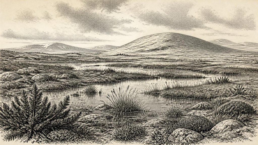
Derryvree was not a forest. Pollen, plant macrofossils, mosses and insects indicate open tundra or muskeg: wet, largely treeless terrain with shallow pools and waterlogged margins. Grasses and sedges formed much of the vegetation, accompanied by low shrubs and hardy herbs. Fossils include bogbean, an aquatic or wetland plant, and mountain avens, a plant now associated in Ireland with arctic-alpine conditions. Evidence for juniper, mosses and plant-rich wet ground further complicates any image of an entirely barren ice-age wilderness. There was freshwater, organic growth and a short but real growing season.
Such a landscape would have been visually unfamiliar beside modern Ireland’s enclosed fields, hedgerows and woodland. Trees were absent or extremely scarce locally, and the ground was likely broken by frost action, wet hollows, sedgy margins and seasonally unstable soils. Winters were severe; summer warmth was limited. Yet the preserved biological remains show that cold did not equal lifelessness. Plants and insects occupied niches around standing or slow-moving water, while the patchwork of dry ground and wetland could change with drainage, snowfall, temperature and the shifting proximity of ice.
The Derryvree deposit is particularly valuable because it records a real Irish place rather than a climate model alone. However, it cannot be enlarged without caution into a map of the whole island. Fermanagh’s interior basins, limestone geology and drainage differed from Atlantic coasts, uplands and the southern lowlands. Pollen can travel, sediments can be reworked, and a wetland favours the preservation of some organisms over others. It is safest to describe Derryvree as a well-attested local window onto a broader cold, open Irish environment, not as a complete portrait of every valley and shore.
Ice Sheet in Formation
This was before the Last Glacial Maximum, conventionally placed at about 26,500–19,000 years ago. Modern reconstructions of the British–Irish Ice Sheet show that its growth was neither instantaneous nor uniform. Research using radiocarbon dating, optically stimulated luminescence, cosmogenic exposure dating, marine cores and glacial landforms suggests that substantial parts of Ireland remained ice-free until about 34,000 years ago, after which the ice sheet expanded greatly. By around 24,000 years ago, ice had reached the southern coast and the adjacent Celtic Sea shelf; later, it covered much of the island.
At approximately 33,730 calendar years BP, therefore, Ireland was entering a long transformation rather than experiencing a single island-wide event. The Derryvree evidence supports ice-free conditions in north-central Ireland during part of this transition. Elsewhere, the size and position of early ice masses are much less securely fixed. Reconstructions are strongest where dated sediments, offshore geomorphology and land-based evidence agree; they are less certain in areas where later ice eroded or buried older traces. It would be wrong to draw a sharp contemporary frontier between “ice-covered Ireland” and “ice-free Ireland” for this nominal year.
Sea level and coastlines were also different from those of today, but the detail most relevant to Ireland remains difficult to reconstruct. Lower global sea level exposed parts of the continental shelf, while ice, sea water and changes in the Earth’s crust affected regional shorelines in complex ways. Whether particular routes between Ireland, Britain and continental Europe were passable at any specific point in Marine Isotope Stage 3 cannot be inferred from Derryvree alone. The responsible conclusion is narrower: geography, ice extent and coastal configuration were changing over long timescales, shaping the potential movement of animals and, in principle, people.
Animals, Caves and Uncertain Associations
Caves in Cork and Waterford provide a second, different kind of evidence. Castlepook Cave near Doneraile, together with Foley and Shandon caves, has yielded remains of animals associated with Late Pleistocene Ireland, including reindeer, mammoth, giant deer, brown bear, wolf and spotted hyaena. These finds establish that a diverse large-mammal fauna reached Ireland during the broader MIS 3 interval. They also indicate that Ireland’s cold landscapes were part of wider ecological networks extending across north-west Europe, rather than an isolated biological world.
But cave assemblages must not be turned into a tidy scene set in 31,781 BCE. Many were excavated in the nineteenth and early twentieth centuries, when recording standards were uneven. Bones may have been moved by carnivores, water, digging or later disturbance; a bone’s age dates the animal’s death, not necessarily the deposition of every object beside it. Crucially, modern redating has found several Castlepook specimens to be 5,000–12,000 radiocarbon years older than earlier determinations suggested. The reassessment indicates that giant deer and spotted hyaena may have disappeared locally before about 40,000 cal BP.
Thus, mammoth, hyaena or giant deer cannot responsibly be asserted as inhabitants of the Derryvree wetland at this particular labelled year. Reindeer and other cold-adapted mammals are plausible components of the wider regional fauna, but the record does not provide an exact census. The caves offer long-range context; Derryvree gives the closer environmental setting. Together they reveal a land in which herbivores, predators, plants and freshwater systems responded to repeated climatic shifts, but they do not supply a photograph of a single season.
No Political History Yet
There is no evidence for a human population in Ireland at this date. Accordingly, there can be no responsible account of political affairs, diplomacy, warfare, settlements, trade, religion, learning or cultural institutions. There were no Irish kingdoms, ethnic communities or languages that archaeology can identify here. It is also unsafe to infer temporary camps merely because large mammals were present: human occupation requires distinctive evidence such as securely contextualised tools, hearths, butchered remains or other traces of activity.
The earliest published evidence for human activity in Ireland is far later: cut marks on a brown-bear patella from Alice and Gwendoline Cave, County Clare, dated to about 12,810–12,590 cal BP. That discovery is important, but it is separated from 31,781 BCE by more than twenty thousand years. The National Museum of Ireland’s caution about the Palaeolithic record remains apt in this earlier context. No confirmed artefact, human remain or occupation deposit currently demonstrates that people were in Ireland during the Derryvree interval.
That absence is itself historically significant, though it must be interpreted carefully. Subsequent glaciers repeatedly scoured, transported and buried landscapes, making evidence exceptionally hard to preserve and find. Absence of known evidence is not absolute proof that no person ever crossed this region. It does mean that a narrative of Irish hunters, camps, kinship or ritual in 31,781 BCE would be invention. The proper subject is the environmental prehistory that preceded later human settlement: cold freshwater pools beneath open tundra, animal movements through a changing north-west European world, and an ice sheet whose eventual growth would reshape almost every surviving trace.
Primary Sources
- A Middle Midlandian Freshwater Series at Derryvree, Maguiresbridge, County Fermanagh, Northern Ireland
- A Reconsideration of the Radiocarbon Dating of the Marine Isotope Stage 3 Fauna from Southern Ireland
- Trimlines, Blockfields and the Vertical Extent of the Last Ice Sheet in Southern Ireland
- Growth and Retreat of the Last British–Irish Ice Sheet, 31,000 to 15,000 Years Ago: the BRITICE-CHRONO Reconstruction
- BRITICE-CHRONO Maps and GIS Data of the Last British-Irish Ice Sheet 31 to 15 ka
- New Data for the Last Glacial Maximum in Great Britain and Ireland
- Maximum Extent and Dynamic Behaviour of the Last British–Irish Ice Sheet West of Ireland
- Radiocarbon Constraints on the Age of the Maximum Advance of the British-Irish Ice Sheet in the Celtic Sea
- Late Pleistocene Chronostratigraphy and Ice Sheet Limits, Southern Ireland
- Sedimentology and Chronology of the Advance and Retreat of the Last British-Irish Ice Sheet on the Continental Shelf West of Ireland
- Stratigraphic and Palaeo-geomorphological Evidence for the Glacial-Deglacial History of the Last British-Irish Ice Sheet in the North-Western Irish Sea
- The Irish Quaternary Fauna Project
- First Evidence of a Late Upper Palaeolithic Human Presence in Ireland
- New Insights on the Fauna of Ireland's Younger Dryas and Early Holocene from Alice & Gwendoline Cave
- Episodic Speleothem Deposition Tracks the Terrestrial Impact of Millennial-Scale Last Glacial Climate Variability in SW Ireland
- A Stratigraphic Framework for Abrupt Climatic Changes During the Last Glacial Period Based on Three Synchronized Greenland Ice-Core Records
- The IntCal20 Northern Hemisphere Radiocarbon Age Calibration Curve (0–55 cal kBP)
- IntCal Publications
- Prehistoric Details: Mell Flint Flake
- Figure 6.— The Subdivision of the Quaternary Period in Ireland
- The Quaternary of Western Ireland
- Menyanthes trifoliata: Fossil Record in Fermanagh
- Dryas octopetala: Fossil Occurrence in Fermanagh
- Myriophyllum alterniflorum: Fossil Occurrence in Fermanagh
- The Problem of a Late Quaternary Landbridge Between Britain and Ireland
