

Derryvree’s Periglacial Pond30309 BCE
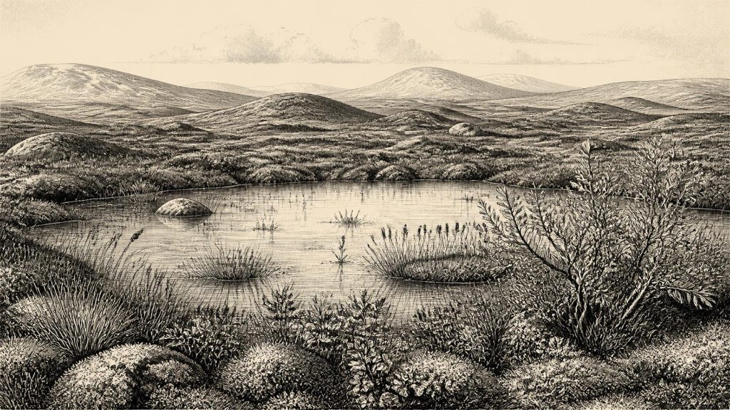
30,309 BCE is not a recoverable Irish historical year but falls within a broadly dated Late Pleistocene interval. At Derryvree, County Fermanagh, roadworks exposed freshwater silts and organic mud between two glacial tills, proving a locally ice-free periglacial phase before renewed glaciation. Fossils of bogbean, water-milfoil, mosses, sedges and cold-adapted plants indicate treeless wetlands amid open, seasonal tundra. Castlepook Cave’s mixed fauna demonstrates intermittent access by Ice Age mammals, while a possibly butchered reindeer bone remains inconclusive evidence of humans. No settlement, polity or annual events can be established. Derryvree preserves fragile environmental evidence of freshwater life during climatic instability.
Dateline
30,309 BCE is a modern chronological label, not a recoverable year in Irish prehistory. No written record, calendar, named community or excavated settlement allows an event to be assigned to this particular year. The appropriate history is therefore a cautious reconstruction of a much wider Late Pleistocene interval, using sediments, fossil plants, animal remains, glacial landforms and scientific dates. Around this numerical horizon, Ireland belonged to the Middle Midlandian part of the last glacial cycle, within Marine Isotope Stage 3: a world of pronounced climatic instability, advancing and retreating ice, and open cold-country habitats.
The nearest exceptionally important Irish evidence comes from Derryvree, near Maguiresbridge in County Fermanagh. It does not describe a single day in 30,309 BCE. Rather, it preserves a sequence of deposits that illuminate an ice-free phase in the region before later glacial activity overwhelmed it. The site offers a rare glimpse of living freshwater and tundra vegetation in an Irish landscape whose earlier deposits were often scoured away or buried by subsequent ice.
A Date Beyond Annual Precision
The numerical year lies roughly 32,250 calendar years before AD 1950, the conventional reference point for ‘before present’ dating. That arithmetic conversion should not be mistaken for an archaeological date. Radiocarbon years and calendar years are not interchangeable, because atmospheric carbon-14 has varied over time. Nor can a single radiocarbon result pinpoint a historical year, particularly this far back in time, where measurement uncertainty and calibration uncertainty are substantial.
At Derryvree, organic material from the freshwater deposits produced the radiocarbon determination BIRM-166: 30,500 ± 1,100 radiocarbon years BP. Modern calibration curves are essential for translating such results into calendar-age probabilities, but the wide error on this older measurement remains decisive. Published calibrations and later discussions place its likely calendar context broadly between about 36,900 and 31,700 calibrated years BP, approximately 34,950–29,750 BCE. Thus 30,309 BCE falls within the broad period to which the Derryvree record may be relevant, but cannot be tied to a particular sediment layer, season, animal or human action.
That distinction matters. The evidence demonstrates an environmental interval, not an annual chronicle. It would be misleading to say that a pond formed, an animal died, or people arrived in Ireland in 30,309 BCE. The responsible conclusion is that, during a broad span embracing this modern label, at least part of Fermanagh was locally free of glacier ice long enough for freshwater sediment, plants and small organisms to accumulate.
Fresh Water Between Two Glaciers
Road works in 1969 cut through a drumlin at Derryvree, some two kilometres north-east of Maguiresbridge. The exposure revealed a remarkable stratigraphic sequence. A lower till, material laid down directly by glacier ice, was overlain by fine sands, silts and organic freshwater mud. Above these lay another substantial till sheet. This order is the firmest historical fact offered by the site: glacier ice had occupied the locality; a non-glacial interval followed, when water and life occupied a basin; and ice later returned or its deposits advanced across the area, sealing the earlier wetland beneath glacial sediment.
The freshwater layer was not a benign woodland lake comparable to a modern Fermanagh lough. Its fossils point instead to a cold, open and periglacial setting. Periglacial means terrain shaped by intense frost, seasonal thaw and ground conditions close to an ice margin, rather than terrain necessarily covered by ice itself. The vegetation was largely treeless. Mosses, sedges, grasses and hardy herbs occupied wet ground and exposed soil; dwarf willow, mountain-avens and lesser clubmoss belong to the cold-adapted flora identified in or associated with this kind of Irish Pleistocene record.
Particularly evocative are remains of bogbean (Menyanthes trifoliata) and water-milfoil. Bogbean is associated with saturated ground and shallow freshwater margins, while water-milfoil indicates standing or slow-moving fresh water. Neither fossil turns Derryvree into a lush oasis. Together, however, they show that even a severe northern landscape could contain pools, marshy edges and a short but productive growing season. Snowmelt, rainfall and shallow drainage channels may have fed such habitats, while sediment settled in quiet water and plant debris became incorporated into mud.
Open Country, Short Seasons
Derryvree’s deposits permit a picture of local ecology, not a complete map of Ireland. The island’s relief, proximity to ice, prevailing winds and drainage would have produced regional variation. Yet the broad image is clear enough: much of the available ground was open, cold and vulnerable to rapid environmental change. There is no evidence here for closed forest, permanent agricultural land or stable soils comparable to those of the later Holocene. Frost action, sparse vegetation, saturated hollows and seasonal water would have shaped movement across the landscape.
Such country was not lifeless. Wetland plants offered cover and forage for small animals; insects and birds could exploit shallow water; and the wider grass-, sedge- and herb-rich mosaic could support grazing mammals when conditions allowed. But productivity was strongly seasonal. Long winters, frozen ground and abrupt climatic deterioration imposed severe limits. The enclosing tills give the record a dramatic final lesson: the wetland was part of a changing glacial landscape, not a permanent refuge.
On the scale of north-west Europe, the decades and centuries around this horizon fell before the fullest extent of the Last Glacial Maximum. Reviews of the British–Irish Ice Sheet generally place its major build-up after roughly 35,000–32,000 years ago, with maximum ice-sheet conditions later, broadly around 27,000–21,000 years ago. These are working regional chronologies rather than a claim that every part of Ireland followed one timetable. They nevertheless explain why Derryvree is so valuable: it records an older ice-free interval within a landscape that would later be extensively glaciated.
Caves, Animals and a Cautious Human Question
Southern Irish caves add a different kind of evidence. Castlepook Cave, near Doneraile in north County Cork, has yielded a notable assemblage of Late Pleistocene fauna, including reindeer, mammoth, giant deer, wolf, fox, Arctic fox, brown bear, lemmings and spotted hyaena. The assemblage demonstrates that Ireland was intermittently accessible to a striking range of cold-stage mammals during the wider period. It does not mean that every species lived together, or that all were present in 30,309 BCE. Cave collections were often recovered by early excavators, and their deposits can combine material from different episodes.
Recent redating has made this warning more important. Improved laboratory methods showed that some Castlepook specimens were much older than earlier radiocarbon results suggested. Researchers therefore treat the cave as important evidence for Marine Isotope Stage 3 fauna, but not as a neatly resolved snapshot of one community. A reindeer femur from Castlepook has been reported as roughly 33,000 years old and as bearing a deep mark interpreted as fresh-bone butchery with a stone implement. If that interpretation is sustained, it would be a very early trace of human activity in Ireland.
For now, it cannot responsibly support a story of an established Irish population. The object is a single bone from an old cave assemblage, not a securely excavated camp floor with associated tools, hearths, dwellings or human remains. It cannot reveal whether people hunted the animal, scavenged it, processed it briefly, travelled in a small party or returned to the island. The first generally accepted direct evidence for human activity in Ireland remains much later: a butchered brown-bear kneecap from Alice and Gwendoline Cave in County Clare, dated to about 12,810–12,590 calibrated years BP.
No Polities, No Proven Trade
There is consequently no evidence for political affairs, conflict, diplomacy, chiefs, tribal territories or formal institutions in Ireland at this horizon. There is likewise no basis for describing religion, language, learning, art, burial custom, exchange routes or a domestic economy. These absences are not proof that no person ever crossed the landscape; they are limits of the surviving record. A possible human encounter with a reindeer would imply practical knowledge of cutting and carcass use, not a demonstrated settlement, trade network or cultural tradition.
If people did reach Ireland during one of these brief Middle Midlandian opportunities, they would have faced a highly mobile subsistence problem: changing shorelines, exposed ground, seasonal animal movements and the risk of renewed glaciation. That is an interpretation grounded in the environmental evidence, not a documented event. Derryvree’s real significance is more fundamental. It preserves proof that, within a volatile Ice Age Ireland, freshwater life endured between episodes of ice advance—and that the island’s deepest past must be told through fragile traces rather than invented annual history.
Primary Sources
- A Middle Midlandian Freshwater Series at Derryvree, Maguiresbridge, County Fermanagh, Northern Ireland
- Pleistocene Glaciations in Ireland
- Extent and Timing of the Last Glacial Maximum (LGM) in Britain and Ireland: A Review
- New Data for the Last Glacial Maximum in Great Britain and Ireland
- Radiocarbon Constraints on the Age of the Maximum Advance of the British–Irish Ice Sheet in the Celtic Sea
- Reconstructing the Last Irish Ice Sheet 2: A Geomorphologically-Driven Model of Ice Sheet Growth, Retreat and Dynamics
- Pattern and Timing of Retreat of the Last British-Irish Ice Sheet
- The Timing and Magnitude of the British–Irish Ice Sheet Between Marine Isotope Stages 5d and 2
- Growth and Retreat of the Last British–Irish Ice Sheet, 31,000 to 15,000 Years Ago
- Deglaciation Chronology of the Donegal Ice Centre, North-West Ireland
- The IntCal20 Northern Hemisphere Radiocarbon Age Calibration Curve (0–55 cal kBP)
- The IntCal20 Approach to Radiocarbon Calibration Curve Construction: A New Methodology Using Bayesian Splines and Errors-in-Variables
- A Reconsideration of the Radiocarbon Dating of the Marine Isotope Stage 3 Fauna from Southern Ireland
- Occurrence of Mammalia Relicts at Site Castlepook Cave
- The Exploration of Castlepook Cave, County Cork
- First Evidence of a Late Upper Palaeolithic Human Presence in Ireland
- New Insights on the Fauna of Ireland's Younger Dryas and Early Holocene from Alice & Gwendoline Cave
- 2019:148 – Alice & Gwendoline Cave, Clare
- The Archaeological Heritage of County Cork
- Our Ancient Landscapes: Hunter-Gatherers in Ireland
- Menyanthes trifoliata L.
- Selaginella selaginoides (L.) P. Beauv.
- Salix herbacea L.
- Myriophyllum alterniflorum DC.
- References and Recommended Reading: Irish Quaternary Association Guide




