
Crag Cave and Derryvree31325 BCE
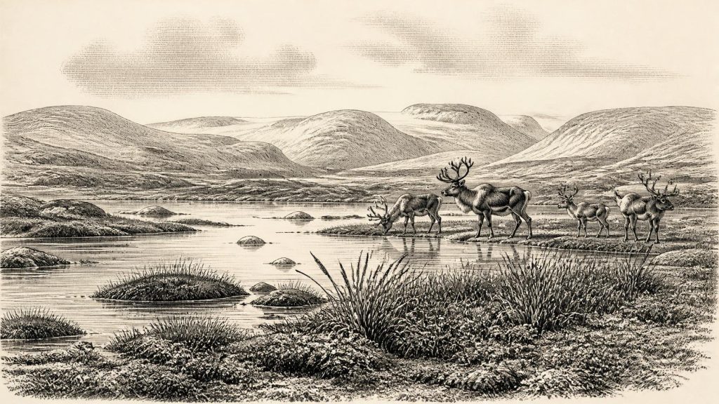
At 31,325 BCE, Ireland was a climatically unstable Late Pleistocene fringe, not a landscape uniformly covered by ice. Derryvree, County Fermanagh, preserves sediments indicating cold, treeless tundra wetlands with freshwater ecosystems before later glaciation. Crag Cave, County Kerry, records intermittent calcite growth, showing milder MIS 3 episodes when liquid water circulated underground. Castlepook Cave, County Cork, contains a complex fauna including mammoth, reindeer, hyaena and other species, demonstrating habitable open environments. A cut-marked reindeer bone may indicate Upper Palaeolithic butchery, but lacks associated artefacts or occupation evidence. No political or settled human society can be inferred; environmental change remains record.
Dateline
Modern calendar-year precision is not available for Ireland in 31,325 BCE. The number is a present-day chronological label, not a date known to anyone then, and no Irish deposit can be assigned responsibly to that single year. In the archaeological convention that counts backwards from 1950, it lies about 33,274 years before present, within the Late Pleistocene and Marine Isotope Stage 3 (MIS 3): a long, cold and highly unstable part of the last Ice Age. The evidence is best expressed in calibrated ranges. It describes changing landscapes, water, ice and animal communities rather than a dated political event, a named people or an Irish ‘society’ recoverable in the ordinary historical sense.
An Island Not Yet Fixed
At this point Ireland was part of the north-western fringe of Europe, but its geographical relationship with Britain and the continental shelf differed greatly from today’s. Global sea level was much lower during the Ice Age, exposing extensive coastal plains and altering routes between western Britain, Ireland and the wider European landmass. That did not mean that a simple, permanent land bridge joined every shore. Coastlines, estuaries, rivers and shallow seas changed repeatedly, while the Atlantic margin imposed formidable weather and travel conditions. Any animal or human movement into Ireland would have depended on a particular combination of sea level, local terrain, season and climate.
Nor was Ireland uniformly entombed beneath ice in 31,325 BCE. The great British–Irish Ice Sheet reached its fullest late-glacial extent later, broadly after about 26,000 years ago. Research on landforms, marine sediments and dates beneath later tills instead indicates a lengthy build-up from more limited or discontinuous ice cover. This distinction matters. The familiar drumlins, moraines and scoured rock surfaces of Ireland largely record the powerful later expansion and retreat of ice, but they should not be projected unchanged onto every earlier millennium. Around the nominated date, conditions varied considerably between regions and through time.
Derryvree’s Buried Wetland
The clearest northern Irish window is Derryvree near Maguiresbridge, County Fermanagh. Road works there exposed organic silts and fine sands trapped between two separate sheets of glacial till inside a drumlin. This sequence is remarkable precisely because later ice sealed and preserved it. Its conventional radiocarbon determination, Birm-166, was 30,500 years before present with a substantial uncertainty; later calibration places the deposit broadly within about 36,900–31,700 calibrated years before present, or approximately 34,950–29,750 BCE. That is a range of millennia, but it securely makes Derryvree relevant to an account of 31,325 BCE.
The plants and small animal remains in these sediments indicate open tundra-like vegetation and a periglacial regime. In plain terms, the landscape supported freshwater and wet ground despite severe cold, while remaining largely treeless. Mosses, sedges, hardy herbs and aquatic plants could occupy pools, marshy margins and seasonally thawed ground. Such evidence does not provide a picturesque snapshot of one day at Derryvree; sediment is accumulated, mixed and preserved over time. Yet it demonstrates an important fact: north-central Ireland had environments capable of sustaining freshwater ecosystems during part of MIS 3 before the later ice-sheet advance covered the district.
That wetland was not a precursor of the modern lakeland in any simple sense. It lay in a cold world shaped by frost, sparse vegetation, unstable soils and nearby or recurrent glacial conditions. Summers may have brought a brief flowering and a productive pulse of insects and wetland growth; winters were far harsher and longer than those of modern Fermanagh. The evidence supports ecological resilience, not environmental comfort. It also cautions against treating ‘Ice Age’ as a single climatic condition. The record preserves a cold interval with liquid freshwater and living vegetation, set between episodes of ice deposition.
Crag Cave’s Climate Signal
Crag Cave in County Kerry supplies a different kind of evidence. Uranium-thorium dating of broken and reworked cave calcite shows that speleothems formed episodically across much of the last glacial period, including MIS 3. Stalagmites and related calcite deposits require water to circulate through soil and limestone above the cave; in this shallow cave system, growth is taken to indicate that mean annual temperatures were generally above the freezing point. The record therefore supports episodes of relative climatic amelioration in south-west Ireland, broadly corresponding with warmer Greenland interstadials.
Crag Cave cannot tell us that every part of Kerry was mild, wooded or inviting at 31,325 BCE. A cave dripstone is a local environmental proxy, and the dated growth episodes have their own uncertainties. Still, alongside Derryvree it overturns a crude picture of an island permanently frozen solid. Ireland experienced abrupt shifts within the wider glacial climate system. In milder phases, water moved through karst, plants generated soil carbon and calcite accumulated underground; in colder phases, those processes diminished or ceased. For any animals—and perhaps people—attempting to use this Atlantic-edge landscape, such fluctuations would have determined where grazing, shelter, water and passable routes were available.
Castlepook’s Animal World
The principal southern Irish faunal archive is Castlepook Cave, also known as Mammoth Cave, near Doneraile in north County Cork. Finds recovered from its deposits include woolly mammoth, reindeer, brown bear, hare, fox, lemming and spotted hyaena, as well as giant deer in the wider assemblage. Reassessment using improved radiocarbon procedures has shown that some older Irish cave dates require caution, but it has also strengthened the case that important elements of the Castlepook fauna belong to MIS 3. The cave testifies to an Irish landscape that could support large herbivores and their predators before the Last Glacial Maximum transformed much of the island.
A cave bone is not automatically proof that an animal lived or died exactly where it was found. Carnivores can drag carcass parts into caves; scavengers, water and later disturbance can rearrange them; early excavations did not always record contexts to modern standards. Castlepook is especially valuable because it forces this taphonomic discipline. Spotted hyaena remains, for example, make a carnivore-den explanation plausible for part of the accumulation. The bones nonetheless demonstrate that an ecological network, including large grazers and scavenging or hunting carnivores, reached Ireland during this period. They do not establish a continuous, island-wide population of every species.
A Narrow Human Possibility
One reindeer femur from Castlepook has given 31,325 BCE unusual significance. It has been reported as dating to about 33,000 years ago and bears a deep mark interpreted by zooarchaeologist Ruth Carden as a stone-tool incision made during carcass processing. If that reading is confirmed by further work, it would be evidence for a human visit to Ireland during the Upper Palaeolithic—tens of thousands of years earlier than the long-accepted record of post-glacial settlement. A person with a sharp stone edge may have removed meat or separated tissue from a reindeer limb.
The claim must, however, be stated exactly. Dating the bone dates the animal’s surviving organic material, not independently the moment when a mark was made. The mark does not identify its maker, show whether people killed the reindeer or scavenged it, locate a camp, or reveal how long visitors remained. Nor has the bone produced a securely associated tool assemblage, hearth, dwelling floor, burial or repeated occupation layer. Recent excavation and archival research at Castlepook aim to obtain the stratified evidence needed to test the proposition. For now, it is responsible to describe a plausible but limited indication of human butchery, not the foundation of a settled Irish population.
No Politics, but Real Adaptation
There is consequently no evidence from Ireland at this date for political communities, leaders, warfare, diplomacy, formal religion, language, trade institutions or organised learning. Assigning any such features would invent a past that the material record cannot sustain. If humans did enter Ireland, their lifeways would have been those of highly mobile Upper Palaeolithic foragers, reliant on detailed knowledge of animal behaviour, stone-working, shelter, fire and seasonal conditions. This is an inference from the wider European archaeological context, not a direct description of a documented Irish group.
The economy visible in Ireland is therefore ecological rather than commercial: plants converting short growing seasons into forage; reindeer and other herbivores moving through open country; predators and scavengers following them; water sustaining wetland niches; and people, if present, taking a fleeting opportunity within that system. No reliable Irish evidence permits claims about exchange networks, ritual practice, art or permanent settlement. The most important regional development was environmental volatility itself. Ireland was an intermittently habitable glacial margin, not yet the island of farms, monuments and recorded communities familiar from later prehistory.
What This Date Can Mean
31,325 BCE should thus be read as a point within overlapping scientific chronologies rather than an anniversary. Derryvree provides a calibrated bracket for cold, open freshwater landscapes in Fermanagh; Crag Cave records episodes when liquid water and calcite growth returned to south-western Ireland; Castlepook preserves a rich but complex pre-maximum faunal archive and a possible trace of butchery. Together they reveal an Ireland of tundra wetlands, caves, mobile animals and changing ice margins. They also show why restraint is part of good history: absence of a named community is not evidence that no person ever arrived, but the surviving record is far too slight to turn a marked bone and a few environmental archives into a year-by-year human story.
Primary Sources
- A Middle Midlandian Freshwater Series at Derryvree, Maguiresbridge, County Fermanagh, Northern Ireland
- A Reconsideration of the Radiocarbon Dating of the Marine Isotope Stage 3 Fauna from Southern Ireland
- Episodic Speleothem Deposition Tracks the Terrestrial Impact of Millennial-Scale Last Glacial Climate Variability in SW Ireland
- Trimlines, Blockfields and the Vertical Extent of the Last Ice Sheet in Southern Ireland
- Late Pleistocene Chronostratigraphy and Ice Sheet Limits, Southern Ireland
- Radiocarbon Constraints on the Age of the Maximum Advance of the British-Irish Ice Sheet in the Celtic Sea
- Extent and Deglacial Chronology of the Last British–Irish Ice Sheet: Implications of Exposure Dating Using Cosmogenic Isotopes
- Growth and Retreat of the Last British–Irish Ice Sheet, 31,000 to 15,000 Years Ago: The BRITICE-CHRONO Reconstruction
- Spatio-Temporal Dynamics of Speleothem Growth and Glaciation in the British Isles
- New Insights on the Fauna of Ireland’s Younger Dryas and Early Holocene from Alice & Gwendoline Cave
- Archaeology Research Excavation Grant 2022
- Castlepook Cave, Co. Cork: Excavation Report 2022
- The Irish Quaternary Fauna Project
- The Subdivision of the Quaternary Period in Ireland
- Dimensions and Chronology of the Last Ice Sheet in Western Ireland
- Response of the Irish Ice Sheet to Abrupt Climate Change During the Last Deglaciation
- Late Quaternary Stratigraphy and Glacial History of Southern Ireland
- Advances in Irish Quaternary Studies
- Quaternary Geology and Geomorphology Data, Geological Survey Ireland
- Irish Quaternary Association Publications
