
Hyenahall’s Long Bone Record31164 BCE
31,164 BCE is a modern label within an uncertain Late Pleistocene chronology, not a datable Irish event. At Derryvree, County Fermanagh, freshwater sediments between glacial tills indicate a cold, open, tundra-like wetland supporting plants, insects and animals during an ice-free interval. Ireland experienced regional environmental variation as ice advanced towards its later maximum, while changing sea levels and land deformation made connections uncertain. Castlepook Cave, County Cork, preserves diverse animal remains, including mammoth, reindeer, hyaena and bear, accumulated over millennia. A marked reindeer femur may suggest brief human carcass processing, but cannot demonstrate settlement, leaving environmental evidence still predominant overall.
Dateline
The label 31,164 BCE is a modern chronological convenience, not a recoverable Irish year. No calendar, written record or archaeological sequence can identify an event, person or season at that level of precision. In conventional archaeological terms it falls about 33,100 years before AD 1950, during the Late Pleistocene and Marine Isotope Stage 3. The responsible way to describe Ireland at this point is through broad calibrated ranges, geological layers and cautiously interpreted animal remains. The nearest evidence does not yield a national snapshot. It instead reveals particular places—especially a buried wetland in County Fermanagh and a cave system in north County Cork—whose deposits preserve fragments of a changing Ice Age world.
A Date Within Wide Ranges
Radiocarbon dating is essential to this history, but it does not transform it into an annal. A conventional radiocarbon measurement must be calibrated against changing atmospheric carbon levels before it can be compared with calendar years. Even then, uncertainties for material this old commonly extend across centuries or millennia. The modern date 31,164 BCE therefore belongs within a broad chronological neighbourhood, rather than marking the start or end of any identifiable Irish development.
The most useful nearby environmental sequence is at Derryvree, near Maguiresbridge in County Fermanagh. Road construction in 1969 exposed freshwater silts and fine sands caught between two thick tills within a drumlin. Till is sediment deposited directly by ice; its position above and below the organic layer shows that glacier ice affected the locality, then a freshwater environment developed, and later ice buried it. The organic deposits produced a conventional radiocarbon determination of 30,500 years BP, with a substantial uncertainty. Later calibration has placed the evidence broadly within roughly 36,900–31,700 calendar years BP. That range overlaps the nominal date considered here, but it cannot prove what was happening at Derryvree in one particular year.
This distinction is more than technical. The stratigraphy securely demonstrates an interval when this part of Fermanagh was not overridden by ice and supported water, plants and animals. Its exact duration, its relationship to wider climate fluctuations and its precise correlation with deposits elsewhere remain matters of reconstruction. Ireland’s ice cover did not necessarily advance or retreat evenly. Local evidence should not be turned into a simple island-wide map.
Derryvree’s Cold Wetland
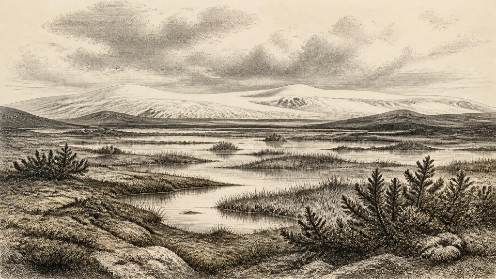
The Derryvree fossils nevertheless give unusually vivid evidence for the kind of landscape available during part of this late Ice Age interval. Pollen, plant macrofossils, mosses and insect remains indicate open, treeless vegetation in a severe periglacial setting. Grasses, sedges, juniper and herbs occurred alongside mosses; aquatic and wetland plants show that shallow freshwater persisted during at least the productive part of the year. The published interpretation is a cold, waterlogged tundra-like mosaic, often described as muskeg: pools, mossy margins, sedge-rich ground and patches of sparsely vegetated mineral soil.
That is not evidence for a featureless Arctic desert. The presence of freshwater organisms and plant matter points instead to ecological variety at a small scale. A shallow pool, wet hollow or sheltered margin could support life even where winter cold, frost disturbance and a brief growing season limited trees and dense vegetation. Yet Derryvree records one lowland basin, preserved by exceptional circumstances. It cannot tell us whether every ridge, valley and coast of Ireland looked the same. Nor can a few surviving pollen grains establish a forest: the combined evidence strongly favours open country rather than woodland.
The later burial of the deposit is equally important. Renewed glaciation protected the freshwater sediments beneath younger till, but the ice also reshaped and removed enormous amounts of older ground surface. This helps explain the scarcity of early archaeological sites. Any camps on exposed land might have been eroded, transported, submerged, buried beneath sediments or simply remain undiscovered. Absence of a settlement record is not proof that no person ever reached Ireland, but it means that permanent occupation cannot responsibly be inferred.
Ice Was Growing, Not Fixed
At this point in the wider last glacial cycle, Ireland stood before the fullest expansion of the British–Irish Ice Sheet. The global Last Glacial Maximum is usually placed about 26,500–19,000 years ago, while maximum ice positions in different Irish and British sectors were not simultaneous. Research on the ice sheet shows advances, retreats and locally different margins rather than one unchanging blanket of ice. Later maximum expansion covered all, or nearly all, Irish low ground and extended far onto the surrounding continental shelf, but that later landscape must not be projected unchanged back onto 31,164 BCE.
Evidence from western Ireland also suggests substantial ice-sheet loading and fluctuating marine conditions before the Last Glacial Maximum. Meanwhile, Derryvree and other northern sites preserve indications of ice-free or less heavily glaciated intervals during Marine Isotope Stage 3. Taken together, these records support an Ireland of regional contrasts and rapid environmental change. Some areas were occupied by ice or lay close to its margins; elsewhere, cold freshwater basins and animal habitats existed. The precise configuration at the modern notional date is not known.
Sea level was lower globally than today because much water was locked in ice sheets, but local relative sea level depended also on the weight of ice depressing the land and on changing coastlines. Consequently, it is unsafe to picture a straightforward, permanent land bridge linking Ireland to Britain or continental Europe. People and animals may have crossed landscapes and coastal zones very different from those of today, but the available Irish evidence does not identify a route, a crossing date or a regular migration corridor.
Castlepook and the Animal Record
Far to the south, Castlepook Cave near Doneraile in County Cork—also known as Mammoth Cave—holds Ireland’s richest known assemblage of vertebrate remains from the period leading towards the Last Glacial Maximum. Early excavators named chambers such as Hyenahall and Elephant Hall, memorable names that reflect the striking material recovered there. More than 2,000 bones have been recorded, and radiocarbon determinations from the cave span a long interval, from about 45,700 to 19,950 years BP.
The cave has yielded remains attributed to woolly mammoth, giant deer, reindeer, brown bear and spotted hyaena, with Arctic fox, wolf and lemmings among later Ice Age fauna. These species demonstrate that Ireland could support, or at least receive, cold-adapted and open-country mammals during parts of the Late Pleistocene. Reindeer in particular fit an open, seasonal grazing landscape; hyaenas and wolves remind us that large carcasses entered a food web involving predators, scavengers and dens.
But Castlepook is a repository, not a single moment sealed in time. Cave bones may have been dragged in by carnivores, accumulated through natural deaths, moved by water or disturbed by excavation. The species list should therefore not be read as a herd standing together in Cork in 31,164 BCE. Nor does it prove that all animals were present at the same time. Its real value is longer-term: it establishes that changing Irish environments during this phase were intermittently accessible to substantial mammals and carnivores.
The Reindeer Femur Question
One Castlepook object has particular bearing on human history. A reindeer femur in the old collection has been publicly reported as dating to about 33,000 years ago and bears a deep surface mark interpreted by zooarchaeologist Ruth Carden as damage made by a sharp stone tool during carcass processing. If that reading is confirmed, it would be remarkable evidence that people handled a reindeer in Ireland during the Upper Palaeolithic, many millennia before the better-attested post-glacial settlement record.
Its limits are just as important as its promise. The bone derives from an old cave collection, not a modern excavation of an intact occupation floor. No securely associated stone-tool assemblage, hearth, dwelling, burial, artwork or repeated sequence of human activity of this age has been established at Castlepook. The animal’s date identifies when the reindeer lived; it does not, by itself, identify the person who may have marked it, where processing occurred, whether the animal was hunted or scavenged, or how long anyone stayed.
The most restrained interpretation is therefore a possibility of brief human visitation and carcass processing, not a settled population and certainly not a named community. There is no evidence from Ireland at this date for political institutions, warfare, diplomacy, farming, pottery, metalworking, trade networks or formal religious monuments. There are likewise no grounds for assigning language, ancestry or ethnicity to any possible visitors. If humans were present, they were most plausibly highly mobile foragers using stone cutting edges and making decisions within an unstable cold-climate environment; that remains an inference, not a directly observed social world.
What Everyday Life Cannot Yet Reveal
For this period, the environment is the principal history. Derryvree shows cold freshwater habitats and open vegetation; Castlepook records a long sequence of animal life and carnivore activity; glacial research shows an island entering a phase of major ice-sheet growth. These sources illuminate survival conditions rather than domestic routines. There are no houses from which to reconstruct family life, no hearths to identify meals, no textiles, no burials and no tools securely tied to this date in Ireland.
That restraint does not make the period empty. It reveals a deeply altered Ireland: an island or near-island of shifting coastlines, exposed cold ground, wetlands, grass and sedge habitats, large herbivores and powerful scavengers, increasingly constrained by expanding ice. The evidence also shows why later landscapes conceal so much of this earlier past. Around 31,164 BCE, Ireland’s story is not one of kingdoms or events. It is the difficult, compelling history of environments briefly preserved between advances of ice, and of a single marked bone that asks—without yet conclusively answering—whether people were among them.
Primary Sources
- A Middle Midlandian Freshwater Series at Derryvree, Maguiresbridge, County Fermanagh, Northern Ireland
- Palaeoecology: Irish Quaternary Association Field Guide
- Trimlines, Blockfields and the Vertical Extent of the Last Ice Sheet in Southern Ireland
- Radiocarbon Constraints on the History of the Western Irish Ice Sheet Prior to the Last Glacial Maximum
- Growth and Retreat of the Last British–Irish Ice Sheet, 31 000 to 15 000 Years Ago: the BRITICE-CHRONO Reconstruction
- Timing and Pace of Ice-Sheet Withdrawal Across the Marine–Terrestrial Transition West of Ireland During the Last Glaciation
- Stratigraphic and Palaeo-Geomorphological Evidence for the Glacial-Deglacial History of the Last British-Irish Ice Sheet in the North-Western Irish Sea
- Extent and Deglacial Chronology of the Last British–Irish Ice Sheet: Implications of Exposure Dating Using Cosmogenic Isotopes
- Last Glacial Maximum Cirque Glaciation in Ireland and Implications for Reconstructions of the Irish Ice Sheet
- Dimensions and Chronology of the Last Ice Sheet in Western Ireland
- Late Pleistocene Chronostratigraphy and Ice Sheet Limits, Southern Ireland
- Castlepook Cave, County Geological Site Report
- Heritage Artefacts of County Cork 2021
- Archaeology Research Excavation Grant 2022: Final Report
- Castlepook Cave, Co. Cork, Excavation Report 2022
- Ireland’s Palaeolithic Archaeology – Fleeting Footprints in a Frozen Land
- New Insights on the Fauna of Ireland’s Younger Dryas
- The Irish Quaternary Fauna Project
- Landscapes and Environments of the Last Glacial-Interglacial Transition: a Time of Amazingly Rapid Change in Ireland
- The Glacial Deposits of the Maguiresbridge Area, County Fermanagh
