
Cork’s Earliest Butchery Debate31163 BCE
31,163 BCE is a modern nominal date, for which Irish archaeology cannot identify events precisely. Evidence instead depicts Late Pleistocene Ireland as a fluctuating, increasingly cold landscape before maximum glaciation. Derryvree, County Fermanagh, preserves an ice-free freshwater tundra wetland, supporting sparse cold-adapted vegetation and animals. Castlepook Cave, County Cork, contains faunal remains, but disturbed deposits prevent their treatment as a single moment. A reindeer bone may indicate human butchery about 33,000 years ago, though it proves neither settlement nor hunting. Ice growth varied regionally, while sea exposure complicated animal and human movement. Subsequent glaciation buried, eroded and obscured much evidence.
Dateline
31,163 BCE is a modern calendar label, not a date that can be recovered from the Irish archaeological record. It corresponds only approximately to 33,100 years before AD 1950, within the Late Pleistocene and Marine Isotope Stage 3. No Irish deposit can identify a particular year, season, person or happening at this distance. Radiocarbon ages carry statistical uncertainty and must be calibrated; sediment layers and animal bones commonly represent longer intervals still. The responsible question is therefore not what occurred in Ireland in this nominal year, but what securely dated evidence can illuminate the island during the surrounding millennia.
That evidence places Ireland in a changing Ice Age world, before the fullest development of the last Irish Ice Sheet. The island was neither a settled country nor an empty abstraction. It was a northern Atlantic landscape in which ice, exposed ground, water, plants and animals repeatedly altered their ranges. A small number of cave deposits, organic beds beneath later glacial sediments, landforms and palaeoclimate records allow a cautious reconstruction. They do not supply a conventional political or social history.
A Date Without Annual Precision
The nearest useful chronological anchors are broad calibrated ranges. At Derryvree near Maguiresbridge, County Fermanagh, freshwater silts and fine sands sealed between two tills produced the conventional radiocarbon determination BIRM-166, 30,500 +1,170/−1,030 radiocarbon years BP. Later discussion places its calibrated range at roughly 36,900–31,700 years ago. That broad span embraces the notional date of 31,163 BCE, but it does not prove that the wetland existed unchanged throughout it, or that every fossil within it is exactly contemporary. What it securely demonstrates is an interval when this part of Fermanagh was ice-free enough for freshwater sedimentation before renewed ice overran the area.
There is a comparable need for restraint at Castlepook Cave near Doneraile in north County Cork. Its deposits have yielded one of Ireland’s most important collections of Ice Age animal remains, but antiquarian excavation, mixed cave sediments and later disturbance mean that the assemblage is not a snapshot. Mammoth, reindeer, giant deer, brown bear, wolf, fox, lemmings and spotted hyaena are evidence that such animals reached Ireland during parts of the Late Pleistocene; they cannot all automatically be placed in one herd, one season or even one climatic phase. The Irish Quaternary Fauna Project made precisely this point by re-dating specimens and exposing the limits of older provenances.
An Island Entering a Colder Phase
By about 33,000 calibrated years ago, the last glaciation was intensifying, but Ireland had not yet reached the familiar maximum extent of ice usually placed around 27,000–23,000 years ago. Recent ice-sheet modelling treats 32,000–23,000 years ago as a build-up phase that differed substantially between regions. At around 31,000 years ago, the model simulations show smaller ice caps on high ground in north-west Ireland rather than a single, fully developed ice sheet covering the whole island. After that point, separate ice masses expanded and merged rapidly. This is a model-based reconstruction, not direct proof of the exact ice margin in every Irish valley.
Other evidence makes the picture more complicated, and more interesting. Marine microfauna and shells from western Ireland indicate substantial ice loading between about 40,000 and 19,000 calibrated years ago, while geomorphology shows that the eventual ice sheet advanced to the continental shelf edge in several sectors. Ice expansion was asynchronous: a coastline, upland or basin could have had a different history from another part of the island. Thus no single sentence such as ‘Ireland was ice-covered’ can responsibly describe every location around 31,163 BCE.
Sea level was lower globally than today, yet lower water did not necessarily create an easy terrestrial corridor to Britain or continental Europe. Ireland’s surrounding seabed drops comparatively quickly, and reconstructions suggest that maximum exposure around much of the island may have extended only about 30 kilometres beyond the modern shore. Ice, sea ice, channels and local relief all mattered. Animal movement between Ireland, Britain and the European mainland was possible at favourable times, but the route, frequency and seasonality cannot be reconstructed from bones alone.
Fermanagh’s Open Wetland
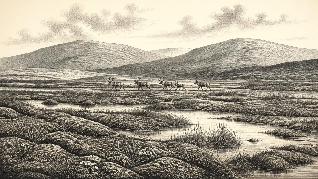
Derryvree supplies the clearest local environmental evidence close to this nominal date. The road cutting revealed a freshwater bed preserved beneath a drumlin: a chance exposure of a landscape later buried and reshaped by moving ice. Its plant and animal remains indicate open tundra vegetation and a periglacial climate. Insects point to a moss-rich, waterlogged setting with open pools and abundant plant matter, rather than to a dense forest or a featureless frozen desert. The site records a particular wetland basin, not the whole island, but it makes an invaluable correction to the notion that Ice Age Ireland was uniformly sterile.
The vegetation was sparse and cold-adapted. Herb pollen, moss macrofossils and aquatic plants indicate ground capable of supporting seasonal growth where liquid water persisted. The old deposits have also mattered to modern biogeography: the fossil record at Derryvree includes evidence relevant to Ireland’s Arctic-alpine flora, including fringed sandwort. Such finds show that plant communities could survive in sheltered, moist local habitats even within a generally severe climate. They do not demonstrate woodland, farming, deliberate cultivation or permanent human management.
For grazing animals, an open mosaic of herbs, grasses, sedges, mosses, wet hollows and better-drained ground could offer forage, although conditions must have been harsh and unstable. Reindeer were well adapted to cold, open country. Mammoths elsewhere in northern Europe occupied open or semi-open tundra-steppe habitats during Marine Isotope Stage 3, and their Irish remains make a broadly similar habitat plausible during some intervals. Giant deer, predators and scavengers would have depended on the same shifting ecological network. This remains an interpretation from fossils, ecology and regional comparison, not a census of animals in Ireland in one year.
The Marked Reindeer Bone
The most arresting human question is a reindeer femur from Castlepook. It has been presented as bearing a groove made by a sharp stone tool and as dating to about 33,000 years ago. If that identification is accepted, it is evidence that a person or people processed a reindeer in Ireland during the broad period represented by this article. It would push the island’s known human story far earlier than the later Mesolithic settlement.
Yet the claim must remain carefully bounded. The object is a single worked bone from a cave collection, not a sealed occupation floor. No securely associated hearth, stone-tool assemblage, dwelling, burial, repeated butchered assemblage or human remains of comparable age has been recovered from Castlepook. A tool mark may record a brief visit, scavenging or butchery at another location before the bone entered the cave; it cannot establish a resident community. The cave’s mixed deposits also require continued re-examination with modern dating and taphonomic methods. Recent work on other Irish cave collections has shown why direct dating, sediment history and the routes by which bones entered a cave are decisive.
Even a genuine butchery mark does not reveal whether the animal was hunted, found dead, taken from another predator or obtained by people passing through a wider Irish-British landscape. Nor does it disclose language, kinship, population size or cultural affiliation. Contemporary Upper Palaeolithic communities elsewhere in Europe possessed sophisticated stone technologies, social ties and symbolic practices, but importing those characteristics into Ireland without an Irish assemblage would be speculation.
No Polity, No Trade Network
There is no evidence for political authority, territories, diplomacy, warfare, chiefs, ritual monuments, formal religion or institutions in Ireland at this time. Nor can archaeology identify an Irish economy in the later historical sense. No farms, fields, houses, storage pits, pottery or exchange goods belong to this horizon. The most that can be said is that wild animals moved through, and perhaps people occasionally entered, a landscape whose available resources were governed by climate and ice.
If visitors did reach Ireland, everyday survival would have demanded mobility, knowledge of animal behaviour, fuel and shelter, and an ability to move through a dangerous seasonal environment. That is a reasonable inference from Ice Age conditions, not direct Irish evidence. It should not be converted into imagined camps on every shore, fur-clad families beneath every limestone overhang, or an established hunting territory centred on Castlepook.
What This Moment Means
The importance of the period around 31,163 BCE lies in transition. Derryvree records ice-free tundra wetland in Fermanagh before later burial beneath ice-related deposits. Castlepook demonstrates that Ireland formed part of a wider Late Pleistocene animal world and preserves a tantalising, still limited case for human action. Cave calcite from Crag Cave in Kerry independently records episodes when liquid water could circulate underground during Marine Isotope Stage 3, reinforcing the conclusion that the climate fluctuated rather than remaining uniformly glacial.
Within a few thousand years, expanding ice would remodel much of the island, erode older surfaces and destroy or conceal much of the evidence needed for a fuller story. That destructive power is itself why the surviving wetland silt, cave bone and calcite matter so much. Ireland around this notional year was not a nation awaiting history. It was a changing northern landscape, intermittently habitable for plants and animals, perhaps briefly visited by people, and already entering the long advance towards the last glacial maximum.
Primary Sources
- A Middle Midlandian Freshwater Series at Derryvree, Maguiresbridge, County Fermanagh, Northern Ireland
- Growth and Retreat of the Last British–Irish Ice Sheet, 31,000 to 15,000 Years Ago: The BRITICE-CHRONO Reconstruction
- Behavioural Tendencies of the Last British–Irish Ice Sheet Revealed by Data–Model Comparison
- Extent and Timing of the Last Glacial Maximum (LGM) in Britain and Ireland: A Review
- Radiocarbon Constraints on the History of the Western Irish Ice Sheet Prior to the Last Glacial Maximum
- Late Pleistocene Chronostratigraphy and Ice Sheet Limits, Southern Ireland
- Last Glacial Maximum Cirque Glaciation in Ireland and Implications for Reconstructions of the Irish Ice Sheet
- Dimensions and Chronology of the Last Ice Sheet in Western Ireland
- Dynamic Cycles, Ice Streams and Their Impact on the Extent, Chronology and Deglaciation of the British–Irish Ice Sheet
- The Timing and Magnitude of the British–Irish Ice Sheet Between Marine Isotope Stages 5d and 2
- Episodic Speleothem Deposition Tracks the Terrestrial Impact of Millennial-Scale Last Glacial Climate Variability in SW Ireland
- The Irish Quaternary Fauna Project
- On the Cave of Castlepook, Near Doneraile, Co. Cork
- New Insights on the Fauna of Ireland’s Younger Dryas and Early Holocene from Alice & Gwendoline Cave
- Sedimentary Ancient DNA Reveals Late Pleistocene Faunal Connectivity Between Ireland and Eurasia
- Ireland: Submerged Prehistoric Sites and Landscapes
- Deglaciation, Earth Crustal Behaviour and Sea-Level Changes in the Determination of Insularity: A Perspective from Ireland
- The Problem of a Late Quaternary Landbridge Between Britain and Ireland
- Quaternary Geological Map of Ireland
- Palaeoecology: The Middle Midlandian Palaeoenvironment of South Fermanagh
- Quaternary Site Descriptions
- Woolly Mammoth and Its Environment in Northern Europe During the Last Glaciation
