Derryvree’s Frostwater Basin30998 BCE
At the notional date of 30,998 BCE, Ireland lay within the climatically unstable later Marine Isotope Stage 3, not a precisely datable historical year. At Derryvree, County Fermanagh, freshwater sediments between glacial tills preserve evidence of an ice-free basin with sedges, mosses, aquatic plants, insects and cold-adapted vegetation. Castlepook Cave, County Cork, records mammoth, reindeer, giant deer, bear and hyaena, indicating wider open-country habitats. A possibly cut-marked reindeer bone offers inconclusive evidence of human activity. No settlements, polities or cultures are securely known. Renewed ice expansion later buried such environments, preceding the Last Glacial Maximum and erasing much earlier evidence.
Dateline
“30,998 BCE” is a useful modern filing point, not a date at which Ireland can be described year by year. No calendar, written record, settlement sequence or dated human episode gives that precision. In archaeological terms, the year falls roughly 32,947 years before the conventional radiocarbon ‘present’ of 1950, within the later part of Marine Isotope Stage 3, a climatically unstable portion of the last Ice Age. The responsible history of Ireland at this depth of time is therefore a history of ranges, deposits and probabilities. It concerns the evidence that overlaps this point in time, rather than an invented event on a particular day.
A Date Inside a Long Range
The clearest Irish environmental archive relevant to this date lies at Derryvree, near Maguiresbridge in County Fermanagh. Roadworks in 1969 cut through a drumlin and exposed freshwater silts, fine sands and organic deposits trapped between two thick layers of glacial till. Till is debris laid down by ice; its position above and below the organic bed establishes an important sequence. Ice had affected the locality, then an ice-free freshwater environment formed there, and a later advance buried that landscape. This is not a diary of continuous conditions, but it is unusually eloquent evidence for a habitable patch of cold-country Ireland.
Material from the Derryvree bed returned a conventional radiocarbon age of 30,500 +1,170/−1,030 radiocarbon years BP, known as BIRM-166. Radiocarbon years are not calendar years, especially so far back in time, because atmospheric carbon levels have varied. Calibration produces a broad calendar range, commonly expressed at approximately 36,900–31,700 calibrated years BP, or roughly 34,950–29,750 BCE. The modern notional year 30,998 BCE falls within that interval, but does not identify the moment at which any particular seed fell, insect lived or pool filled with silt. The date is best treated as a point within Derryvree’s long environmental window.
Older regional terminology calls this the Middle Midlandian, while wider Quaternary scholarship places it in MIS 3. Neither label means that Ireland was environmentally uniform. North Atlantic climates changed abruptly between relatively milder interstadials and harsher stadials. Ice margins, snow cover, watercourses and vegetation could alter markedly over periods far longer than a human lifetime, yet short in geological terms. Modern ice-sheet reconstructions likewise show that the growth of the British–Irish Ice Sheet was uneven and uncertain in detail around 31,000 years ago. It would be wrong either to picture the whole island under a single unbroken ice cap or to imagine an entirely open land awaiting settlement.
Water Between the Tills
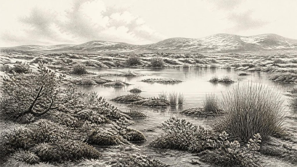
Derryvree’s fossils make the local setting more tangible. Pollen, plant macrofossils, mosses and insect remains indicate an open, largely treeless, periglacial landscape. Sedges, grasses and herbaceous plants grew around wet ground; the assemblage includes cold-adapted species such as mountain-avens, dwarf willow and arctic-alpine clubmoss. Bogbean and water-milfoil are particularly valuable because they point to standing or slow-moving fresh water. Mosses and insect evidence suggest a wet, peat-forming terrain with shallow pools and plant-rich margins, often described as muskeg-like.
That word should not summon an imaginary uniform tundra. The evidence instead suggests a mosaic: open water, saturated mossy ground, sedge-fringed hollows, patches of sparse dry-land vegetation and frost-disturbed mineral soils. Long winters and severe freezes would have restricted plant growth; seasonal thaw nevertheless allowed freshwater habitats to persist. A basin capable of preserving organic mud was therefore not an empty white desert. It supported a small but resilient community of plants and invertebrates, while offering drinking water and forage to animals moving through the wider landscape.
The direct evidence applies first to Derryvree itself. A pollen grain or seed does not provide a complete map of the island, and a few grains from trees do not prove local woodland: pollen can travel considerable distances. Nor does the buried wetland establish that every part of modern Ireland was ice-free at the same time. Its great value lies in being specific. It demonstrates that, during part of the broad range encompassing 30,998 BCE, an exposed Fermanagh hollow held freshwater, organic sediment and cold-adapted life between phases of glaciation.
Castlepook and the Animal World
In north County Cork, Castlepook Cave near Doneraile supplies a different, though equally difficult, archive. Its nineteenth- and early twentieth-century excavations recovered a large collection of Late Pleistocene animal bones. Later reassessment and improved radiocarbon pretreatment have shown that some earlier determinations were too young, a warning against treating old cave dates as final. Even so, the cave establishes that Ireland formed part of a wider north-west European faunal world before the Last Glacial Maximum. Its assemblage has included woolly mammoth, giant deer, reindeer, brown bear and spotted hyaena.
These finds require careful reading. A cave bone does not necessarily mean that its animal lived, died and was eaten at the point where excavators found it. Carnivores can drag remains into caves; water, sediment movement and older excavation methods can disturb their position. Castlepook is particularly associated with hyaena activity, and the cave probably acted at times as a carnivore den or scavenging place. The fauna nevertheless shows that large mammals reached at least parts of Ireland during this long pre-maximum interval. Their presence implies productive open-country habitats somewhere in the landscape, but not a stable population size, a mapped migration route or a single shared date for every species.
Reindeer are the most relevant animal for thinking about possible human subsistence, because throughout Upper Palaeolithic Europe they were often a major resource for highly mobile groups. Yet continental analogy is not Irish proof. At Castlepook, a reindeer femur has been reported as bearing a deep mark interpreted by some investigators as having been made by a sharp stone tool on fresh bone. County Cork heritage interpretation has presented the bone as possible evidence of butchery around 31,000 BCE. If confirmed, it would be extraordinarily early evidence of a person handling a reindeer in Ireland.
For now, however, the interpretation must remain qualified. No securely associated hearth, stone-tool assemblage, dwelling floor, burial, repeatedly used camp or stratified food-processing area of comparable age has been published from Ireland. The marked femur cannot tell us whether one traveller, a small hunting party or no people at all were present in the island at the exact time represented by this article. It is evidence worth investigating, not a licence to populate Ice Age Ireland with organised reindeer-hunting communities.
No Polities, No Recorded Conflict
Accordingly, there is no evidence for political affairs, rulers, diplomacy, tribes or warfare in Ireland in 30,998 BCE. There are no known houses, villages, farms, monuments, graves, artworks or writing from this horizon. There is likewise no direct basis for reconstructing language, kinship, religious practice, social rank or gender roles. The absence of such evidence does not prove that people could not have made a brief visit; it means that neither permanent settlement nor a particular society can responsibly be described.
The same restraint applies to economy and trade. Derryvree records natural freshwater productivity, not fishing, cultivation or exchange. Castlepook’s fauna records animal presence and cave processes, not a market in hides, ivory or meat. Lower global sea levels altered the surrounding continental shelves and the geography of western Europe, but it is unsafe to turn this into a simple land-bridge story. The relationship between Ireland, Britain, sea and ice changed through time, and the practical routes available to people or animals remain uncertain. Movement was possible only through landscapes shaped by ice margins, exposed shelves, waterways and changing coastlines; no route can be assigned to an individual or community.
An Island Becoming Iceward
The major development relevant to this date was environmental change. Derryvree’s organic layer was ultimately sealed by renewed glaciation. The larger British–Irish Ice Sheet expanded towards its Last Glacial Maximum in the millennia after this interval, profoundly reshaping Irish terrain. Drumlins, scoured rock basins, glacial deposits and meltwater systems visible in Ireland today are much later legacies of repeated ice movement, but they also conceal or erase many earlier surfaces. This helps explain why evidence for any fleeting human activity is so sparse.
Later Irish prehistory should not be projected backwards. Firm evidence for substantial, sustained settlement belongs to the Mesolithic, beginning around 8000 BCE. A butchered bear bone from Alice and Gwendoline Cave in County Clare provides published evidence for a much later Late Upper Palaeolithic human presence, around 10,800–10,500 BCE. Those discoveries show both the promise and the limits of cave archaeology: rare bones can transform a chronology, but they cannot fill a gap of tens of millennia with invented continuity.
Around 30,998 BCE, then, Ireland’s best-supported story is one of frostwater rather than folklore. At Derryvree, freshwater accumulated among sedges, mosses and cold-adapted plants in an exposed basin between episodes of ice. At Castlepook, an assemblage of large mammals demonstrates a wider Ice Age ecosystem and preserves a provocative, but not yet decisive, clue to human action. These scattered records do not yield a political narrative. They reveal something more fundamental: an Irish landscape that was changing rapidly, locally alive, and poised within the long approach to greater glaciation.
Primary Sources
- Palaeoecology
- Figure 6 — The Subdivision of the Quaternary Period in Ireland
- A Middle Midlandian Freshwater Series at Derryvree, Maguiresbridge, County Fermanagh, Northern Ireland
- A Reconsideration of the Radiocarbon Dating of the Marine Isotope Stage 3 Fauna from Southern Ireland
- The Irish Quaternary Fauna Project
- First Evidence of a Late Upper Palaeolithic Human Presence in Ireland
- New Insights on the Fauna of Ireland’s Younger Dryas and Early Holocene from Alice & Gwendoline Cave
- New Insights on the Fauna of Ireland’s Younger Dryas and Early Holocene from Alice & Gwendoline Cave (open-access PDF)
- Growth and Retreat of the Last British–Irish Ice Sheet, 31,000 to 15,000 Years Ago: the BRITICE-CHRONO Reconstruction
- Pattern and Timing of Retreat of the Last British-Irish Ice Sheet
- Exploring Controls of the Early and Stepped Deglaciation on the Western Margin of the British-Irish Ice Sheet
- Dimensions and Chronology of the Last Ice Sheet in Western Ireland
- The Last Glacial Maximum British–Irish Ice Sheet: a Reconstruction Using Digital Terrain Mapping
- Quaternary
- Ireland Through Geological Time
- The Mesolithic in Ireland: When Was It?
- Heritage Artefacts of County Cork
- Ireland: Submerged Prehistoric Sites and Landscapes
- Ireland’s First Settlers: Time and the Mesolithic
- The Mesolithic in Ireland: Hunter-Gatherers in an Insular Environment
- The Archaeology of Caves in Ireland
- Archaeological Excavations at Killuragh Cave, Co. Limerick: A Persistent Place in the Landscape from the Early Mesolithic to the Late Bronze Age
