
BIRM-166’s Tundra Horizon30957 BCE
At the notional date of 30,957 BCE, Ireland lay within the Midlandian glacial cycle, without annual historical evidence. Derryvree in County Fermanagh preserves freshwater sediments broadly assigned to Marine Isotope Stage 3, revealing an ice-free periglacial tundra of wetlands, sedges, grasses, dwarf shrubs and few trees. Later glaciation sealed this ecosystem beneath till. Southern caves, especially Castlepook, yielded mammoth, giant deer, reindeer, bears, hyenas and other cold-adapted fauna. A cut-marked reindeer femur may indicate an Upper Palaeolithic human visit, but disturbance and uncertain context prevent claims of settlement or society. Together, these records show shifting ecological opportunities before advancing ice.
Dateline
The label 30,957 BCE is a modern chronological peg, not a recoverable Irish year. No calendar, written source, named community or datable event allows historians to describe what happened in Ireland in that particular twelve-month interval. At this depth of time, precision comes in broad probability ranges, not anniversaries. The most responsible frame is the later part of Marine Isotope Stage 3 (MIS 3), within the Midlandian, Ireland’s last glacial cycle. Evidence from Irish cave deposits and buried sediments shows that parts of the island supported cold-stage life before the Last Glacial Maximum, but it does not provide an annual narrative.
The most revealing environmental archive for this period lies at Derryvree, near Maguiresbridge in County Fermanagh. In 1969, roadworks cut through a drumlin and exposed freshwater silts and fine sands sealed between two thick layers of glacial till. The organic bed, catalogued as BIRM-166, returned a radiocarbon age of 30,500 +1,170/−1,030 radiocarbon years BP. Modern calibration translates a radiocarbon determination into a broader calendar-age estimate rather than a single date; one published conversion places the Derryvree deposit around 35.9 ± 1.1 thousand calendar years BP. It is therefore an invaluable guide to an Irish cold-stage landscape, but it cannot be equated exactly with 30,957 BCE.
A Date Without Annals
It is tempting to turn an ancient date into a conventional historical entry: to ask who ruled, where people lived, or whether a conflict occurred. None of those questions can be answered for Ireland at this point. There is no evidence for states, chiefs, diplomatic relations, permanent settlements, social ranks or named peoples. Nor is there a securely excavated dwelling, hearth, tool-making floor or burial that can be assigned to this modern calendar year. The absence is meaningful: later glaciation, erosion, changing shorelines and the very small scale of any possible human presence have left an exceptionally fragmentary record.
Radiocarbon science also requires caution. A result expressed in radiocarbon years before present uses AD 1950 as its reference point and reflects past atmospheric carbon levels, not a direct calendar count. Calibration curves such as IntCal20 are necessary because atmospheric radiocarbon varied markedly through the Ice Age. At more than thirty millennia’ distance, a date may have a wide calibrated range. Moreover, a date on bone establishes when an animal died, within statistical limits; it does not automatically date a mark on the bone, the entire cave deposit, or a human visit to the site.
Wet Ground Beneath the Drumlin
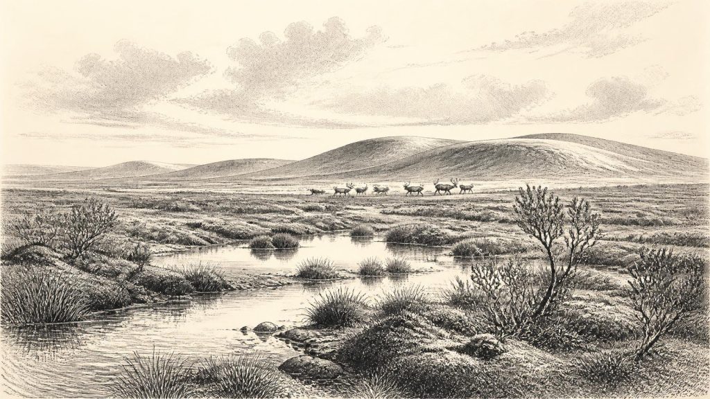
Derryvree offers the clearest local picture. Before a later glacier overran the site and helped form the drumlin, shallow freshwater conditions allowed silts, fine sand, plant remains and animal traces to accumulate. Pollen was poorly preserved, but the surviving record included herbaceous taxa, while plant macrofossils and mosses indicated a treeless, open landscape. Sedges, grasses, dwarf shrubs and cold-adapted plants belonged to a tundra or muskeg-like mosaic of wet ground, pools and sparsely vegetated drier patches.
This was not the modern, green Ireland of enclosed fields, oak woods and peat bogs. Trees were absent locally or extremely scarce. The tiny quantity of pine and hazel pollen was judged likely to have been reworked from older deposits rather than evidence of nearby woodland. The study’s climatic interpretation was severe: a periglacial environment with a short cool summer and very cold winters. Moss beds and aquatic sediments nevertheless show that this was not lifeless frozen desert. Water moved, plants grew during the season, and sheltered wet places supported a specialised flora.
That conclusion applies securely to the Derryvree locality during the formation of its deposit, not automatically to every valley, coast and upland across Ireland at once. Ireland’s terrain, proximity to the Atlantic and shifting ice margins made local conditions varied. Still, the Derryvree sequence is important precisely because it demonstrates that at least one part of the island experienced an ice-free interval between glacial advances and preserved a functioning cold-climate ecosystem.
Animals at Europe’s Edge
The animal record from southern Irish caves expands the picture. Castlepook Cave, also known as Mammoth Cave, near Doneraile in County Cork is Ireland’s richest known assemblage of vertebrate remains from the period leading towards the Last Glacial Maximum. Excavations in the early twentieth century recovered more than 2,000 bones from complex cave deposits. Direct dates on individual specimens span a long interval rather than one occupation. The cave has yielded remains of woolly mammoth, giant deer, reindeer, brown bear and spotted hyena, as well as later cold-adapted animals including lemmings, Arctic fox and wolf.
These finds demonstrate that Ireland was connected, ecologically at least, to the broader north-west European world in which large herbivores and predators moved through open cold-country habitats. They do not prove that all those species shared one valley, season or moment. Cave assemblages mix material introduced by water, carnivores and earlier excavators as well as by animals dying or sheltering underground. Re-dating has shown that several older Irish cave determinations were substantially too young, reinforcing the need to date individual bones and assess each find’s context.
Spotted hyenas are especially instructive. Their bones and the character of some deposits indicate that caves could be carnivore places, not simply natural cupboards preserving the debris of human hunters. A cave might have been a den, a refuge, a trap, a water-affected sediment chamber or several of these at different times. The Ice Age landscape was therefore dangerous as well as productive: reindeer and giant deer supplied prey for carnivores, while mammoth remains evoke a much larger ecological network than survives in Ireland today.
The Castlepook Human Question
One reindeer femur from Castlepook has made this era historically significant. The specimen bears a deep linear modification interpreted by zooarchaeologist Ruth Carden as a cut or chopping mark made with a sharp stone tool while the bone was fresh. It has been publicly associated with an age of about 33,000 radiocarbon years BP. If the interpretation and contextual relationship are sustained, it may represent the earliest known trace of human activity in Ireland: not a village or a population, but a brief episode of carcass processing by one or more Upper Palaeolithic people.
The limits are as important as the possibility. Castlepook’s principal excavations pre-dated modern recording, systematic sieving, microscopic use-wear analysis and accelerator mass spectrometry. Its deposits have also been disturbed by water and animal activity. A possible stone-tool incision is not the same as a securely stratified tool assemblage, and a dated femur is not evidence for continuous residence. It cannot establish the hunters’ language, identities, beliefs, route into Ireland, group size or duration of stay.
Yet even this restrained conclusion changes the scale of the question. Ireland need not have been wholly beyond the reach of Upper Palaeolithic foragers during the wider MIS 3 period. A visit may have been seasonal, opportunistic or tied to movements of game; any such explanation remains interpretation rather than demonstrated fact. There is no basis for describing an Irish hunting society, trade system or ritual life at 30,957 BCE. Nor can art, religion or learning be recovered from a single modified bone.
Economy, Settlement and Mobility
For humans, if present, the only defensible economic inference is immediate use of wild resources, most plausibly animal carcasses. The marked femur may indicate meat removal, dismemberment or marrow-related processing, but even the precise action is uncertain. There is no evidence for farming, herding, pottery, metalworking, exchange networks or permanent buildings. In a treeless periglacial setting, fuel, shelter and transport would have posed major practical problems, but reconstructing solutions from mainland European Upper Palaeolithic communities would be analogy, not direct Irish evidence.
Mobility is easier to infer for animals than for people. Mammals reached Ireland during intervals when sea level, ice extent and coastal geography differed greatly from those of today, although the precise routes and degree of terrestrial connection remain debated. The Irish Sea was not a fixed modern barrier, but neither should it be casually imagined as a simple land bridge. Changing ice margins, relative sea level and exposed shelves created a complex, shifting frontier. Animal bones establish that dispersal occurred; they do not reveal every route or guarantee that people followed it.
Approaching the Great Ice
The great advance of the British–Irish Ice Sheet lay ahead or was developing unevenly across the wider region. Recent reconstructions show that maximum extent and retreat varied between sectors, with major advance and ice-sheet growth occurring over millennia rather than in one sudden event. By the Last Glacial Maximum, broadly after this MIS 3 interval, ice covered all or almost all of Ireland’s low ground. The till sealing Derryvree’s freshwater bed is physical evidence of that environmental reversal: an inhabitable wet tundra landscape was buried beneath glacier-derived sediment.
Thus the most important development illuminated around this notional year is neither a battle nor a dynasty. It is the fragility of an Irish Ice Age refuge. Derryvree records plants and shallow water between ice advances; Castlepook preserves the bones of a wider cold-steppe fauna and a provocative, still limited hint of people. Together they show an island of changing ecological opportunities on the north-western edge of Europe, before advancing ice erased much of the evidence by which its earliest visitors might otherwise be known.
Primary Sources
- A Middle Midlandian Freshwater Series at Derryvree, Maguiresbridge, County Fermanagh, Northern Ireland
- Palaeoecology: The Middle Midlandian Palaeoenvironment of South Fermanagh
- Figure 6: The Subdivision of the Quaternary Period in Ireland
- A Reconsideration of the Radiocarbon Dating of the Marine Isotope Stage 3 Fauna from Southern Ireland
- The Irish Quaternary Fauna Project
- Castlepook Cave: Cork County Geological Site Report
- Spotted Hyena Skull
- First Evidence of a Late Upper Palaeolithic Human Presence in Ireland
- First Evidence of a Late Upper Palaeolithic Human Presence in Ireland
- New Insights on the Fauna of Ireland's Younger Dryas and Early Holocene from Alice & Gwendoline Cave
- Heritage Artefacts of County Cork
- The Timing and Magnitude of the British–Irish Ice Sheet Between Marine Isotope Stages 5d and 2
- Growth and Retreat of the Last British–Irish Ice Sheet, 31,000 to 15,000 Years Ago: The BRITICE-CHRONO Reconstruction
- Pattern and Timing of Retreat of the Last British-Irish Ice Sheet
- Trimlines, Blockfields and the Vertical Extent of the Last Ice Sheet in Southern Ireland
- The IntCal20 Northern Hemisphere Radiocarbon Age Calibration Curve (0–55 cal kBP)
- IntCal Publications
- IntCal Data
- The IntCal20 Approach to Radiocarbon Calibration Curve Construction
- The Problem of a Late Quaternary Landbridge Between Britain and Ireland
- Introduction to the Late Quaternary and Holocene of Northern Ireland
- Salix herbacea in Fermanagh: Fossil History
- The Archaeology of Ireland
