
Birm-166 Freshwater Find30951 BCE
Labelled 30,951 BCE, this imprecise horizon falls within MIS 3, roughly 32,900 years before present. At Derryvree, County Fermanagh, freshwater silts between glacial tills, dated by Birm-166, preserve evidence of a treeless, tundra-like wetland with cold-adapted plants, insects and shallow water. The deposit shows that ice cover fluctuated before the Last Glacial Maximum. Castlepook Cave, County Cork, contains remains of reindeer, bear, fox, hare, lemmings, hyaena and mammals, demonstrating intermittent animal presence. A possibly cut-marked reindeer bone suggests, but does not prove, human activity. No settlement, tools, politics or beliefs are known; Ireland remained a variable, intermittently habitable Ice-Age landscape.
Dateline
“30,951 BCE” is a modern label, not a year that could have been recognised in Ireland at the time. There were no written calendars, named rulers, states or chronicles from which a year-by-year narrative might be recovered. In the archaeological convention that counts backwards from AD 1950, the label corresponds to roughly 32,900 years before present. That places it in the Late Pleistocene, broadly within Marine Isotope Stage 3 (MIS 3), a long and climatically unstable part of the last Ice Age. Modern calendar-year precision is not available: the responsible evidence is a set of broad, calibrated ranges, not an event dated to a particular season or generation.
A Date Within a Range
The closest important Irish chronological anchor is a freshwater deposit exposed at Derryvree, near Maguiresbridge in County Fermanagh. Road works in 1969 cut through a drumlin and revealed silts and fine sands trapped between two separate sheets of glacial till. Organic material in this deposit produced the conventional radiocarbon measurement Birm-166: 30,500 radiocarbon years BP, with a substantial published uncertainty. A radiocarbon measurement is not the same thing as a calendar age. Calibration against changing atmospheric carbon levels places the deposit broadly in a range of approximately 36,900–31,700 calibrated years BP. The notional date of 30,951 BCE falls within that wide interval.
That is valuable, but it must not be exaggerated. The range does not show that conditions on one modern calendar date were known, or that every part of Ireland shared Derryvree’s landscape. It records an episode of freshwater sedimentation and life between glacial advances in one locality. The numerical year is therefore best treated as a doorway into a prehistoric environmental horizon, rather than as a date on which an Irish political, military or cultural event occurred.
Water Beneath the Drumlin
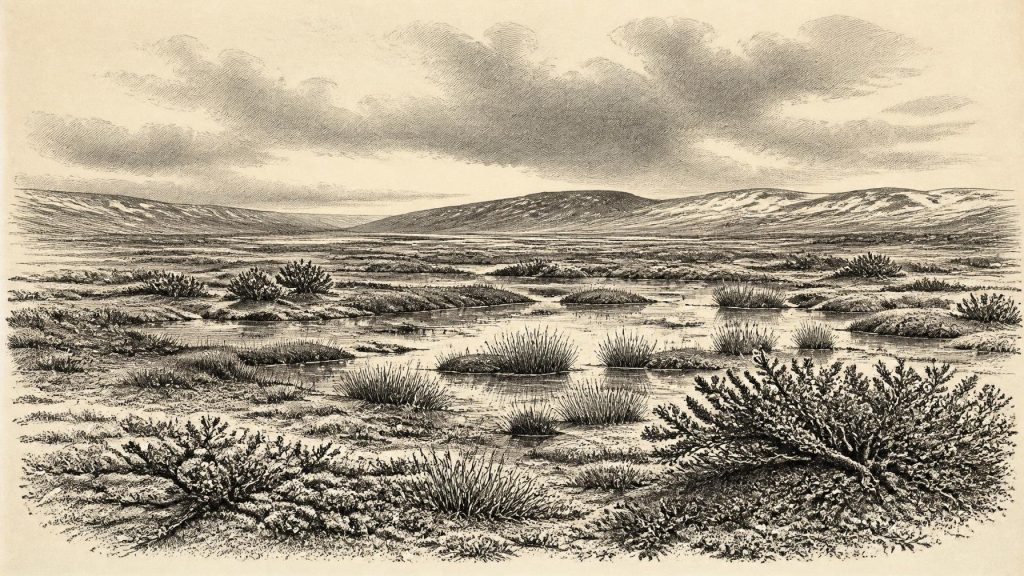
Derryvree is exceptional because the later ice preserved a small archive of an earlier cold landscape beneath the drumlin. Pollen, plant macrofossils, mosses, insect remains and freshwater sediments point to a treeless, periglacial wetland. The vegetation was not a familiar Irish woodland. It included grasses, sedges and herbs, with plants suited to cold, open ground and wet hollows; mosses, bogbean, water-milfoil, mountain-avens, dwarf willow and juniper feature among the remains reported from the sequence. Some pollen was poorly preserved, and individual plant occurrences require cautious reading, but the combined evidence strongly supports open tundra-like vegetation around shallow water and saturated ground.
This was a landscape shaped by frost, meltwater and short growing seasons. A modern visitor would not have found peat bogs, oak woods or enclosed green fields. Instead, there were likely pools, muddy margins, sedge beds and sparse vegetation across exposed ground. Such a setting could support insects, waterfowl, small mammals and grazing animals, yet it was environmentally demanding. The phrase sometimes used by researchers, “muskeg”, conveys the mixture of wet, organic-rich ground and harsh cold conditions, though no modern northern landscape is an exact replica of Pleistocene Fermanagh.
The evidence also has a larger geological meaning. Freshwater deposits lying between tills demonstrate that ice did not simply cover Ireland in one unbroken, uniform episode. There were intervals in which ice margins retreated or conditions locally permitted open ground and standing water before renewed glaciation buried the evidence. At around 32,900 years ago, the British–Irish Ice Sheet had not yet reached its better-established Last Glacial Maximum extent. Its later expansion, broadly between about 27,000 and 23,000 calibrated years BP, covered Ireland and much of its continental shelf. Derryvree preserves a fragile glimpse of an earlier, changeable phase before that maximum.
Animals in the Southern Caves
County Cork provides a second, very different line of evidence. Castlepook Cave, near Doneraile in the Awbeg valley, has yielded remains of Ice Age animals from antiquarian excavations and more recent investigation. The wider assemblage includes cold-stage species such as reindeer, brown bear, fox, hare, lemmings and spotted hyaena, alongside remains attributed to larger mammals including mammoth and giant deer. Revised accelerator radiocarbon dating has shown that some southern Irish faunal remains belong to MIS 3, while other specimens and deposits have different ages. Ireland was therefore not a sterile or permanently ice-bound place throughout this earlier portion of the last glacial cycle.
Nevertheless, a cave collection is not a photograph of a single ecosystem. Carnivores can drag prey into caves; water and sediment can move bones; early excavators did not always record layers to modern standards; and bones recovered together may have accumulated over many thousands of years. It would be wrong to picture all Castlepook species standing together in the Awbeg valley in 30,951 BCE. The assemblage establishes repeated animal presence over a long period, not one precisely dated local fauna.
Reindeer matter especially because one Castlepook femur has a deep linear mark that has been interpreted as damage made on fresh bone by a sharp stone edge. The bone has been redated to roughly 33,000 years ago. If that interpretation is upheld, it may indicate that people butchered a reindeer in Ireland during MIS 3, vastly earlier than the previously secure evidence for human activity on the island. But the wording matters: it is a potentially human modification, not a settled conclusion. The bone does not identify who made the mark, where they lived, what language they spoke or whether they returned.
People: A Possibility, Not a Population
There is no securely dated house, hearth, stone-tool assemblage, burial or occupation surface in Ireland from this horizon. Excavations at Castlepook have sought undisturbed deposits and unequivocal cultural material, but have not yet produced a stone or bone tool that can certainly be assigned to a human presence of this age. The proper historical conclusion is therefore restrained. Ireland may have been visited intermittently by Upper Palaeolithic hunter-gatherers; it cannot presently be described as having had a known resident human population in 30,951 BCE.
If people did reach the island, they would have required intimate practical knowledge of cold weather, animal movement, shelter and food. A reindeer carcass, if processed by people, would have offered meat, marrow, hide, sinew and bone. Yet this is an inference from the potential cut mark and wider knowledge of hunter-gatherer economies elsewhere in Europe, not direct evidence for an Irish camp or trading system. No exchange networks, imported materials, boats, tents, clothing or tools can responsibly be assigned to Ireland at this point.
Lower global sea levels altered the geography of the Irish Sea basin, but low water alone does not demonstrate a land route that people or herds could simply walk across. Ice extent, local relative sea level, coastlines and seasonal hazards changed over time. Research on Irish insularity has repeatedly warned against treating a supposed land bridge as an uncomplicated fact. Whether animals and possible people arrived via short water crossings, exposed coastal terrain, temporary island chains or other routes remains unresolved for this date.
No Politics, No Known Creed
Political affairs, diplomacy and warfare leave no identifiable trace in the evidence for this period. There is no basis for naming a community, territory, leader, alliance or conflict. Equally, there is no Irish cave art, portable art, shrine, grave or ritual deposit securely belonging to the Derryvree–Castlepook horizon. Religion, language, kinship and learning are not absent because prehistoric people necessarily lacked them; they are absent from the surviving Irish record. To invent them would substitute modern expectation for evidence.
The strongest cultural lesson is instead methodological. Ireland’s deep past is recovered from a road cutting, cave bones, laboratory dating, pollen grains and microscopic plant remains. Birm-166 does not tell a story of kings or monuments. It records water, vegetation and cold in an interval later hidden by ice. Castlepook broadens that picture with animals adapted to open, severe conditions and with a single, consequential but disputed clue to human activity. Together they show an Ireland that was environmentally active, geographically variable and vulnerable to rapid climatic change, while remaining almost silent about individual lives.
An Ice-Age Threshold
The importance of 30,951 BCE lies not in a documented event but in its position near an environmental threshold. The Derryvree wetland demonstrates that parts of Ireland supported freshwater habitats and tundra vegetation during MIS 3. The southern cave faunas demonstrate that large and small mammals reached the island during the wider period. Subsequent growth of the British–Irish Ice Sheet would scour, bury and fragment many earlier landscapes, helping to explain why the record is so sparse. What survives is enough to reject an empty Ireland, but not enough to write a conventional national history. Around this notional year, Ireland is best understood as a cold, open, intermittently habitable edge of north-west Europe, known through deposits rather than dates and through probabilities rather than certainties.
Primary Sources
- A Middle Midlandian Freshwater Series at Derryvree, Maguiresbridge, County Fermanagh, Northern Ireland
- A Reconsideration of the Radiocarbon Dating of the Marine Isotope Stage 3 Fauna from Southern Ireland
- The Irish Quaternary Fauna Project
- Palaeoecology
- Archaeology Research Excavation Grant 2022: Castlepook Caves Project Final Report
- Archaeology Research Excavation Grant Report 2023: Castlepook Cave
- 2022:564 – Castlepook Cave, Castlepook South, Cork
- New Insights on the Fauna of Ireland's Younger Dryas and Early Holocene from Alice & Gwendoline Cave
- Investigating Seasonal Mobility in Irish Giant Deer Megaloceros giganteus Through Strontium Isotope Analysis
- Deglaciation, Earth Crustal Behaviour and Sea-Level Changes in the Determination of Insularity: A Perspective from Ireland
- The Problem of a Late Quaternary Landbridge Between Britain and Ireland
- The Island of Ireland: Drowning the Myth of an Irish Land-Bridge?
- Ireland: Submerged Prehistoric Sites and Landscapes
- Maximum Extent and Dynamic Behaviour of the Last British–Irish Ice Sheet West of Ireland
- Early Deglaciation of the British-Irish Ice Sheet on the Atlantic Shelf Northwest of Ireland Driven by Glacioisostatic Depression and High Relative Sea Level
- Growth and Retreat of the Last British–Irish Ice Sheet, 31,000 to 15,000 Years Ago: The BRITICE-CHRONO Reconstruction
- The Timing and Magnitude of the British–Irish Ice Sheet Between Marine Isotope Stages 5d and 2
- Pattern and Timing of Retreat of the Last British-Irish Ice Sheet
- Stratigraphic and Palaeo-Geomorphological Evidence for the Glacial-Deglacial History of the Last British-Irish Ice Sheet in the North-Western Irish Sea
- The IntCal20 Northern Hemisphere Radiocarbon Age Calibration Curve (0–55 cal kBP)
- IntCal Publications
