Derryvree’s Coldwater Silt30950 BCE
30,950 BCE is a modern label within the climatically unstable MIS 3, not a precisely recoverable Irish date. Derryvree, County Fermanagh, preserves freshwater silts between glacial tills, indicating locally ice-free tundra wetlands with cold-adapted plants and insects. Castlepook Cave, County Cork, records diverse fauna, including mammoth, reindeer and hyaena, though its mixed deposits cannot establish contemporaneous populations. Lower sea levels may have enabled changing connections, but no certain land bridge is known. A possibly tool-marked reindeer femur suggests, but does not prove, human presence. No settlements, hearths or social structures are evidenced; expanding ice later buried or destroyed much evidence.
Dateline
30,950 BCE is a modern chronological label, not a date that can be recovered from Ireland’s archaeological record with calendar-year precision. No written calendar, named community, political event or excavated settlement can be assigned to this particular year. In simple chronological terms it falls about 32,900 years before AD 1950, the conventional “present” used in archaeological dating. The responsible setting is the later part of the Late Pleistocene, within Marine Isotope Stage 3 (MIS 3), a long and climatically volatile interval before the fullest growth of the last British–Irish Ice Sheet.
For Ireland, the closest useful evidence is not a village or monument but a buried wetland at Derryvree near Maguiresbridge, County Fermanagh. Organic silt and fine sand, sealed between two separate glacial tills, produced a conventional radiocarbon determination of 30,500 +1,170/−1,030 years BP. Published calibrations place this broadly at roughly 36,900–31,700 calibrated years BP. The modern label 30,950 BCE therefore falls within that wide range, but it does not identify a single season, generation or event at Derryvree. It allows the deposit to illuminate the environmental world of this broad period.
A Wetland Between Glaciers
Derryvree is important precisely because it preserves a pause between advances of ice. Beneath later glacial deposits, its freshwater sediments retain pollen, plant macrofossils and insect remains. These are direct traces of organisms that lived in or close to the water, while the enclosing tills show that glaciers occupied the district before and after the wetland formed. The evidence indicates local ice-free ground, liquid water and a cold periglacial environment; it does not prove that every part of Ireland was simultaneously ice-free or environmentally identical.
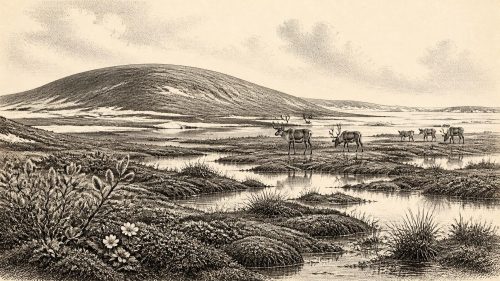
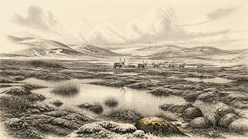
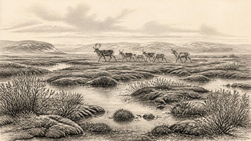
The plant record points to treeless, open country. Mosses, sedges and other herbaceous taxa suggest damp ground, pools and fen-like surfaces rather than woodland. The assemblage included cold-adapted plants such as dwarf willow, mountain-avens, lesser clubmoss and bogbean or water-clover. Some plants grew in or beside water, others on wet margins or exposed mineral soils. Insect evidence similarly has a northern, cold-climate character. Together, the proxies support an interpretation of tundra or muskeg: a patchwork of shallow water, sedgy marsh, mossy ground and sparse vegetation, subject to frost and short growing seasons.
This was not a featureless wasteland. Summer light, meltwater and wetland vegetation could make such places biologically productive on a local scale. Yet the scene would have been severe by modern Irish standards. There is no evidence of the dense oak, elm, hazel or ash woods of later millennia. Nor is there evidence for fields, grazing livestock, managed burning or cultivation. The Derryvree sequence is an ecological archive, not proof of a settled landscape.
Animals in an Open Landscape
Caves in southern Ireland, particularly Castlepook Cave near Doneraile in County Cork, provide a second kind of evidence. Their mixed deposits have yielded a remarkable Late Pleistocene fauna, including woolly mammoth, reindeer, giant deer, horse, brown bear, Arctic fox, mountain hare, lemmings and large carnivores such as spotted hyaena. The collections were excavated mainly in the late nineteenth and early twentieth centuries, often before modern recording standards. Bone accumulations may reflect animals dying in caves, carnivore activity, water movement and disturbed excavation deposits. They cannot be treated as a single, neatly contemporary herd list.
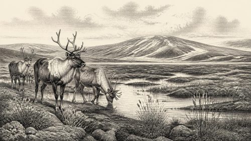
Even so, revised radiocarbon work has shown that important elements of the Castlepook fauna are substantially older than some earlier measurements suggested and belong to MIS 3, before the Last Glacial Maximum. Reindeer, mammoth and hyaena fit an open, cold and varied landscape rather than a forested island. Their presence demonstrates that, during portions of this long interval, Ireland was part of a north-west European world in which large mammals and predators could reach and survive in suitable habitats. It does not demonstrate that all these species occupied one valley at once, or that they were present everywhere on the island in 30,950 BCE.
The environmental picture is therefore one of regional contrast and continual change. Derryvree supplies a northern freshwater locality; Castlepook supplies a southern cave archive. Between them lies a large geographical and chronological gap. Their combined value is to show the range of conditions and animals that could occur in Ireland before the ice sheet reached its later maximum, not to create a detailed map for a particular year.
Ice, Land and Changing Routes
At this time the British–Irish Ice Sheet was not yet at its better-documented Last Glacial Maximum extent. Research on the ice sheet places major expansion and its maximum phases later, chiefly after about 31,000 years ago and into MIS 2. Derryvree’s organic layer, protected beneath a later till, is one of the clues that parts of north-central Ireland remained ice-free during an earlier cold interval. Subsequent glacial growth repeatedly transformed the terrain, eroding deposits and covering much of the evidence that earlier people or animals might have left.
Global sea level was lower than today because much water was held in continental ice sheets, but this must not be simplified into a certain land bridge or an easy walking route to Ireland. Coastlines, ice margins, rivers and channels changed over long periods, and the exact practical routes available to animals or people varied with climate and geography. The evidence supports connection and movement within a changing north-west European borderland; it does not establish a permanent road from Ireland to Britain or the continent.
The Reindeer Femur Question
Castlepook also raises the most tantalising human question for this period. A reindeer femur from the cave has been publicly reported as bearing a deep mark interpreted as a fresh-bone cut or chop made by a sharp stone tool. The bone has been presented as about 33,000 years old, broadly close to the chronological horizon considered here. If microscopic and taphonomic assessment ultimately confirms that the mark was made by a person while the bone was fresh, it would be evidence that a human visitor processed a reindeer in Ireland during the Upper Palaeolithic.
That is a significant possibility, not an established account of Irish settlement. The specimen comes from an old and complex cave collection, not a sealed occupation floor. Its radiocarbon date concerns the death of the animal, rather than automatically dating the mark, the place of killing or the duration of any human visit. No securely associated hearth, stone-tool assemblage, dwelling, burial, food store or repeatedly occupied camp of comparable antiquity has been published from Castlepook. A single modified bone cannot tell us whether people hunted locally, scavenged a carcass, arrived in a small party, stayed briefly or returned.
The contrast with the better-supported terminal Pleistocene evidence is instructive. At Alice and Gwendoline Cave in County Clare, a butchered brown-bear bone has yielded two closely agreeing calibrated ranges around 12,800–12,590 cal BP, many millennia later than this article’s horizon. That find is evidence of human action, but it too does not make a cave itself a permanent home. For 30,950 BCE, the Castlepook femur should remain a proposed early trace, open to further testing rather than a foundation for confident narratives about an Ice Age Irish population.
What Cannot Be Reconstructed
There is no responsible evidence for political authority, chiefs, kingdoms, diplomacy, warfare or territorial boundaries in Ireland at this point. Nor can archaeologists identify a language, personal name, religious rite, artistic tradition, school of learning or formal trade network. If people were present, they would have belonged to mobile foraging societies comparable in broad economic principle to Upper Palaeolithic groups elsewhere in Europe: reliant on knowledge of seasonal animals, weather, materials and routes. But that comparison is an interpretative framework, not direct proof of a camp, community or technology in Ireland.
Accordingly, everyday life remains mostly beyond recovery. No Irish hearth can be placed securely in 30,950 BCE; no dwelling tells us how people sheltered; no tool assemblage records work, hunting or ornament. There is equally no evidence for farming, domesticated animals, pottery, metal, long-distance commerce or seafaring. What can be said is narrower but consequential: freshwater wetlands existed in at least one northern locality; cold-adapted vegetation occupied open ground; large mammals and predators moved through parts of the island during MIS 3; and advancing ice would later erase or bury many traces of that world.
The central development around this notional year was environmental rather than political. Ireland was a shifting cold-stage landscape, capable at intervals of sustaining wetlands and a diverse Pleistocene fauna, but increasingly constrained by climatic deterioration and expanding ice. Derryvree’s silts and Castlepook’s bones are fragments of that history. They offer a valuable, evidence-based glimpse of an Ireland long before recorded history, while firmly marking the limits of what the surviving record can bear.
Primary Sources
- A Middle Midlandian Freshwater Series at Derryvree, Maguiresbridge, County Fermanagh, Northern Ireland
- Early Midlandian–Middle Midlandian, Pleistocene, Northern Ireland
- Palaeoecology
- Figure 6.— The Subdivision of the Quaternary Period in Ireland
- A Reconsideration of the Radiocarbon Dating of the Marine Isotope Stage 3 Fauna from Southern Ireland
- The Irish Quaternary Fauna Project
- The Exploration of Castlepook Cave, County Cork, Being the Third Report from the Committee Appointed to Explore Irish Caves
- Heritage Artefacts of County Cork
- Castlepook Cave, Co. Cork, 2022 Excavation Report
- The Timing and Magnitude of the British–Irish Ice Sheet Between Marine Isotope Stages 5d and 2
- Late Pleistocene Chronostratigraphy and Ice Sheet Limits, Southern Ireland
- Mammoth and Musk Ox ESR-Dated to the Early Midlandian at Aghnadarragh, County Antrim, Northern Ireland, and the Age of the Fermanagh Stadial
- Freshwater Organic Deposits and Stratified Sediments Between Early and Late Midlandian (Devensian) Till Sheets, at Aghnadarragh, County Antrim, Northern Ireland
- First Evidence of a Late Upper Palaeolithic Human Presence in Ireland
- New Insights on the Fauna of Ireland’s Younger Dryas and Early Holocene from Alice & Gwendoline Cave
- Red Deer in Ireland: Phylogeography, Phylogeny and a Potential Native Status
- First Evidence of a Late Upper Palaeolithic Human Presence in Ireland
- IntCal20 Northern Hemisphere Radiocarbon Age Calibration Curve (0–55 cal kBP)
- A 60,000 Year Greenland Stratigraphic Ice Core Chronology
- The Last Eurasian Ice Sheets – a Chronological Database and Time-Slice Reconstruction, DATED-1
- Growth Dynamics and Deglaciation of the Last British-Irish Ice Sheet: the Deep-Sea Ice-Rafted Detritus Record
- The Geological Heritage of Clare