
Derryvree’s Tundra Drumlin30919 BCE
About 30,919 BCE, Ireland lay within the climatically unstable Late Pleistocene, not a datable historical year. During MIS 3, advancing but uneven ice, permafrost and open tundra habitats varied regionally. At Derryvree, County Fermanagh, freshwater sediments between tills indicate an ice-free interval, dated broadly by radiocarbon, with treeless periglacial vegetation. Castlepook Cave, County Cork, preserves remains of mammoth, reindeer, giant deer, hyaena and other cold-adapted fauna, demonstrating intermittent ecological links with north-west Europe. A possibly cut-marked reindeer bone suggests, but does not prove, brief human presence. Evidence cannot support claims of settlement, polities, trade, religion or warfare at this horizon.
Dateline
Modern calendar-year precision is not available for Ireland in 30,919 BCE. The label is a convenient point on a modern chronological scale, roughly 32,868 years before AD 1950, rather than a recoverable Irish year in which archaeology can identify a particular season, event or generation. No written record, settlement sequence or securely dated human occupation allows historians to say what happened on the island at that exact moment. The responsible approach is to place it within the Late Pleistocene, broadly Marine Isotope Stage 3 (MIS 3), and to use the fragmentary evidence of caves, sediments, fossils and radiocarbon measurements to describe conditions across a much wider span.
A Cold Interval, Not a Historical Year
Ireland at this depth in time was part of a climatically unstable north-west European world. MIS 3, conventionally dated to about 57,000–29,000 years ago, was marked by sharp shifts between severe cold phases and relatively milder interstadials. Ice masses, sea level, vegetation and animal ranges changed repeatedly over millennia. Conditions in one Irish region could differ greatly from another: uplands and northern districts were especially vulnerable to expanding ice, while southern lowlands and sheltered karst caves could preserve evidence of animals during intervals when suitable habitat existed.
The numbered date should therefore not be imagined as an entry in a prehistoric annal. It falls before the maximum expansion of the last British–Irish Ice Sheet, whose major shelf-edge advances occurred later, especially around 27,000–24,000 calibrated years before present. Yet it was part of the long approach to that glacial maximum. Research on the ice sheet indicates that ice growth was complex and regionally uneven; it was not a single smooth advance that instantly buried Ireland. Around the horizon represented by 30,919 BCE, some landscapes could still contain open ground, water and animal life, while other areas were affected by cold-based ice, permafrost or advancing glaciers.
Derryvree Between the Tills
The clearest Irish environmental window broadly relevant to this date lies at Derryvree, near Maguiresbridge in County Fermanagh. Roadworks in 1969 cut through a drumlin and exposed freshwater silts and fine sands trapped between two substantial layers of glacial till. The sequence is important because it records order rather than a story: glacier ice deposited the lower till; an ice-free interval then permitted freshwater and organic sediments to accumulate; later ice overrode the locality and sealed the deposit beneath another till sheet.
Organic material in the Derryvree freshwater series produced the radiocarbon determination Birm-166, 30,500 radiocarbon years before present, with a substantial uncertainty of +1,170 and −1,030 years. A radiocarbon age is not identical to a calendar age. Atmospheric carbon-14 levels varied in the past, and calibration at such antiquity carries broad ranges rather than year-level accuracy. Modern calibration work can place comparable results within wide calibrated intervals, but cannot make 30,919 BCE a precise date for the Derryvree wetland. The site is relevant because it demonstrates that part of Fermanagh supported a freshwater environment during the later middle of the last glacial period, not because it records a day or year in the life of a community.
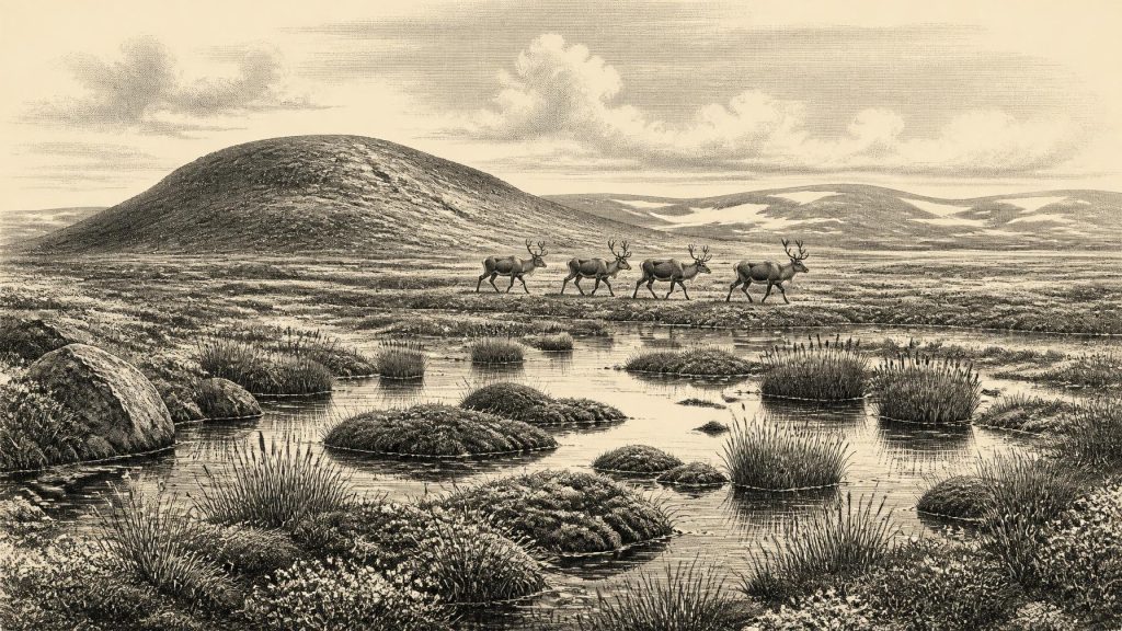
The Derryvree flora and fauna indicated open tundra vegetation and a periglacial regime. This was no familiar Irish countryside of woodland, hedges and pasture. Short growing seasons, frozen ground and wet, shallow-water habitats favoured hardy plants. Pollen, plant remains and invertebrate evidence offer direct testimony to organisms present in or near the water. Their wider interpretation is of a largely treeless mosaic of wet ground, pools, sedges, mosses and sparse cold-adapted vegetation. Such places could be locally productive, especially in summer, but they were not evidence for farming, permanent villages or a settled political landscape.
Cork’s Cave Fauna
Far south of Derryvree, Castlepook Cave near Doneraile in north County Cork provides the richest Irish assemblage of vertebrate remains from before and around the onset of the Last Glacial Maximum. Also known as Mammoth Cave, it is a limestone maze cave whose excavations, particularly those directed by Richard J. Ussher and reported by the Royal Irish Academy in 1918, recovered a remarkable range of bones. Later study and redating have made the site central to any account of Ireland’s MIS 3 fauna.
Its deposits contain evidence for woolly mammoth, reindeer, giant deer, brown bear and spotted hyaena, alongside wolf, Arctic fox, mountain hare and lemmings. This is not a list of animals that can safely be pictured standing together at Castlepook in 30,919 BCE. Cave accumulations formed over long periods and were altered by carnivore activity, water movement, sediment disturbance and early excavation. Individual bones have different ages. Revised radiocarbon work has also shown that some older dates obtained in the 1990s require reconsideration because improved pretreatment techniques can produce markedly older and more reliable results.
Nevertheless, the fauna establishes a vital point: during parts of MIS 3, Ireland had ecological connections with the wider cold-stage landscapes of north-western Europe. Reindeer imply open country capable of supporting grazing herds; mammoths point to expansive herb-rich habitat at least intermittently; lemmings and Arctic fox indicate severe climatic conditions; and spotted hyaenas demonstrate the presence of formidable scavenging and predatory animals. Caves may have been dens, traps, shelters or places where bones were washed and reworked. They were not necessarily human homes.
For everyday life on the island, the animal evidence is stronger than the human evidence. We can responsibly envisage a difficult seasonal environment in which animals moved through open, cold terrain and competed for food and shelter. We cannot infer a named people, language, kin group, technology or territory from the fossil record. Nor can the faunal list establish a continuous population of any species across the whole island. It instead records changing opportunities for particular animals in particular regions.
The Human Question
Castlepook has acquired special significance because a reindeer femur from the old collection has been reported as carrying a deep mark consistent with cutting or chopping by a sharp stone tool while the bone was fresh. If that interpretation is upheld, it would indicate human handling of a reindeer about 33,000 years ago and would push possible human activity in Ireland far earlier than the well-established post-glacial record. It is an important claim, but it must be kept in proportion.
The bone itself is evidence for a reindeer. Its direct age dates the animal, not an excavated camp. The proposed tool mark is an interpretation based on the form and placement of damage to bone. Castlepook’s antiquarian excavations removed and mixed much sediment, and the femur was not recovered with a securely stratified hearth, stone-tool collection, dwelling surface or human remains. There is no confirmed Upper Palaeolithic settlement in Ireland of this age, no securely associated tool-making area and no basis for assuming permanent occupation.
The most cautious conclusion is therefore that a brief visit by people remains possible, perhaps involving the processing of an animal, but is not yet a demonstrated population history. A visitor could have arrived over a wider, lower-sea-level north-west European landscape by routes that are now submerged or obscured; equally, the surviving evidence cannot identify the route, duration or frequency of any visit. Lower sea levels did not automatically provide a simple land bridge, and neither boats nor crossings can be demonstrated for Ireland at this date.
No Polities, No Diplomacy
Political affairs, diplomacy and organised warfare cannot be reconstructed for Ireland around 30,919 BCE. There are no monuments, burials, boundaries, weapons assemblages or settlement hierarchies from which authority or conflict can be inferred. It would be misleading to project later tribal societies, kingdoms, Gaelic identities or modern regional divisions into this period. If humans did enter Ireland, they left no evidence capable of revealing how they organised themselves socially.
The same restraint applies to religion, culture and learning. No art, ornament, musical instrument, grave or ritual deposit from Ireland can be securely assigned to this horizon. People elsewhere in Upper Palaeolithic Europe made sophisticated tools and symbolic objects, but that wider fact cannot fill Ireland’s evidential silence. There is likewise no evidence for local trade. Animal movement and ecological connectivity across the region are real archaeological questions; commerce, exchange networks and maritime transport in Ireland at this date are not demonstrated.
What Can Be Said
The most important development relevant to 30,919 BCE was environmental rather than political: Ireland was entering a more intensely glacial phase while retaining, at least intermittently and regionally, cold open habitats capable of supporting a distinctive Ice Age fauna. Derryvree preserves the environmental signature of an ice-free freshwater interval in Fermanagh. Castlepook preserves a long, complicated archive of animals in Cork, including species now absent from Ireland and, potentially, one trace of human butchery.
These sites also show why prehistoric precision matters. Derryvree’s intertill sediments are direct evidence for past water, vegetation and climate; Castlepook’s dated bones are direct evidence for individual animals. From them, scholars infer wider tundra-like environments, changing ice margins and intermittent faunal colonisation. Claims of resident human communities, hunting territories, trade, political conflict or belief belong to a further level of inference for which the Irish evidence around this date is presently insufficient. The silence is not emptiness: it is the proper boundary of what the archaeology can bear.
Primary Sources
- A Middle Midlandian Freshwater Series at Derryvree, Maguiresbridge, County Fermanagh, Northern Ireland
- The Irish Quaternary Fauna Project
- A Reconsideration of the Radiocarbon Dating of the Marine Isotope Stage 3 Fauna from Southern Ireland
- Cork County Geological Site Report: Castlepook Cave
- The Exploration of Castlepook Cave, County Cork, Being the Third Report from the Committee Appointed to Explore Irish Caves
- Middle Midlandian Interstadial Deposits at Greenagho, Near Belcoo, County Fermanagh, Northern Ireland
- New Insights on the Fauna of Ireland's Younger Dryas and Early Holocene from Alice & Gwendoline Cave
- Growth and Retreat of the Last British–Irish Ice Sheet, 31,000 to 15,000 Years Ago: The BRITICE-CHRONO Reconstruction
- The Timing and Magnitude of the British–Irish Ice Sheet Between Marine Isotope Stages 5d and 2
- Advance and Retreat of the Marine-Terminating Irish Sea Ice Stream into the Celtic Sea During the Last Glacial: Timing and Maximum Extent
- Exploring Controls of the Early and Stepped Deglaciation on the Western Margin of the British Irish Ice Sheet
- Timing and Pace of Ice-Sheet Withdrawal Across the Marine–Terrestrial Transition West of Ireland During the Last Glaciation
- Sea-Level Change During the Last Glacial Cycle in Bantry Bay, Southwestern Ireland
- Pattern, Style and Timing of British–Irish Ice Sheet Advance and Retreat Over the Last 45,000 Years
- Quaternary Site Descriptions: Ireland
- The Subdivision of the Quaternary Period in Ireland
- References and Recommended Reading: Irish Quaternary Sites
- The IntCal20 Northern Hemisphere Radiocarbon Age Calibration Curve (0–55 cal kBP)
- IntCal Publications
- Irish Cave Exploration
- Advice to the Public: Caves and Archaeology
- Archaeological Heritage of County Cork
