
BIRM-166 Freshwater Silts30752 BCE
Although labelled 30,752 BCE, this horizon cannot be reconstructed as a recorded year. Derryvree, County Fermanagh, preserves freshwater silts between glacial tills, radiocarbon dated broadly to 36,900–31,700 calibrated years before present. Plant and insect remains indicate cold, open tundra-like wetlands during an ice-free interval. Similar northern deposits confirm intermittent non-glacial conditions before expanding ice-sheet cover. Caves contain MIS 3 remains of mammoths, reindeer, giant deer and predators, but these animals were not necessarily contemporaneous. A possibly tool-marked reindeer bone from Castlepook suggests human presence around 33,000 years ago, yet settlement remains unproven. Evidence documents fluctuating habitats, fauna and ice-sheet growth.
Dateline
The label 30,752 BCE gives a useful place in a modern sequence, but it must not be mistaken for a year recorded by people living in Ireland. No written calendar, settlement sequence or event horizon allows archaeological evidence to be assigned to that precise year. In calendar terms it lies about 32,700 years before AD 1950, within Marine Isotope Stage 3 (MIS 3), a long, climatically unstable part of the Late Pleistocene. The most responsible approach is therefore to use dated ranges and to ask what Ireland’s surviving deposits can reveal about the broader interval surrounding it.
For this horizon, the crucial Irish evidence is environmental rather than historical. It comes from buried sediments, fossil plants and insects, animal bones, cave deposits and the physical traces of moving ice. These sources describe changing habitats and the opportunities or barriers faced by animals and, perhaps, small numbers of people. They do not provide a political history, the name of a community, a fixed coastline, or a reliable account of a single season in 30,752 BCE.
Fresh Water Beneath a Drumlin
The most informative local archive is at Derryvree townland near Maguiresbridge, County Fermanagh. Road works in 1969 cut through a drumlin and exposed fine freshwater sands and silts enclosed between two substantial tills: the unsorted sediment left directly by glacier ice. The sequence is unusually eloquent. First, ice deposited the lower till. Then an interval without overriding ice allowed freshwater sediment, organic matter and biological remains to accumulate. Later, renewed ice or ice-related deposition sealed the basin beneath upper till. It is a rare survival from a landscape repeatedly scoured, buried and rearranged by glaciation.
Organic material from the Derryvree bed produced the radiocarbon determination BIRM-166, 30,500 radiocarbon years before present, with a large laboratory uncertainty of +1,170 and −1,030 years. Radiocarbon years are not calendar years. When calibrated, the result belongs broadly to roughly 36,900–31,700 calibrated years before present, depending on the calibration method and statistical range used. The nominal date of this article falls within that broad span, but the deposit accumulated over time and cannot supply an observation for one numbered year. Derryvree is best treated as a closely relevant environmental window, not as a snapshot.
An Open, Cold Landscape
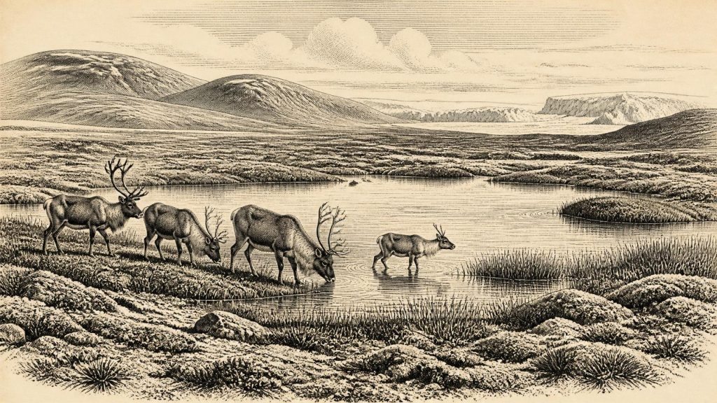
The Derryvree plant and insect evidence points to a cold, periglacial landscape. Mosses, sedges and herbaceous pollen, along with aquatic and wet-ground plants, indicate shallow or slow-moving fresh water bordered by marshy ground. The assemblage includes species and plant communities consistent with tundra or Arctic-alpine conditions. It does not show the dense, mixed woodland associated with much later Ireland. Short growing seasons, severe winters and seasonal frost restricted taller vegetation, although sheltered ground, water margins and soils enriched by sediment could support locally productive patches.
This matters because “Ice Age Ireland” was not a single unchanging white expanse. Derryvree demonstrates that at least one part of Fermanagh was ice-free long enough for water, plants and invertebrates to leave an organic record. Comparable inter-till deposits at Hollymount near Maguiresbridge and Greenagho near Belcoo reinforce the wider conclusion that cold, non-glacial intervals occurred in northern Ireland during the Midlandian. Yet such sites do not prove that every district was open at the same time. Conditions could have differed sharply between lowland basins, uplands, coasts and areas close to advancing ice.
Ice on the Move
The period around 32,700 calibrated years before present preceded the fullest extent of the last British–Irish Ice Sheet, but it was not a tranquil prelude. Modern reconstructions identify major ice-sheet growth from about 31,000 to 26,000 years before present, before maximum ice cover later enveloped Ireland and its continental shelf. That broad trajectory helps explain the Derryvree sequence: an environment able to sustain freshwater life was eventually overwhelmed and preserved beneath glacial deposits. The precise timing, direction and reach of any advance at a particular Irish locality remain subjects for geological reconstruction, not facts available to a calendar-year chronology.
Sea level was lower than today, and the outlines of the Irish Sea basin and surrounding coasts were different. Nevertheless, lower water does not automatically mean a simple land bridge on which animals or people could walk from continental Europe to Ireland. Ice loading, relative sea-level change, marine channels and shifting topography created complex, temporary configurations. A route may have involved exposed land, ice, water crossings or combinations of all three; its accessibility to particular species cannot be assumed from a modern map. Ireland was ecologically connected to north-west Europe, but the character of that connection was changing.
Caves and Large Mammals
Southern Irish caves provide a second, very different kind of evidence. Castlepook Cave near Doneraile in north County Cork, once called Mammoth Cave by its early excavator Richard Ussher, has yielded a rich but complicated collection of Late Pleistocene animal remains. Reassessment and improved radiocarbon methods have altered the chronology of several bones. The cave’s wider MIS 3 fauna includes reindeer, woolly mammoth, giant deer, horse, brown bear, wolf, foxes, Arctic fox, mountain hare, lemmings and spotted hyaena. Such a list indicates that Ireland was reached, at different points in the period, by animals associated with open cold-country habitats and by their predators.
It would be unsafe, however, to assemble these species into a single herd walking past Derryvree in 30,752 BCE. Cave bone collections can accumulate through carnivore activity, deaths in or near a cave, flooding, sediment movement and nineteenth- or early twentieth-century excavation. Individual specimens may be separated by thousands of years. The key evidence is that these animals reached Ireland during the broad Late Pleistocene interval, not that they all occupied one field, cave mouth or season together. Equally, mammoth or giant-deer bones demonstrate animal presence; they do not prove hunting.
The Human Question
Castlepook also raises the most important and unsettled question for this date: whether people reached Ireland during MIS 3. A reindeer femur from the historical cave collection has been reported as bearing marks consistent with cutting or chopping by a sharp stone tool and as dating to around 33,000 years ago. If the marks are confirmed as anthropogenic and contemporary with the animal’s death, the specimen would be evidence that people handled a carcass in Ireland or its contemporary landscape far earlier than the traditionally accepted record of human activity on the island.
That possibility must be described with care. The marked bone is not an excavated hearth, a sealed camp floor, a stone-tool assemblage, a dwelling or a burial. Its early excavation history means that its original position and associations are poorly documented. One modified bone cannot establish whether people hunted the reindeer, scavenged it, camped nearby, travelled through briefly or returned in later generations. Ongoing work at Castlepook has located surviving Pleistocene deposits and aims to improve this evidential position. Until a securely stratified assemblage is recovered and fully analysed, permanent settlement in Ireland around this date remains unproven.
What Everyday Life Cannot Yet Tell Us
There is consequently no defensible political narrative for Ireland in 30,752 BCE. There are no named leaders, territories, alliances, diplomatic exchanges, wars, fortifications or institutions. Conflict can be documented only at the ecological level: predators and scavengers competed for carcasses, while advancing ice transformed habitable ground. It would be misleading to turn animal movement or changing ice margins into tribal politics.
Likewise, society, religion, culture and learning remain archaeologically invisible here. No human grave, art, ornament, ritual deposit, house, hearth or worked-stone industry of this age is securely known from Ireland. If visitors did enter the island-region, their material lives may have resembled those of Upper Palaeolithic hunter-gatherers elsewhere in north-west Europe, but that is comparison rather than Irish evidence. It cannot supply a language, belief system, social structure or technological repertoire for the people potentially represented by the Castlepook bone.
Resources Without a Recorded Economy
The landscape could have offered substantial resources in favourable seasons: grazing animals, meat and fat, hides, sinew, bone, antler, freshwater, edible plants and perhaps driftwood or sparse woody fuel. But potential is not proof of use. No securely associated Irish toolkit or camp deposit permits reconstruction of hunting practices, food sharing, clothing, storage or movement routes. Nor is there evidence for trade. The movement of mammals into Ireland reveals ecological dispersal, not commerce, and a possible human visit does not demonstrate an exchange network.
Settlement must therefore be understood chiefly as an environmental question. Derryvree records a freshwater basin within cold open country, while Castlepook preserves evidence from a limestone cave system in the south. Neither is a village. The most important development around this broad date was the instability of the land itself: locally ice-free wet ground and animal habitat existed within a regional world becoming increasingly dominated by a growing ice sheet. That tension between temporary ecological opportunity and approaching glaciation is the clearest history Ireland can responsibly offer for 30,752 BCE.
Primary Sources
- A Middle Midlandian Freshwater Series at Derryvree, Maguiresbridge, County Fermanagh, Northern Ireland
- Early Midlandian–Middle Midlandian, Pleistocene, Northern Ireland
- Palaeoecology: The Middle Midlandian Palaeoenvironment of South Fermanagh
- Middle Midlandian Interstadial Deposits at Greenagho, Near Belcoo, County Fermanagh, Northern Ireland
- An Inter-Till Freshwater Deposit at Hollymount, Maguiresbridge, Co. Fermanagh
- Freshwater Organic Deposits and Stratified Sediments Between Early and Late Midlandian (Devensian) Till Sheets, at Aghnadarragh, County Antrim, Northern Ireland
- The Irish Quaternary Fauna Project
- A Reconsideration of the Radiocarbon Dating of the Marine Isotope Stage 3 Fauna from Southern Ireland
- Growth and Retreat of the Last British–Irish Ice Sheet, 31,000 to 15,000 Years Ago: the BRITICE-CHRONO Reconstruction
- BRITICE-CHRONO Maps and GIS Data of the Last British-Irish Ice Sheet 31 to 15 ka
- The Timing and Magnitude of the British–Irish Ice Sheet Between Marine Isotope Stages 5d and 2
- Trimlines, Blockfields and the Vertical Extent of the Last Ice Sheet in Southern Ireland
- Ireland: Submerged Prehistoric Sites and Landscapes
- The Problem of a Late Quaternary Landbridge Between Britain and Ireland
- Deglaciation, Earth Crustal Behaviour and Sea-Level Changes in the Determination of Insularity: A Perspective from Ireland
- Archaeological Heritage of County Cork
- Heritage Artefacts of County Cork
- Archaeology Research Excavation Grant Report: Castlepook Cave
- 32564: Castlepook Cave, Doneraile, County Cork
- New Insights on the Fauna of Ireland's Younger Dryas and Early Holocene from Alice & Gwendoline Cave
