
Maguirebridge’s Buried Season30660 BCE
Labelled 30,660 BCE by modern chronology, this period cannot be tied to a specific Irish event or season. Derryvree, near Maguiresbridge, preserves freshwater silts between glacial tills, indicating locally ice-free, cold conditions during MIS 3 before later ice expansion. Radiocarbon dating places the deposits broadly within a range encompassing this notional year. Plant and insect remains reveal treeless tundra wetland, with mosses, sedges, pools and cold-adapted flora. Cave fauna from Castlepook indicates a wider Ice-Age mammal community. A possibly cut-marked reindeer bone suggests transient human activity, but cannot demonstrate settlement. Ireland remained environmentally unstable as the British–Irish Ice Sheet advanced.
Dateline
30,660 BCE is a modern calendar label, not a date that can be pinpointed in Ireland’s prehistoric record. No Irish site can presently identify an event, a person, or a particular season in that numbered year. The most responsible approach is to place it within the late Pleistocene, during Marine Isotope Stage 3 (MIS 3), a long and climatically unstable part of the last Ice Age. In calendar terms, 30,660 BCE is about 32,600 years before the conventional radiocarbon ‘present’ of 1950. It falls within the broad calibrated span of one of Ireland’s most revealing environmental archives: the buried freshwater deposits at Derryvree near Maguiresbridge, County Fermanagh.
A Wetland Between Glaciers
Road works in 1969 cut through a drumlin at Derryvree, about two kilometres north-east of Maguiresbridge. Beneath the familiar glacial landform, investigators found an extraordinary sequence: thick till, then freshwater silts and fine sands rich in organic remains, then another thick till. Till is unsorted sediment laid down directly by glacier ice. The sequence therefore establishes a major environmental fact. Ice had occupied this part of Fermanagh; an interval followed in which standing or slowly moving fresh water, wet ground and vegetation developed; and later ice-related deposition sealed that landscape from view.
The organic layer produced a conventional radiocarbon age of 30,500 years BP, with a substantial uncertainty range of +1,170/-1,030 years. Such a result is not the same thing as a calendar date. Radiocarbon years must be calibrated because atmospheric carbon levels have varied over time. Later scholarship has expressed the Derryvree result broadly as about 36,900–31,700 calibrated years BP, or approximately 34,950–29,750 BCE. Thus 30,660 BCE lies within the outer calendar range relevant to the deposit, but it cannot be claimed that the pool, plants or insects were observed in that precise year. The dated material accumulated across an interval, and the calibration range remains wide.
Derryvree is valuable precisely because it resists the old picture of an Ireland simply buried beneath continuous ice. It records cold, non-glacial conditions at one north-central locality during the build-up to the Last Glacial Maximum. That does not prove that the entire island was ice-free at once. Ice margins were mobile, regional conditions differed, and the surviving record is fragmentary. But it does demonstrate that parts of Ireland could contain exposed ground and functioning freshwater habitats during a severe phase of the Ice Age.
Open Tundra, Living Water
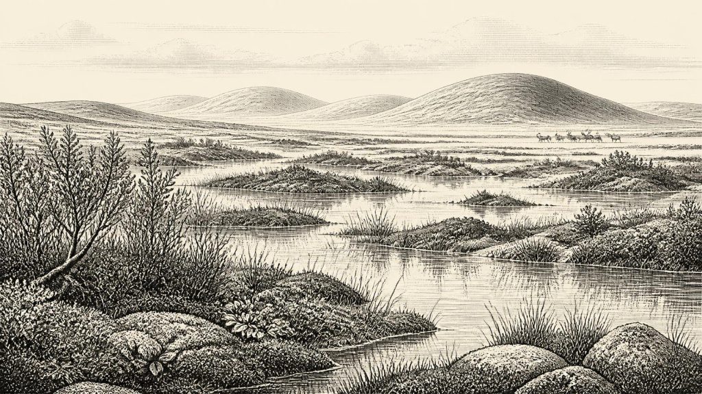
The fossils from Derryvree provide the clearest evidence for everyday ecological conditions. Pollen was poorly preserved, but it was mainly from herbaceous plants rather than trees. Plant macrofossils included mosses, sedges and cold-adapted species. Dwarf willow, mountain-avens, bogbean and alternate water-milfoil have all been identified or reported from the freshwater series. Together they point to an open, treeless landscape: tundra-like ground with mossy wetland, sedge growth, pools and sparse vegetation on drier surfaces.
This was not an empty frozen desert. Water-milfoil indicates freshwater; bogbean and sedges indicate wet margins; mosses accumulated where damp ground and shallow water allowed them to grow. Insect remains add to the picture. Their northern, cold-climate character was interpreted as evidence for a muskeg-like environment: saturated, plant-rich ground with open water among mosses. The landscape would have offered seasonal resources to insects, birds and mammals, although its productivity was sharply constrained by cold, short growing seasons and winter severity.
Nor should “interstadial” be mistaken for a mild, forested respite. In Irish Quaternary terminology, Derryvree belongs to a middle-Midlandian cold phase. It was a time when ice was absent locally, not a time of comfortable weather. Periglacial conditions mattered: repeated freezing and thawing, seasonal snow cover, thin or discontinuous soils, exposed mineral ground and very limited woodland. The few tree pollen grains cannot responsibly be used to reconstruct local forest; they may have travelled long distances or entered deposits in small quantities. The strongest evidence is for low vegetation and a cold wetland mosaic.
An Island in a Changing Ice-Age World
Ireland’s geography was very different from today’s, although it is unsafe to draw a single coastline for this particular year. Global sea level was lower during the Ice Age, exposing parts of the continental shelf and changing the extent of seas and coastal plains. Yet Ireland’s connections with Britain and mainland Europe were controlled not only by sea level but also by ice, rivers, coastal terrain and rapidly changing climate. A lower sea did not automatically create an easy, permanent route for people or animals.
Glaciological research shows that the British–Irish Ice Sheet did not expand everywhere at one moment. Organic deposits at Derryvree and Greenagho in Fermanagh demonstrate ice-free conditions in north-central Ireland until at least roughly 34,000 calibrated years ago. Subsequently, the ice sheet grew and expanded. By the global Last Glacial Maximum, conventionally dated to around 26,000–20,000 calibrated years BP, extensive ice affected most or all of the island. Around 30,660 BCE, therefore, Ireland belonged to an unsettled transition: habitats existed, but their long-term survival was vulnerable to the advancing cold-stage ice system.
This environmental instability is the closest equivalent to a major regional development. There were no states, borders, rulers or diplomatic relations that archaeology can identify in Ireland at this depth of time. No evidence supports talk of tribes, nations, languages, ethnic identities or political territories. The meaningful forces shaping life were climate, ice movement, water availability, vegetation and the movement of animals through a wider north-west European zone.
Animals and the Cork Cave Record
Late Pleistocene Ireland was capable, at intervals, of supporting an imposing mammal fauna. Cave collections, especially from Castlepook Cave near Doneraile in north County Cork, include remains attributed to woolly mammoth, reindeer, giant deer, brown bear, wolf, Arctic fox, hare, lemmings and spotted hyaena. These animals should not be assembled into one simultaneous scene. A cave collection may have accumulated over thousands of years, and predators, scavengers, water, sediment movement and early excavators all affected what survived and where it was recovered.
Castlepook nevertheless helps illuminate the wider world to which Derryvree belonged. Reindeer and mammoth imply open landscapes able to sustain large grazing mammals; hyaenas and wolves show that carcasses were contested by predators and scavengers. Re-dating of southern Irish cave material has also shown why caution is essential: improved pretreatment can make bones thousands of radiocarbon years older than earlier measurements suggested. The island’s faunal history is being refined rather than simply read from an unchanging list of finds.
A reindeer femur from Castlepook has particular importance. County Cork heritage publications identify it as a Palaeolithic bone of about 31,000 BCE and interpret a deep mark as damage made by a sharp stone tool while the carcass was processed. If that interpretation is sustained, it may represent Ireland’s earliest claimed evidence for human handling of an animal. It is an important possibility, not proof of a settled population. The bone derives from an old, complicated cave assemblage, not from a sealed campsite. There is no securely associated hearth, stone-tool collection, dwelling surface, human burial or repeated concentration of butchered waste of this age.
People: Possibility, Not Population
Accordingly, Ireland at or around 30,660 BCE cannot responsibly be described as inhabited in any continuous sense. The Castlepook femur may indicate a brief human encounter with a reindeer carcass during the broader period, perhaps by mobile Upper Palaeolithic hunters moving through an exposed or changing coastal world. It does not reveal whether they killed the animal, butchered it at the cave, arrived in a larger party, crossed open water, or returned. Nor can it identify their technology beyond the possible use of a sharp stone edge, their social organisation, beliefs, speech or origin.
For this reason, conventional headings such as politics, conflict, diplomacy, religion, learning, trade and settlement must mostly remain blank. No Irish evidence from this horizon demonstrates organised warfare, exchange networks, ritual places, artistic traditions, leadership or permanent homes. It would be misleading to fill those absences with analogy from better-known Upper Palaeolithic societies elsewhere in Europe. Those comparisons can suggest what was possible, but they are not evidence for Ireland.
There may have been no human community on the island at all at the moment represented by the modern date. If people did visit during the Derryvree interval, their lives would have been governed by mobility, weather, animal movements and the practical demands of warmth, shelter and food. That is interpretation, not direct observation. What the evidence securely records is a cold freshwater landscape, rich enough to sustain specialised plants and small invertebrates, set between episodes of glaciation and within reach of Ice-Age mammal communities.
What Derryvree Preserves
The significance of 30,660 BCE for Irish history therefore lies not in a named event but in a buried ecological moment. Derryvree preserves proof that, before the later ice advance, a Fermanagh wetland existed between glacier-laid sediments. Its silts hold the remains of plants and insects that turn an otherwise abstract Ice Age into a particular landscape of shallow water, sedges, mosses and open tundra. Castlepook, far to the south, adds evidence for a broader animal world and a tantalising but unconfirmed human trace.
These records are incomplete, geographically separate and dated in ranges rather than calendar years. Their limitations are part of their historical meaning. Ireland’s deep past is not a blank page, but neither is it a story that can yet be narrated day by day. Around this notional year, the island was a changing cold-world environment: locally ice-free in places, ecologically alive, and increasingly exposed to the expansion of the British–Irish Ice Sheet.
Primary Sources
- A Middle Midlandian Freshwater Series at Derryvree, Maguiresbridge, County Fermanagh, Northern Ireland
- A Reconsideration of the Radiocarbon Dating of the Marine Isotope Stage 3 Fauna from Southern Ireland
- New Insights on the Fauna of Ireland’s Youngest Prehistoric Period from Alice and Gwendoline Cave, County Clare
- Trimlines, Blockfields and the Vertical Extent of the Last Ice Sheet in Southern Ireland
- BRITICE Glacial Map, Version 2: A Map and GIS Database of Glacial Landforms of the Last British–Irish Ice Sheet
- Early Midlandian–Middle Midlandian, Pleistocene, Northern Ireland
- Palaeoecology
- The Quaternary of Northern Ireland: A Field Guide
- Cenozoic: Tertiary and Quaternary
- Soils of County Waterford
- Maximum Extent and Dynamic Behaviour of the Last British–Irish Ice Sheet West of Ireland
- Radiocarbon Constraints on the Age of the Maximum Advance of the British–Irish Ice Sheet in the Celtic Sea
- Pattern and Timing of Retreat of the Last British-Irish Ice Sheet
- Growth, Dynamics and Deglaciation of the Last British–Irish Ice Sheet: The Deep-Sea Ice-Rafted Detritus Record
- New Data for the Last Glacial Maximum in Great Britain and Ireland
- Extent and Retreat History of the Barra Fan Ice Stream Offshore Western Scotland and Northern Ireland During the Last Glaciation
- AMS 14C Dating of Deglacial Events in the Irish Sea Basin and Other Sectors of the British–Irish Ice Sheet
- Menyanthes trifoliata
- Salix herbacea
- Dryas octopetala
- Myriophyllum alterniflorum
- Heritage Artefacts of County Cork