Menyanthes Under Drumlin Clay30659 BCE
30,659 BCE is a modern label within Marine Isotope Stage 3, not a recoverable Irish year. Evidence from Derryvree, County Fermanagh, records a freshwater wetland between glacial advances, later sealed beneath drumlin till. Its sediments, dated broadly to 36,900–31,700 calibrated years before present, contain bogbean, sedges, mosses and other plants indicating cold, treeless periglacial conditions. Castlepook Cave, County Cork, preserves bones of mammoth, giant deer, reindeer, bear, hyaena and later cold-adapted fauna, demonstrating changing open environments and movement routes. A possibly cut-marked reindeer bone may indicate transient human activity, but cannot securely establish settlement, chronology or social life with certainty.
Dateline
30,659 BCE is a modern chronological label, not a year that could be recovered from an Irish record or recognised by people then living. At this depth of time, archaeology cannot identify a season, a political event, an individual or a settled community in one particular calendar year. The best responsible approach is to place the date within a broad late-Pleistocene interval: roughly 32,600 calibrated years before present, where “present” conventionally means AD 1950. It falls within Marine Isotope Stage 3, an unstable part of the last Ice Age marked by abrupt shifts between relatively milder and colder conditions.
Ireland around this notional point is therefore known through deposits, fossils and landforms rather than through chronicles. The evidence is scattered and frequently difficult to date. Later glaciers scraped away, mixed or buried much of the older landscape. Yet two very different Irish archives are especially revealing: the freshwater sediments sealed within a drumlin at Derryvree near Maguiresbridge, County Fermanagh, and the rich cave-bone assemblage at Castlepook near Doneraile, County Cork. Together they indicate a cold, open and changing island-edge environment in which wetlands, tundra vegetation and large mammals could occur during intervals between episodes of more extensive ice.
Dating a Landscape, Not a Year
The distinction between radiocarbon years and calendar years matters greatly here. Organic material from Derryvree produced the well-known radiocarbon determination BIRM-166: 30,500 radiocarbon years before present, with a large laboratory uncertainty of +1,170 and −1,030 years. Radiocarbon ages cannot simply be subtracted from 1950, because atmospheric carbon-14 levels have changed over time. Calibration with modern curves places the Derryvree material broadly in the range of about 36,900 to 31,700 calibrated years before present, or approximately 34,950 to 29,750 BCE.
That wide interval encompasses 30,659 BCE, but does not turn it into a securely dated episode. The organic sediments accumulated over time; they are not a snapshot of one day, year or generation. Nor can Derryvree be treated as a weather station for the entire island. What it does demonstrate is more valuable and more limited: at some point in this broad period, a locality in present-day Fermanagh lay free of overriding glacier ice long enough for freshwater sediment, plants and small animals to build up, before a later ice advance buried the deposit.
The Derryvree Wetland
Road works in 1969 cut through a drumlin about two kilometres north-east of Maguiresbridge and exposed an exceptional sequence. Beneath the drumlin lay a thick lower till, then fine sands, freshwater silts and organic beds, followed by another thick till. Till is the unsorted mixture of clay, stones and debris deposited directly by glacier ice. The sequence establishes the order of events clearly: ice had previously occupied the site; an intervening, non-glacial phase allowed a wetland or shallow pool to form; and later ice sealed the evidence beneath fresh glacial sediment.
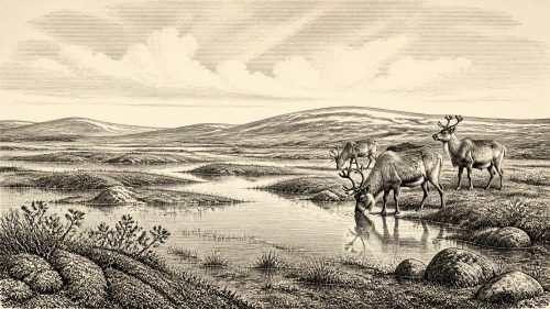
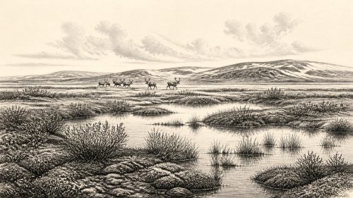
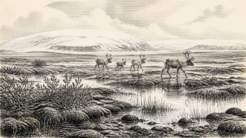
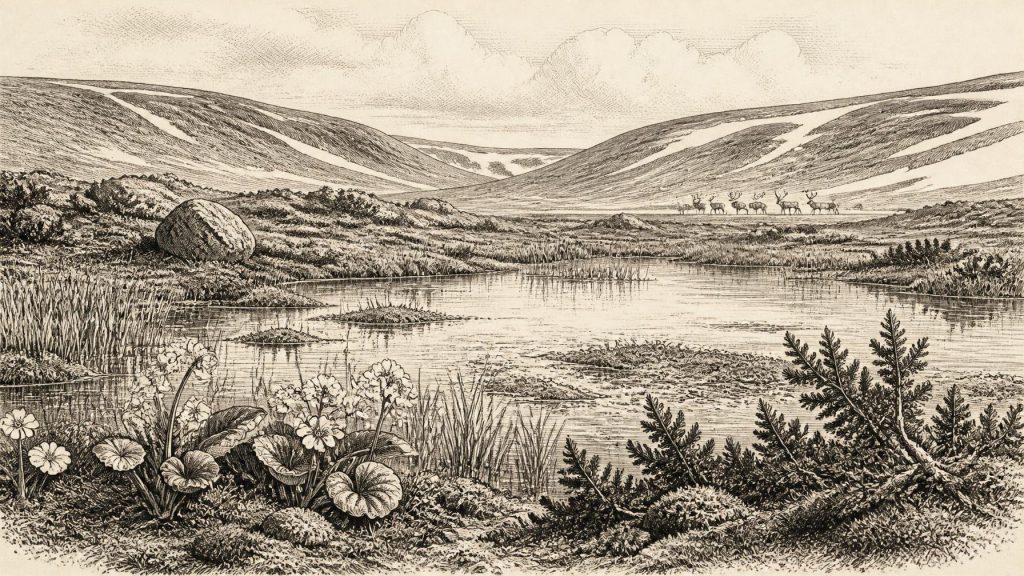
The fossils from the middle beds point to a treeless, periglacial environment. Sedges and grasses were important, accompanied by mosses, herbs, juniper and low-growing plants suited to exposed conditions. The recovery of bogbean (Menyanthes trifoliata) is especially evocative. This is a plant of wet ground and shallow water, and its fossil seed confirms that freshwater habitats existed locally amid the cold landscape. Lesser clubmoss and other arctic-alpine or boreal plants reinforce the picture of open vegetation rather than woodland. “Muskeg” is a useful description for parts of this setting: waterlogged ground with mossy, sedgy vegetation, pools and saturated sediments.
This was not necessarily an unbroken, level tundra plain. The surrounding ground was likely varied by frost action, drainage channels, patches of bare sediment, shallow water and glacially fashioned relief. Long winters, frozen ground and brief growing seasons would have constrained plant cover. But a wetland with aquatic plants, mosses and sedges was biologically productive in its own way. It provided food and shelter for insects and other small creatures, while its water and vegetation would have made it a conspicuous refuge within a harsher wider terrain.
Ice, Water and Regional Change
The date belongs before the Last Glacial Maximum, when the British–Irish Ice Sheet reached its most extensive late-glacial form thousands of years later. That does not mean Ireland was comfortably ice-free in 30,659 BCE. Research increasingly depicts the preceding period as one of dynamic ice growth, retreat and reorganisation, rather than a simple progression from mild conditions to a single all-encompassing freeze. Some regions may have had substantial ice nearby while others retained ice-free ground, and the precise extent of ice remains debated.
Derryvree’s position between two tills is vital evidence for this instability. It preserves a local pause between glacial episodes, not proof that the whole island shared a uniform climate or surface cover. The organic beds survived precisely because later till protected them. Elsewhere, ice erosion and meltwater probably destroyed equivalent deposits. This uneven survival explains why Ireland’s deep prehistoric record is so patchy: absence of evidence often reflects the violence of glacial processes, not necessarily absence of plants, animals or people.
Cave mineral deposits add another perspective. At Crag Cave in County Kerry, phases of speleothem growth during Marine Isotope Stage 3 indicate episodes when liquid water could circulate through shallow cave systems. Such deposits are not a detailed diary of Derryvree or of 30,659 BCE, but they support the broader conclusion that Ireland experienced repeated climatic oscillations during this part of the Ice Age.
Castlepook’s Mammal World
Far to the south, Castlepook Cave preserves Ireland’s richest known archive of vertebrate remains from the period leading towards the Last Glacial Maximum. More than 2,000 bones have been recovered from its narrow galleries and chambers. Direct dates show that the assemblage spans a long period rather than one occupation event. Its fauna includes woolly mammoth, giant deer, reindeer, brown bear and spotted hyaena; later material includes Arctic fox, wolf and lemmings.
These animals should not be imagined as a single herd crossing one landscape together. Cave deposits accumulated through many processes and over millennia. Carnivores used caves; bones could be carried in, scavenged, disturbed by water or redeposited. Individual bones have different ages. Nonetheless, the assemblage proves that cold-adapted and open-country mammals reached Ireland during the wider Marine Isotope Stage 3 world. Reindeer and lemmings are particularly consistent with sparse vegetation and cold conditions, while hyaenas demonstrate that a formidable predator and scavenger was part of the animal community.
The practical geography of this world was shaped by changing sea levels, ice margins, coastlines and ecological corridors across north-west Europe. Mammals did not live in an isolated Irish ecosystem in the modern sense. Their presence indicates that routes of movement into and out of the island were available during suitable phases, though the exact routes and timing remain uncertain.
A Possible Human Trace
Castlepook is also relevant to the question that inevitably arises: were people in Ireland at this time? A reindeer femur from the cave has a deep incision interpreted by zooarchaeologist Ruth Carden as a cut or chop made with a sharp stone tool while the bone was fresh. County Cork heritage publications associate the specimen with approximately 31,000 BCE. If that interpretation is correct, it is potentially Ireland’s earliest evidence that a person processed an animal carcass, and it places a human action in the broad chronological neighbourhood of this article’s date.
Its importance should not be exaggerated. The bone’s age does not date the instant when the mark was made with annual precision, and the specimen came from an old cave collection rather than a newly excavated, sealed occupation layer. Castlepook has not yielded a securely associated hearth, stone-tool assemblage, built shelter, human burial, food store or repeated living surface of this age. The cave’s complex formation history also means that a bone found there need not mark the place where an animal was killed or butchered. A cautious conclusion is that a single modified bone may record a brief encounter between people and reindeer, not a permanent settlement.
If humans did visit Ireland during this interval, their social and economic life cannot be recovered in detail. There is no evidence for chiefs, territories, diplomacy, warfare, religious institutions, language or formal political organisation. Nor is there evidence for farming, trade networks or permanent villages. The most that can be said is that Upper Palaeolithic people elsewhere in north-west Europe possessed sophisticated stone-working skills, extensive knowledge of animal behaviour and highly mobile ways of obtaining food and raw materials. Any Irish visitors may have shared some of these capacities, but projecting a fully documented continental lifeway onto one uncertain Irish bone would go beyond the evidence.
No Chronicle, but a Real Past
The history of Ireland around 30,659 BCE is thus environmental before it is political. The strongest evidence concerns water, ice, vegetation and animals: a Fermanagh wetland with bogbean beneath a later drumlin, and Cork caves containing the remains of mammals adapted to a cold and open world. The possible cut-marked reindeer femur adds an arresting but still limited human dimension. It asks historians to recognise that Ireland’s past reaches far deeper than its later monuments and manuscripts, while also accepting the severe limits of what the surviving record can tell us.
Primary Sources
- A Middle Midlandian Freshwater Series at Derryvree, Maguiresbridge, County Fermanagh, Northern Ireland
- A Reconsideration of the Radiocarbon Dating of the Marine Isotope Stage 3 Fauna from Southern Ireland
- Castlepook Cave, County Geological Site Report
- Exploring Controls of the Early and Stepped Deglaciation on the Western Margin of the British-Irish Ice Sheet
- The Timing and Magnitude of the British–Irish Ice Sheet Between Marine Isotope Stages 5d and 2
- Episodic Speleothem Deposition Tracks the Terrestrial Impact of Millennial-Scale Last Glacial Climate Variability in SW Ireland
- The IntCal20 Northern Hemisphere Radiocarbon Age Calibration Curve (0–55 cal kBP)
- IntCal Publications
- Figure 6.— The Subdivision of the Quaternary Period in Ireland
- Heritage Artefacts of County Cork
- Archaeology Research Excavation Grant 2022: Final Report
- 2022:564 – Castlepook Cave, Castlepook South, Cork
- New Insights on the Fauna of Ireland’s Younger Dryas and Early Holocene from Alice & Gwendoline Cave
- First Evidence of a Late Upper Palaeolithic Human Presence in Ireland
- The Irish Quaternary Fauna Project
- BSBI: Menyanthes trifoliata
- BSBI: Selaginella selaginoides
- The Geological Heritage of County Leitrim
- Introduction to the Late Quaternary and Holocene of Northern Ireland
- Archaeological Heritage of County Cork