
Derryvree’s Threeleaf Sands30639 BCE
Although 30,639 BCE cannot be identified precisely in Ireland’s record, it falls within the Late Pleistocene MIS 3 interval represented by Derryvree, County Fermanagh. There, freshwater silts, sealed between glacial tills, record an ice-free wetland before glacier advance. Plant and insect remains indicate shallow water, sedges, mosses and tundra vegetation in a cold, seasonal landscape. Castlepook Cave, County Cork, preserves cold-stage mammals, but its disturbed, long-lived deposits cannot establish their coexistence at this date. Possible human evidence is limited to a disputed cut-marked reindeer bone. Ireland’s history at this horizon is therefore environmental: ice, habitats, animal movements and fragmentary sediments.
Dateline
30,639 BCE is a modern chronological label, not a recoverable year in Ireland’s archaeological record. No written calendar, settlement sequence, named community or securely dated event allows modern calendar-year precision at this depth of time. The responsible frame is the Late Pleistocene, broadly Marine Isotope Stage 3 (MIS 3), a climatically unstable part of the last glacial cycle. In radiocarbon terms, the point falls about 32,588 years before AD 1950, but radiocarbon years and calendar years are not interchangeable. The nearest informative Irish evidence comes in broad calibrated ranges and layered sequences, not annual entries.
The most relevant record is the Derryvree freshwater deposit near Maguiresbridge, County Fermanagh. Organic-rich silts and fine sands there were sealed between two deposits of glacial till: debris laid down directly by ice. A conventional radiocarbon determination, BIRM-166, gave an age of 30,500 radiocarbon years BP, with a large uncertainty. Published syntheses have placed the deposit broadly at about 36,900–31,700 calibrated years BP, or approximately 34,950–29,750 BCE. The nominal year considered here lies within that wide interval. It cannot be assigned to a particular layer, season, animal or action within it.
A Wetland Between Ice Advances
Derryvree matters because its stratigraphy preserves a sequence that later ice otherwise erased across much of Ireland. First, glacier ice deposited the lower till. Then, at least locally, conditions allowed water, mineral sediment and organic matter to accumulate in a shallow freshwater basin. Later ice laid down the upper till, burying the wetland. The deposit therefore demonstrates an interval when this part of Fermanagh was not continuously overridden by glacier ice. It does not demonstrate that all Ireland was ice-free at once, nor that the island possessed one uniform climate or landscape.
The old term “Middle Midlandian interstadial” is often attached to this kind of evidence: an interruption or fluctuation within the wider last glacial period. More recent work stresses that the British–Irish Ice Sheet was dynamic and that its pre-Last Glacial Maximum history remains difficult to reconstruct. The great ice-sheet maximum came later, during roughly the interval from 27,000 to 19,000 years ago, depending on the sector and method of dating. Around 30,639 BCE, Ireland was therefore moving through an earlier, shifting glacial world rather than standing at the maximum of the last ice sheet.
Treeless Water and Tundra Plants
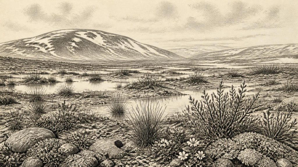
The Derryvree silts preserve the remains of a cold, open environment. Pollen, seeds, mosses and insect evidence point to a treeless wetland or muskeg landscape, with shallow water and saturated ground bordered by tundra-like vegetation. Sedges and mosses were important elements. Finds attributed to plants such as bogbean, water-milfoil, dwarf willow, mountain avens and fringed sandwort indicate that conditions were not simply lifeless snowfield. There were pools, wet margins and patches of vegetation capable of supporting specialised cold-climate communities.
This evidence must be read carefully. Plant remains establish that those species, or close ecological communities, grew near the basin during the time represented by the deposits. They do not create a complete map of Fermanagh, still less a single picture of Ireland. A plant might have grown at the pool edge while nearby slopes were barer, windier or seasonally snow-covered. Equally, freshwater species show local open water, not mild weather throughout the year. The strongest conclusion is modest but significant: part of northern Ireland held a biologically active, treeless freshwater landscape during a cold phase before later glacier advance.
Such a setting would have been highly seasonal. Long winters, frost action, sparse woodland cover and short growing seasons are reasonable inferences from the flora and the wider climatic setting. Spring and summer would have transformed wet ground as meltwater, rainfall and thaw fed pools and sedge beds. Insects and aquatic plants make clear that even a severe glacial climate contained ecological niches. The landscape was not an empty foreground to advancing ice; it was a changing mosaic of water, mud, low vegetation and exposed mineral ground.
Animals in a Fragmentary Record
Southern Ireland supplies a different, though equally imperfect, window. Castlepook Cave, also called Mammoth Cave, near Doneraile in County Cork, has yielded Ireland’s richest assemblage of last-cold-stage mammal remains. Its fauna includes woolly mammoth, reindeer, giant deer, brown bear, wolf, Arctic fox, mountain hare, lemmings and spotted hyaena. These animals show that, at intervals during the Late Pleistocene, Ireland formed part of a wider north-west European faunal world. Low sea level and changing ice and coastal conditions permitted movements that are impossible across the modern Irish Sea.
The cave is not a census for 30,639 BCE. Its deposits accumulated over long periods, excavation began in the early twentieth century, and material was recovered from complicated, sometimes disturbed contexts. Modern redating has revised several earlier ages substantially older. In particular, reappraisal suggests that giant deer and spotted hyaena may have disappeared locally before about 40,000 calibrated years BP. Thus a mammoth or hyaena bone from Castlepook is evidence for Pleistocene Ireland, but not proof that every animal in the collection lived together, or was present in Cork, in the specified year.
Nevertheless, the animals illuminate the kinds of food webs possible in Ireland around this broad timescale. Reindeer and giant deer fed on plants; mammoths, if present locally at a particular moment, required substantial forage; wolves and hyaenas were predators and scavengers. Caves may have been shelters or dens for carnivores as well as traps or repositories for bones moved by animals, water and people. Their assemblages consequently record both living communities and the processes by which remains entered, were gnawed, buried and rediscovered in caves.
The Human Question
There is no securely excavated settlement, hearth, house, burial or tool assemblage that can be dated specifically to Ireland in 30,639 BCE. Political institutions, diplomacy, warfare, formal religion, literacy, trade networks and named cultural groups are therefore beyond the evidence. It would be misleading to furnish this landscape with tribes, chiefs or a calendar of conflict merely because people elsewhere in Europe made Upper Palaeolithic art and stone tools.
One controversial but important object keeps the possibility of human activity open. A reindeer femur from Castlepook has a deep incision interpreted by some researchers as a cut or chop made by a sharp stone tool. Its reported age, around 33,000 years, has been publicised as possible evidence for very early human presence in Ireland. If that interpretation is confirmed, it would suggest a brief human encounter with a reindeer carcass rather than a demonstrated settled population. The bone’s date is the date of the animal’s death, not automatically the date of the mark; nor does one marked bone identify the maker, the place of butchery or the size and duration of any human visit.
The careful position is consequently twofold. Human presence in Ireland during the broader MIS 3 period is possible and the Castlepook bone merits continued study. Yet no evidence presently permits a narrative of everyday human society in Ireland at this particular point. The much firmer archaeological record of people on the island belongs to the terminal Pleistocene and Holocene, long after the Derryvree wetland was buried beneath ice-derived sediment.
Economy, Culture and Connection
For non-human life, the economy was ecological: plants converted the brief growing season into forage; herbivores moved through open country; predators followed prey or scavenged carcasses. If people did reach Ireland, their practical economy would have depended on mobile hunting, gathering and careful use of animal and plant resources, as among contemporary Upper Palaeolithic groups elsewhere. That is an analogy, however, not evidence for an Irish camp, technology or tradition. No Irish object from this horizon currently establishes trade, craft production, ritual practice or artistic culture.
Connection to Britain and continental Europe should likewise not be simplified into a permanent land bridge. Lower sea levels enlarged exposed shelves, while ice margins, marine channels and coastlines shifted repeatedly. Animals evidently reached Ireland at some stages, but the precise routes and their availability at any single date remain uncertain. The most defensible regional history is one of intermittent accessibility within a volatile glacial geography, not an open road across the sea.
What This Date Can Mean
For Ireland, 30,639 BCE is best understood as a point within a long environmental window. At Derryvree, freshwater silts preserve a cold, treeless wetland that existed after one glacial episode and before another. At Castlepook, cave bones show that remarkable mammals entered Ireland during the broader Late Pleistocene, though their exact overlap and chronology require caution. Later ice reshaped the island and destroyed or buried much of this earlier evidence.
The history of this notional year is therefore not one of rulers, battles or monuments. It is a history of sediments: a pool filling beneath open tundra vegetation, animals moving through changing corridors, and ice returning to seal much of the evidence away. That fragmentary survival is precisely why Derryvree’s threeleaf sands deserve attention. They offer not an anniversary, but a rare, responsibly dated glimpse of Ireland before the last ice sheet reached its greatest extent.
Primary Sources
- A Middle Midlandian freshwater series at Derryvree, Maguiresbridge, County Fermanagh, Northern Ireland
- Figure 6.— The subdivision of the Quaternary Period in Ireland
- A reconsideration of the radiocarbon dating of the Marine Isotope Stage 3 fauna from southern Ireland
- The Irish Quaternary Fauna Project
- New insights on the fauna of Ireland's Younger Dryas and Early Holocene from Alice & Gwendoline Cave
- Castlepook Cave, County Cork: County Geological Site Report
- Spotted Hyena Skull
- Castlepook Cave Excavation, County Cork, 2022
- Occurrence of mammalia relicts at site Castlepook Cave
- Mammoth Cave, County Cork
- The timing and magnitude of the British–Irish Ice Sheet between Marine Isotope Stages 5d and 2
- Timing, pace and controls on ice sheet retreat: an introduction to the BRITICE-CHRONO transect reconstructions of the British-Irish Ice Sheet
- New data for the Last Glacial Maximum in Great Britain and Ireland
- Dimensions and chronology of the last ice sheet in Western Ireland
- Trimlines, blockfields and the vertical extent of the last ice sheet in southern Ireland
- Dynamic cycles, ice streams and their impact on the extent, chronology and deglaciation of the British–Irish ice sheet
- The IntCal20 Northern Hemisphere Radiocarbon Age Calibration Curve (0–55 cal kBP)
- The IntCal20 Northern Hemisphere radiocarbon age calibration curve (0–55 cal kBP)
- The Geological Heritage of County Cork
- County Geological Heritage Audit Reports
- Ireland Under the Ice
- The biogeography of Ireland
