
Maguiresbridge’s Milfoil Basin30637 BCE
At roughly 30,637 BCE, Ireland was in the climatically unstable Marine Isotope Stage 3, not a period with precise calendar dating or written history. At Derryvree near Maguiresbridge, freshwater sediments between glacial tills preserve mosses, sedges and water-milfoil, indicating treeless, cold wetland habitats during an interval of local ice retreat. Comparable Fermanagh deposits confirm environmental oscillation. Southern caves contain diverse cold-stage fauna, including reindeer, mammoth and predators, though deposits cannot date species to one moment. A cut-marked reindeer bone from Castlepook may indicate early human activity, but no settlement is known. Evidence instead reveals life amid advancing and retreating ice.
Dateline
Modern calendar-year precision is not available for Ireland in 30,637 BCE. The label is a convenient modern way of pointing to roughly 32,586 years before AD 1950, the conventional ‘present’ used in radiocarbon science. No Irish written record, named person, excavated settlement or datable political event can be assigned to that year. The responsible subject is a wider Late Pleistocene interval: part of Marine Isotope Stage 3, a climatically unsettled phase of the last Ice Age.
The closest particularly valuable Irish evidence is environmental rather than historical in the ordinary sense. At Derryvree, near Maguiresbridge in County Fermanagh, a road cutting exposed freshwater sediments preserved between two deposits of glacial till. Organic material from this sequence produced the radiocarbon determination BIRM-166, conventionally reported as 30,500 radiocarbon years BP, with a large uncertainty. Scholarship has treated its calibrated age as a broad span of approximately 36,900–31,700 calibrated years BP. Thus 30,637 BCE lies within the general chronological horizon illuminated by the deposit, but cannot be attached to one pool, plant, animal, season or human generation.
A Wetland Between Glaciers
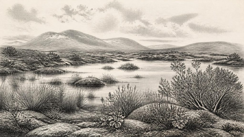
Derryvree matters because its layers record sequence. A lower till shows that glacier ice had previously occupied the locality. Above it came fine sands, freshwater silts and organic-rich material: evidence that ice no longer covered this particular basin long enough for water, sediment and plant remains to accumulate. An upper till later sealed the deposit when ice returned. This is direct evidence for changing local conditions, not proof that all of Ireland was ice-free at once. The island’s terrain, exposure, ice margins and drainage would have varied greatly from region to region.
The plants and insects preserved at Derryvree offer the most immediate glimpse of life around this broad period. Freshwater mosses and sedges occur alongside remains associated with cold, open environments. Published accounts identify plants including bogbean, dwarf willow, mountain-avens, clubmosses and alternate water-milfoil. Their presence supports a picture of shallow or slow-moving freshwater bordered by wet, low vegetation. It does not recreate a modern bog in every detail. Terms such as tundra and muskeg are useful ecological comparisons, but the ancient landscape was its own changing mixture of waterlogged hollows, exposed mineral ground, frost-affected soils and sparse plant cover.
Treeless country is a much more defensible reconstruction than the familiar green, wooded Ireland of later millennia. Short growing seasons, cold winters and repeated freeze-thaw action limited taller vegetation. Yet a severe climate was not an empty one. Pools and marshy margins could support aquatic plants, insects and browsing animals; sheltered ground could offer more food than an exposed ridge. The survival of delicate organic remains beneath a drumlin makes Derryvree unusually important, because later glaciation removed or scrambled evidence across much of the island.
Ice, Water and an Uncertain Coastline
Thirty thousand years before the present, Ireland formed part of a wider north-west European cold-stage world. Sea level was lower than today because much water was stored in continental ice sheets, altering the outlines of coasts and shelves. This should not be simplified into a claim that there was necessarily an easy, continuous dry route from continental Europe to every part of Ireland. The Irish Sea basin, changing glaciers, rivers, islands, sea channels and seasonal conditions all mattered. How particular animals—and any people—moved through this landscape remains uncertain.
The great Last Glacial Maximum had not yet reached its later fullest Irish extent. Modern reconstructions of the British–Irish Ice Sheet show that its growth and retreat were complex, regionally uneven processes rather than one uniform advance. Derryvree’s inter-till freshwater sequence is a warning against imagining a permanently frozen island at 30,637 BCE. Conversely, its eventual burial beneath till warns against imagining a stable refuge. Ireland contained locally favourable environments within a landscape increasingly vulnerable to renewed glaciation.
Regional comparison reinforces that caution. Other Fermanagh sites, notably Hollymount near Maguiresbridge and Greenagho near Belcoo, have yielded inter-till freshwater or organic deposits attributed to cold, non-glacial intervals. Their dates and stratigraphic contexts are not identical, and some determinations are explicitly treated with caution. Together, however, they show that northern Ireland preserves evidence for environmental oscillation: episodes when freshwater habitats developed between phases of glacial activity. These deposits are not annual records and should not be made to speak with more precision than they possess.
Animals in the Open Country
Caves in southern Ireland provide a different, equally qualified window onto the wider animal world. Castlepook Cave near Doneraile, County Cork, has produced one of Ireland’s richest pre-Last Glacial Maximum vertebrate assemblages. Its fauna has included remains attributed to reindeer, woolly mammoth, giant deer, brown bear, wolf, Arctic fox, mountain hare, lemmings and spotted hyaena. Such a list demonstrates that cold-stage animal communities reached or occupied Ireland over long spans of time. It does not demonstrate that every species lived together, nor that each stood near Castlepook in 30,637 BCE.
This distinction is especially important because cave deposits are accumulations, not instant landscapes. Carnivores may drag bones into caves; water may move material; animals may die centuries or millennia apart; and early excavations did not always record contexts to modern standards. Re-dating of southern Irish cave fauna with improved techniques has shown that some older radiocarbon results were substantially too young. The revision has strengthened the case for a significant Marine Isotope Stage 3 fauna in Ireland, while also making simple reconstructions less secure.
Reindeer are particularly relevant to the open, cold-country setting suggested by Derryvree and Castlepook. Their presence indicates that Ireland could support animals adapted to seasonal, low-vegetation environments. Mammoth, giant deer and large predators point to wider food webs and substantial areas of usable habitat. But animal bones do not reveal fixed migration routes, herd sizes or the appearance of any particular valley in a particular year. They establish possibilities constrained by evidence, not an illustrated census of Ice Age Ireland.
The Human Question
The most provocative evidence near this period is a reindeer femur from Castlepook Cave. It has been directly dated broadly to about 33,000 years ago and bears a deep modification that zooarchaeologist Ruth Carden has interpreted as a cut made by a sharp stone tool during carcass processing. If that interpretation is correct, it is evidence that people were present in Ireland far earlier than the previously accepted terminal-Pleistocene record. It would imply the use of a cutting implement and the exploitation of a reindeer carcass.
Even so, the bone cannot sustain a full social history. No securely dated house, hearth, stone-tool workshop, burial, camp surface or sustained settlement of this age has yet been excavated in Ireland. The mark does not identify its maker, establish whether hunters killed the animal, reveal whether butchery happened at the cave, or prove a permanent population. The cave itself may have been a carnivore den or a place where bones were later moved. The careful conclusion is that a brief human visit or small mobile hunting party is possible, perhaps strongly suggested by the cut-mark interpretation, but a resident community cannot be demonstrated.
For that reason, there can be no responsible account of Irish political affairs, diplomacy, organised warfare, named leaders, religious institutions or formal learning in 30,637 BCE. There is no evidence for kingdoms, territories, treaties, languages or collective identities that can be recovered from this period. Nor is there evidence for farming, metalworking, pottery, monuments, long-distance commerce or seafaring networks. Their absence from the record is not proof that every form of social meaning was absent; it is a statement about what the evidence can and cannot show.
Everyday Survival, Not an Annal
If people did enter Ireland during this interval, comparison with Upper Palaeolithic groups elsewhere in north-west Europe suggests that mobility, detailed environmental knowledge, clothing, fire, shelters and stone tools would have been essential. But this is comparison, not direct Irish evidence. No particular tool kit or custom can be imported from Britain or the continent and labelled Irish. The only appropriately modest economic inference from the Castlepook specimen is that people capable of using a sharp lithic edge may have obtained useful resources—meat, hide, sinew, marrow or bone—from a large animal.
Religion and culture are even less recoverable. A cut bone is not art, ritual or a language. Wetland plants are not a belief system. The cultural achievement visible in the evidence is instead scientific: sediments, fossils and landforms allow later investigators to reconstruct fragments of a vanished world. Pollen, macrofossils, insect remains, animal bones, stratigraphy and radiocarbon measurement each answer different questions. Their value lies in being combined carefully, while keeping observation distinct from interpretation.
Ireland around 30,637 BCE was therefore neither a blank nor a conventional historical society. It was a dynamic Late Pleistocene landscape of freshwater basins, open cold-climate vegetation, animals moving through changing habitats and ice that could return to erase or bury what had existed before. Derryvree’s water-milfoil and sedges, preserved beneath later glacial deposits, provide a more trustworthy emblem for the period than an invented chief or battle: life persisted locally in a severe and unstable country, leaving traces too broad for an annal but rich enough to reveal an ancient Irish environment in motion.
Primary Sources
- A Middle Midlandian Freshwater Series at Derryvree, Maguiresbridge, County Fermanagh, Northern Ireland
- Early Midlandian–Middle Midlandian, Pleistocene, Northern Ireland
- Middle Midlandian Interstadial Deposits at Greenagho, Near Belcoo, County Fermanagh, Northern Ireland
- An Inter-Till Freshwater Deposit at Hollymount, Maguiresbridge, County Fermanagh
- Freshwater Organic Deposits and Stratified Sediments Between Early and Late Midlandian (Devensian) Till Sheets, at Aghnadarragh, County Antrim, Northern Ireland
- A Reconsideration of the Radiocarbon Dating of the Marine Isotope Stage 3 Fauna from Southern Ireland
- Growth and Retreat of the Last British–Irish Ice Sheet, 31,000 to 15,000 Years Ago: The BRITICE-CHRONO Reconstruction
- Late Pleistocene Chronostratigraphy and Ice Sheet Limits, Southern Ireland
- Trimlines, Blockfields and the Vertical Extent of the Last Ice Sheet in Southern Ireland
- Dimensions and Chronology of the Last Ice Sheet in Western Ireland
- Response of the Irish Ice Sheet to Abrupt Climate Change During the Last Deglaciation
- The IntCal20 Northern Hemisphere Radiocarbon Age Calibration Curve (0–55 cal kBP)
- The IntCal20 Approach to Radiocarbon Calibration Curve Construction: A New Methodology Using Bayesian Splines and Errors-in-Variables
- The Irish Quaternary Fauna Project
- The Exploration of Castlepook Cave, County Cork, Being the Third Report from the Committee Appointed to Explore Irish Caves
- Heritage Artefacts of County Cork 2021
- 2022:564 – Castlepook Cave, Castlepook South, Cork
- New Insights on the Fauna of Ireland's Younger Dryas and Early Holocene from Alice & Gwendoline Cave
- Investigating Seasonal Mobility in Irish Giant Deer, Megaloceros giganteus (Blumenbach)
- The Geological Heritage of County Leitrim
