
Rosy Saxifrage Under Till30472 BCE
Thirty thousand years BCE is a modern label for a broad Late Pleistocene interval, not a recorded Irish year. At Derryvree, County Fermanagh, freshwater silts containing pollen, plants, mosses and insects lie between glacial tills, demonstrating episodic ice cover and a cold, open wetland mosaic. Radiocarbon dating places this episode broadly between about 34,950 and 29,750 BCE. Castlepook Cave, County Cork, preserves cold-stage animal remains, including reindeer, mammoth and hyaena. A possibly cut-marked reindeer femur suggests fleeting human activity, but requires confirmation. Evidence reveals seasonal, biologically active landscapes, not settled societies, political life or proven continuous land routes to Europe.
Dateline
“30,472 BCE” is a modern chronological label, not a date that people in Ireland could have known or recorded. There was no calendar, writing, named community, ruler, state or historical chronicle on the island at this depth of time. Modern calendar-year precision is unavailable. The responsible subject is therefore not an event in one particular year, but Ireland during the broad Late Pleistocene interval into which that notional date falls: Marine Isotope Stage 3, part of the last Ice Age, when climate and ice margins changed repeatedly.
The strongest Irish environmental evidence comes from Derryvree townland, near Maguiresbridge in County Fermanagh. There, roadworks in 1969 cut through a drumlin and exposed an extraordinary sequence: a lower layer of glacial till, freshwater silts and fine sands rich in organic remains, then a later upper till. The sequence establishes a relative history. Ice had occupied the locality; later, water and living things occupied a basin or hollow; eventually ice or ice-associated sediment returned and sealed the deposit. It is one of the rare windows onto an Irish landscape of this antiquity.
A Broad Chronological Window
Organic material from the Derryvree freshwater deposit produced radiocarbon determination BIRM-166: 30,500 radiocarbon years before present, with an uncertainty of +1,170/−1,030 years. In radiocarbon terminology, “present” means AD 1950. A radiocarbon age is not a calendar age, because atmospheric carbon-14 has varied through time. Calibration is necessary, and at this age produces a probability range rather than a date precise to a year. Published calibration places the Derryvree episode broadly at about 36,900–31,700 calibrated years before present, approximately 34,950–29,750 BCE.
The modern label 30,472 BCE falls within that broad calibrated span. It does not identify the year in which a particular pool formed, a willow shed a leaf, an insect died, or a glacier advanced. Nor can it show that all parts of Ireland had the same weather or ice cover simultaneously. The value of Derryvree lies in its ability to illuminate conditions during a prolonged interval, not to supply an anniversary. Its lower and upper tills are particularly important: they show that the history of ice was episodic and dynamic, rather than a simple story of one uninterrupted frozen island.
Fresh Water in a Cold Landscape
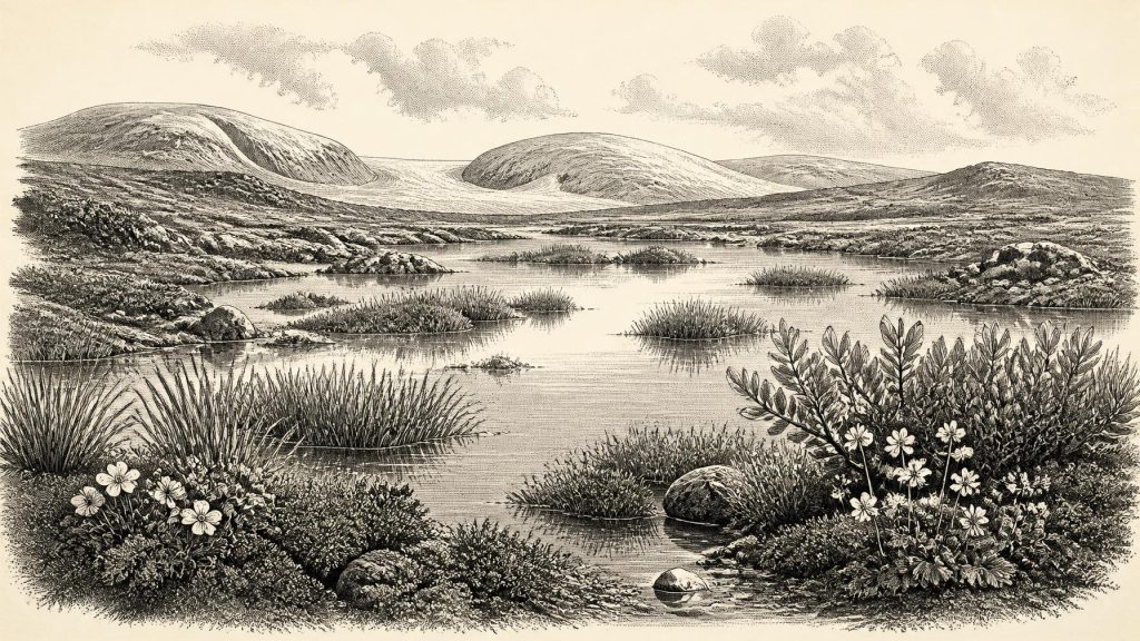
The sediments directly preserve a local freshwater environment. Their pollen, plant macrofossils, mosses and insect remains point to open tundra vegetation and a periglacial climate: a landscape strongly shaped by frost, seasonal thaw, wind exposure and a short growing season. This was not later Ireland’s wooded world of oak, hazel and farmland. It was treeless or nearly treeless ground, with wet hollows, shallow water, mossy patches, sedges, herbs and exposed mineral soil.
Among the recorded plants are mountain avens, dwarf willow, lesser clubmoss, bogbean, alternate water-milfoil and rosy saxifrage. These remains are evidence that such plants, or their parts and propagules, entered the local deposit. Aquatic and wetland species show that water persisted locally. Cold-adapted plants support the reconstruction of a severe environment. Yet the distinction between evidence and interpretation matters. Derryvree was a particular low-lying basin, not a complete map of the island. A sheltered wetland could preserve moisture and vegetation unlike nearby slopes; pollen can also travel or be redeposited. The best interpretation is a varied, open wetland mosaic, not a uniform blanket of tundra.
That modest conclusion is nevertheless significant. It corrects an easy but misleading image of Ice Age Ireland as permanently sterile beneath solid ice. At least during the interval represented at Derryvree, freshwater sediment accumulated and a distinctive plant and invertebrate community survived. In the warmer months, shallow margins may have offered concentrated plant growth and insect activity. In winter, snow cover, frozen ground and severe winds would have imposed formidable limits. The landscape was biologically active, but fragile and seasonal.
Ice, Land and Changing Routes
Ireland stood in a wider north-west European world of fluctuating climate. Greenland ice-core records demonstrate that the last glacial period included abrupt shifts between colder stadials and relatively milder interstadials. Irish sequences cannot always be securely matched to one named Greenland event: their chronological resolution is much lower. Still, Derryvree’s placement between tills, together with wider work on the British–Irish Ice Sheet, demonstrates changing local ice conditions before the fuller expansion of the Last Glacial Maximum, generally dated later, around 26,000–20,000 years ago.
Sea level was lower than today because great quantities of water were stored in northern ice sheets. Coastlines and coastal plains were consequently different, while land now on the seabed may once have formed part of wider terrestrial landscapes. But lower sea level does not prove a simple, continuous, usable land bridge between Ireland, Britain and continental Europe at this particular time. The exact arrangement of sea, ice, rivers, exposed shelves and viable travel routes changed through the glacial cycle. Any human or animal movement must therefore be discussed as a possibility constrained by changing geography, not as a known migration route.
Caves and Large Mammals
Southern Irish cave deposits provide another, differently preserved record. Castlepook Cave, near Doneraile in north County Cork, has yielded remains attributed to cold-stage animals including reindeer, woolly mammoth, brown bear, fox, hare, lemming and spotted hyaena. These discoveries show that Ireland, or its changing landmass, could be reached by a substantially richer Pleistocene fauna than the island’s later Holocene fauna might suggest. Carnivores also mattered: caves could serve as dens and bone accumulations could be altered by scavenging, transport and water.
Such faunas must not be compressed into one imagined scene. Cave assemblages may contain bones deposited over long periods, and some were excavated under early twentieth-century recording standards that cannot provide the tightly controlled contexts expected today. Reindeer, mammoth and hyaena remains establish that these species occurred in Ireland during parts of the Late Pleistocene; they do not prove that every animal was alive together, beside the Derryvree wetland, or in the selected calendar year. Their primary importance is ecological: they indicate opportunities for grazing herbivores, predators and scavengers across at least some cold-stage landscapes.
The Castlepook Human Question
Castlepook is also central to the question of Ireland’s earliest people. A reindeer femur from the cave, now in the National Museum of Ireland’s natural-history collections, has been reported as bearing a deep mark interpreted by zooarchaeologist Ruth Carden as a cut or chop made with a sharp stone tool during carcass processing. County Cork heritage material presents the specimen as roughly 31,000 BCE. If the mark is confirmed as a contemporary stone-tool cut mark, it would be exceptionally early evidence that people handled an animal in Ireland during the broader period considered here.
The claim needs careful limits. A radiocarbon result dates the death of the animal or age of its bone, not an exact moment of butchery. A single marked femur does not establish a permanent population, a camp, a hunting party’s size, a language, ethnicity or descent from later inhabitants. No securely associated stone-tool assemblage, hearth, built shelter, burial, human skeleton, art or occupation floor of comparable age has been published from Ireland. It is possible that people made a brief visit, processed a carcass and left little trace; it is equally essential that further microscopic, dating and contextual research test the mark’s interpretation.
No Politics, but a Living World
For political affairs, conflict and diplomacy, the evidence is silent. There is no basis for imagining tribes, territories, alliances or warfare in Ireland at 30,472 BCE. Likewise, there is no direct Irish evidence for religious practice, ceremonial places, language, art, formal learning, trade or an organised economy. Derryvree records natural production—plants growing, insects breeding, sediment settling—not agriculture, exchange or settlement. Castlepook’s possible human trace, if upheld, would indicate a practical encounter with an animal carcass, not a trading network or established society.
The closest responsible account of everyday life is therefore environmental. For animals, and perhaps for occasional people, survival depended on mobility, seasonal resources, shelter and the changing availability of open ground. A reindeer carcass could have supplied meat, fat, hide, sinew and bone to hunter-gatherers, but that is a general inference from Upper Palaeolithic practice elsewhere, not a demonstrated Irish activity beyond the possible femur mark. Ireland’s evidence supports a more restrained conclusion: around this broad period, parts of the island contained cold but productive freshwater and tundra habitats, large mammals and predators moved through changing landscapes, and an intriguing but limited clue raises the possibility of fleeting human activity.
What makes this period historically compelling is precisely its incompleteness. Later ice, erosion, rising seas and old excavation methods removed or obscured much evidence. Yet a road cutting at Derryvree preserved waterlogged silts beneath till, and a cave collection at Castlepook retained a reindeer bone for renewed study. Together they reveal not a year of kings or battles, but an older Ireland: open, cold, intermittently ice-bound, and alive with hardy plants and animals at the far edge of human knowledge.
Primary Sources
- Middle Midlandian Freshwater Series at Derryvree, Maguiresbridge, County Fermanagh, Northern Ireland
- Exploring Controls of the Early and Stepped Deglaciation on the Western Margin of the British-Irish Ice Sheet
- Previously Published 14C Ages
- The Irish Quaternary Fauna Project
- New Insights on the Fauna of Ireland’s Younger Dryas
- Trimlines, Blockfields and the Vertical Extent of the Last Ice Sheet in Southern Ireland
- The Deglaciation of the Western Sector of the Irish Ice Sheet from the Inner Continental Shelf to its Terrestrial Margin
- Last Glacial Maximum Cirque Glaciation in Ireland and Implications for Reconstructions of the Irish Ice Sheet
- Palaeoecology
- Quaternary Site Descriptions
- Quaternary Geomorphology
- Quaternary Geological Map of Ireland
- Heritage Artefacts of County Cork
- 2022:564 – Castlepook Cave, Castlepook South, Cork
- Ireland’s Palaeolithic Archaeology – Fleeting Footprints in a Frozen Land
- The IntCal20 Northern Hemisphere Radiocarbon Age Calibration Curve (0–55 cal kBP)
- Ireland: Submerged Prehistoric Sites and Landscapes
- Deposits of the Last Glaciation
- Dryas octopetala
- Saxifraga rosacea
- Ireland’s Underwater Cultural Heritage