
Shandon’s Grassland Interval30414 BCE
Thirty thousand four hundred and fourteen BCE is a modern chronological waypoint, not a precisely recoverable year. During Marine Isotope Stage 3, Ireland experienced unstable pre-Last Glacial Maximum conditions, with advancing and shifting ice, altered coastlines and low sea levels. Derryvree, County Fermanagh, preserves freshwater organic sediments between glacial tills, demonstrating a temporary ice-free wetland supporting treeless arctic-alpine vegetation, insects and small animals. Cave faunas from Shandon and Castlepook indicate changing open habitats supporting mammoth, reindeer, horse, predators and cold-adapted species. A possibly tool-marked Castlepook reindeer bone may indicate brief human activity, but no securely dated Palaeolithic occupation is known.
Dateline
The label 30,414 BCE should not be mistaken for a date at which Ireland can be described year by year. No written record, settlement layer, tree-ring sequence or archaeological site permits modern calendar precision this deep in time. In fact, the date is a modern chronological waypoint: it falls roughly 32,363 years before AD 1950, the conventional “present” used in radiocarbon work. Around this horizon, Ireland belonged to the Late Pleistocene, within Marine Isotope Stage 3, during the long descent towards the Last Glacial Maximum. What can be responsibly recovered is not an event in a particular year, but a changing world of ice, cold water, sparse vegetation and mobile animals.
A Date Measured in Ranges
Radiocarbon ages and calendar ages are not interchangeable. Carbon-14 in the atmosphere has varied over time, so a measurement expressed in radiocarbon years must be calibrated against independent climatic archives. At more than 30,000 years ago, calibration ranges are wide and chronological models are revised as methods improve. Consequently, 30,414 BCE cannot be assigned to a particular season, lake level or human generation. It is best treated as lying broadly within a period of pronounced climatic instability, when environments in Ireland changed on scales of centuries and millennia rather than according to a neat historical timetable.
The closest major Irish environmental archive is at Derryvree, near Maguiresbridge in County Fermanagh. Roadworks in 1969 cut through a drumlin and revealed freshwater silts and fine sands, rich in organic material, between two thick layers of glacial till. The sequence is unusually eloquent: ice had deposited the lower till; a period followed in which water, plants and small animals occupied the hollow; later ice or ice-derived sediment buried the evidence beneath the upper till. A radiocarbon determination from the organic deposit, BIRM-166, was reported as 30,500 radiocarbon years before present, with an uncertainty of more than a thousand years either way. Modern modelling places the deposit broadly in the mid-30,000s to low-30,000s calibrated years before present, rather than at a single calendar year.
Freshwater Beneath Later Ice
Derryvree therefore provides an important correction to the simple image of an Ireland continuously sealed under ice throughout the last cold stage. It demonstrates that at least part of Fermanagh was ice-free for an interval before a later glacial advance. Its sediments preserve the remains of a functioning freshwater and wet-ground ecosystem. They do not prove that every Irish region was similarly open at the same moment, nor that the island was hospitable in any modern sense. The deposit is local evidence, but local evidence of exceptional value because later ice protected it.
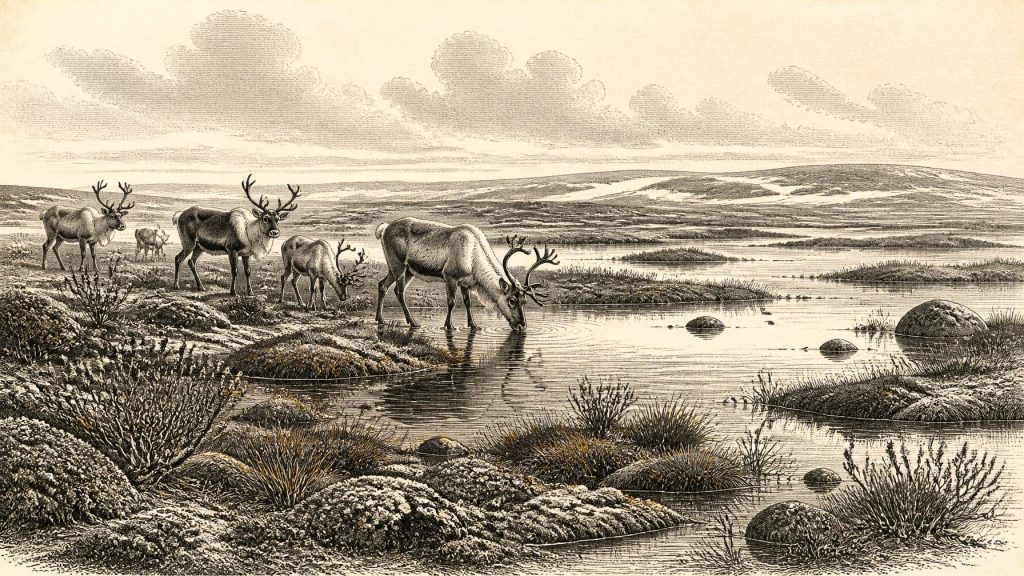
Plant remains, pollen, mosses and insects indicate a treeless, cold and open setting. Wetland plants included buckbean or bogbean (Menyanthes trifoliata), while dwarf willow and other arctic-alpine elements point towards low vegetation able to endure short growing seasons, frost and exposed ground. Grasses, sedges, herbs, mossy margins and shallow pools probably formed a varied mosaic rather than a uniform plain. Earlier researchers compared such conditions to muskeg: wet, organic-rich ground with slow or standing water. That is a useful ecological analogy, not a claim that a modern North American peatland stood unchanged in Fermanagh.
The difference matters. A freshwater basin could remain biologically active even where surrounding ground was frost-shattered, thin-soiled and seasonally frozen. Fine silts indicate quiet water at least at times; seeds and aquatic plant remains indicate life in or beside it. Yet the wider landscape may have been windy and severe, interrupted by snow cover, permafrost-like ground conditions and seasonal thaw. The Derryvree record supports an interpretation of a cold wetland refuge within a periglacial landscape. It does not support woodland, farming, a village or a stable island-wide climate.
Ice Was Growing, Not Static
The year lies before the fullest extent of the Last Glacial Maximum, conventionally dated in this region to roughly 27,000–23,000 years before present for maximum British–Irish Ice Sheet extent, with wider global definitions often spanning about 26,500–19,000 years ago. But “before the maximum” did not mean free from glaciers. Newer reconstructions of the British–Irish Ice Sheet show that ice build-up was complex, regional and asynchronous. Some uplands and sectors supported ice early; margins advanced, retreated and reconfigured. There remains genuine scholarly uncertainty about precisely how much of Ireland was glaciated at particular moments around 32,000–33,000 calibrated years ago.
That uncertainty is itself historical evidence of a difficult landscape. The Derryvree silts lay between tills, while other deposits, raised-shore evidence and offshore records point to changing relations between ice, land and sea. Sea level was much lower globally than today, but local coastlines were also affected by the immense weight of ice depressing the crust. Ireland was not a fixed modern island viewed through a colder lens. Its coastal shelves, river systems, drainage routes and possible animal corridors differed substantially from those familiar now. Exact routes across the Irish Sea cannot be reconstructed for this particular date.
Animals in the Open Country
Southern Irish caves provide a complementary, though less precisely dated, record. Castlepook Cave, also called Mammoth Cave, near Doneraile in north County Cork, yielded one of Ireland’s most significant collections of Pleistocene animal remains. Historic excavations recovered bones of woolly mammoth, reindeer, giant deer, brown bear, wolf, Arctic fox, mountain hare, lemmings and spotted hyaena. Other cave sites, especially Shandon in County Waterford, broaden the picture. The Irish Quaternary Fauna Project showed that mammals reached Ireland at intervals between at least about 45,000 and 20,000 years ago.
These bones should not be arranged into a single dramatic scene at 30,414 BCE. Cave assemblages accumulated over long periods. Carnivores dragged in prey, animals used caves as dens or shelters, water shifted bones, and early twentieth-century excavations could not apply the recording standards expected today. Individual species may belong to different climatic phases. Nevertheless, the combined evidence shows that suitable parts of Ireland could sustain substantial cold-stage food webs. Reindeer and mammoth imply open grazing landscapes; Arctic fox and lemmings are consistent with severe conditions; wolves and hyaenas attest to predation and scavenging.
Shandon is particularly useful for warning against an overly uniform “tundra” picture. Radiocarbon dates from its fauna cluster broadly between 32,000 and 26,000 radiocarbon years before present, and researchers have identified horse and red deer among the material. Such species may suggest patches of more productive grassland or parkland within an open plain during some episodes. This is not proof of forested Waterford at the date under discussion. Rather, it shows that Late Pleistocene Ireland contained shifting habitats, and that cold-stage animal communities changed with climate, vegetation and access routes.
The Castlepook Reindeer Question
The most provocative evidence relevant to people is a fragment of reindeer femur from Castlepook. Zooarchaeologist Ruth Carden has interpreted a deep incision on it as a cut or chop made by a sharp stone tool while a carcass was being processed. County Cork heritage material places the bone broadly around 31,000 BCE, while public reporting has described it as about 33,000 years old. If the mark was made by a person on fresh bone and is broadly contemporary with the animal’s death, it would be potentially the earliest indication of human activity in Ireland.
The conditional language is essential. The femur comes from an old collection, not a sealed modern excavation containing a hearth, stone-tool assemblage, dwelling floor and associated animal remains. A radiocarbon measurement dates the organic material in the bone, not automatically the incision or the duration of a visit. No securely associated Palaeolithic camp, human skeletal remains, burial, art or tool kit has yet been recovered in Ireland for this time. Excavation at Castlepook in 2022 sought surviving Pleistocene deposits, but did not establish an Upper Palaeolithic occupation surface.
Accordingly, it would be irresponsible to invent a resident Irish hunting people, a named culture or a first settlement for 30,414 BCE. The most that may be inferred, if Carden’s interpretation is sustained, is that one or more people could have handled and cut a reindeer during this broad period. They may have been a short-lived mobile party, perhaps exploiting a carcass rather than maintaining a camp. Reindeer elsewhere in Upper Palaeolithic Europe supplied meat, fat, hide, sinew, antler and bone; the single Irish femur does not show which of those resources were taken, where the animal died, or whether its processors returned.
No Politics, but a Living Landscape
There is no evidence for political institutions, leaders, territorial boundaries, diplomacy, warfare, trade networks, religious rites, language, formal learning or art in Ireland at this precise point. Nor can economy or everyday domestic life be reconstructed in the usual historical sense. Such absences are not invitations to fill the record with assumptions borrowed from better-documented Upper Palaeolithic societies in France, Iberia or central Europe. Those comparisons can suggest possibilities, but they are not evidence for Ireland.
What the record does reveal is a living landscape shaped by physical constraints. Water accumulated in sheltered basins; sedges and mosses stabilised wet ground; herbivores exploited available vegetation; predators and scavengers followed them. The movement of animals into Ireland shows that the island was not biologically isolated in every cold-stage phase, though neither the routes nor their duration can be specified here. Glaciers would later erase or bury much of this terrain, helping to explain why the archaeological record is so slight.
For Ireland around 30,414 BCE, then, the central development was environmental rather than political: a volatile pre-maximum glacial world in which locally ice-free wetlands and open habitats briefly supported plant and animal communities. Derryvree’s freshwater sediments, Shandon’s fauna and Castlepook’s bones are not fragments of a lost kingdom. They are more valuable than that: hard-won witnesses to an Ireland whose history survives chiefly in silt, pollen, bone and ice-laid clay.
Primary Sources
- A Middle Midlandian Freshwater Series at Derryvree, Maguiresbridge, County Fermanagh, Northern Ireland
- The Irish Quaternary Fauna Project
- Irish Pleistocene Biostratigraphy
- Figure 6.— The Subdivision of the Quaternary Period in Ireland
- Publications
- Field Guides
- Outreach and Education Resources
- The Timing and Magnitude of the British–Irish Ice Sheet Between Marine Isotope Stages 5d and 2
- Behavioural Tendencies of the Last British–Irish Ice Sheet Revealed by Data–Model Comparison
- Growth and Retreat of the Last British–Irish Ice Sheet, 31,000 to 15,000 Years Ago: the BRITICE-CHRONO Reconstruction
- Timing, Pace and Controls on Ice Sheet Retreat: an Introduction to the BRITICE-CHRONO Transect Reconstructions of the British–Irish Ice Sheet
- Timing and Pace of Ice-Sheet Withdrawal Across the Marine–Terrestrial Transition West of Ireland During the Last Glaciation
- Stratigraphic and Palaeo-Geomorphological Evidence for the Glacial-Deglacial History of the Last British-Irish Ice Sheet in the North-Western Irish Sea
- Radiocarbon Constraints on the Age of the Maximum Advance of the British–Irish Ice Sheet in the Celtic Sea
- The Colonization of Ireland: A Human Ecology Perspective
- Anthropogenic Changes to the Holocene Nitrogen Cycle in Ireland
- 2022:564 – Castlepook Cave, Castlepook South, Cork
- Heritage Artefacts of County Cork
- UCD School of Archaeology Research Day 2022
- The Exploration of Castlepook Cave, County Cork
- Irish Pleistocene Mammals
- Studies in Irish Quaternary Deposits. No. 3: The Reindeer in Ireland
- The Irish Quaternary Fauna Project
- Dublin Radiocarbon Dates II
