Contested Visitation30407 BCE
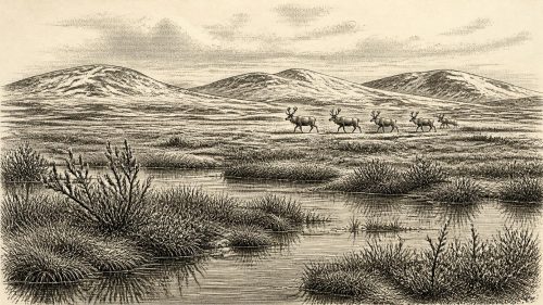
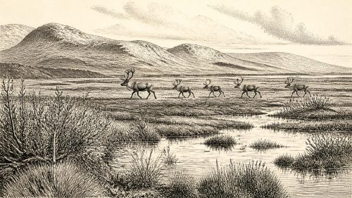
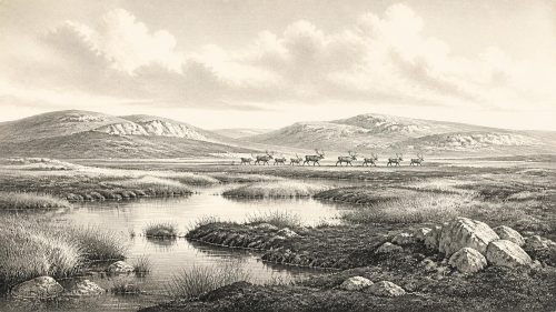
Around 30,407 BCE is a modern filing label rather than a precise date. Derryvree, County Fermanagh, preserves freshwater silts between glacial tills, indicating a locally ice-free, cold wetland during Marine Isotope Stage 3. Its plants and insects reveal treeless tundra-like ground, shallow water and seasonal productivity amid severe winters. Ireland’s ice cover and coastlines were unstable, while cave faunas attest reindeer, mammoth and other cold-adapted animals regionally, not necessarily locally. A possible cut-marked reindeer bone from Castlepook suggests early human visitation, but remains contested. No settlement, society, culture or religion can be demonstrated; environmental evidence is strongest at this horizon.
Dateline
The label 30,407 BCE is useful only as a modern filing point. No Irish evidence can be assigned to that calendar year, or even to a particular generation. At this depth of time, dates are expressed as ranges with substantial uncertainty, and the relevant evidence is environmental rather than historical in the ordinary sense. The closest important archive is the Derryvree freshwater deposit near Maguiresbridge, County Fermanagh: its conventional radiocarbon determination, BIRM-166, is 30,500 radiocarbon years before present, with a wide error margin. When calibrated against changing atmospheric radiocarbon, it falls broadly within c. 36,900–31,700 calibrated years BP. The nominal year 30,407 BCE, approximately 32,356 years before 1950, lies towards the younger part of that broad span, not at a recoverable moment within it.
A Wetland Between Ice Advances
Derryvree was revealed by road works in 1969, which cut through a drumlin north-east of Maguiresbridge. The exposure contained freshwater silts and fine sands enclosed between two substantial layers of till: sediment deposited by glacier ice. This sequence is exceptionally valuable because it records three large-scale changes in local conditions. Ice had previously overridden the district; an interval then allowed water, sediment, plants and invertebrates to accumulate in an ice-free basin; later ice again covered and sealed the deposit. The organic bed does not prove that all Ireland was ice-free at once, but it does establish that this corner of Fermanagh supported a cold freshwater environment during part of Marine Isotope Stage 3, long before the fullest expansion of the Last Glacial Maximum.
Its original radiocarbon result is now close to the limit at which calendar calibration becomes broad and complex. That is a reason for care, not a reason to discard it. Modern calibration curves and subsequent reviews make the deposit a valuable, though imprecisely dated, constraint on Ireland’s glacial history. The evidence is strongest for local ice-free conditions during an extended interval of deposition. It is weaker for matching the deposit exactly to a named Greenland warming episode, and weaker still for treating its whole fossil assemblage as the landscape of one particular century. Derryvree is an environmental sequence, not a diary.
Open Ground and Cold Water
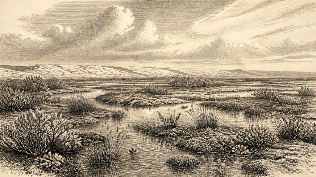
The plant and insect remains nevertheless permit a vivid, evidence-led reconstruction. The flora points to open, treeless tundra or muskeg: a saturated, uneven ground surface of mosses, sedges, grasses and low herbs, interspersed with shallow pools and silty freshwater margins. Recorded plants include dwarf willow, mountain avens, clubmoss, bogbean and water-milfoil. None indicates forest. Juniper pollen and herbaceous vegetation suggest sparse cover, while aquatic plants show that at least some water remained available through the growing season. The insects similarly support cold, periglacial conditions and wet ground rich in plant debris.
This was not a uniformly frozen white wilderness. Summer thaw permitted standing water, plant growth and insect life; winter was harsh enough for frost processes to shape soils and sediments. In modern terms, the best comparison is not an exact place but a broad Arctic-alpine range of conditions. Even that comparison must be handled carefully. Ancient Fermanagh was a changing ice-age landscape, and its plants grew under different combinations of temperature, seasonality, carbon dioxide, grazing pressure and geography from those of any modern moor or tundra. The secure conclusion is modest and important: north-western Ireland contained locally productive cold wetlands during part of this interval.
An Island in an Unstable Ice-Age World
At around 32,000 calibrated years ago, Ireland stood within the later part of Marine Isotope Stage 3, a period of abrupt climate shifts across the North Atlantic region. The major Last Glacial Maximum lay ahead, conventionally dated to roughly 26,500–19,000 calibrated years BP, but ice masses in and around Ireland had already advanced, retreated and reorganised more than once. Recent work on the British–Irish Ice Sheet stresses that its earlier history is not settled by a single map. Evidence from raised shorelines, offshore sediments, glacial landforms and dated deposits indicates dynamic ice growth and retreat before the final maximum. Derryvree matters because its organic silts sit physically between glacial deposits, providing rare terrestrial testimony to one of those interruptions.
Sea level was lower globally than today, but local coastlines cannot simply be drawn by subtracting metres from a modern map. The weight of ice depressed the land, while changing ice distribution altered relative sea level from region to region. Nor can the archaeological record demonstrate a particular route by which animals, or people, might have reached Ireland. The later Irish Sea was an important barrier, but the physical geography of this much earlier interval was changing. Responsible reconstruction therefore avoids confident claims of a permanent land bridge, a fixed shoreline or routine crossings. What can be said is that Ireland was part of the north-west European ecological zone, subject to the same great climatic oscillations and capable, during suitable intervals, of supporting cold-adapted life.
Animals and a Sparse Faunal Record
Cave collections, especially from Castlepook Cave near Doneraile in County Cork, demonstrate that Late Pleistocene Ireland supported a markedly different mammal community from the modern island. Finds from Castlepook include reindeer, woolly mammoth, spotted hyaena, brown bear, wolf, Arctic fox, mountain hare, lemmings and giant deer. The assemblage was accumulated over long periods and in complicated cave conditions; it is not a census for 30,407 BCE. Improved radiocarbon pretreatment has shown that several older Irish cave dates require revision, while some animals formerly thought to belong to a later phase proved much older. In particular, research suggests that giant deer and spotted hyaena may have disappeared locally before the Last Glacial Maximum, perhaps around 40,000 calibrated years BP.
For this article’s broad horizon, the animal bones establish regional possibility rather than a precise food chain at Derryvree. Reindeer are especially plausible inhabitants of open, cold country, while hares, foxes and lemmings fit a tundra setting. Large grazers and their predators may have moved through favourable districts seasonally, following vegetation and avoiding the most extensive ice. Yet the evidence cannot reveal the size of herds, migration routes, breeding grounds or the exact animal present in Fermanagh in any named year. Fossil records preserve survivals from particular depositional settings, not an evenly sampled national fauna.
The Human Question
The possibility of people in Ireland at such an early date remains one of the most consequential and most cautiously handled questions in Irish archaeology. A reindeer femur from Castlepook Cave has been presented as bearing a deep mark consistent with fresh-bone cutting by a stone tool, and the bone has been reported as about 33,000 years old. If the mark is confirmed as anthropogenic and securely associated with that animal’s age, it would indicate a brief Upper Palaeolithic human presence far earlier than Ireland’s well-established post-glacial settlement. It would not prove a village, a resident population or uninterrupted occupation.
That distinction is crucial. Castlepook has a long and disturbed collecting history, its faunal deposits span different periods, and a cut-mark interpretation requires independent taphonomic testing. No securely published settlement surface of this age in Ireland has produced a hearth, dwelling, stone-tool assemblage, burial, artwork or human skeletal remains. The Derryvree deposit itself contains no evidence of people. The responsible conclusion for c. 30,407 BCE is therefore that human visitation is possible, perhaps even suggested by a remarkable object from Cork, but is not presently demonstrated as a settled Irish society.
Society Without a Social Record
There is consequently no basis for naming communities, languages, leaders or territories. Political affairs, diplomacy and organised conflict leave no identifiable trace in the Irish evidence for this horizon. Nor can religion be recovered: there are no graves, ritual deposits, images or monuments securely attributable to it. A European Upper Palaeolithic context can supply comparisons for mobile hunter-gatherer lifeways elsewhere, but it cannot be imported wholesale into Ireland. It would be misleading to populate Derryvree with known traditions from France, Iberia or central Europe merely because those regions have richer records.
The same restraint applies to everyday life, learning and culture. If small groups did reach Ireland, they would have needed knowledge of seasonal weather, animal behaviour, shelter, fire and the handling of stone or other materials. That is an inference from survival in a glacial environment, not a direct Irish observation. The possible Castlepook incision, if human-made, would most immediately imply carcass processing: the removal of meat, hide or sinew from reindeer. It does not identify a tool type, a hunting method, a camp location or the identity of those involved. No trade network can be documented, and there is no evidence for farming, pottery, metalworking or permanent built settlement.
What the Record Can Sustain
The most substantial story around this notional year is environmental change. Derryvree records a living freshwater margin between episodes of glaciation: pools, fine sediment, moss, herb-rich open ground and a brief productive season in a severe climate. Castlepook and other cave assemblages show that Ireland’s Ice Age fauna could be richer and more continental in character than that of later millennia. Together, these records overturn the older image of an Ireland that was simply and continuously buried beneath ice before its final deglaciation. They do not turn the period into conventional national history.
For 30,407 BCE, then, the strongest evidence concerns landscape rather than institutions. Fermanagh’s buried wetland supplies a calibrated window, not an annual report. Its water-milfoil, bogbean, mosses, insects and silt offer a rare glimpse of ecological persistence between glaciers. The human story remains unresolved: potentially profound, but founded on sparse and contested traces. That combination of rich environmental evidence and extreme archaeological silence is itself the defining feature of Ireland at this remote point in time.
Source References
Hover over a number to see the source. Select it to open the source.

- [1] A Middle Midlandian Freshwater Series at Derryvree, Maguiresbridge, County Fermanagh, Northern Ireland
- [2] A Reconsideration of the Radiocarbon Dating of the Marine Isotope Stage 3 Fauna from Southern Ireland
- [3] New Insights on the Fauna of Ireland's Younger Dryas and Early Holocene from Alice & Gwendoline Cave
- [4] First Evidence of a Late Upper Palaeolithic Human Presence in Ireland
- [5] Phylogeographic, Ancient DNA, Fossil and Morphometric Analyses Reveal Ancient and Modern Introductions of a Large Mammal: the Complex Case of Red Deer (Cervus elaphus) in Ireland
- [6] The Timing and Magnitude of the British–Irish Ice Sheet Between Marine Isotope Stages 5d and 2: Implications for Glacio-isostatic Adjustment, High Relative Sea Levels and ‘Giant Erratic’ Emplacement
- [7] Growth and Retreat of the Last British–Irish Ice Sheet, 31,000 to 15,000 Years Ago: the BRITICE-CHRONO Reconstruction
- [8] Exploring Controls of the Early and Stepped Deglaciation on the Western Margin of the British Irish Ice Sheet
- [9] The IntCal20 Northern Hemisphere Radiocarbon Age Calibration Curve (0–55 cal kBP)
- [10] A Stratigraphic Framework for Abrupt Climatic Changes During the Last Glacial Period Based on Three Synchronized Greenland Ice-core Records: Refining and Extending the INTIMATE Event Stratigraphy
- [11] The Irish Quaternary Fauna Project
- [12] Irish Pleistocene Biostratigraphy
- [13] Heritage Artefacts of County Cork
- [14] Archaeological Heritage of County Cork
- [15] BRITICE-CHRONO Maps and GIS Data of the Last British-Irish Ice Sheet 31 to 15 ka, Including Model Reconstruction, Geochronometric Age Spreadsheet, Palaeotopographies and Coastline Positions
- [16] IntCal | Radiocarbon Dating Research | 14CHRONO
- [17] First Evidence of a Late Upper Palaeolithic Human Presence in Ireland
- [18] Irish Quaternary Association: Outreach and Education Resources
- [19] The IntCal20 Northern Hemisphere Radiocarbon Age Calibration Curve (0-55 kcal BP)
- [20] Growth and Retreat of the Last British–Irish Ice Sheet, 31,000 to 15,000 Years Ago: the BRITICE-CHRONO Reconstruction
Primary Sources
- A Middle Midlandian Freshwater Series at Derryvree, Maguiresbridge, County Fermanagh, Northern Ireland
- A Reconsideration of the Radiocarbon Dating of the Marine Isotope Stage 3 Fauna from Southern Ireland
- New Insights on the Fauna of Ireland's Younger Dryas and Early Holocene from Alice & Gwendoline Cave
- First Evidence of a Late Upper Palaeolithic Human Presence in Ireland
- Phylogeographic, Ancient DNA, Fossil and Morphometric Analyses Reveal Ancient and Modern Introductions of a Large Mammal: the Complex Case of Red Deer (Cervus elaphus) in Ireland
- The Timing and Magnitude of the British–Irish Ice Sheet Between Marine Isotope Stages 5d and 2: Implications for Glacio-isostatic Adjustment, High Relative Sea Levels and ‘Giant Erratic’ Emplacement
- Growth and Retreat of the Last British–Irish Ice Sheet, 31,000 to 15,000 Years Ago: the BRITICE-CHRONO Reconstruction
- Exploring Controls of the Early and Stepped Deglaciation on the Western Margin of the British Irish Ice Sheet
- The IntCal20 Northern Hemisphere Radiocarbon Age Calibration Curve (0–55 cal kBP)
- A Stratigraphic Framework for Abrupt Climatic Changes During the Last Glacial Period Based on Three Synchronized Greenland Ice-core Records: Refining and Extending the INTIMATE Event Stratigraphy
- The Irish Quaternary Fauna Project
- Irish Pleistocene Biostratigraphy
- Heritage Artefacts of County Cork
- Archaeological Heritage of County Cork
- BRITICE-CHRONO Maps and GIS Data of the Last British-Irish Ice Sheet 31 to 15 ka, Including Model Reconstruction, Geochronometric Age Spreadsheet, Palaeotopographies and Coastline Positions
- IntCal | Radiocarbon Dating Research | 14CHRONO
- First Evidence of a Late Upper Palaeolithic Human Presence in Ireland
- Irish Quaternary Association: Outreach and Education Resources
- The IntCal20 Northern Hemisphere Radiocarbon Age Calibration Curve (0-55 kcal BP)
- Growth and Retreat of the Last British–Irish Ice Sheet, 31,000 to 15,000 Years Ago: the BRITICE-CHRONO Reconstruction