BIRM-166 Roadcut Silts30406 BCE
Around 30,406 BCE, Ireland has no recoverable year-specific human history; the date lies within a broad Late Pleistocene range represented by Derryvree, County Fermanagh. Roadworks exposed freshwater organic silts and sands between two glacial tills, dated Birm-166 to about 36,900–31,700 calibrated years BP. They record a temporary, locally ice-free wetland amid climatic instability preceding the Last Glacial Maximum. Macrofossils reveal treeless tundra with grasses, sedges, dwarf willow, juniper, mosses and aquatic plants. Comparable evidence permits cold-adapted fauna but not local sightings. No secure human occupation existed. Later ice buried and preserved this exceptional environmental archive for more than thirty millennia.
Dateline
30,406 BCE is a modern chronological label, not a year that can be recovered from Ireland’s prehistoric record. No written calendar, settlement layer, burial, tool assemblage or named individual can be tied to that point with year-by-year precision. In archaeological terms, the date falls in the Late Pleistocene, within Marine Isotope Stage 3, during the long and unstable climatic descent towards the Last Glacial Maximum. The most responsible way to illuminate Ireland at this horizon is through a small number of environmental archives, above all the extraordinary freshwater deposit found at Derryvree near Maguiresbridge, County Fermanagh.
The date is nevertheless meaningful as a point within a broad range. 30,406 BCE corresponds approximately to 32,356 years before 1950, the conventional ‘present’ used in radiocarbon reporting. At Derryvree, organic silts and fine sands yielded the radiocarbon determination Birm-166: 30,500 radiocarbon years BP, with a large uncertainty of +1,170 and −1,030 years. Later syntheses express the deposit as approximately 36.9–31.7 thousand calibrated years BP, or roughly 34,950–29,750 BCE. This range includes the notional year under consideration, but it cannot identify a particular season, generation, pool edge or human episode in 30,406 BCE.
A Freshwater Interval Beneath Ice
Derryvree was exposed by roadworks in 1969, cutting through a drumlin about two kilometres north-east of Maguiresbridge. The section revealed a powerful sequence: a lower sheet of glacial till, then freshwater silts and sands rich in organic remains, then an upper till. Its basic significance is secure. Glacier ice had deposited the lower till; subsequently, conditions allowed water, sediment, plants and invertebrates to accumulate; later ice overran and sealed the deposit beneath a second blanket of till. The sequence is not a chronicle of uninterrupted mildness. It records a local interval in which the site was free from overriding glacier ice, bracketed by episodes of glaciation.
For an Ireland Year by Year entry, this distinction matters more than any imagined event. It would be wrong to say that all Ireland was ice-free on this exact date, or that a Derryvree pond provides a complete weather report for Cork, Donegal, the Irish Sea basin and the Atlantic shelf. The evidence is local and its chronology broad. Yet it is exceptionally valuable because later ice and erosion destroyed or deeply disturbed much of the earlier landscape. The buried sediment preserved a rare, direct sample of life and climate in northern Ireland before the full expansion of the last Irish Ice Sheet.
Open Tundra, Pools and Moss
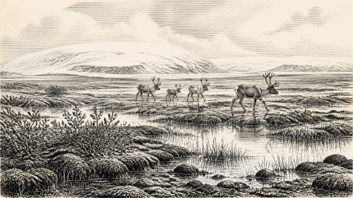
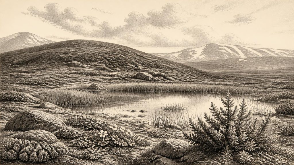
The Derryvree flora describes a cold, treeless and periglacial landscape: one shaped by severe frost, seasonal thaw and sparse cover rather than woodland. Pollen was poorly preserved, but plant macrofossils and mosses proved especially informative. They include grasses and sedges, dwarf willow, juniper, mountain avens, lesser clubmoss, bogbean and water-milfoil. Some were rooted in or beside shallow water; others belonged to exposed, open ground. Together they indicate a varied small-scale environment of wet hollows, sedge margins, mossy ground and sparse tundra vegetation. The older word ‘muskeg’ has often been used for this wet, moss-rich setting, though it should not evoke a modern peat bog transplanted unchanged into the Ice Age.
This was therefore not a featureless white wilderness. During the growing season, liquid freshwater sustained aquatic plants and insects, while low vegetation offered patches of forage and shelter in a generally harsh terrain. The same evidence makes clear how unlike later Ireland it was. There were no oak, hazel or elm woods; no deep agricultural soils; no settled field boundaries; and no familiar patchwork of farms. Wind exposure, frost disturbance and a short productive season would have governed the lives of every plant and animal able to use the landscape.
Faunal evidence from Irish deposits of broadly comparable Late Pleistocene age shows that the island’s environments could support cold-adapted large mammals, including reindeer and woolly mammoth, as well as carnivores and smaller animals. But such finds are unevenly dated and distributed. They cannot responsibly be turned into a claim that a particular herd passed Derryvree in 30,406 BCE. The defensible conclusion is narrower: the Fermanagh deposit records a productive freshwater-tundra niche within a wider Irish landscape undergoing major climatic and glacial change.
Ice Was Advancing in a Wider World
The Derryvree horizon belongs to the changing conditions before the Last Glacial Maximum, not to its coldest and most extensive phase. Modern reconstructions place the Irish sector’s maximum late-glacial expansion broadly after this interval, with major advances and maximum limits developing between about 27,000 and 23,000 calibrated years BP in different sectors. Ice behaviour was asynchronous: upland centres, marine outlets and the Irish Sea system did not all advance or retreat in lockstep. Consequently, a locally ice-free Fermanagh wetland and increasing regional glacial severity are entirely compatible.
Evidence from Crag Cave in County Kerry adds a longer climatic perspective. Speleothems grow only when liquid water can circulate through cave systems, and uranium-thorium dates from Crag Cave show episodic deposition during Marine Isotope Stage 3, broadly corresponding to Greenland interstadials. These cave records do not date the Derryvree mud directly, but they reinforce the central lesson: the Irish climate was not simply a smooth slide into cold. It changed abruptly and repeatedly, allowing brief or local windows for freshwater processes before colder conditions again curtailed them.
No Political or Human History Yet
There is no secure archaeological evidence for people in Ireland at 30,406 BCE. No house, hearth, stone tool, butchered bone, burial, artwork or trackway has been reliably dated to this Derryvree interval. It follows that there is no evidence for political communities, leaders, warfare, diplomacy, trade routes, religious practice, language, schooling or inherited cultural traditions in Ireland at this date. These absences are not minor gaps in an otherwise familiar story; they define the subject.
Europe certainly contained Upper Palaeolithic populations at the time, and Ireland’s lowered sea levels and changing coastlines make questions of access important. Yet proximity to human populations elsewhere is not proof of an Irish crossing or occupation. Ireland’s earliest published evidence for a human presence is vastly later: a modified brown-bear patella from Alice and Gwendoline Cave in County Clare has been dated to roughly 12,810–12,590 calibrated years BP. That discovery is important for the terminal Pleistocene, but it is around twenty millennia younger than the date considered here and cannot be projected backwards. Wider reviews likewise stress how late and archaeologically difficult Ireland’s colonisation remains to reconstruct.
Society Inferred Only Through Absence
The economy visible at Derryvree was ecological rather than human. Plants fixed energy during a short growing season; standing and slow-moving water retained sediment; invertebrates and perhaps larger animals used the resources available in the tundra mosaic. There is no evidence of cultivation, herding, pottery, buildings, quarrying, exchange or deliberate landscape management. Nor should the freshwater record be mistaken for a settlement site. It reveals the conditions that any future visitors, human or animal, would have encountered, not the actions of people.
Religion and learning are similarly beyond recovery. Moss fragments, seeds, pollen and insect remains can establish environmental conditions, but cannot disclose beliefs. Their real cultural value is modern: they have taught researchers that Ice Age Ireland contained highly local, dynamic habitats, and that apparent blank spaces in the archaeological record can be products of ice erosion, burial and survival bias as much as of genuine absence. The deposit is a lesson in archaeological restraint. A single preserved basin can speak clearly about landscape and climate, while remaining silent about people.
A Landscape Awaiting Its Next Transformation
At some time within the broad Derryvree range, including the modern label 30,406 BCE, northern Fermanagh held open tundra beside freshwater. The interval was temporary. Later glacier ice crossed the locality and buried the evidence under till, preserving it even as it erased the living landscape above. That double action—destruction and preservation—explains why Birm-166 matters. It is not a record of a prehistoric event in a calendar year. It is a tightly bounded environmental witness to an Ireland of shallow waters, low plants, severe cold and approaching ice.
The appropriate history for this date is therefore one of regional change rather than rulers or battles: a cold Late Pleistocene island or near-island environment, locally capable of supporting wetland life, but increasingly vulnerable to the expansion of the British-Irish Ice Sheet. The most important development was the climatic and glacial instability that made such a freshwater world possible, then buried it from view for more than thirty thousand years.
Primary Sources
- Middle Midlandian Freshwater Series at Derryvree, Maguiresbridge, County Fermanagh, Northern Ireland
- Middle Midlandian Freshwater Series at Derryvree, Maguiresbridge, County Fermanagh, Northern Ireland
- Palaeoecology
- Figure 6.— The Subdivision of the Quaternary Period in Ireland
- Exploring Controls of the Early and Stepped Deglaciation on the Western Margin of the British-Irish Ice Sheet
- Pattern and Timing of Retreat of the Last British-Irish Ice Sheet
- The Evolution of the Terrestrial-Terminating Irish Sea Glacier During the Last Glaciation
- Dating Constraints on the Last British-Irish Ice Sheet: A Map and Database
- Response of the Irish Ice Sheet to Abrupt Climate Change During the Last Deglaciation
- Deglaciation Chronology of the Donegal Ice Centre, North-West Ireland
- Maximum Extent and Dynamic Behaviour of the Last British-Irish Ice Sheet West of Ireland
- Episodic Speleothem Deposition Tracks the Terrestrial Impact of Millennial-Scale Last Glacial Climate Variability in SW Ireland
- The IntCal20 Northern Hemisphere Radiocarbon Age Calibration Curve (0–55 cal kBP)
- A Stratigraphic Framework for Abrupt Climatic Changes During the Last Glacial Period Based on Three Synchronized Greenland Ice-Core Records
- First Evidence of a Late Upper Palaeolithic Human Presence in Ireland
- The Colonization of Ireland: A Human Ecology Perspective
- Ice Age Ireland
- Early Midlandian–Middle Midlandian, Pleistocene, Northern Ireland
- BSBI: Menyanthes trifoliata
- BSBI: Salix herbacea
- BSBI: Selaginella selaginoides
- BSBI: Dryas octopetala
- BSBI: Myriophyllum alterniflorum
- New Insights on the Fauna of Ireland's Younger Dryas and Early Holocene From Alice & Gwendoline Cave